Colorado Weather Forecast, Denver Weather Forecast for June 2, 2026
This next system moving through June 4th, has been an interesting one since it showed up the first time in August. We had no idea, way back then in late summer, that we would have a super long cycle length of 76 days. Back then the thinking was half of that, around 38-39 days. It became apparent, that length just did not work–very well. If you were to forecast using that cycle length, about 38 days, you would be able to predict storms correctly 71% of the time, still much better than typical long-range models that have an accuracy around 30-50% about the same as climatology.
We have tools that help us find the true length. These tools take they data and point towards the correct length, visually, so you can eliminate the obviously wrong lengths and home in on the true one. 76 fit that number, but long lengths make it harder for wave patterns to line up so that anyone can see the similarities.
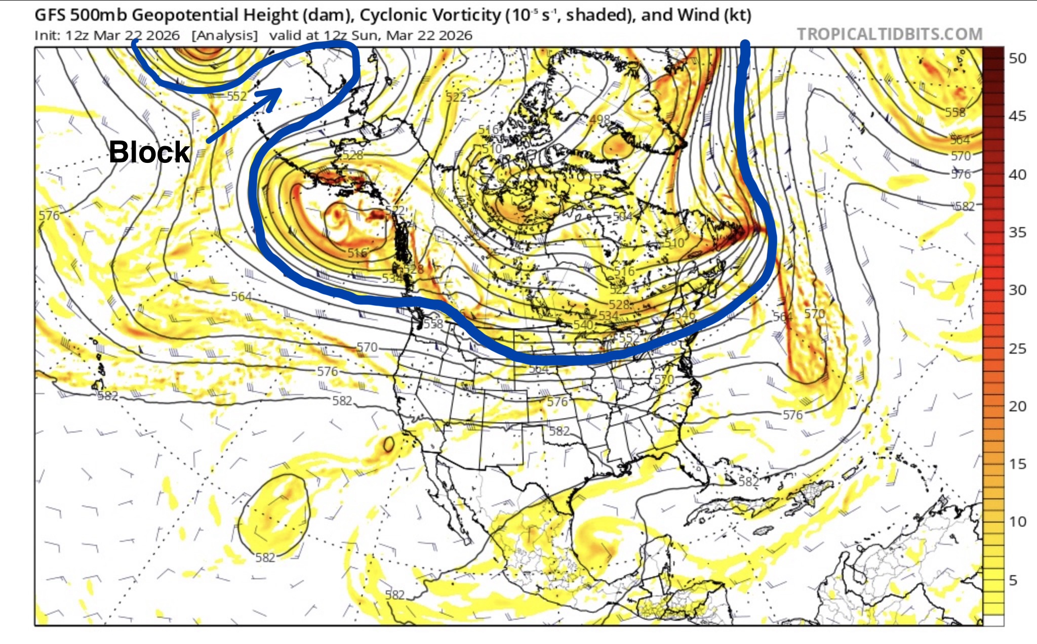
That is longwinded way of saying these next charts of the June 4-12th part of the pattern are hard to see, so I drew them out and pointed out the important parts that are “kind of” easy to see. From pic 1 thru 5 are the same storm that kicks off this section of the pattern–there just a little bit different each cycle. The 1st and last chart are the closest in similarity because they mirror each other from the late summer, early spring positions. The jet stream is at a similar strength, so the contour lines on the chart, called geopotential height contours, are roughly equal. When you look at chart the Jan 3rd chart, the height contours are very strong and dive deep due to the strongest time of year for the jet stream.
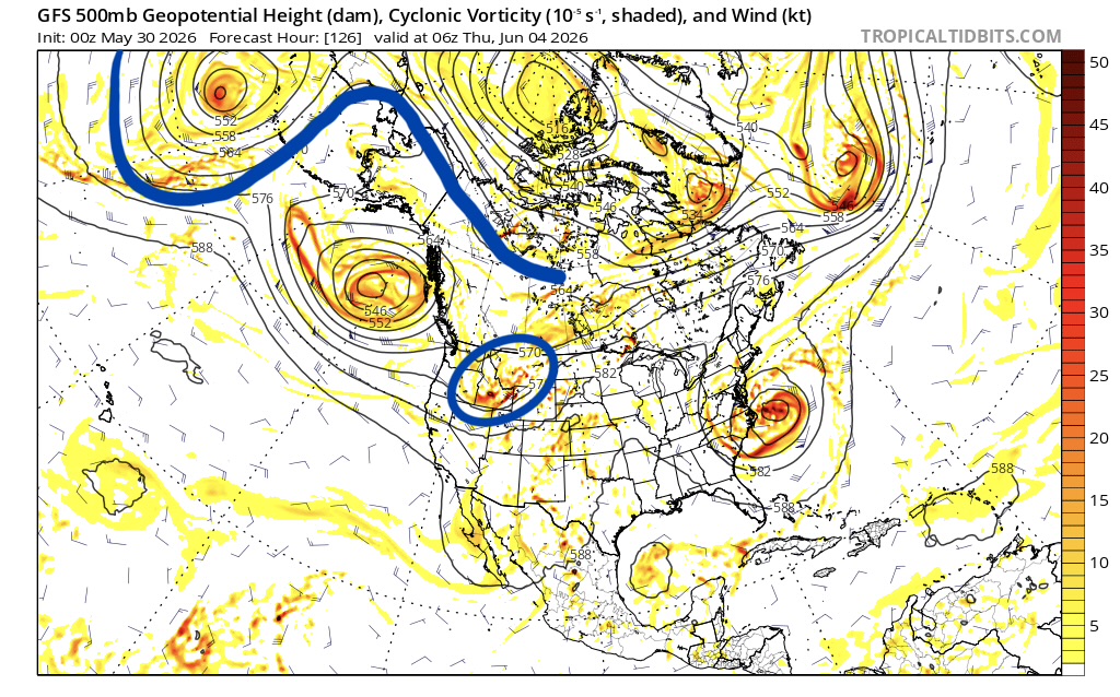
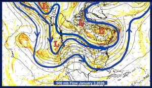
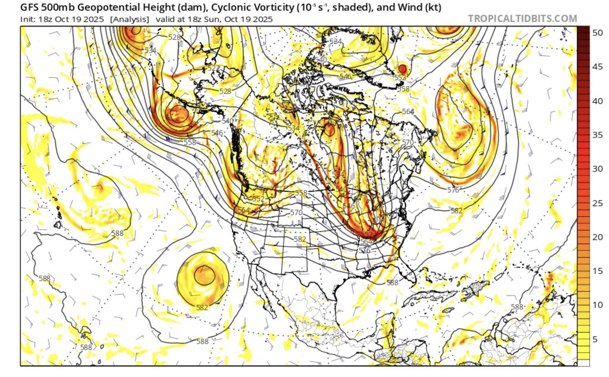
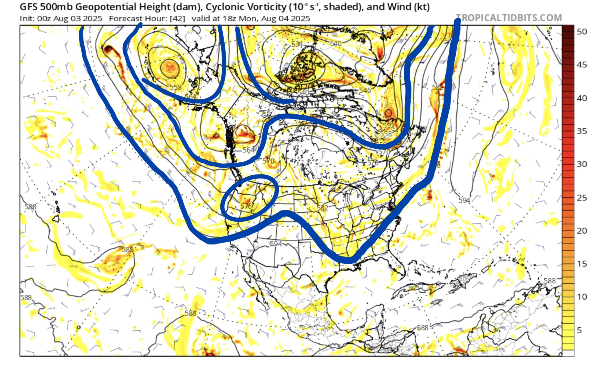
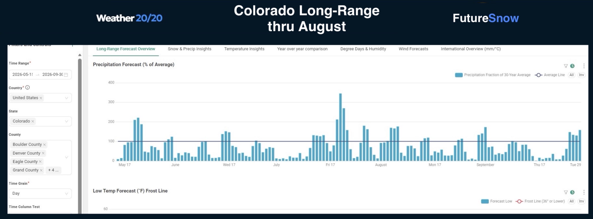
Now look at the chart below. The LRC model predicts a minimal impact regarding this storm, and it is likely right, this storm looks to miss to the north, the LRC model takes in account the receding of the jet stream northward. The typical monsoon energy may get drawn further north due to this system coming by.
- May 19-25 Series of storms that produced in all cycles
- June 4-12 Series of storms that produced in cycles 1 and 2 but missed in March due to the massive West Coast ridge
- June 16-18 The model forecast above thinks this will return
- June 29-31 Storm hit in all 3 cycles
- July 13-22 Return of the “Almost Trifecta”
 If you are new to FutureSnow and the cycling pattern, we will catch you up to speed. Click on the link and we will explain the terminology you will be reading on our blog, along with our methodology using the Cycling Weather Pattern. Thanks for joining our Team!
FutureSnow uses exclusive patent pending technology to predict weather, over 30 days in advance, so you can plan the perfect powder trip.

Upcoming Pattern Storms Published April 8th