Posted March 31, 7:08 am MT 6:08 am PT
Snow Stake Cams
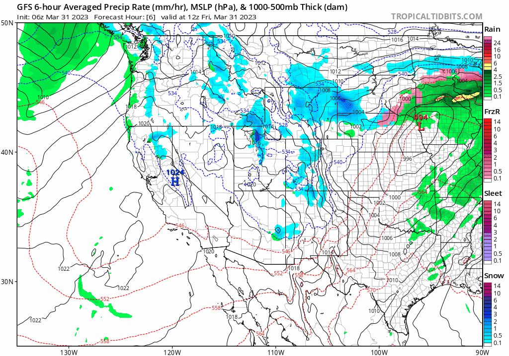
MSLP Surface Chart
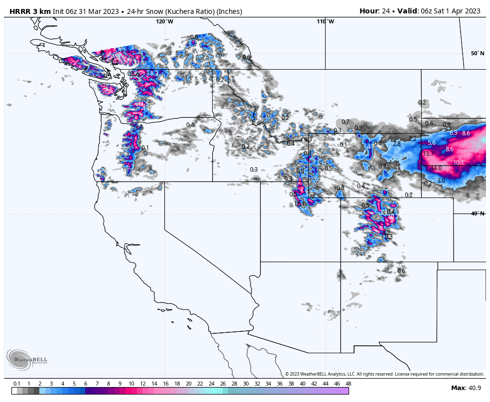
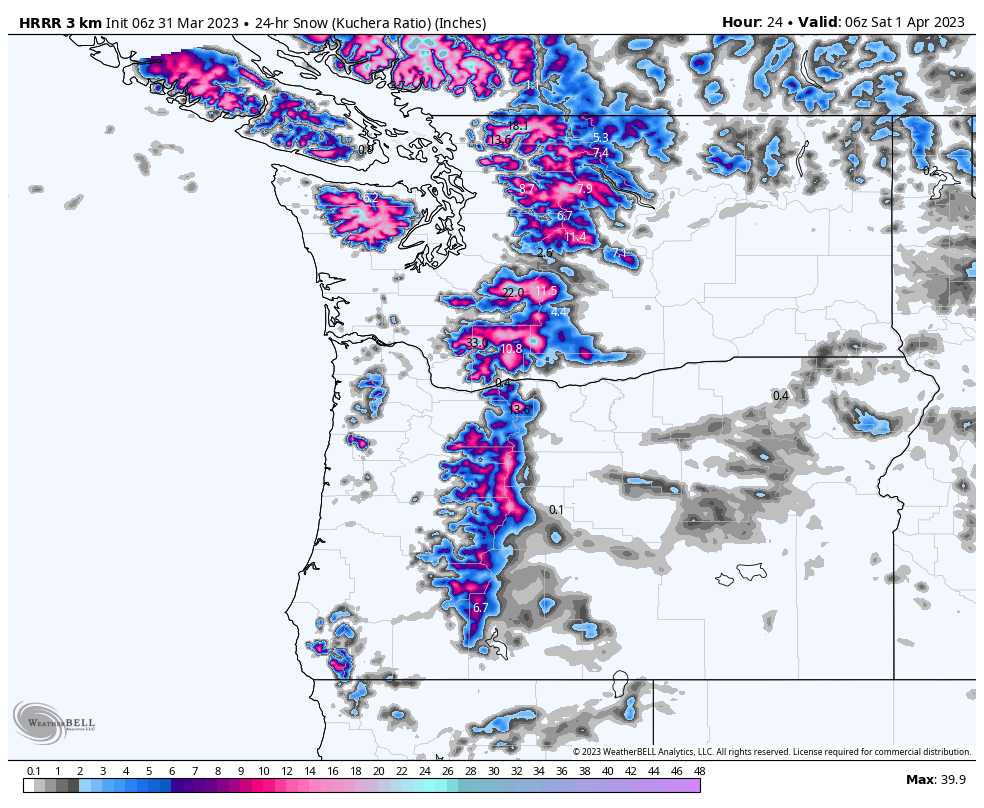
 High Resolution All Snow
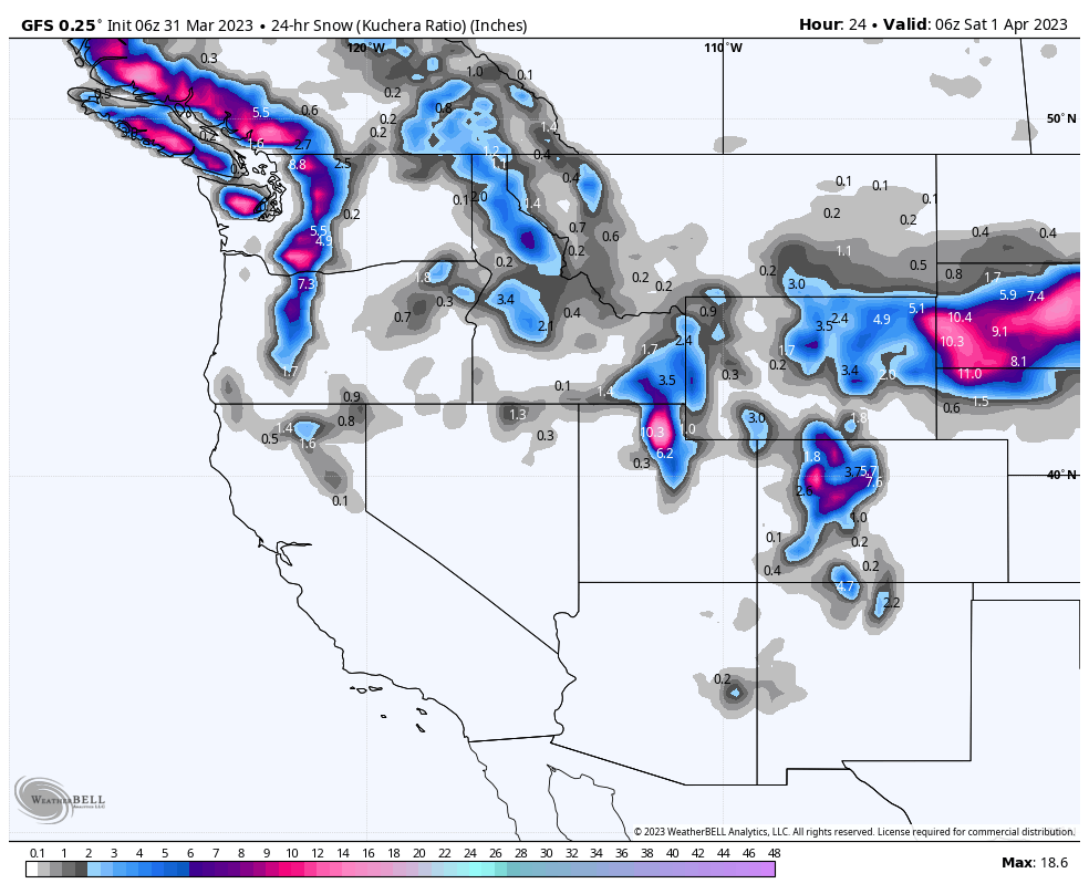
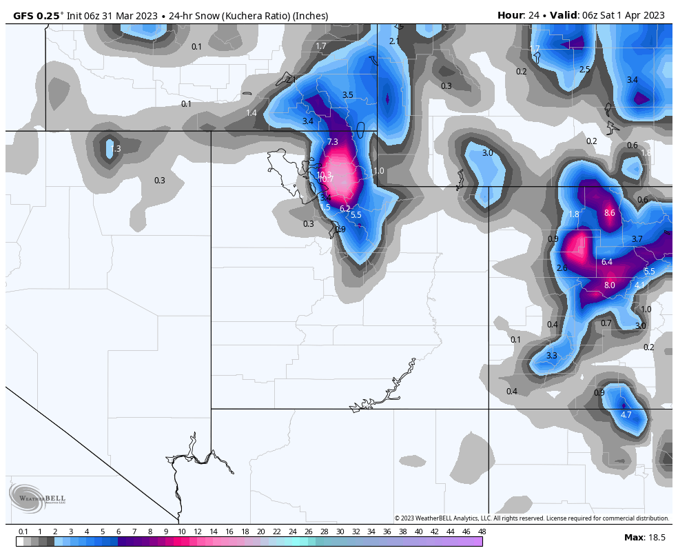
GFS All Snow thru Next Week
 Forecast Discussion
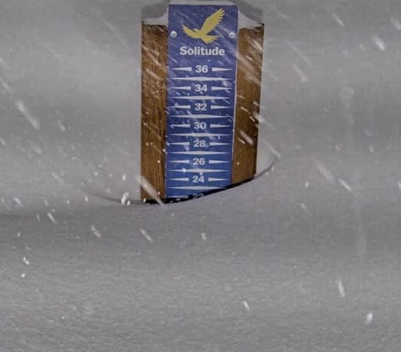
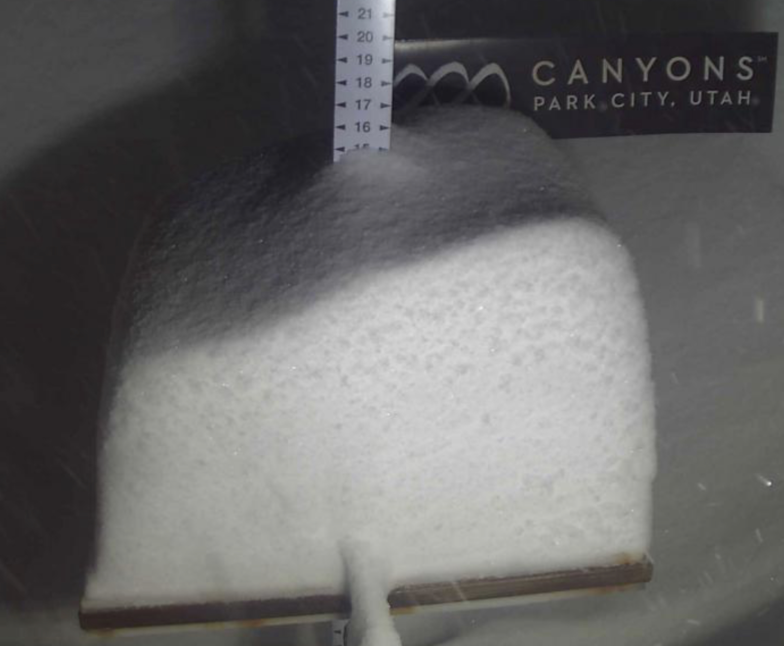
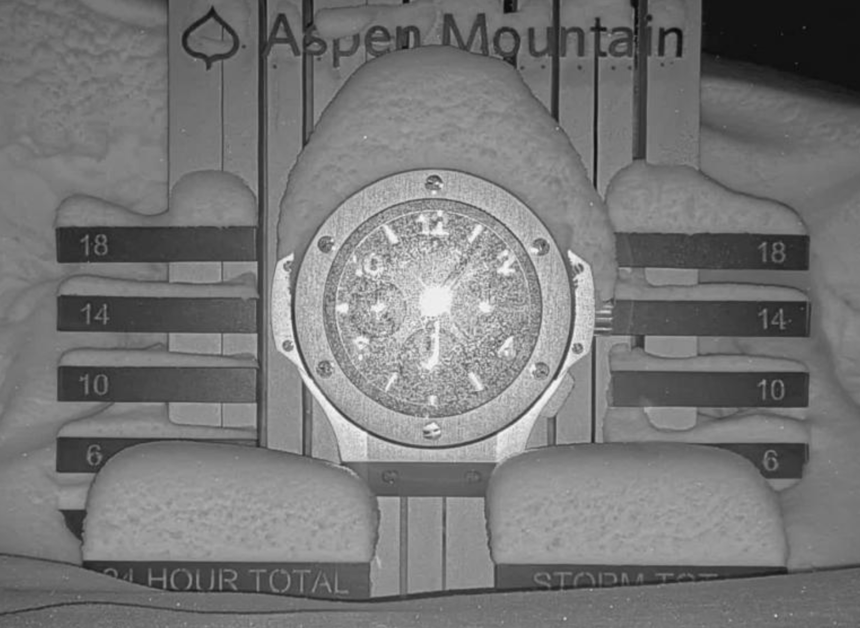
Powder day number 184 for Utah resorts. Ok more like 40-something. Our friends at Alta have reached the 800 club. Wow, what a year they are smashing the old record, with another 6-10 before noon likely. Top snowfall this morning is 22 at Solitude, 16 at Snowbasin and 14 as Alta. This storm moves out this afternoon, while the storm continues for Colorado resorts.
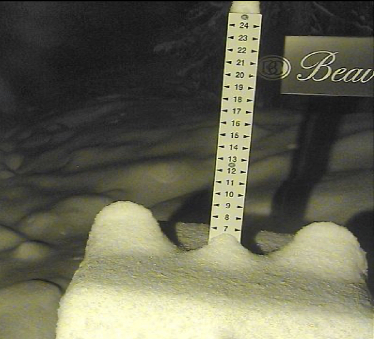
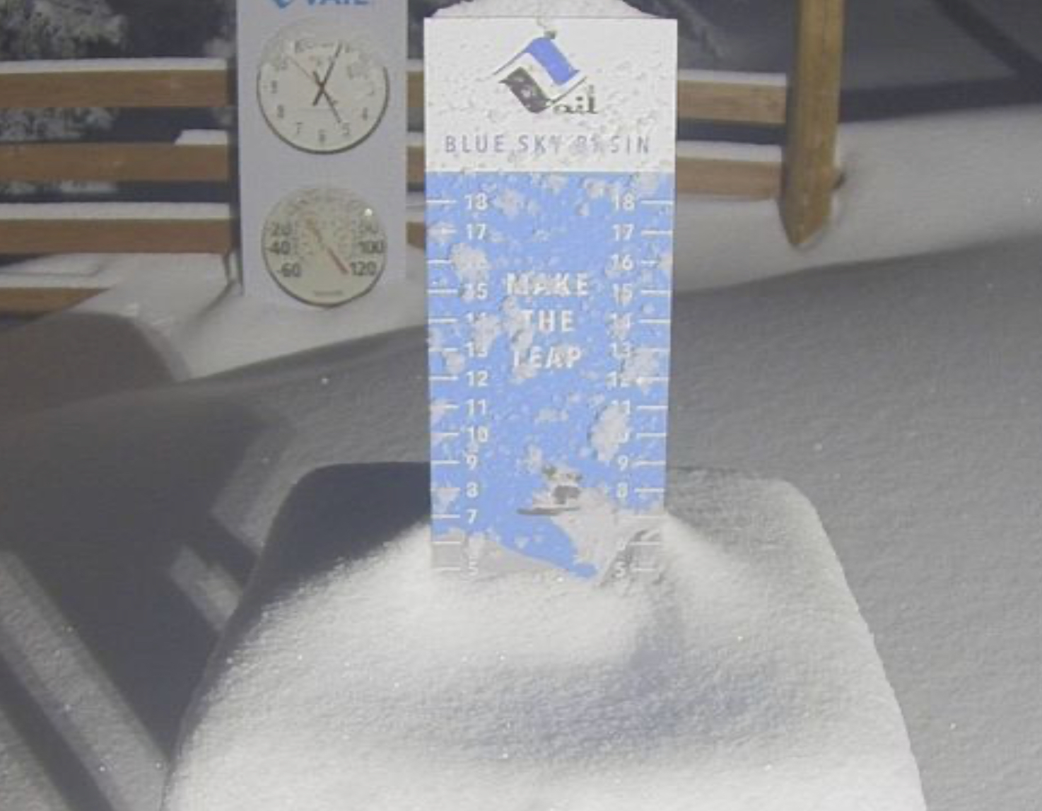
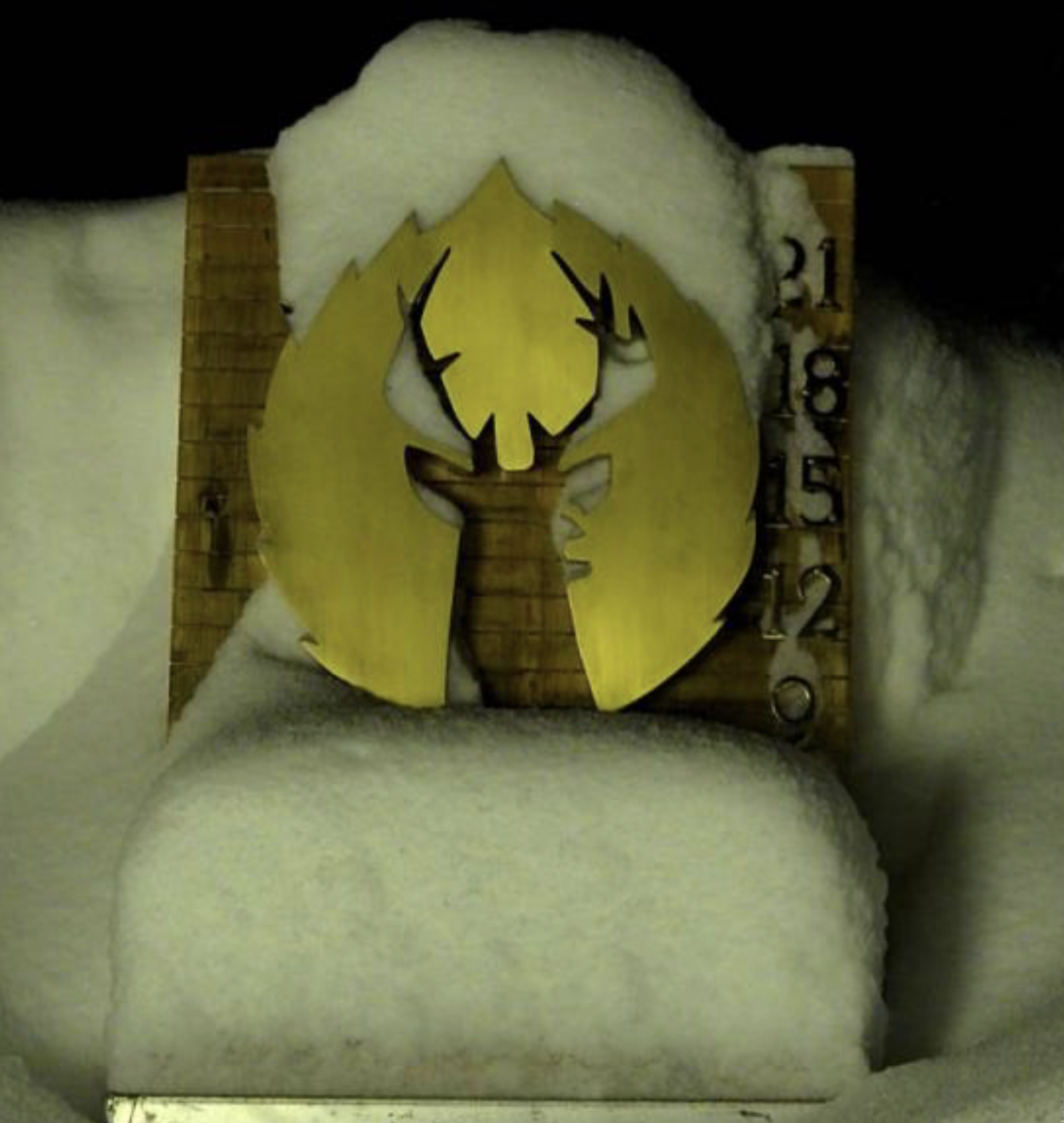
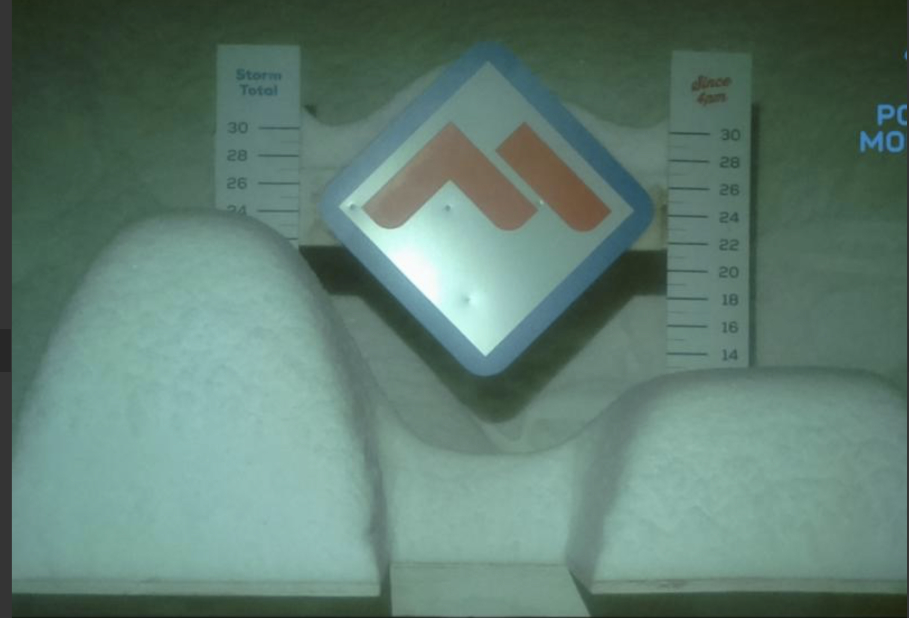
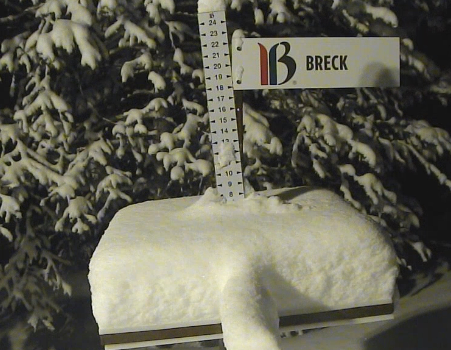
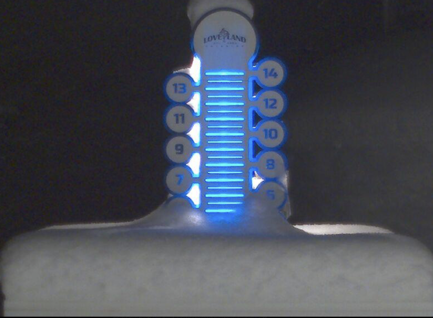
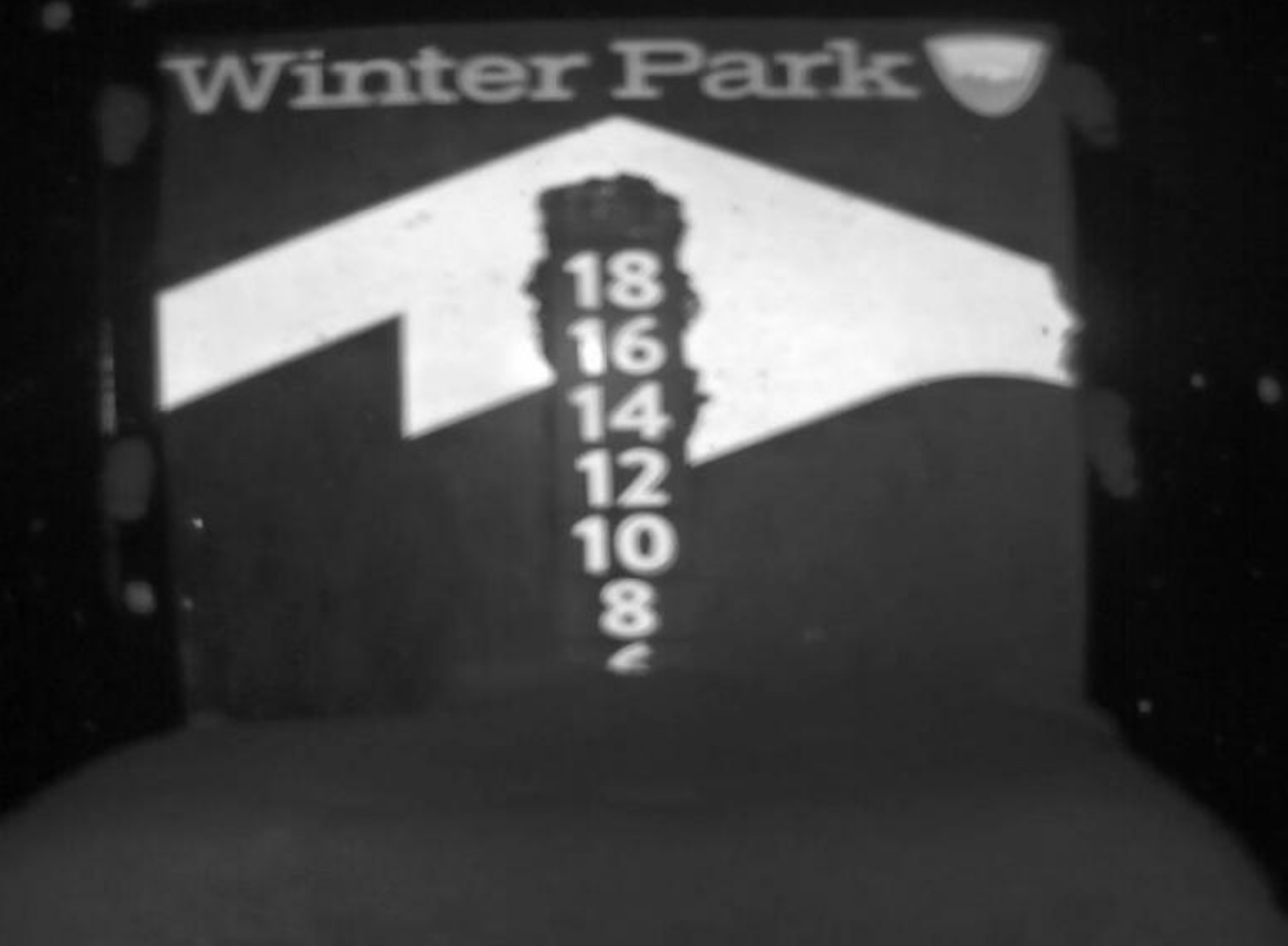
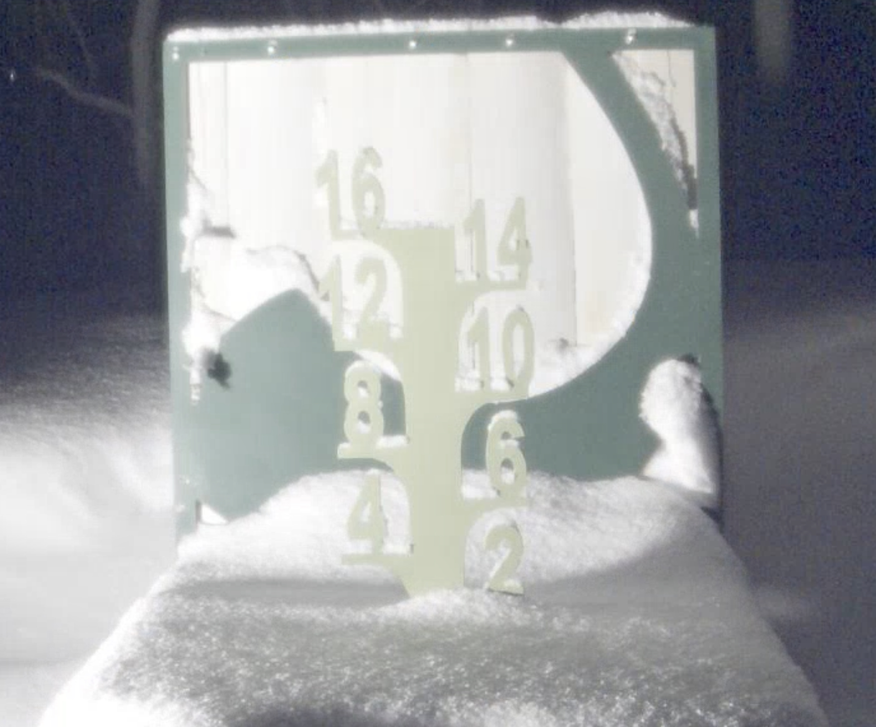
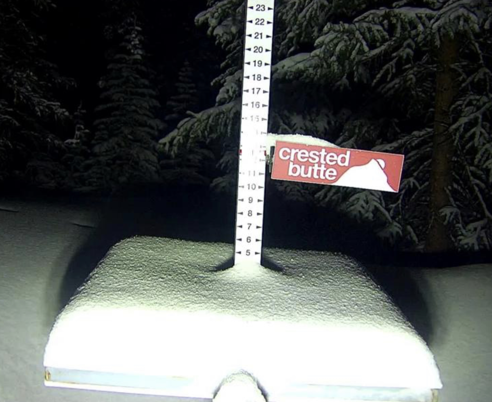
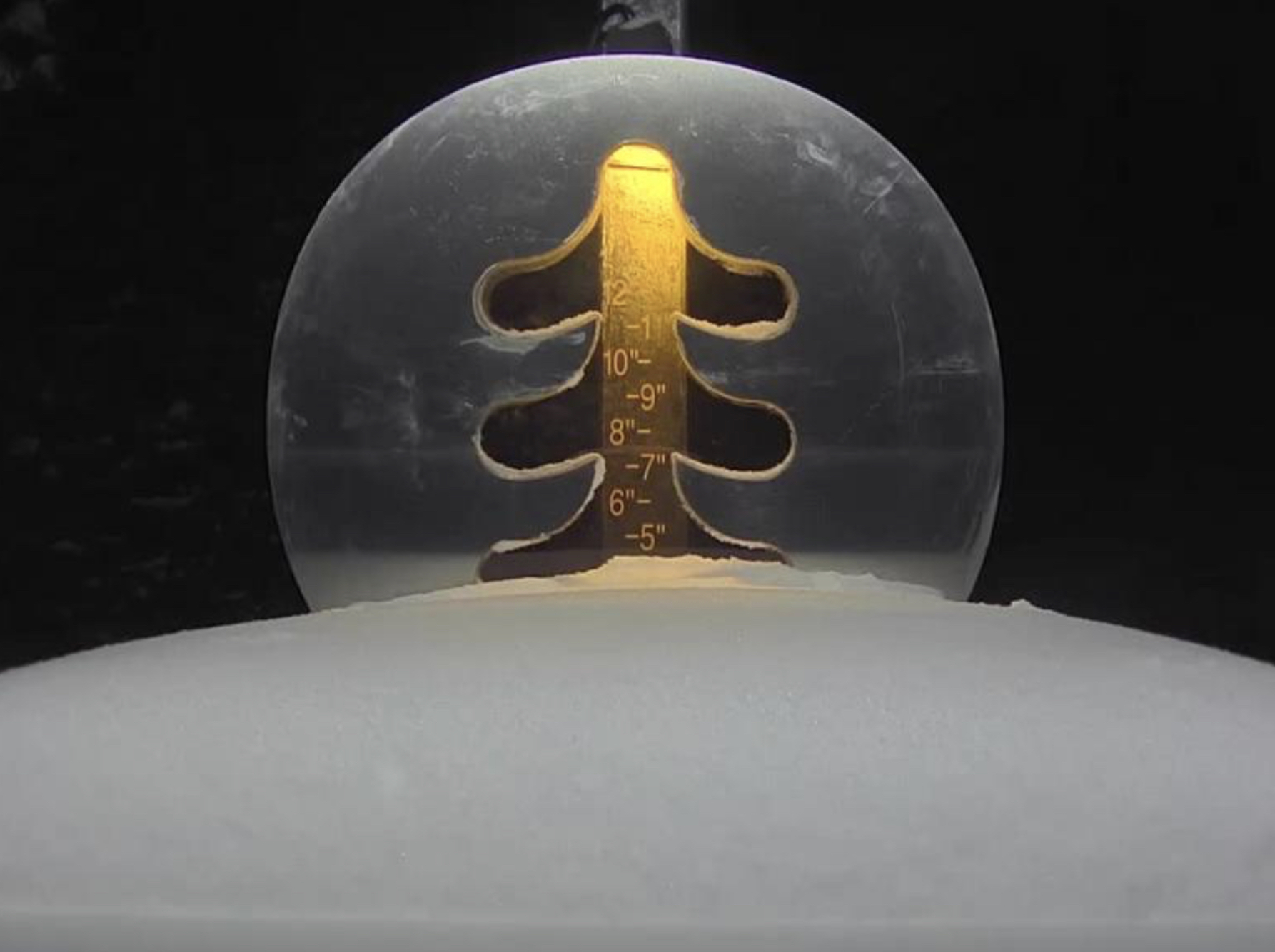
Snow and wind are on deck for Colorado today as the system works its way through. Most of the heavy snow has already fallen but there will be more to come with most resorts receiving another 2-4 to 3-5 before the lifts close. The winner so far is Breckenridge with 7, followed by Beaver Creek with 6. Powderhorn is showing just a few inches on their stake but there is much more than that as the high winds have stripped the stake.
Click to Animate
The next system will dump mounds of snow in the Pacific Northwest as the pattern may be shifting to what we were used to last year, The jet stream is likely to begin lifting and I am expecting this change. We will see if this comes to fruition or this is just a one-off storm. Regardless, there will be big totals.
This system hits Seattle today, around noon, and will take a southeast track through Utah Sunday night and Colorado Monday afternoon.
Forecast
Utah

From Yesterday
 Today
Today
Heavy snow in this morning with moderate winds between 15-20 mph. The snow will begin to taper off around lunchtime and the sun may come out late in the day. Temperatures will be in the low 20’s, at base level with windchills in the single digits.
Next System Sunday Morning

Colorado

Ridgetop Wind Map (click to animate)

From Yesterday
Today
Snow and blowing snow today throughout the afternoon. There will be breaks in between bands, as the radar is showing the bands are spread out, with about an hour in between them.
Tonight, scattered snow showers possible as any lingering waves of snow move through. Not much precipitation is expected.
LRC Model Prediction for Colorado thru April
Looking into April for Colorado resorts. There looks to be some good storms moving in April, as the jet stream begins to recede. We will keep you posted as these storms begin to show up.
The storm systems have weakened all year as they approached Colorado, running out of energy. The thinking is that the storms will begin to be larger for Colorado, as a more traditional track is likely once the jet stream begins to move north. That would mean less snow for California and more snow for Colorado.

Colorado Calendars thru May


Utah Calendar To Date

Forecasted Areas
Pacific Northwest Cascade Mountains
Crystal Mountain, Mount Hood Meadows, Timberline, 49 Degrees North, Bachelor, Mt Baker,
Lake Tahoe Sierra Mountains
Heavenly, Palisades Tahoe, Kirkwood, Dodge Ridge, Donner Ski Ranch
Utah Wasatch Mountains
Alta, Park City, Deer Valley, Brighton, Snowbird, Brian Head
Colorado Rocky Mountains
Aspen, Aspen Highlands, Snowmass, Vail, Beaver Creek, Winter Park, Keystone, Arapahoe Basin, Breckenridge, Copper Mountain, Powderhorn, Ski Cooper, Telluride, Crested Butte, Silverton, Wolf Creek, Eldora, Loveland
