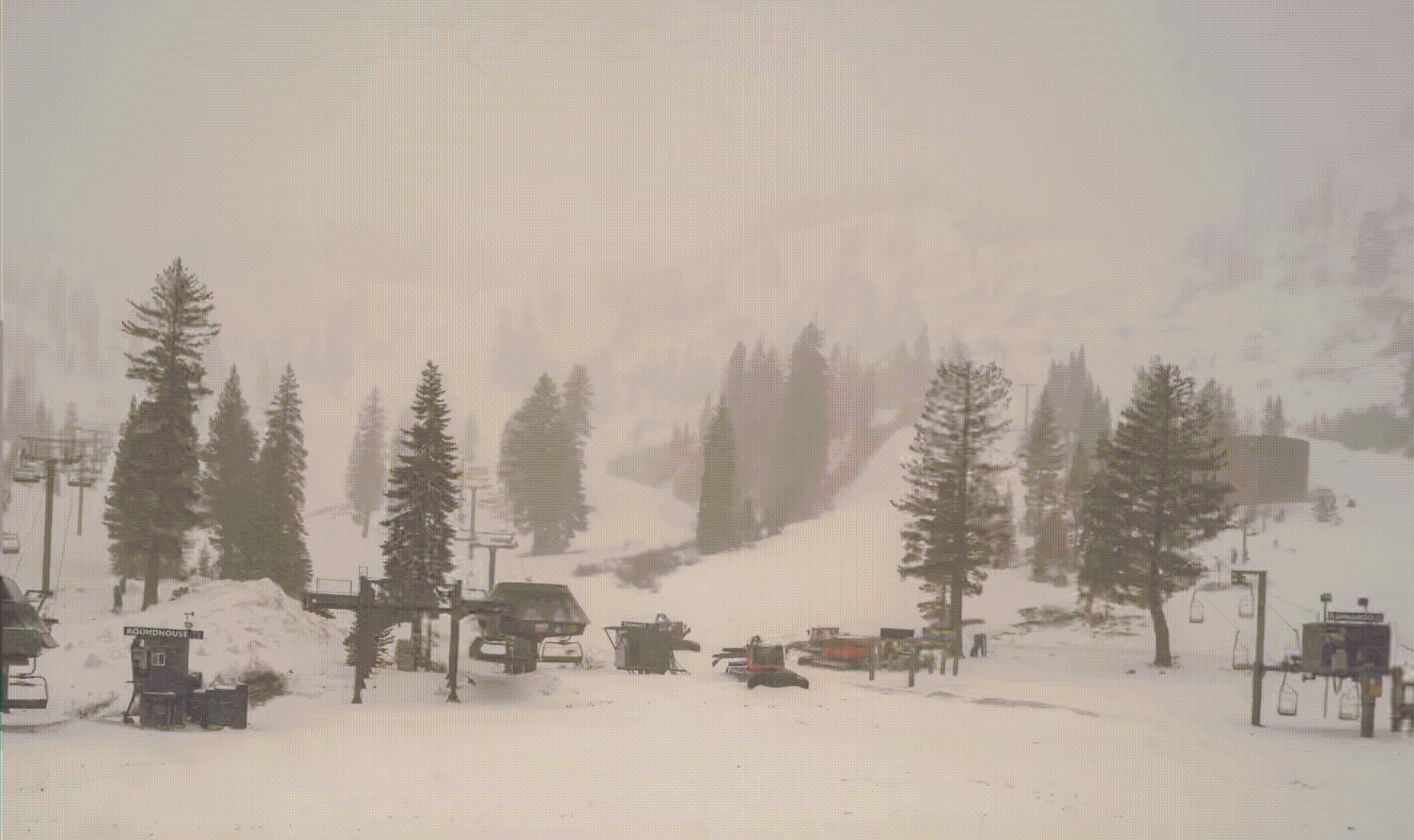
Courtesy Alpine Meadows Base cam
Pattern Discussion
That was a nice system for Tahoe. Palisades reported 2-day totals of 15″, at 8000 ft, and 409″ total for the year. That storm moves into Utah tonight where I expect Alta/Snowbird area to receive around 4-8. Alta is closed for the season, but Snowbird is open on the weekends.
We have a couple more systems left in the Active West (AW) part of the pattern. The first is a slider storm that enters the Pacific Northwest Sunday. That storm is showing up on the GFS, but looks to stay north of its usual track, which is normal for this time of year, due to the receding jet stream. The slider storm is followed by the last storm of the AW pattern and likely the last chance for good snow.
There is another storm, during the Northern Pattern, on Day 45 (May 26), that does mimic the AW pattern, but it’s practically June by then. I will monitor that one.
Possible 4th AR, as we gaze into our crystal ball for June
The last item I am personally looking forward to occurs on June 5-6th (days 56-57). That is when a possible fourth atmospheric river (AR) event is scheduled to hit Seattle. Below are the 3 previous charts that show the variations the last three times through beginning with cycle 3 down to cycle 1.
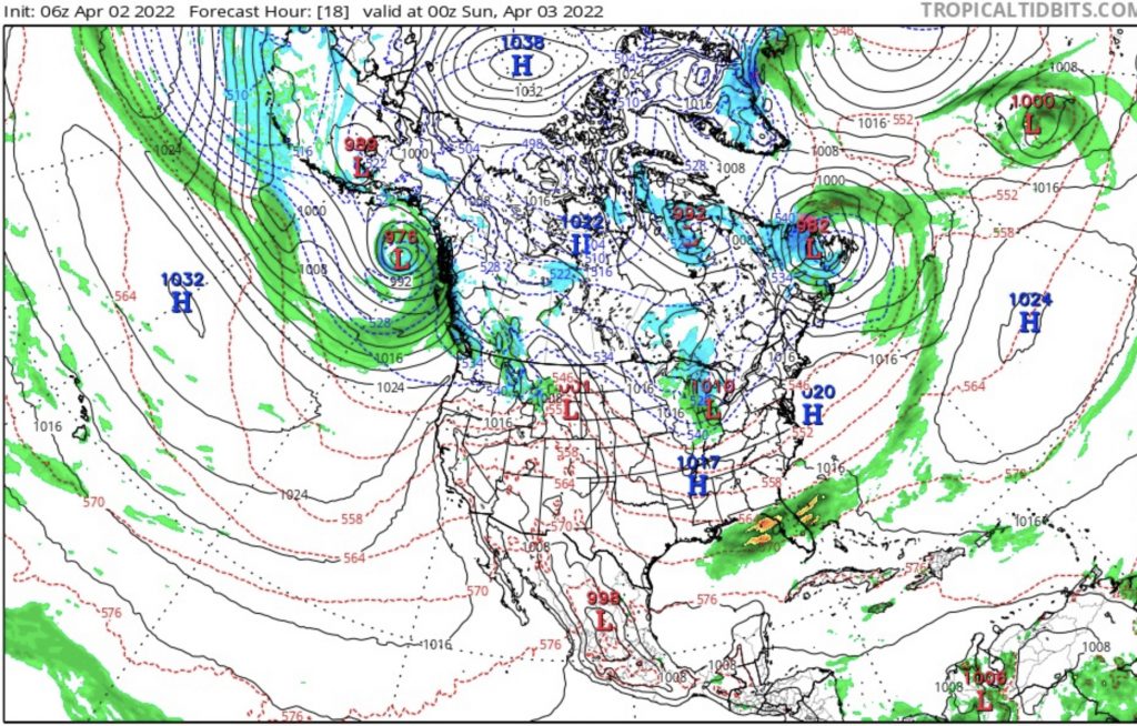
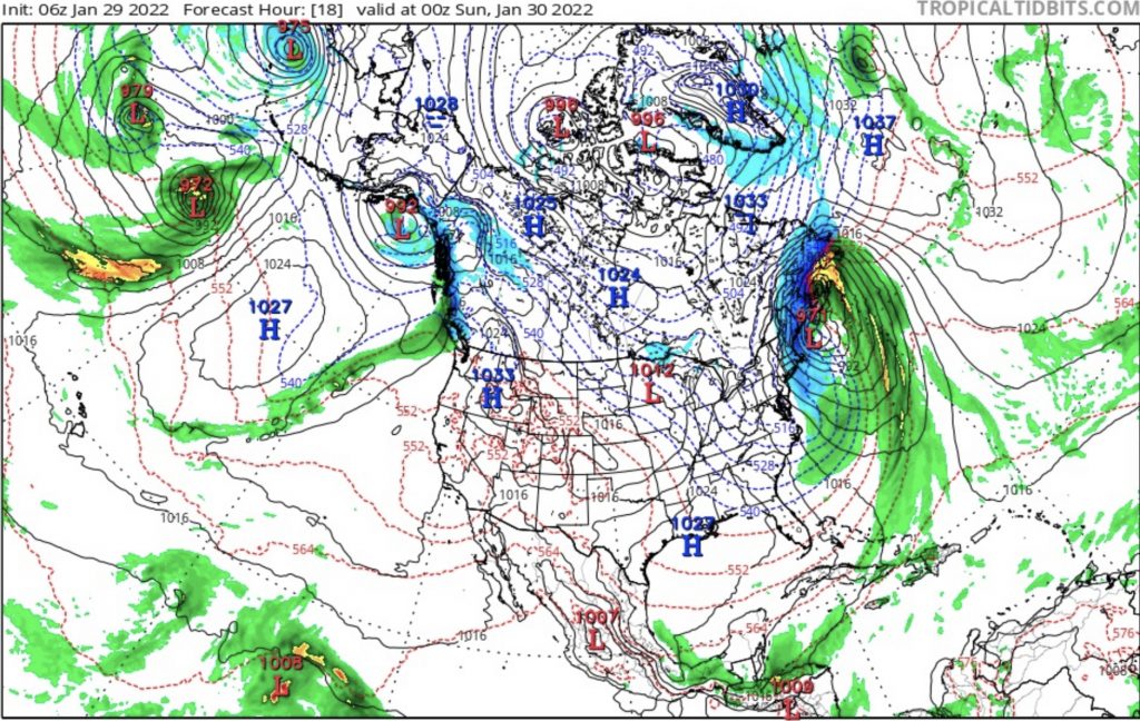
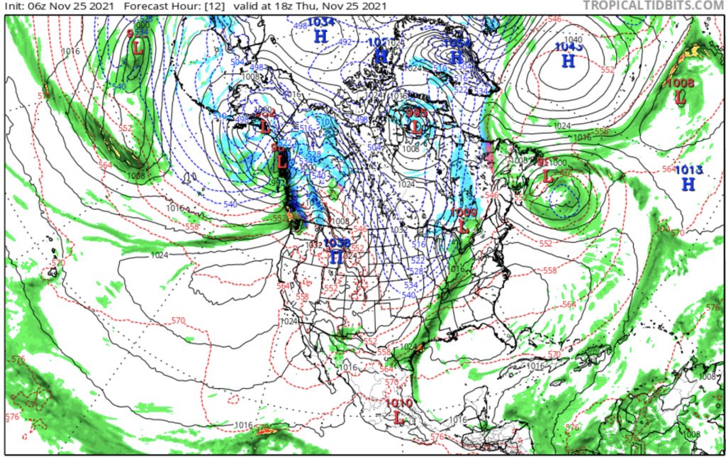
Looking at the charts you can see the low pressure in the Gulf of Alaska with an AR extending out in the Pacific in all charts. There are slight differences between them that are variations of the pattern. Cycles mirror each other every other cycle. This year that means the variations in cycles 2 and 4 are alike, and cycles 3 and 5 are alike. All of those blocking high pressure ridges off the coast of California, in cycle 3, will return in cycle 5 and there will likely be record heat in California and possibly wildfires (June 14-26). Below is the chart for the June 26 trough. I don’t expect this trough to drop this far south, but it should go as deep as Tahoe–hopefully.

The January chart above, will look like the June chart—with seasonal differences. I expect the high pressure to be in a very similar position, as well as the low. There should also be a big storm off the Atlantic coast in the same spot. There will be a trough that will bring cooler air and possible rain, around June 26th.
Summary of Remaining Pattern Storms
May 11-12 PNW — May 13-14 Storm hit Colorado all 3 cycles and missed to the north of Utah, in Cycle
May 17-18 Slider System Missed Utah and Colorado to the north in Cycle 1, but hit in both Cycle 2-3
May 20-21 Last storm of Active West Last Active West storm and transition to the Northern Pattern. Hit in all 3 cycles for Utah and Colorado
June 5-6 AR 4th Straight for Seattle?
