Pow Alert Friday/Saturday May 20th Arapahoe Basin….Details soon.

ENSO Discussion
What is ENSO?
What is El Nino Southern Oscillation (ENSO)? ENSO is a climate driver that changes temperature and precipitation patterns throughout the world.
There are three phases–El Nino, Neutral, and La Nina. This diagram below shows the differences between El Nino and La Nina. Neutral falls in between the two.

Current ENSO Status
This was the second year in a row we had a La Nina winter, will it be 3-straight? Two winters in seventy-two years had triple-dip La Ninas, the odds are against it, for sure. However, NOAA writes in their April 25th ENSO (El Nino-Southern Oscillation) report, that there is a 59 percent likelihood of a La Nina Persisting into summer and a 50-55 percent chance remaining for the fall.
Below is NOAA’s long-range outlook predicting La Nina to continue thru the fall.
 Washington Post columnist Mathew Cappucci, BA Meteorology Harvard, says “Since bookkeeping began in 1950, there have been eight “double-dip” La Ninas, including the present. Only two ended up evolving to have a third consecutive La Nina winter.”
Cappucci further summarizes that La Nina, because it overlapped with record-breaking hurricane season in 2020 (30 named storms), followed by the third most named storms, in 2021, that La Nina patterns “bolster the risk of severe weather” during tornado and hurricane season. Which I would agree with. However, the cycling pattern, which sets up in the fall and cycles through the following fall, does have an indicator for the following hurricane season. Therefore, according to what happened last fall during the transition, it should be just the opposite–mild hurricane season.
Admittingly, it is not a strong correlation, due to only 20 years of data for the Cycling Pattern Hypothesis (Lezak et al, J Climatology Weather Forecasting 2018), but if my indicator is true, we will switch to El Nino this fall. With El Nino in place, there will be less hurricane activity. Which is what I am predicting.
’22 Hurricane Predictions
 If you understand the CPH, you get a preview of what is to come for hurricane season, and when and where severe weather outbreaks will occur. This year, the Pattern shows a quiet hurricane season–not active. I am officially predicting a hurricane will hit one of these dates and locations:
Florida (Gulf side), around August 14
New England around September 5
Texas (coast) around September 28
I will put the odds around 70%, that a hurricane will form and hit one of those spots. If not, at least a strong tropical storm.
California Heat Wave
All of those blocking high pressure ridges off the coast of California, in cycle 3, will likely return in cycle 5 and there could be record heat in California and possibly wildfires June 14-26 and cycle 6 Aug 17-29.
California should get some relief at the end of that possible heatwave when a trough comes through. Below is the chart for what the June 26 trough should look like. I don’t expect this trough to drop this far south, but it should go as deep as Tahoe–hopefully.

The February chart above, will look like the June chart, when it shows up on the GFS—with seasonal differences. I expect the high pressure to be in a very similar position, as well as the low. It is this trough that will bring cooler air and possible rain, around June 26th.
An extended dry stretch of 38 days, no precipitation in Tahoe from Jan 8 thru Feb 15, occurred in cycle 2. That corresponds to May 16 thru June 26. There are indications that that is setting up, however, there is a storm showing up on the GFS around May 26. It that storm goes “poof” then its game-on.
Thank you for reading the blog, if you have any questions, as always, feel free to comment or send an email to Mike@FutureSnow.CO
Below are the remaining storms and a discussion from last week about a possible 4th AR in a row to hit Seattle in June.
Summary of Remaining Pattern Storms
May 17-18 Slider System Missed Utah and Colorado to the north in Cycle 1, but hit in both Cycle 2-3
May 20-21 Last storm of Active West Last Active West storm and transition to the Northern Pattern. Hit in all 3 cycles for Utah and Colorado
June 5-6 AR 4th Straight for Seattle?
Possible 4th AR, as we gaze into our crystal ball for June
The last item I am personally looking forward to occurs on June 5-6th (days 56-57). That is when a possible fourth atmospheric river (AR) event is scheduled to hit Seattle. Below are the 3 previous charts that show the variations the last three times through beginning with cycle 3 down to cycle 1.
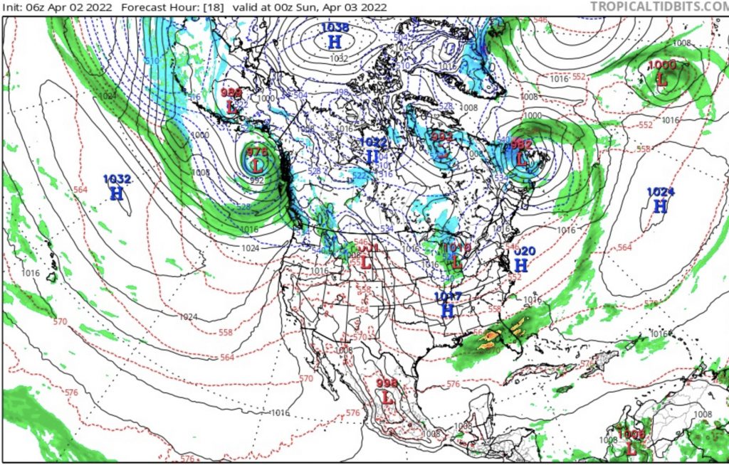
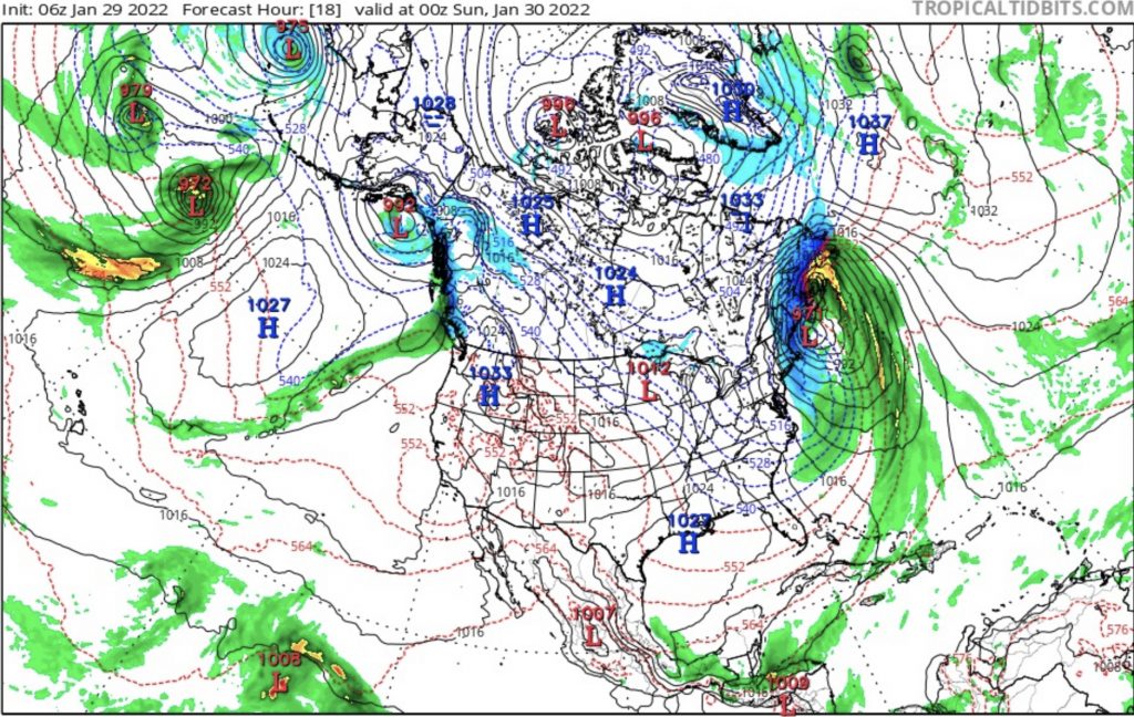
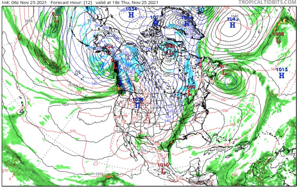
Looking at the charts you can see the low pressure in the Gulf of Alaska with an AR extending out in the Pacific in all charts. There are slight differences between them that are variations of the pattern.
Cycles mirror each other every other cycle. This year that means the variations in cycles 2 and 4 are alike, and cycles 3 and 5 are alike.
