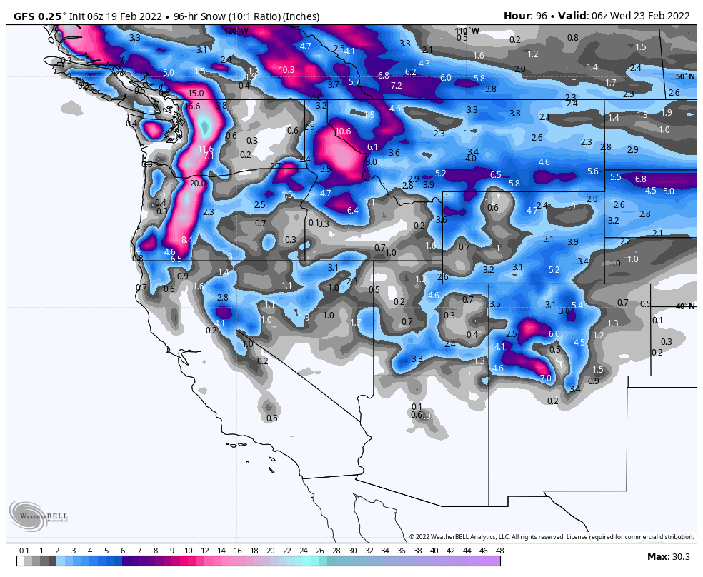
Forecasted Snowfall through Wednesday
Pattern Discussion
There is a little over 3 weeks left of the Active West Pattern, which appears to be back to strength, as the ridge is back to its regular position. We have taken a hit on our predictions chart, due to the extreme high pressure we had in the last couple of weeks. I have updated the sheet on my end and will update the site later today. We are sitting at 87.5% accuracy, at the moment and appeared to have weathered the storm and are back on track. The double barrel high pressure wrecked the charts perfect record.
Our next set of predictions are out for March. The first date of March 1st, for Colorado, is a left-over from the last set of predictions back on December 27th. That storm is showing up on the models and is on time. The Spring Break forecast, released yesterday, added these next predictions below.
March 4th Colorado
March 9-11 Colorado
We have been working hard to bring the next set of predictions out and are finishing up that work and will release soon. The next set of predictions will get us through April.
Forecast Summary
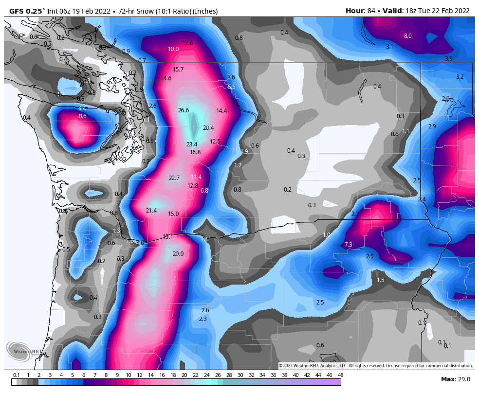
The next storm has already begun in Washington and Oregon and is moving according to the path it took last time through. It will reach the Sierra and Wasatch mountains Sunday night, then reach Colorado Presidents Day.
Forecast
PNW
Northern Cascades
Snow today with snow levels across the PNW around 500 ft. Strong winds from the northwest between 10-20 mph with gust upwards of 30 mph. I am expecting 4-8 for the northern Cascades today, with another 3-5 tonight.
Southern Cascades
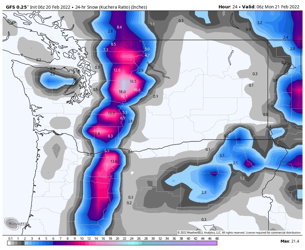 Snow and blizzard conditions possible early in the morning, so if you are driving up to one of the resorts plan on a little extra time. It will most likely snow all day with 6-10 for the southern resorts like Mt Hood Meadows and Bachelor. It will continue to snow tonight with another 4-8 overnight.
Presidents Day
Snow continues for the northern Cascades as the system begins to wind down by noon. Expect another 2-4 as the winds settle down and switch to the east. Southern Cascades the show continues, with another 3-7 during the day with light winds from the west at 5-10 mph. The system moves out overnight but not before another 2-4 falls.
Tahoe
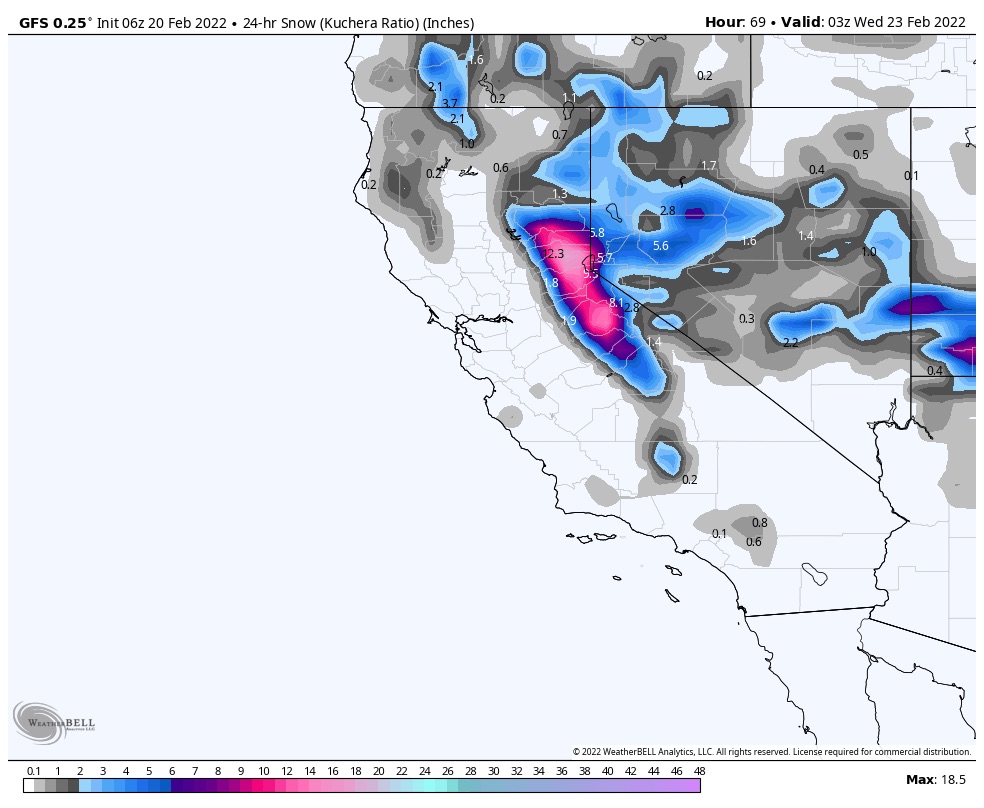 The system arrives tonight with a few flakes with this first wave. The bulk of the precipitation is going to happen with the back edge of this system tomorrow and Wednesday. Expect 1-3 tonight for resorts along the crest and east side of the lake.
The bulk of the system will arrive Monday night, where I expect snow accumulations to be in the 4-8 range with another 4-8 Tuesday. Moderate winds with gusts between 20-30 for the storm system with falling temps beginning Monday. The high temp on Tuesday is expected to be around the middle 20’s and drop to the single digits Tuesday night.
Utah
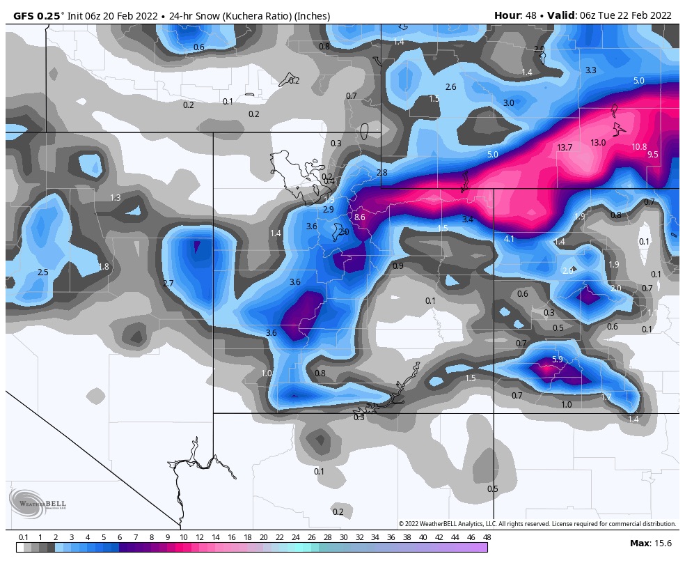
The storm rolls in tonight before midnight. Great temperatures overnight with a low around 15. I am expecting 1-3 before the lifts turn and another 3-5 throughout Presidents Day. Moderate winds between 10-15 mph but cold wind chills so bundle up!
Colorado
The snow arrives Monday, around noonish. Expect the bulk of the storm to arrive tomorrow night with most mountains receiving 2-4 with the central and southern mountains picking up 3-5.
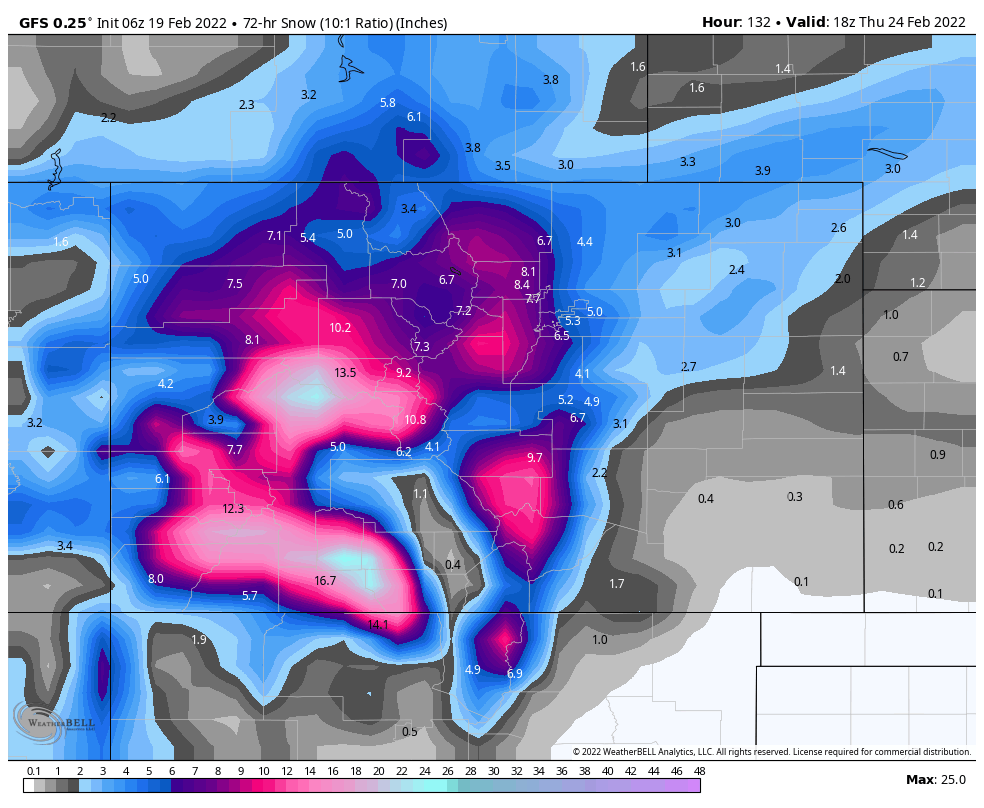
3 Day Storm Totals
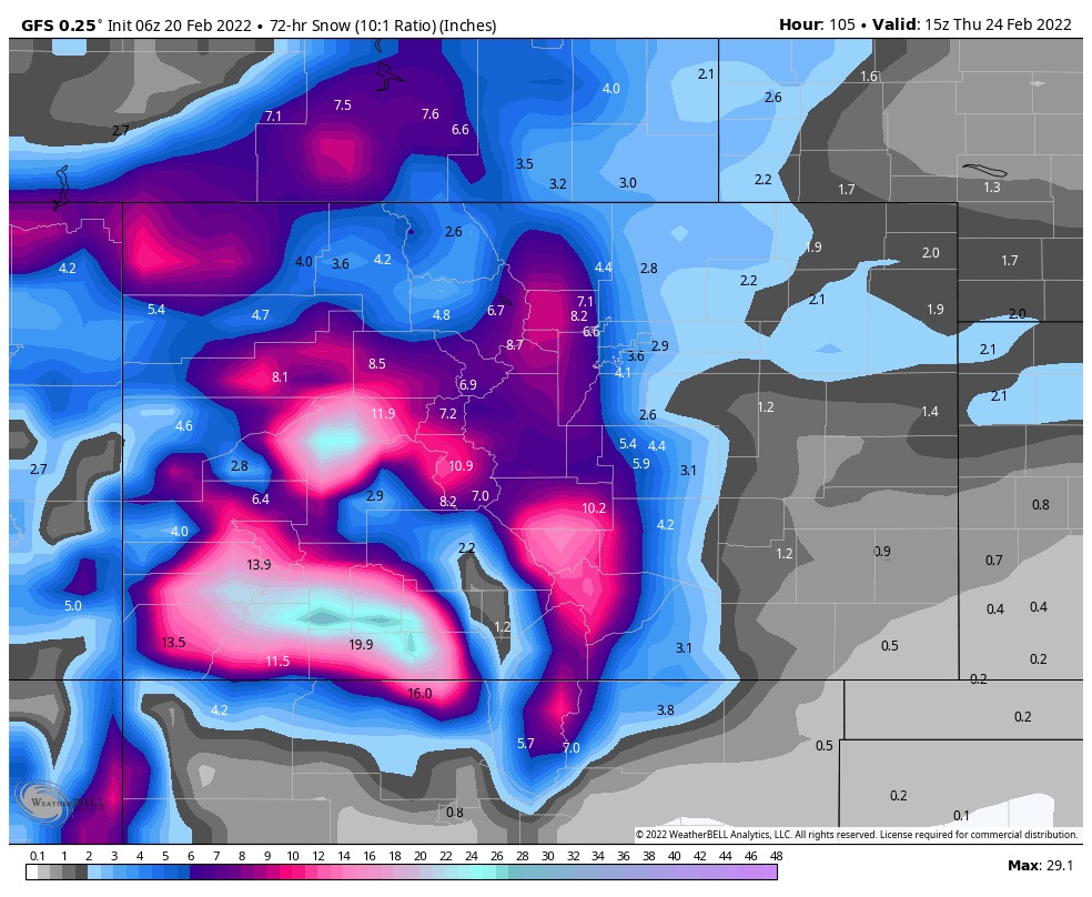 The snow will continue through Wednesday with the northern mountain totals in the 6-10 range, central 8-12, and southern mountains in the 12-20 range.
