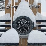
Yesterday’s Snow Stake Totals


Next Two Systems
 Forecast Pattern Summary
 We are on Storm 4 for the Long-Range forecast chart, arriving tomorrow to the Pacific Northwest (PNW). We are in an amplified pattern, meaning we have favorable teleconnection patterns. This amplification is why these storms are bigger and dive deeper into California hitting Tahoe.
I have learned, over the years, that Tahoe has specific storms, but with amplification, can have additional systems. That is exactly what is happening now.
Look at the Precipitation percentages. What a start to the season. Take advantage while you can, because these patterns can flip. We saw that last year. Cycle 2 was amplified, then cycle 3 came and we had positive teleconnections with a huge double High pressure of the coast and over Utah. Let’s look at the current indexes.
Currently, the Artic Oscillation (AO) is deep negative, the North Atlantic Oscillation (NAO) is negative and projected to dive deeper in the negative. Finally, the Pacific North American Pattern (PNA) is negative and is projected to rise in the coming days. These negative indexes add fuel to the storms.


We are in another La Nina, the 3rd in a row, but it is behaving like we are in an El Nino. What drives all of these mechanisms? The LRC. That is the secret sauce that makes the dish. It took me a long time to believe, and even longer to understand that the LRC drives/is mother nature, not just another teleconnection and we are beginning to figure this out.
Storm Number 4, 4.5, 5 and 6

 The pattern right on time at the moment and the next storm will hits early Thursday morning (forecasted 29 days ago). I have added 4.5 for Lake Tahoe, that gets in on the action Thursday night. That storm reaches Utah Friday and Colorado Saturday. We will dial in the forecasted amounts for Utah and Colorado tomorrow. The models don’t appear to have the strength figured out yet.
Cascades
Sunshine today with highs in the low 30’s, moderate winds 10-15. Tonight, the storm moves in from the south to the north, beginning in Oregon, 11 pm, and moving into Washington in the wee hours (3 am). Snow levels near 3000, falling to 2000. Expect 3-5 before the lifts open Thursday morning.
Thursday
Another 3-5 expected for Crystal Mountain, with 2-4 expected for Stevens Pass and Snoqualmie. For southern cascade resorts Mt Hood Meadows/Timberline and Mt Bachelor. The best snow will fall during the day with 6-10 expected during operating hours, with another 2-4 overnight. Temperatures in the mid 20’s north and upper 20’s south with moderate winds with gusts around 20 mph. Temps in the teens to low 20’s at the peaks.
History of this storm: The last time this system came thru, in October, had similar numbers. Mt Hood was the winner with 2-day totals of 12, Stevens Pass was second with 9.
Lake Tahoe

Today will be beautiful, with light winds and temperatures in the lower 30’s at base. Tomorrow, carbon copy. Tomorrow afternoon is when the first wave rolls in, after 4 pm. The winds will pick up and gusts will be near 40 mph as the front approaches. Friday morning snow totals should be in the 6-10 range for resorts north of the Lake and along the crest. This storms bullseye is tracking near Donner Summit.
The second wave hits late Friday afternoon. This wave is the meat of the storm and will produce heavy snow totals from 1-3 feet, as of now. We will dive deeper into the totals tomorrow.
Utah and Colorado
Colorados current system moves out later this evening after another 4-6 for Steamboat, 3-5 for Vail Beaver Creek and 3-5 for southern resorts Telluride and Silverton. Temperatures will be warm with light winds.
Storm 4 arrives Saturday

Thanks for reading the blog, as always if you have any questions, please ask in the comments below or send an email to Mike@FutureSnow.CO
Forecasted Areas
Pacific Northwest Cascade Mountains
Crystal Mountain, Mount Hood Meadows, Timberline, 49 Degrees North, Bachelor, Mt Baker,
Lake Tahoe Sierra Mountains
Heavenly, Palisades Tahoe, Kirkwood, Dodge Ridge, Donner Ski Ranch
Utah Wasatch Mountains
Alta, Park City, Deer Valley, Brighton, Snowbird, Brian Head
Colorado Rocky Mountains
Aspen, Aspen Highlands, Snowmass, Vail, Beaver Creek, Winter Park, Keystone, Arapahoe Basin, Breckenridge, Copper Mountain, Powderhorn, Ski Cooper, Telluride, Crested Butte, Silverton, Wolf Creek, Eldora, Loveland


Pardon my ignorance, but what does “LRC” stand for, please? Thank you!
Hello Tony, Sorry forgot to mention that the LRC stands for Lezak’s Recurring Cycle. Named after Gary Lezak, he discovered the cycling pattern about 30 years ago and has been forecasting weather using that hypothesis. We will be discussing the LRC, and go in depth about how it works in an upcoming blog post. Thanks for your question, Mike