Big Snow in New Mexico
 Summary
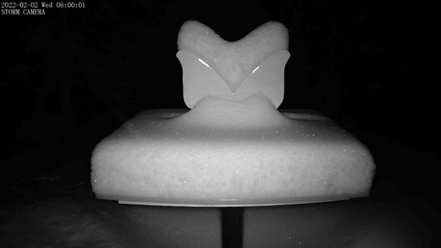
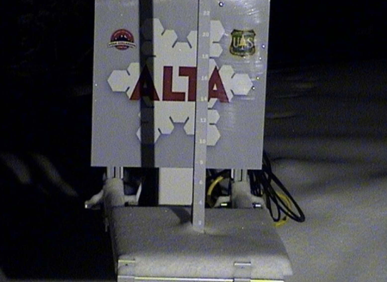
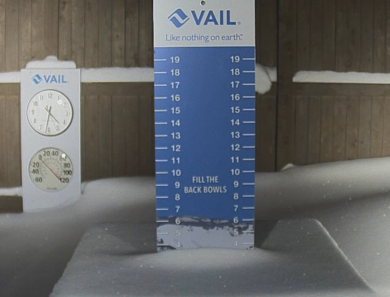
Snow fell across the Pacific Northwest, Utah, Colorado and New Mexico as this system exits through Colorado today. I am very happy that Utah got at least a couple of inches, it was looking like it was going to be missed. The next storm will begin off the British Columbia Coast on Monday.
Medium Stoke


Pattern Discussion
We have had some interesting developments with this year’s pattern. I have spent quite a bit of time going through analyzing what is happening. The double-barrel High pressures, off the coast and over Nevada, have altered the Pattern path to the north and east. The storms are slightly off on the timing, due to the altered path. The storms that track through Alaska and down are sped up, and the Storms that track west of the Aleutians are slightly delayed. The storms are also weaker, due to the dry air. Remember, last cycle, we tapped into the Pineapple Express (atmospheric river). This cycle it is nowhere to be found.
This diagram shows the change in the path. The blue areas are the moisture for precipitation. The red areas are dry sinking air. The California Track is blocked by the High and some storms shear apart (next animation).
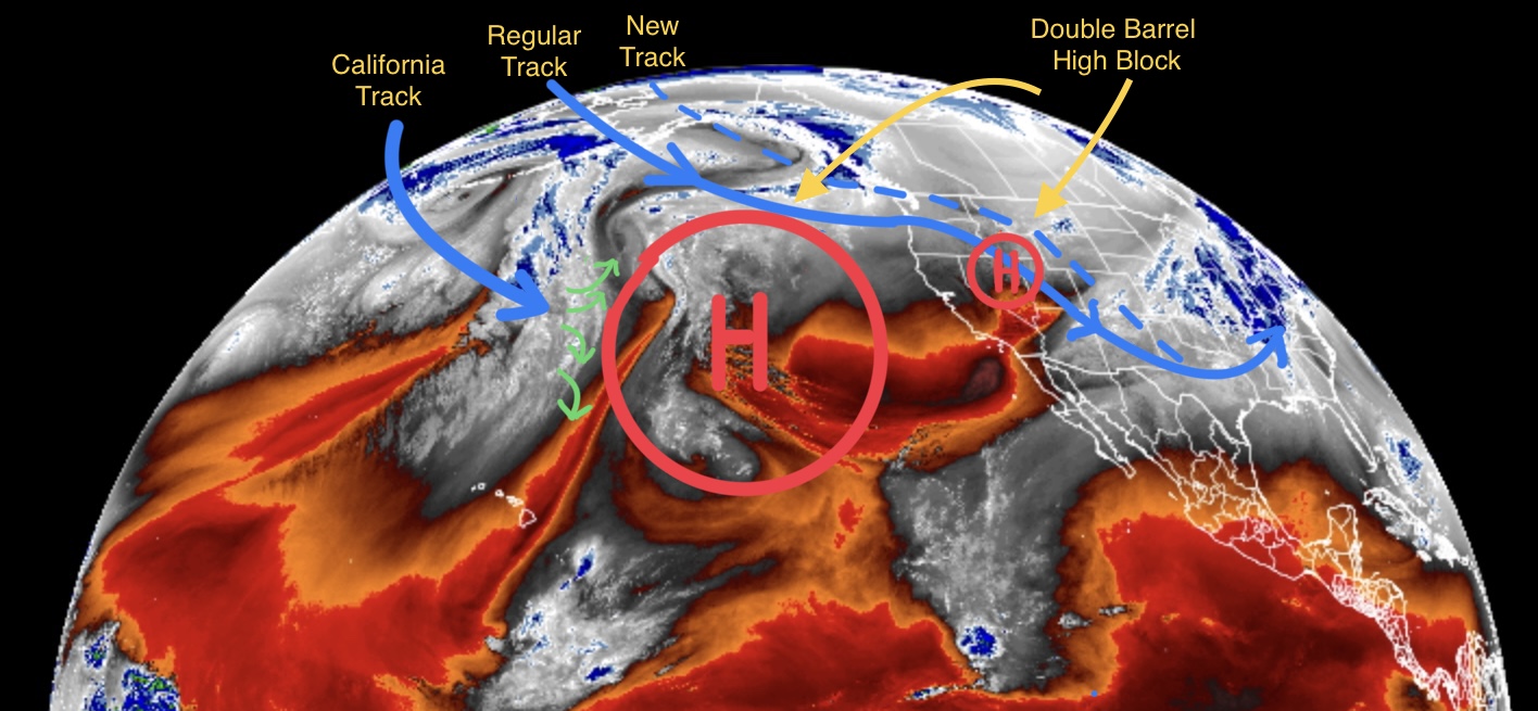
In this next animation, keep your eye on the High off of the coast. Watch how the High blocks the storms and shears apart the incoming storm (where the video reverses). Eventually the High goes back to where it was in the last cycle and the storm door for California opens up–hopefully right on time for my Feb 22 prediction.
