 Pattern Discussion
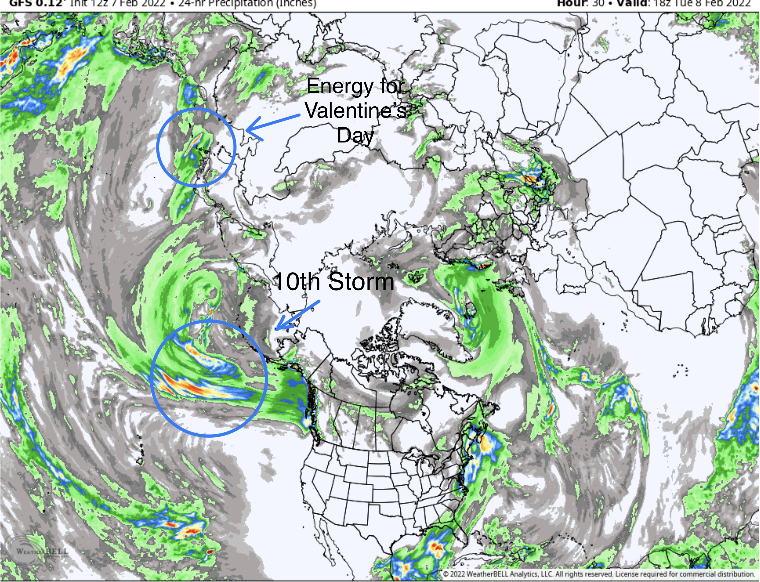
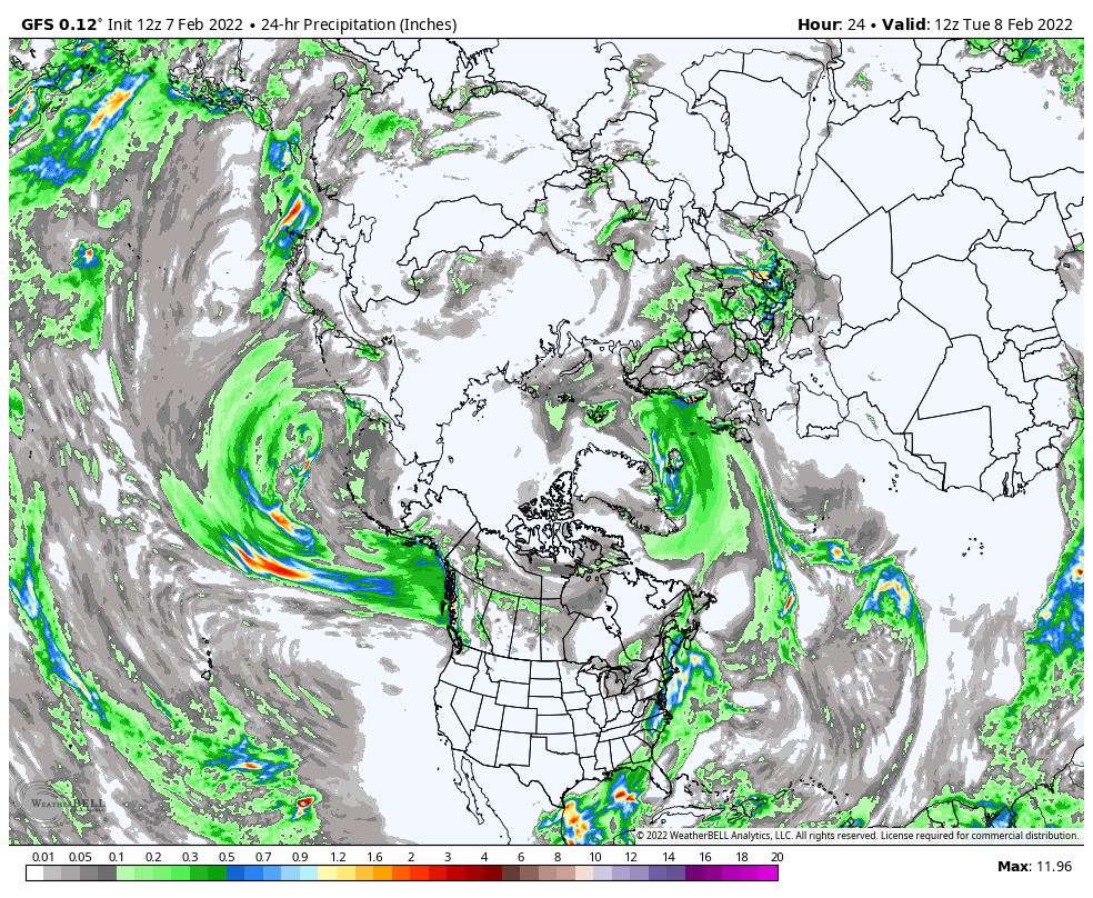
The coast of British Columbia is getting pounded with wave after wave of storms. The double barrel high pressure, that I’ve been talking about the last few days, is beginning to shift, allowing these next three waves to breakthrough. Here in the continental United States, there is not much going on. A few inches on the East Coast, but that’s it.
It has been feast or famine for Alyeska Ski resort, about an hour away from Anchorage. When the High (pressure) was stuck in the Gulf of Alaska, famine. With the High where it is now, feast. The storm have to go up and over the ridge, right towards the resort. Alyeska has over 500 inches for the season, even with long dry spells from the high pressure block.
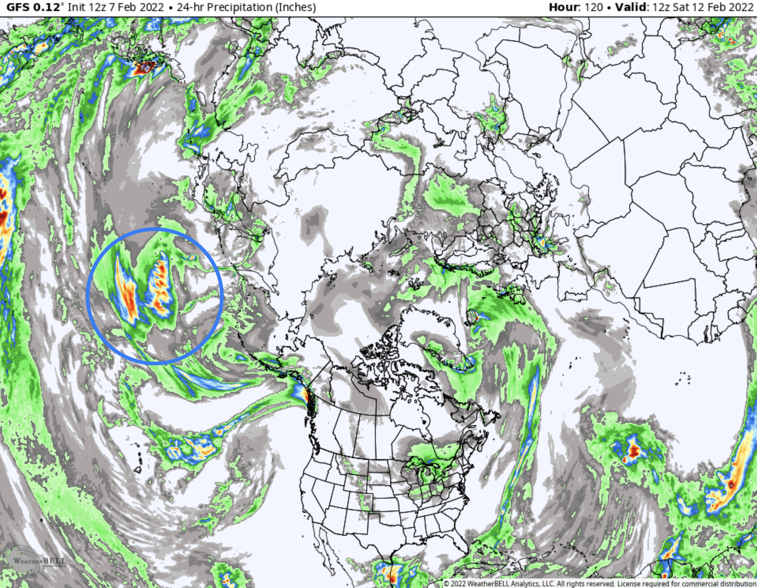
In this next animation, you can see the changing pattern. It also shows the next three waves for Colorado and the Pacific Northwest, and a couple extra “fantasy land” storms that are too far out to count. I will say though, that those “fantasy” storms DO fit the upcoming Pattern storms.
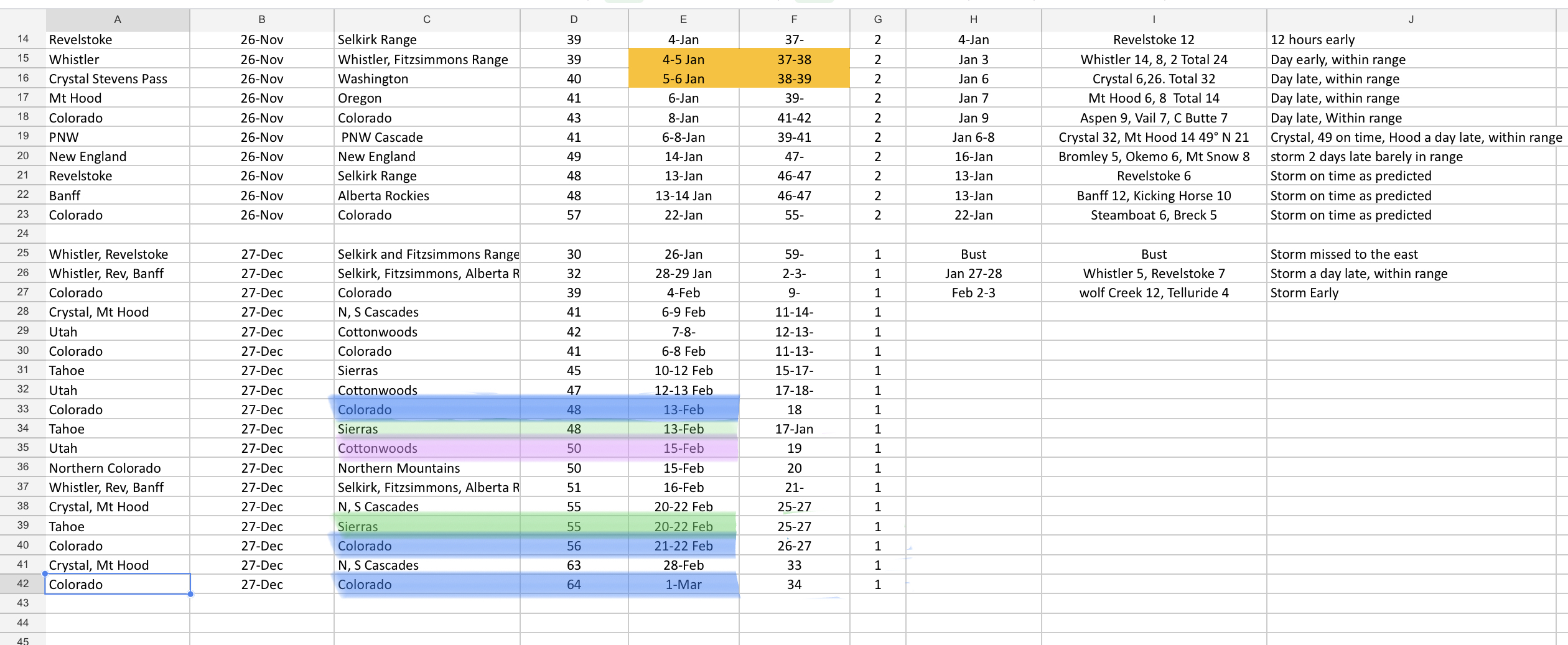
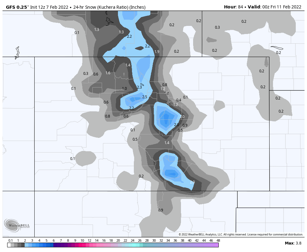
Looking at the prediction sheet, the prediction for February 13th, Colorado and the Sierras, is showing up with precipitation for Colorado and zip for the Sierras. The next prediction, February 15th, is also showing up on the models with this wave looking a little stronger. This storm will slide across Utah and hit Colorado on Thursday the 17th, or so.
These systems are still way out, and the models have not come to an agreement yet, so we will keep an eye on it.
Forecast
Colorado
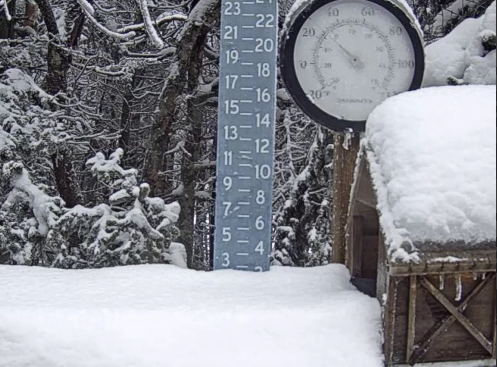
 A small system coming through late in the day Wednesday, and overnight. Temperatures will be falling as the snow begins, so the snow quality will be nice and dry. With a low around 15° for Thursday morning. Arapahoe basin, and Loveland could pick upwards of 5 inches, along the pass.

This blog is awesome and the long range prediction chart is remarkable. I have read other snow prediction sites that largely discount long-term forecasts, and therefore, don’t really discuss much beyond 7 days. But what is the point of giving a powder forecast to try and plan a sick or vacation day with only a week’s warning? Anyone can figure out where it is going to snow in the next 7 days, it is beyond that range that a true snow prediction site provides value, like yours. If I want to know what the short-term will bring, I will just read the NWS reports, and certainly not some pay site like OpenSnow that only gives short-term forecasts. I have been spreading the good word about your site this winter to those in Colorado. Thanks for the loooooong-range forecasts.
Thank you Darrin, that is why I started doing this, for people like us. Living in Kansas City I wanted to know when was the best time to plan a trip. Because I,like everyone else, want to have fresh snow in the trees and especially on the slopes. This method is not perfect, by any means, but it works and I’m getting better at knowing the details. Thanks for spreading the word! Mike
You’re doing great Mike. It’s so cool to follow the storms and see them come through even when I’m not riding. Im staying near Aspen this week. Will be ready to drive all the way to Copper on Thursday if the snow that way calls my name.