Pattern Discussion
We are in Cycle three, in a stretch that in both previous cycles, experienced a brief lull. The Active West pattern gets back on track Saturday. What is encouraging about Saturday’s storm is that it is on the correct path that it took last time through back in December.
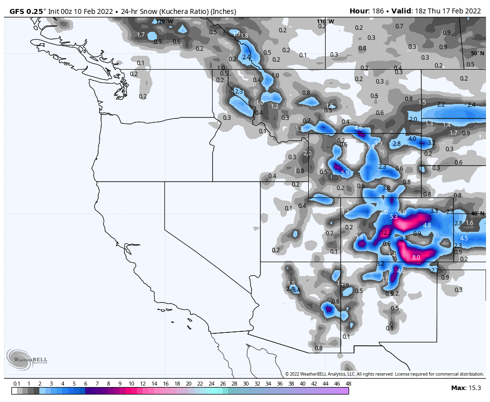
That storm will be followed by a system due to arrive Thursday the 17th. That storm also looks to be in the proper path, with the exception of the entry point, which is off a hair. The models may correct this solution in the coming days.
Following the 17th storm, way out in model la-la land is a storm that I call a slider, that is due to come back through Feb 26th, or so. That storm will slide across, if it is in the proper alignment. Below are the 3 charts from last time through.
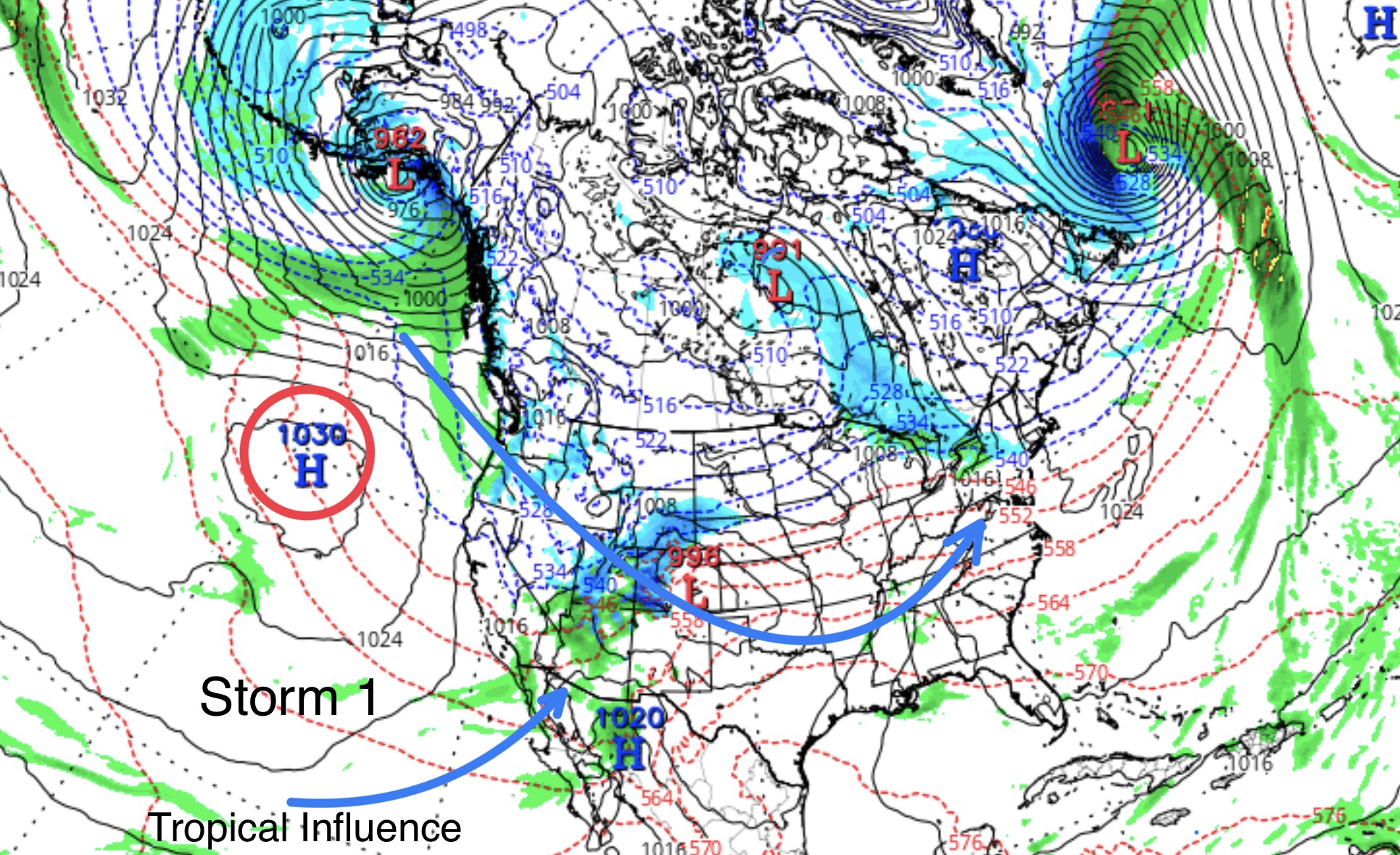
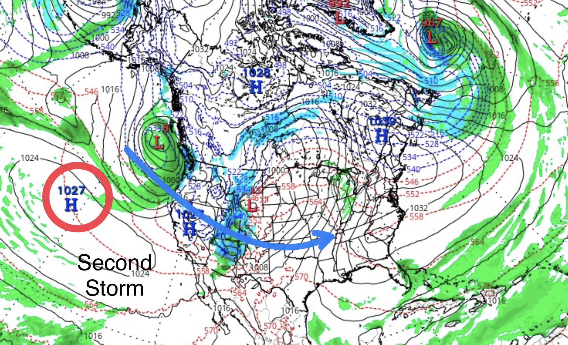
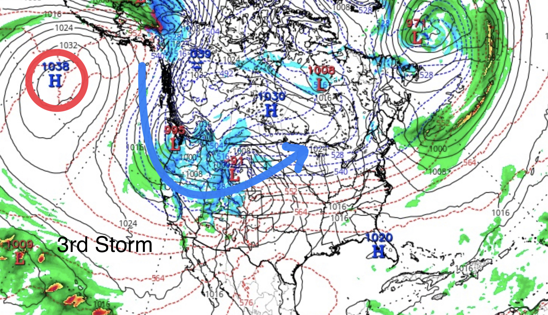
What is different, in cycle three, is the tropical moisture that was tapped in Cycle2, is not there–it is more similar to Cycle 1. Therefore, the strength of the storms has been weaker this cycle. Similar to how they were in cycle one. Also, they are weaker due to the influence of the teleconnections. The Arctic Oscillation (AO), and the North Atlantic Oscillation (NAO) are both positive, whereas in Cycles 1 and 2, they were negative. Below are the 3 charts from cycle 1. Notice the similarities to Cycle 2. Notice the influence of tropical moisture compared to the lack of it.
Next, a video of the 500 millibar flow demonstrating the flow of the jet stream and the position of the high pressure off the coast. It begins to wobble, then disappears as the flow takes a more favorable track.
Forecast
PNW
After a week-long dry stretch, snow is finally back in the forecast, although not until Sunday. Expect clear skies and warm temperatures through Sunday, until the next storm arrives Sunday afternoon.
Colorado
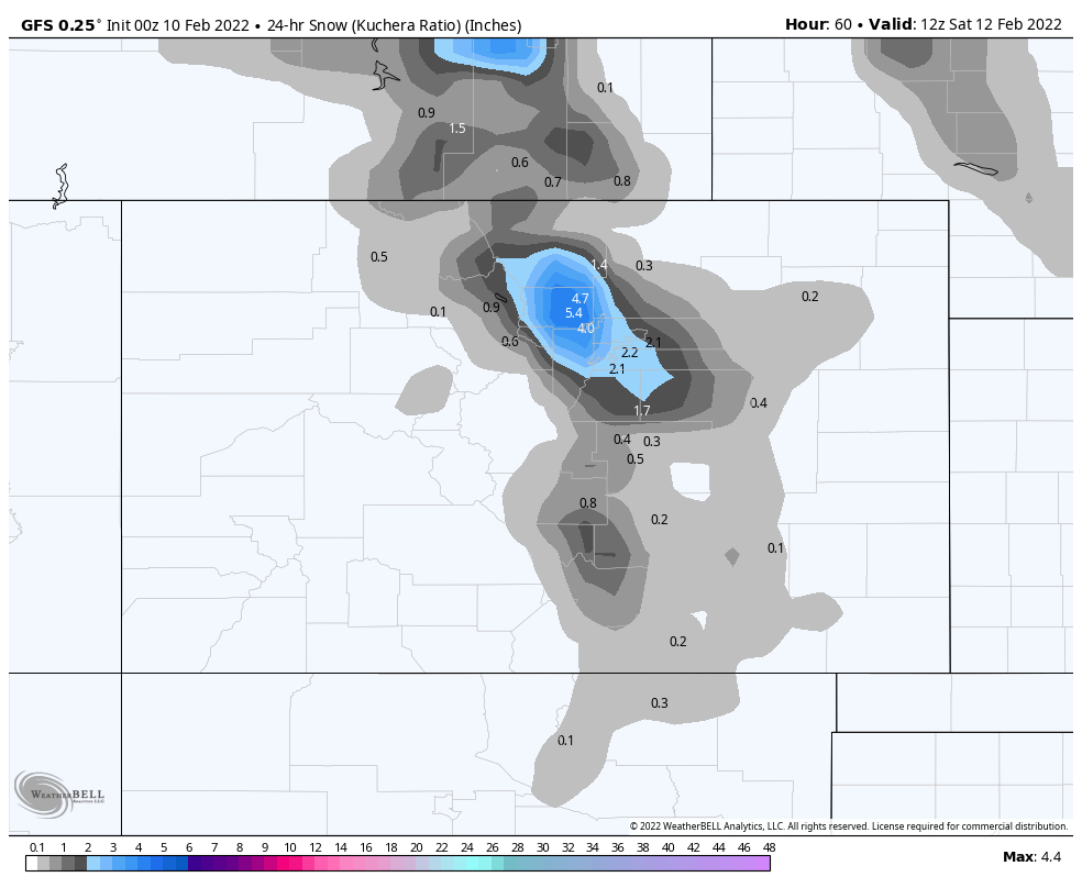
Friday nights Storm is trending in the wrong direction. The latest run shows 1-4 inches for the northern mountains, with the highest totals around Winter Park, for now. Temperatures dropping to around 10° overnight, so soft snow for Saturday morning. Saturday will be a gorgeous bluebird day, with highs around the freezing mark with lite winds.
Next system
Thanks for spending time reading the blog. If you have any questions, please ask them in the comments below. If you would like to take advantage of our free Ski Concierge, which gives you detailed information for your trip, send me an email to Mike@FutureSnow.co
