Powder Day Saturday at Arapahoe Basin
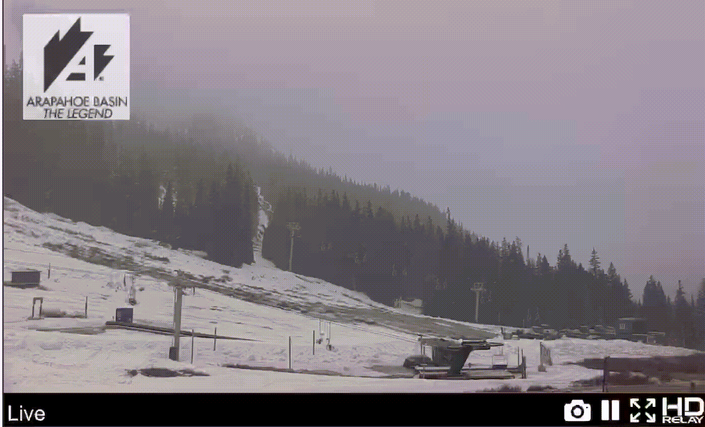
Snowing at Arapahoe Basin
Summary
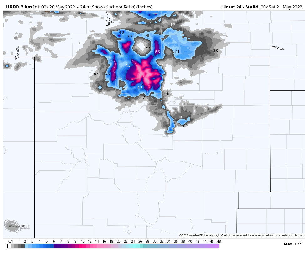
It is May 20th, and we are under a Winter Storm Warning for Denver, Winter Park, and Loveland/Arapahoe Basin, as well as a host of other areas, until tomorrow midnight. The storm is moving in from northwest to southeast, with the bulk of today’s precipitation occurring tonight and overnight.
Base elevation temperatures will be in the low thirties for both Arapahoe Basin and Winter Park. Expect windy conditions to persist until early afternoon, then winds will calm to 5-10 mph.
Forecast
Today
Not much has changed since yesterday, with the exception of timing. The moisture is a few hours late. I am expecting 3-5 throughout the day today with 8-12 overnight. Moderate winds with 30 mph gust this morning, as the waves move in.
In the afternoon it will be quite nice with calm winds 10-15 mph. In the trees it should be very quiet this afternoon–if you like that exceptional quite you only get with snow acting as a sound block.
Tomorrow, Powder Day
Cold temperatures overnight, in the teens at base level and possibly single digits at the peaks, will allow soft powder turns on Saturday. It will be a great day with moderate winds and temperatures around freezing, at base and mid 20’s up top. Maybe Pali chair for Sunday AL?
Sunday
The bulk of the storm moves out overnight. Expect lingering snow flurries or a small shower in the afternoon, with some sun peeking through, at times. Moderate winds between 10-15 with 20 mph gusts. Temps in the upper 30’s at base and lower 30’s up top.
We Have Come Full Circle
Thats It! Thats the last storm (most likely) and it is interesting how this was the storm that really kicked off the season, back in November.
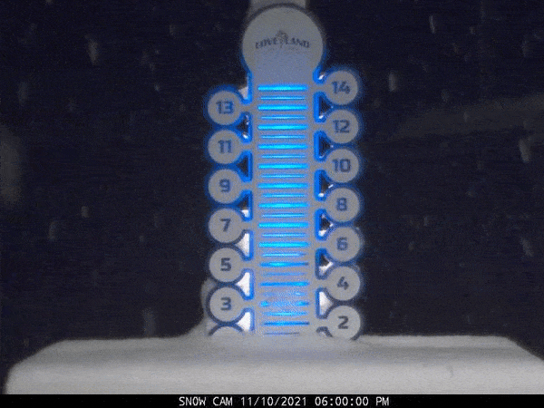
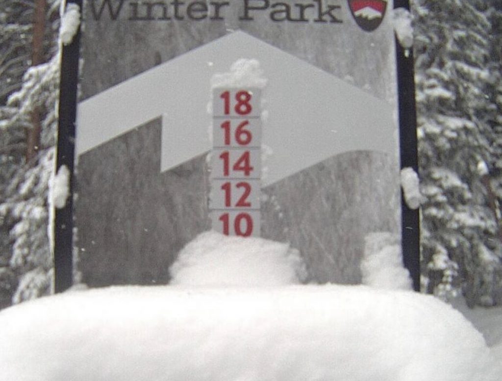
As those of you know that follow the Pattern, the weather cycles (repeats). When this system came through the first time and blanketed Colorado November 10-11th. Winter Park and Loveland both received 8″. This is the fourth cycle, we don’t know the numbers yet, but it is fitting that this particular storm ends the year.
Begin Northern Pattern Tuesday
June 5-6 AR 4th Straight for Seattle?
Possible 4th AR, as we gaze into our crystal ball for June
The last item I am personally looking forward to occurs on June 5-6th (days 56-57). That is when a possible fourth atmospheric river (AR) event is scheduled to hit Seattle. Below are the 3 previous charts that show the variations the last three times through beginning with cycle 3 down to cycle 1.
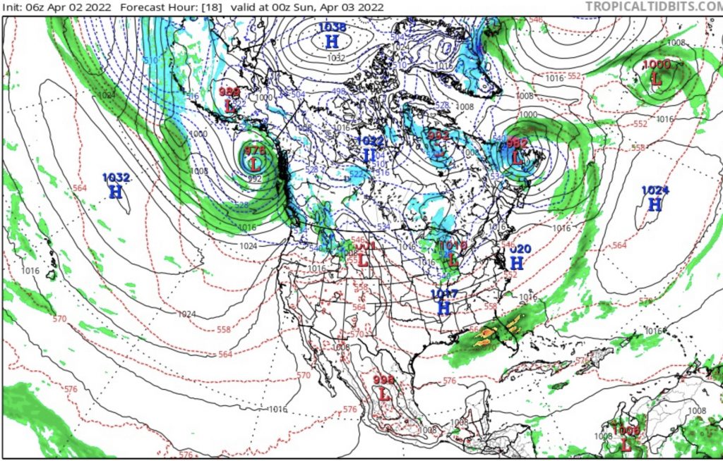
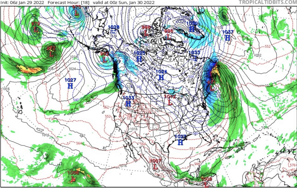
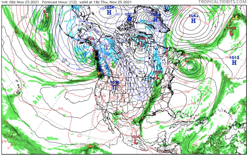
Looking at the charts you can see the low pressure in the Gulf of Alaska with an AR extending out in the Pacific in all charts. There are slight differences between them that are variations of the pattern.
