Atmospheric River for California
Winter storm warning for the Sieras until Tuesday, as the second AR for California gets engaged today. Take a look at the offshore flow from this animation. 

The action begins this afternoon with modest totals until late this evening, as the AR slingshot engages to amplify the moisture content from the pineapple express. Last cycle this storm had an AR as well, this is an important discovery, that these seemingly random events can repeat. That brings into focus the other AR events that have already occurred.
This AR was not the system that came through California last time. This one came through Seattle. The California AR is due back December 23rd. Let’s see if that storm has an AR attached when it comes back through.
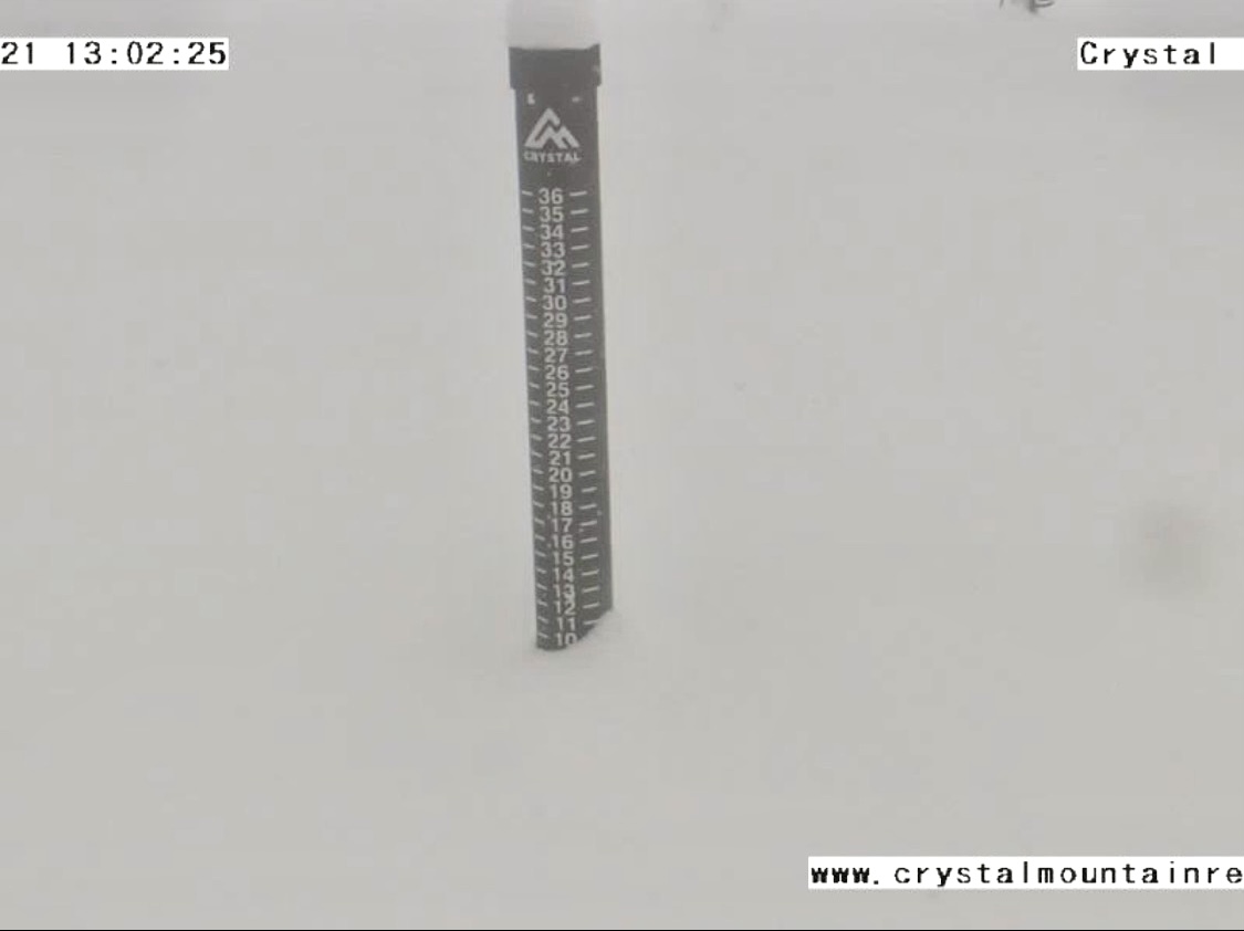
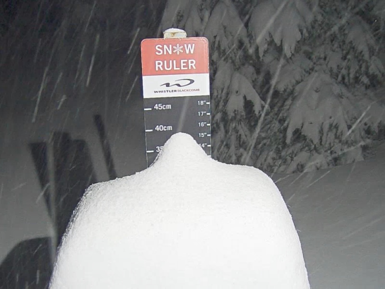
Pacific Northwest
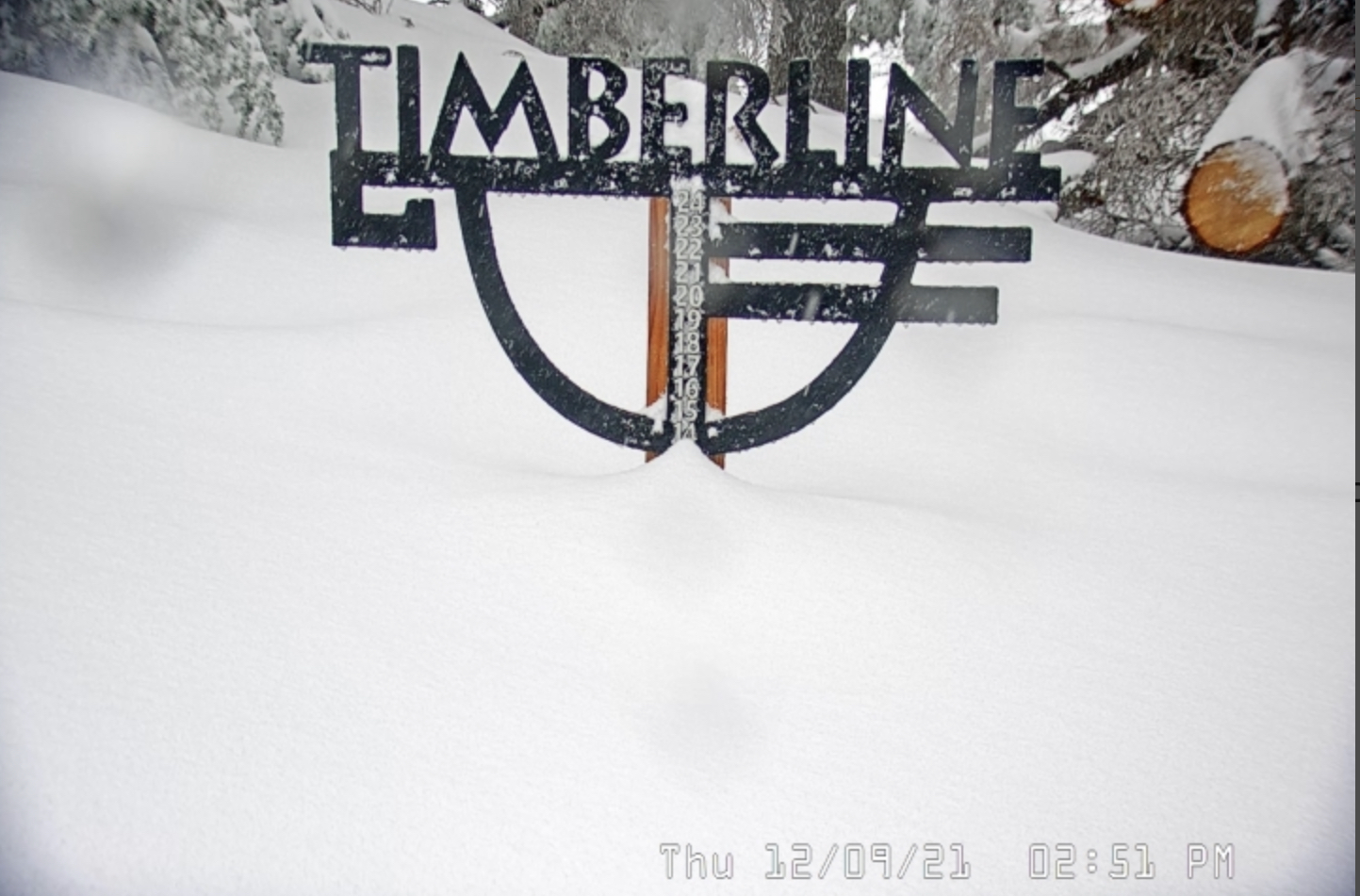
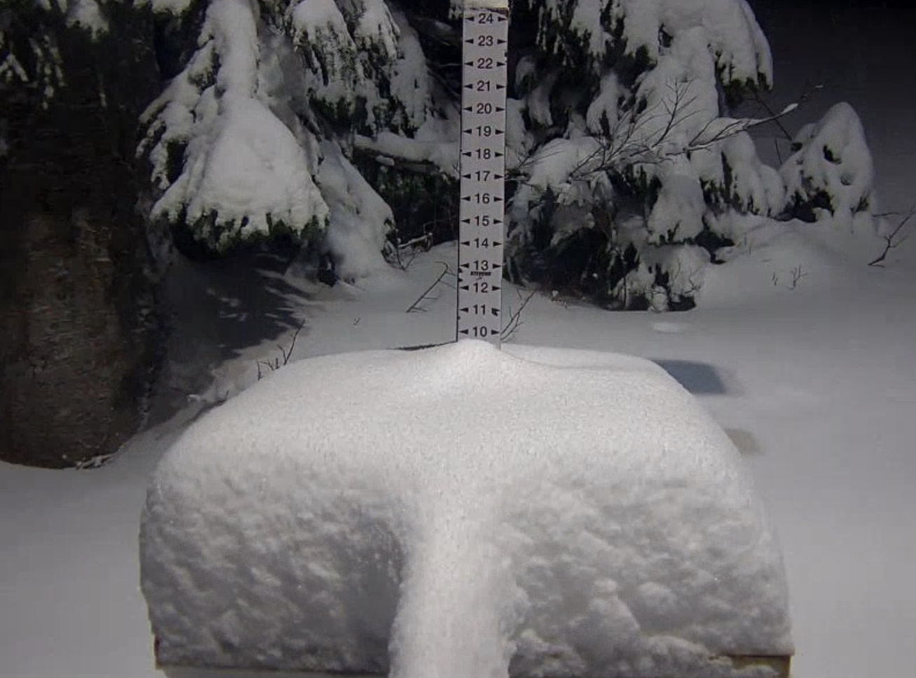
Really good storm totals from yesterday. Here are a few snow stake cams.
Today Tahoe

Snow tapers off in the Cascades as the storm moves into the Sierras. Modest amounts this afternoon and evening. Expect 4-8 for most resorts. The bulk of the precipitation will arrive early Monday morning. Strong winds along the front with gusts from 50-70 mph expected.
Monday Tuesday

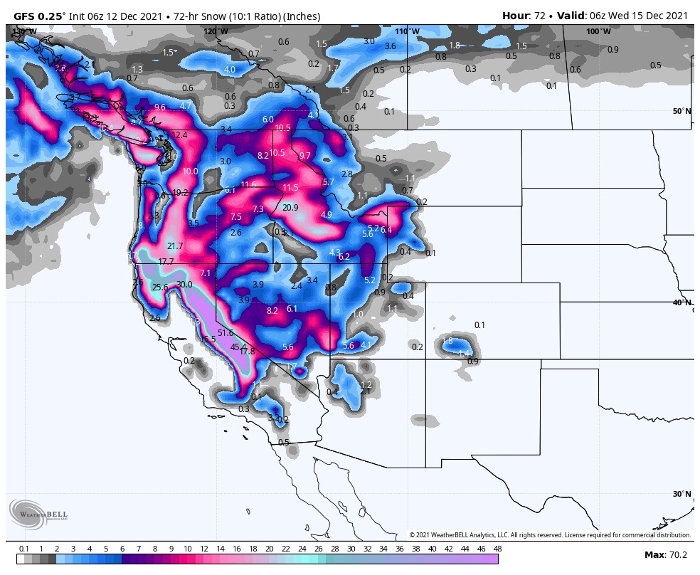
Monday: Widespread heavy snow with 18-24 on the East side, 20-25 West and 18-20 for the Crest. Another 20-30 for the Crest and West, with 25-35 for the East side Monday night and Tuesday. This next map is the 3-day storm total. Pretty impressive.
Wednesday and Thursday
The next system dives down from the Aleutian Islands into southern Washington and Oregon. More to come on this one as we get a little closer.
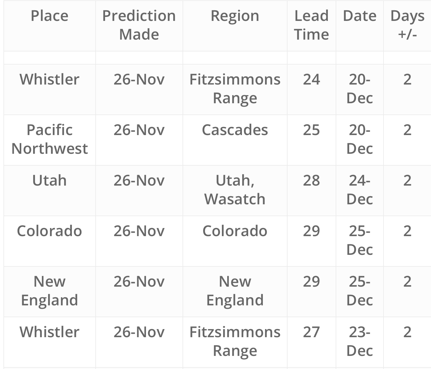
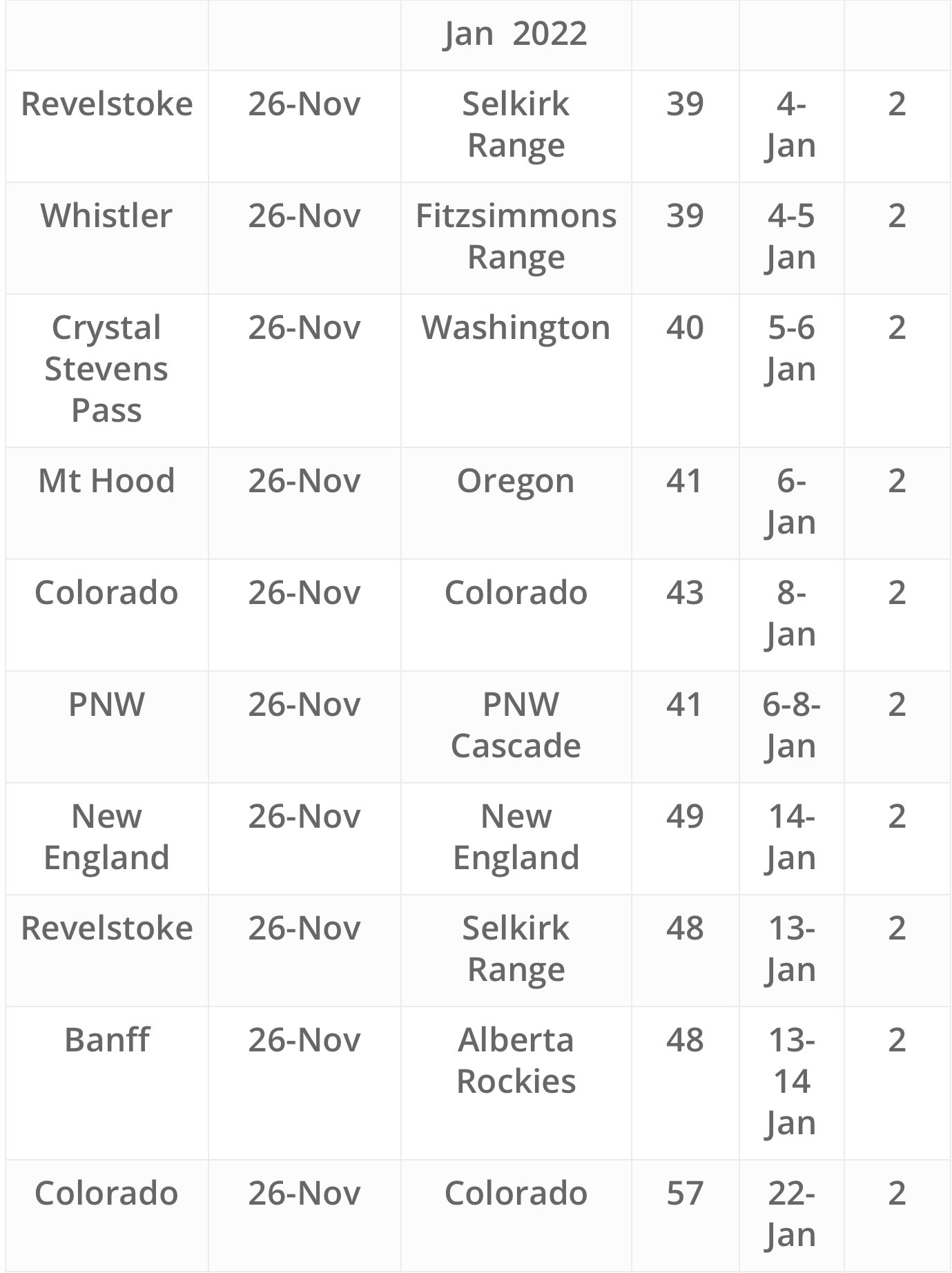
FutureSnow Predictions