Winter Storm Warning for Sierras thru Tuesday
If you can get there, and they are open, you will need your snorkels Monday and Tuesday because it’s going to be deep in the Sierras. Heavenly and Kirkwood plan to open this weekend.
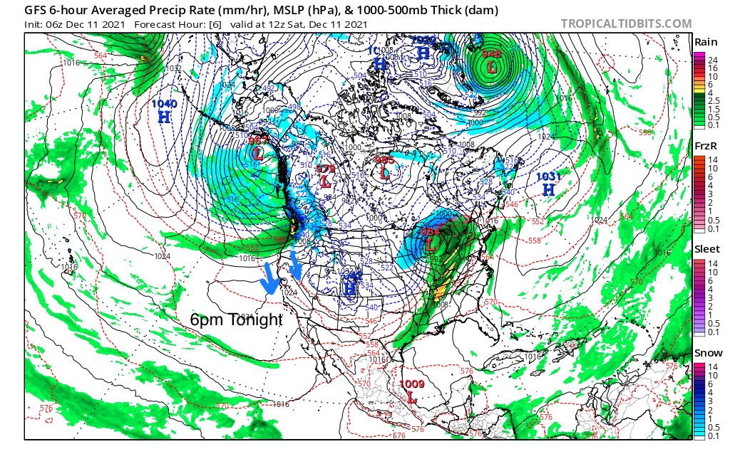
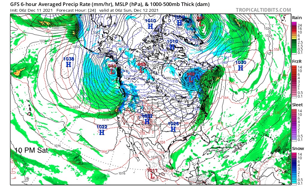
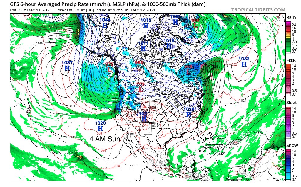
Let’s take a look at the latest GFS and break down when this is going to take place. The huge coma head type storm gradually pushes to the south. By 10 PM tonight the atmospheric river (AR) kicks into gear with moisture streaming in from the pineapple express. This is a repeat of the AR that came through Seattle in October. This time through, the Jet is stronger, the storm in bigger, and the contact point is mid-California.

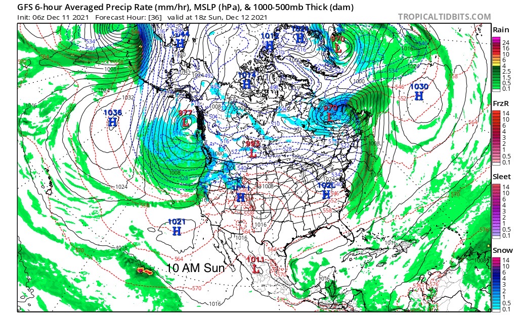
This is especially significant, because the AR repeated. The last AR event in California came through the 3rd week of October. That would be due back December 22nd. That is one of my prediction dates for the PNW. I have been a little shy to include Tahoe, because again, Tahoe is on the edge of the pattern. Many of you that read Bryan Allegrettos Blog on OpenSnow, know I have predicted a Tahoe storm for Dec 23rd. Let’s watch if an AR shows up for this date.
This next animation shows the flow today in the PNW. At the very end of the clip, you can see the AR begin to set up. This is exactly how this setup occurred last time through in Seattle.
Short Term Forecast, U-Storm
Today
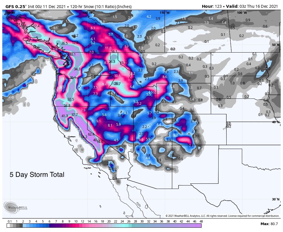
Heavy snow in the Cascades with accumulations of 18-30 in the southern Cascades (Oregon) with slightly lower totals to the north (Washington).
Tomorrow
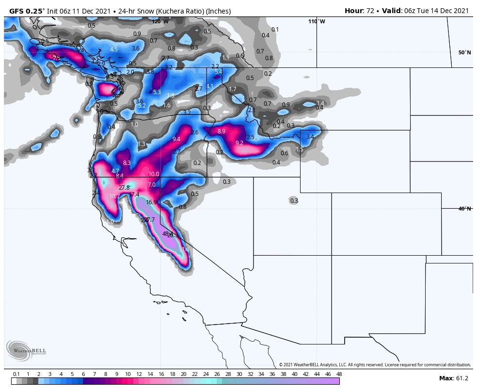
Snow tapers off in the Cascades as the storm moves into the Sierras. Expect modest amounts on Sunday with 4-8″ across most resorts in the Tahoe region. Tomorrow night is when the train really gets moving. Widespread heavy snow with 8-12 additional on the East side with 10-15 on the West, and 14-20 for the Crest.
Monday
Another 20-30 for the Crest and West, with 25-35 for the East. Wow! Storm wraps Tuesday with another 10-15. There could be places with over a 100.
Wednesday and Thursday
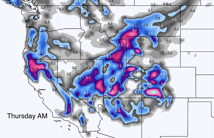
U-Storm moves into Utah and Colorado. We will discuss totals as we get a little closer.
Long Range
That gets us to day 19 of Cycle 3. I haven’t talked about specific days of the cycle yet, that is forthcoming, but the next wave due is a small wave. Last time through it produced double digits at Alta and just a few inches for the Colorado resorts.
FutureSnow
Thank you for reading the blog, if you are interested in any resort that I am not covering, please mention it in the comments. As always, if you have any questions please comment below or send an email to Mike@FutureSnow.co

I am planning a trip to Big Sky for some time in January. Can you give me some dates that would have a good storm?
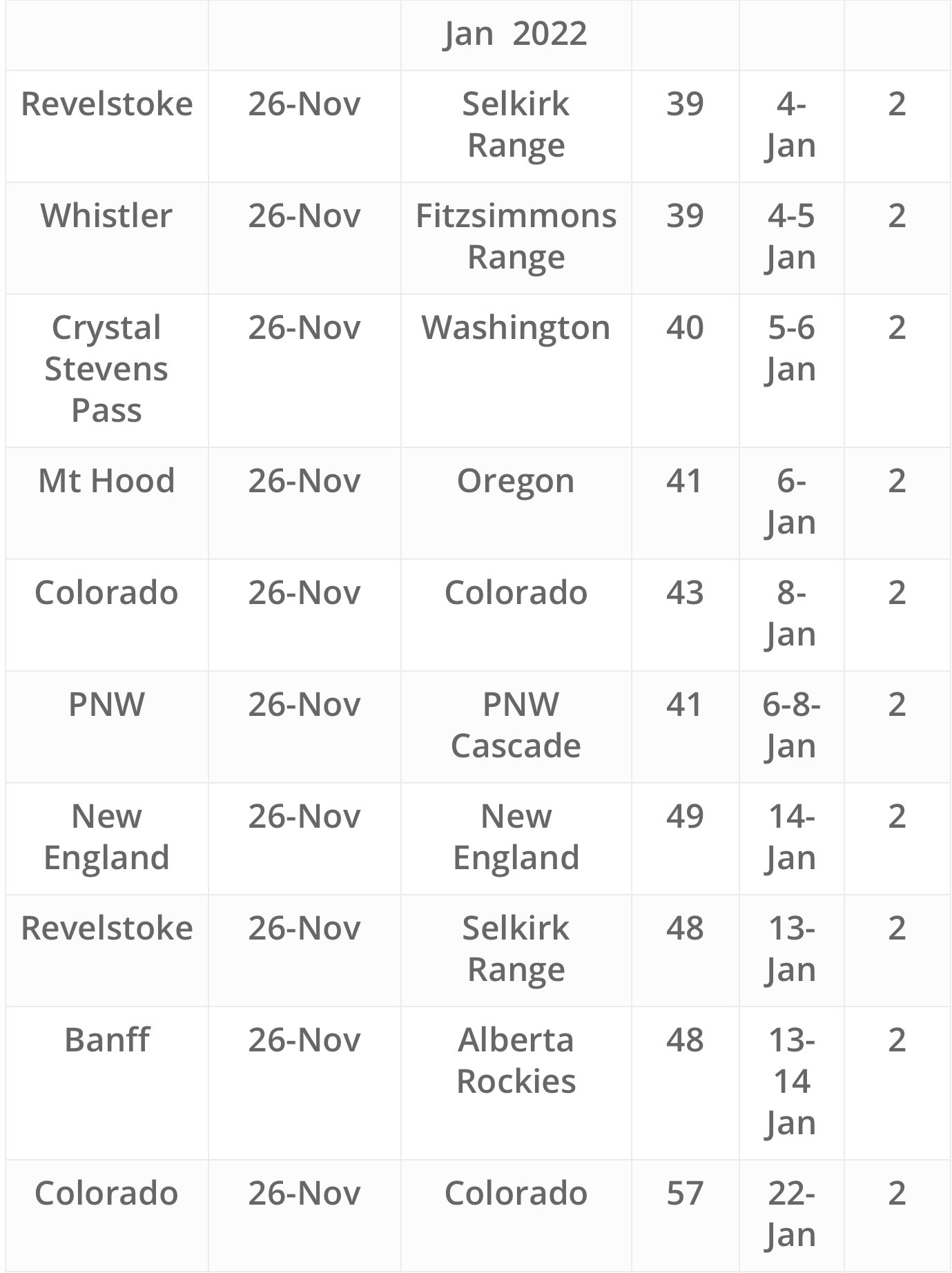
Big Sky is a tweener. It is in between the Northern part of the Pattern and the Active West. Here are the best pattern storms for Big Sky: Dec 19th, Dec 23rd, Jan 5th, Jan 26th, Feb 4th, Feb 11th