Summary
 Snow is back in the Pacific Northwest with all mountains receiving snow. The storm will move into Idaho, Montana and Wyoming on a path to Colorado. As of this post, it was snowing heavy at Idaho’s Brundage and Montana’s Big Sky.
Stoke
Sunshine Village
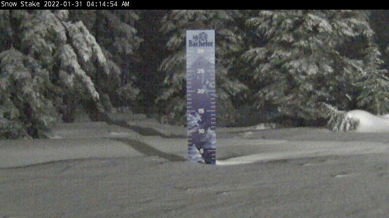
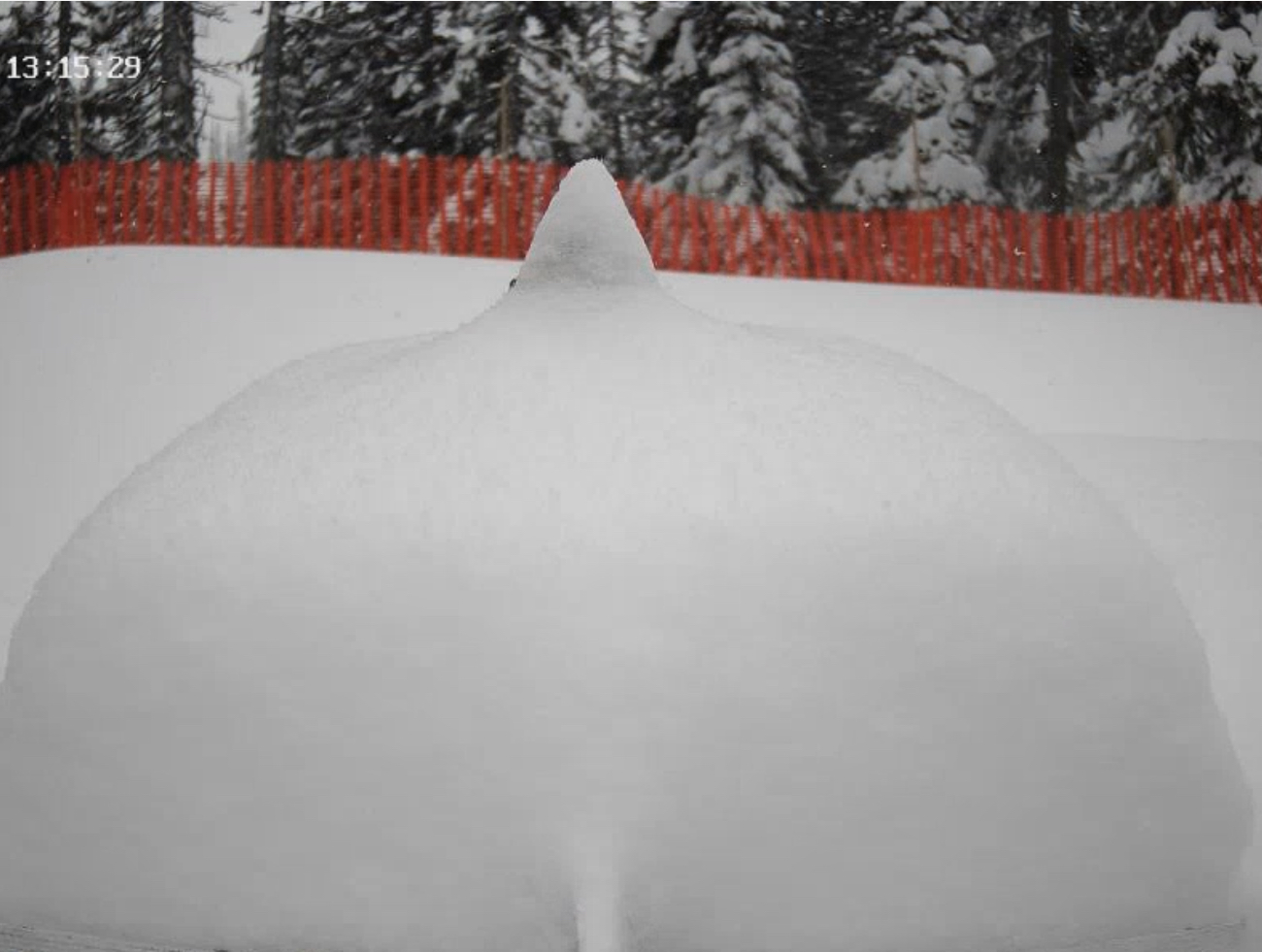
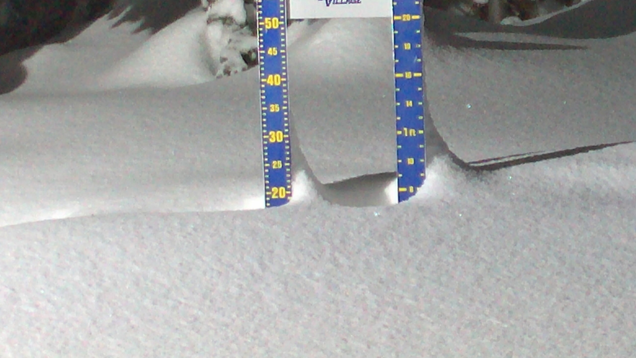
Mt Bachelor
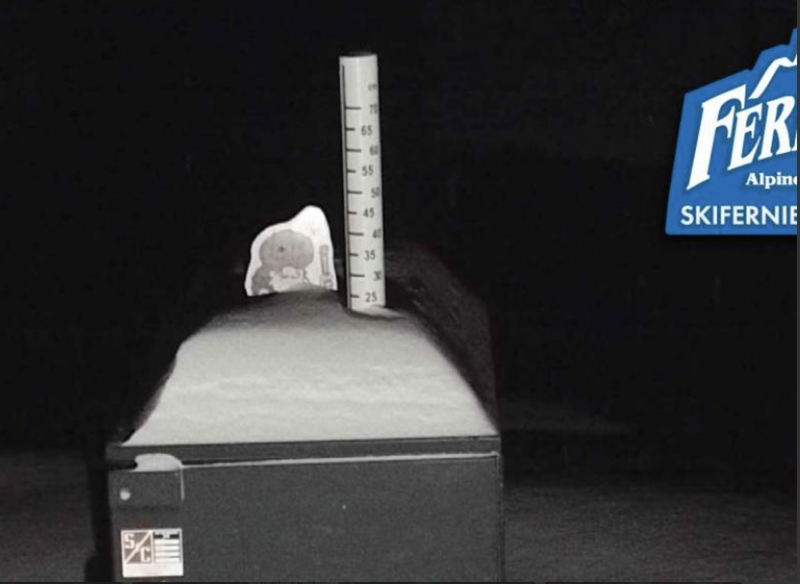
Fernie
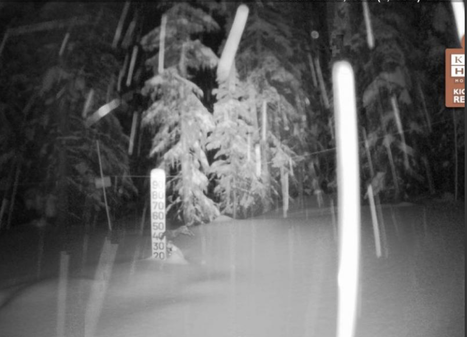
Kicking Horse
Forecast
PNW
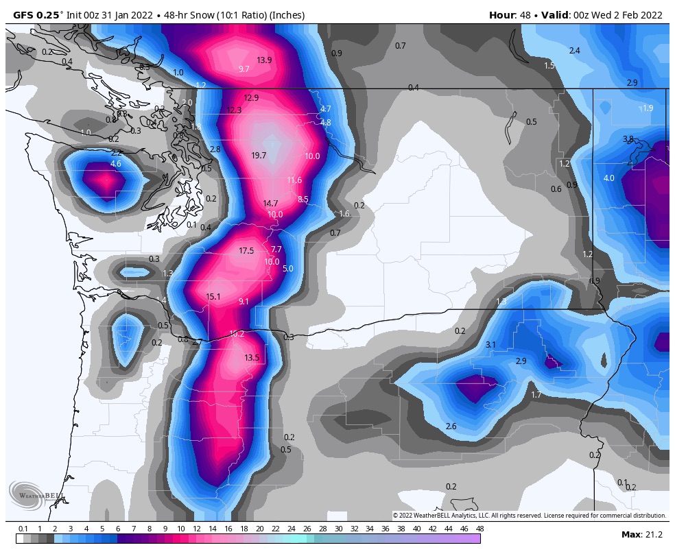 Northern Cascades: Winter Storm Warning for mountains around Stevens Pass today until 4 o’clock. Strong winds with 25 mph gusts. Temperatures in the mid 20s. Expect another 8-12 today as the bulk of this storm comes through, with a couple more inches on Tuesday. Similar conditions for Crystal Mountain with less snow. Expect 3-5 more today and a couple more on Tuesday as the storm exits.
Utah
 The storm is still projected to skirt the northern part of the state. It is looking like a couple of inches for the Cottonwoods. Cold temps, in the low teens so any snow will be light.
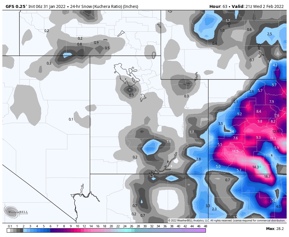
Colorado
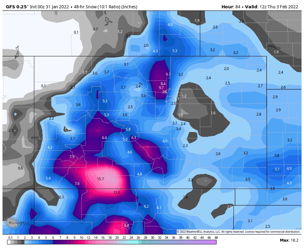
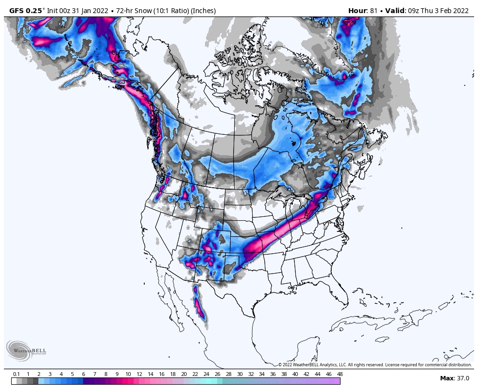
Storm reaches Colorado in the early afternoon Tuesday. As you can see by the chart, this storm is favoring the southern Mountains.
Next Storm Friday
Next storm hits the coast late Friday. It is a small wave and will be followed by a larger wave that is the next predicted storm for the Sierras, and Colorado. I am still holding out hope that this will come through for Tahoe, but my hope is fading.

Looks like the Trifecta will be decimated by the High pressure in CO next week. Ooof. Hoping for some magic mid month and on.
It’s not looking good. The first wave is the one hitting now, it’s about a day early (based on snow reporting), it will exit on the 3rd. It is early for the same reason the next storm will be late–the high pressure pinching northward, pinched off this storm early, while the next storm gets caught behind the High and has to maneuver up and over the ridge. Crazy
Hey Mike, this next predicted storm you refer to (the one after the Friday system)…what is the general timing of that? As a Sierra resident, all the outlets I’m in tune with are showing negligible precip for a few weeks out, if not longer. Just curious about the timing of the next “larger wave” you refer to, and also curious what you foresee for Tahoe later in feb and again in March.
Thanks!
JP
The storm that is predicted for the Sierras (Tahoe). The models still don’t have a good grasp on the track. The High off the coast is projected to go way up to the Aleutians. That is pushing the timing of the storm back a couple of days, because it has to go around the High. I have been working on this to try to figure it out. Stay tuned.
Mike,
Back from Big Sky. About a month and half ago or so you said to expect a storm Sat the 22nd, a couple of small shots on tuesday/thursday and another small storm on the 29th. Well the 22nd storm was a day early, came in thursday night/friday am. During the week there was 4 inches tuesday am and 3 on thursday am, and it snowed sunday night. You were within a day or right on with all your predictions!! well done. The snow was soft and we had a great time.
Thanks James! I’m glad it worked out for your trip. Big Sky is in a tough spot to forecast for the pattern this year. Love that mountain.