Summary
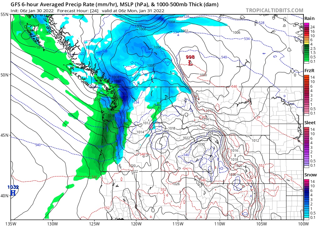
Snow has arrived at the Pacific Northwest overnight. Whistler Blackcomb (5) and Revelstoke (3) each coming in with a good start. The storm that is moving into Washington is later than the models were projecting. The snow has arrived at Mt Baker and 49 Degrees North, with each receiving an inch so far. The storm will move southeast towards Colorado.
Forecast
PNW
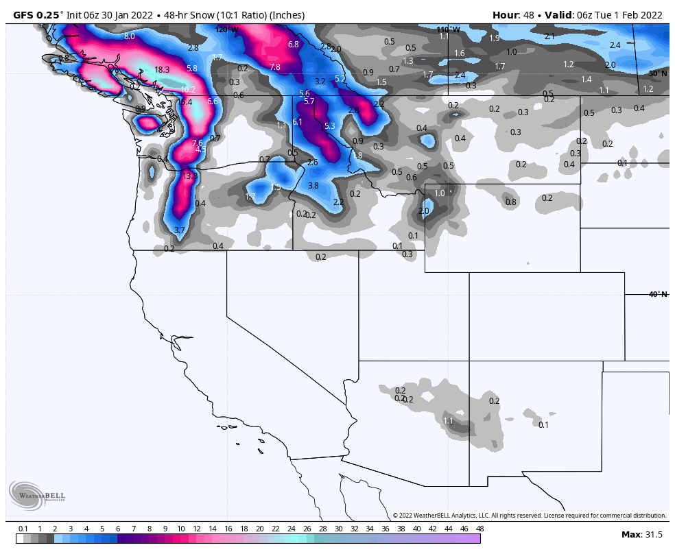
Snow today, heavy at times, with snow levels lowering to 1000 ft. Winds in the 15-25 mph range with gusts up to 30. Should be double-digit storm totals for most of the higher elevation resorts. I’m expecting 10-15 for Crystal Mountain, 12-16 for Stevens Pass, 12-16 for Mt Baker and Oregon resorts 10-15 for Mt Hood Meadows and Timberline.
Utah
The system skirts the northern part of the state on Tuesday, right now it is not looking promising. Will update tomorrow.
Colorado
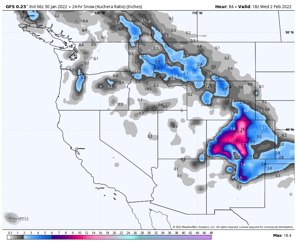
Snow moves into Colorado late Tuesday morning with cold temps and light winds. It is looking good for double digit numbers for Wednesday. Stay tuned!
