Note: We believe we have the login and membership issues corrected. We have 1 more support item we are chasing down. If you are having problems logging in or has been getting error messages, please screenshot and email me at Mike@FutureSnow.co
We are working the kinks out and appreciate any feedback! Thank you, Mike
Snow Stake Cams…..Coming Soon Snow Stake Page
Forecast Summary
The fourth storm in the series moves out of Utah today around lunchtime and works its way through Colorado today, exiting late tonight. Storm 5 moves into California this morning and hits Lake Tahoe around noon. This is not a Tahoe like storm, as the winds will be mild and freezing levels around lake level. There is a little ridge that is disrupting the flow that is pointed out by the squiggly line.
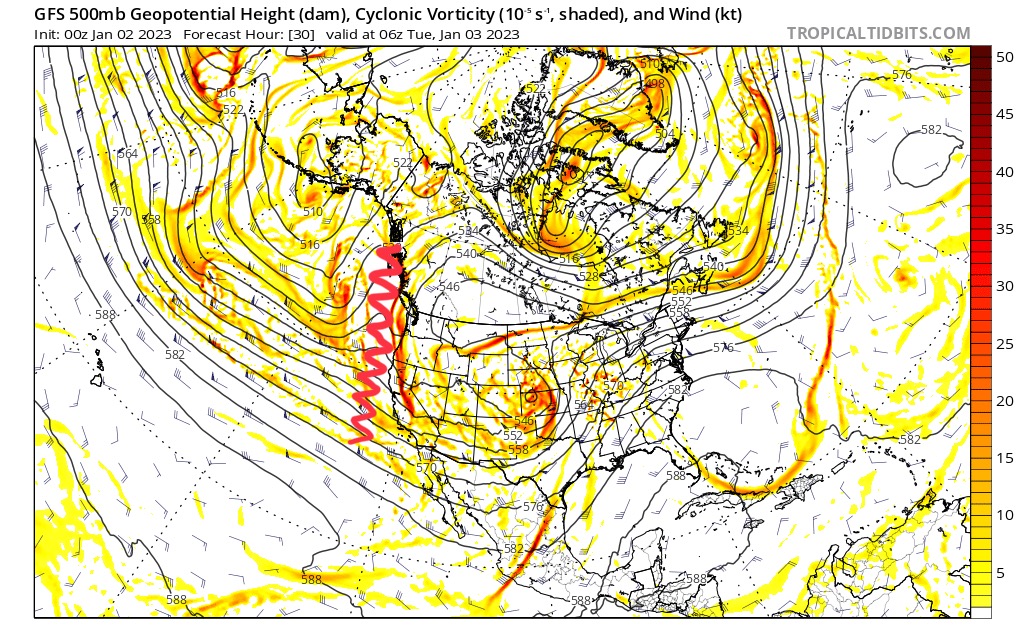
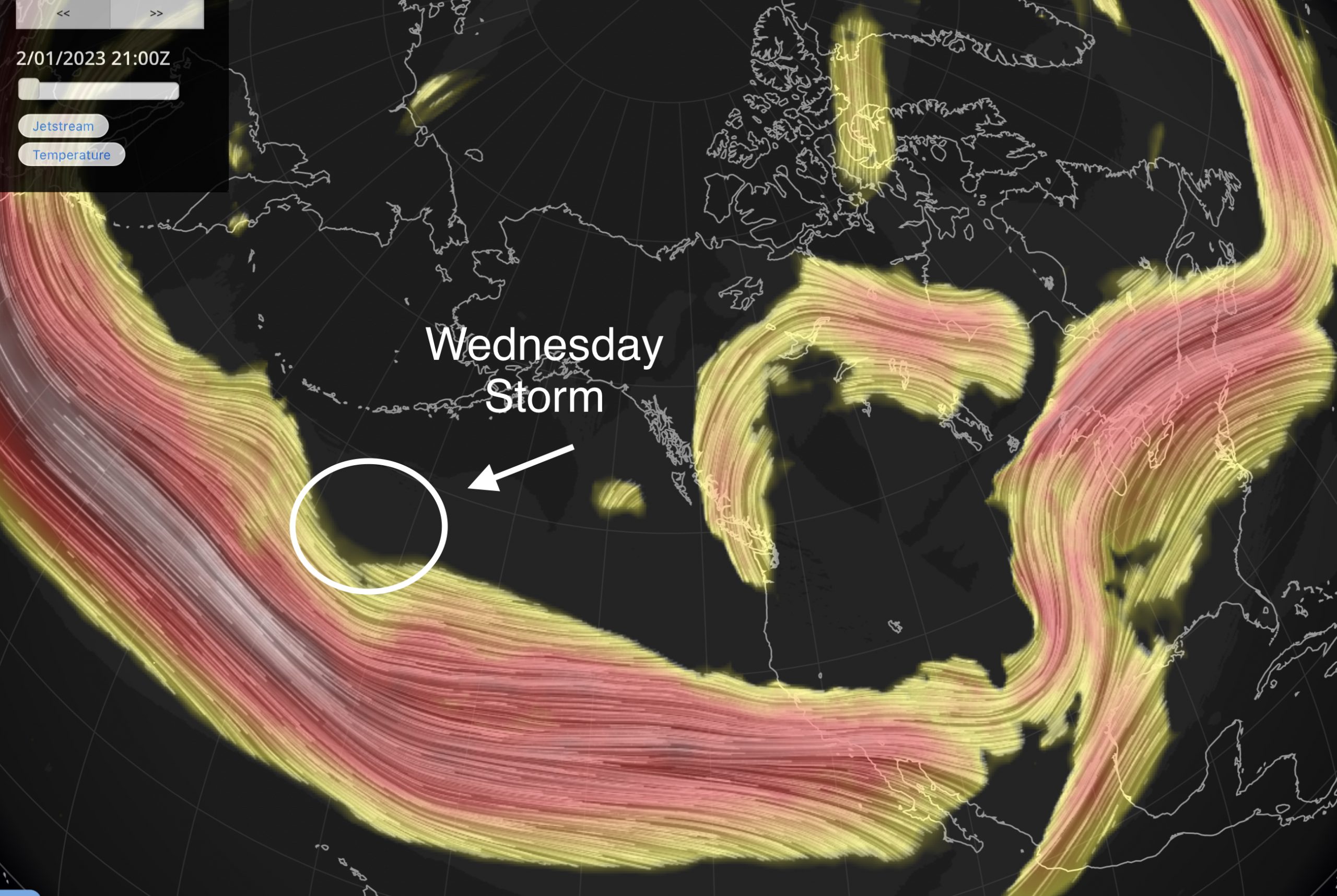
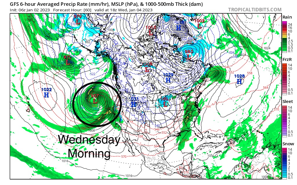
That will work itself out by Wednesday afternoon, as the next storm hits the coast. These next series of charts show the jet stream with the next storm carved out of the flow. That will grow as the storm moves towards the coast by Wednesday morning. The last shot is the surface chart of the incoming storm.

Forecast
Colorado
Summary
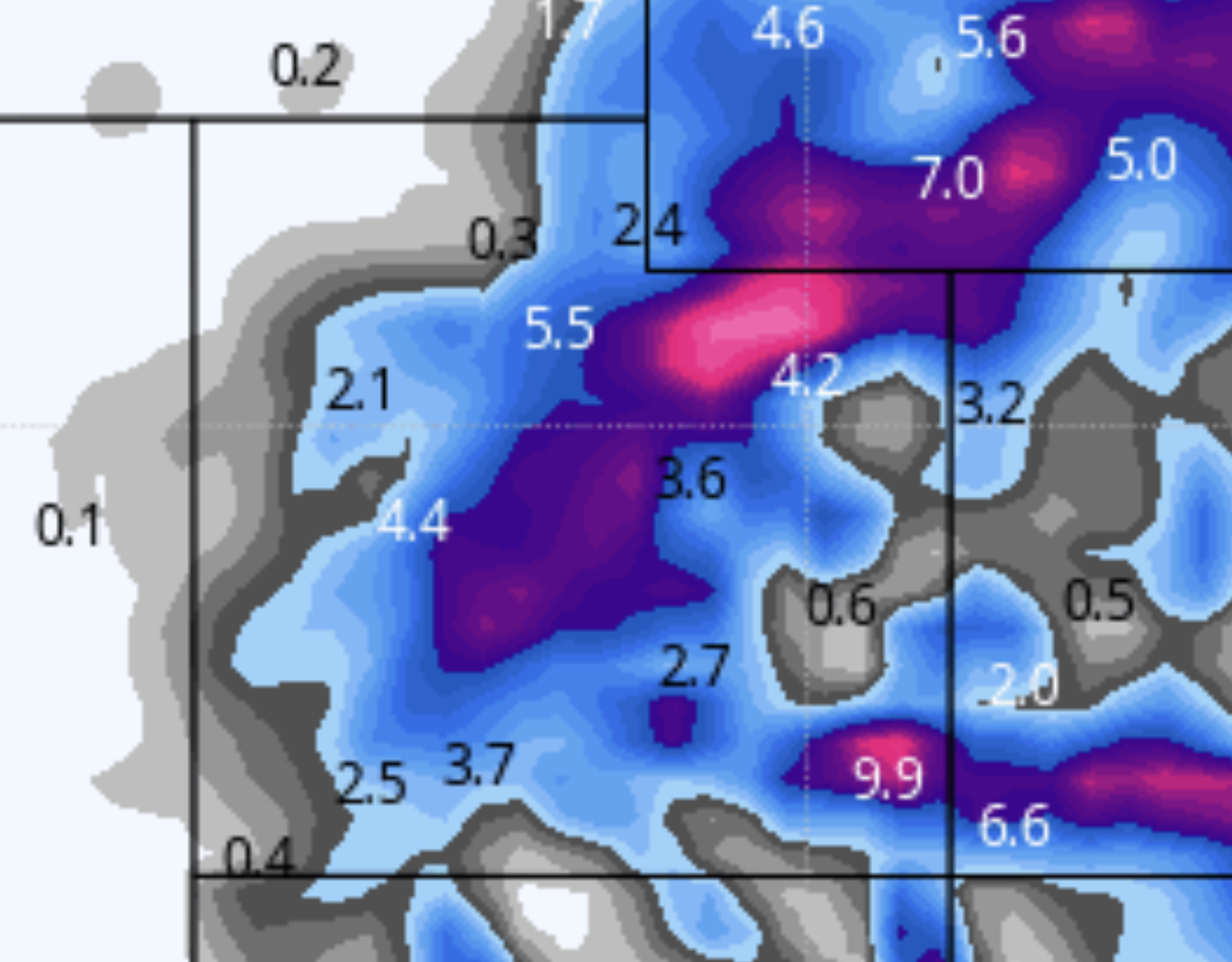
Light snow continues today throughout Colorado as this system spins its way out by this evening. Expect another 2-4 today before the system exits. It will be pleasant with light winds between 5-10 mph and temperatures in the upper 20’s to near 30 degrees.
Tonight
 Expect another 1-3 for the Central and northern mountains with 1-2 for resorts along the divide.
Tomorrow
The next system moves in and this one will be weak. Expect another 1-3 for most resorts, with the most moisture around the northern mountains.
Utah
 Another 2-5 for most resorts today as the system moves out by 2 or 3 o’clock today. Temperatures will be in the low 20’s with light winds 5-10 mph. The next system will move in tonight, but it is not looking like this will bring much accumulation. Tomorrow will have scattered showers with little additional accumulation.
Lake Tahoe
Storm 5
Storm 5 hits hit’s around 1 o’clock with light winds. Generally, we are looking at 2-4 throughout the day, with another 3-5 overnight. This system has a line of energy that will roll through, like they do here in the Midwest. Snow will fall pretty evenly throughout the Sierra and exit by midnight. Tomorrow will be bluebird skies and have temperatures in the upper 20’s at base.

Click for the latest radar
Next Storm Wednesday Morning
Forecasted Areas
Pacific Northwest Cascade Mountains
Crystal Mountain, Mount Hood Meadows, Timberline, 49 Degrees North, Bachelor, Mt Baker,
Lake Tahoe Sierra Mountains
Heavenly, Palisades Tahoe, Kirkwood, Dodge Ridge, Donner Ski Ranch
Utah Wasatch Mountains
Alta, Park City, Deer Valley, Brighton, Snowbird, Brian Head
Colorado Rocky Mountains
Aspen, Aspen Highlands, Snowmass, Vail, Beaver Creek, Winter Park, Keystone, Arapahoe Basin, Breckenridge, Copper Mountain, Powderhorn, Ski Cooper, Telluride, Crested Butte, Silverton, Wolf Creek, Eldora, Loveland
