Angry Snow at Tahoe
Summary
Day 4 of this 5-day storm for the Pacific Northwest. Mt Hood 20”, Timberline 14, and Mt Baker 14” 2-day totals with more on the way.
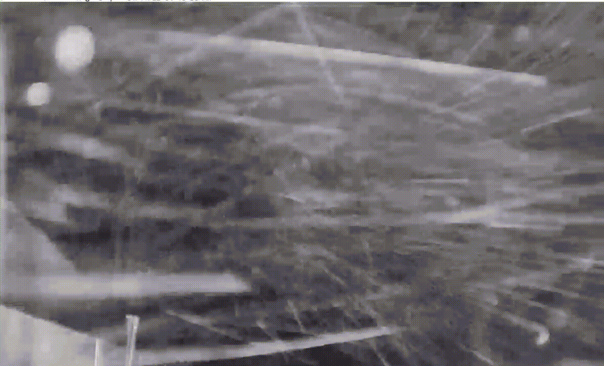
The snow seems to be angry at Lake Tahoe–Palisades is nuking as of this post 4:30 am PDT.
Tahoe could be in for a bookend season, with tons of snow in December and meager amounts since then. The Pattern has some strange quirks, and this may be one of them.
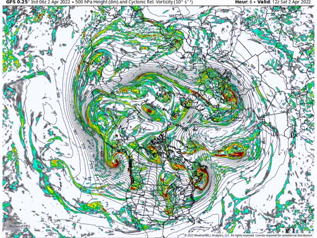
Teleconnections influences the strength of the pattern, like the Artic Oscillation (AO) North Atlantic Oscillation (NAO) and especially El Nino and La Nina (ENSO). Lastly, the polar vortex, located around the north pole, also has an influence on where ridging and troughing sets up throughout the hemisphere. Currently the polar vortex (PV) is disrupted allowing a huge trough to set up.
Below is a quick GIF illustrating the setup of PV disruption, and ridge/trough setup. Watch the PV (that hole spinning in the middle) get squished, then split. This allows a huge ridge to rise up, into its place and a deep trough, dives down to southern California.
Forecast
PNW
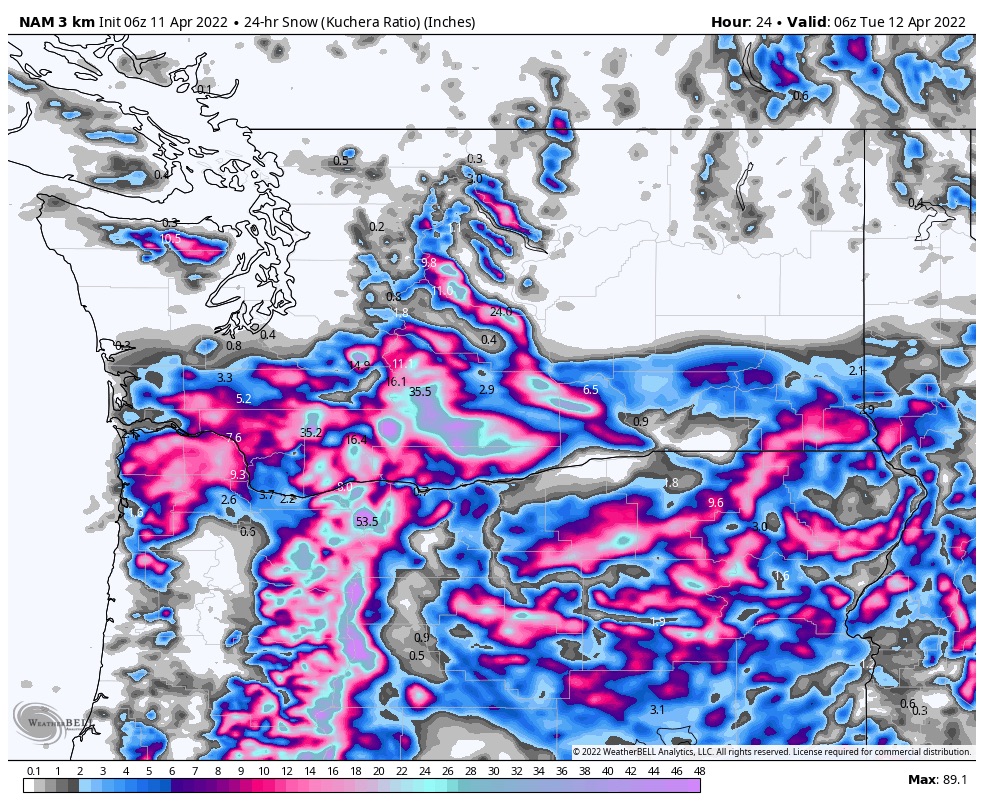
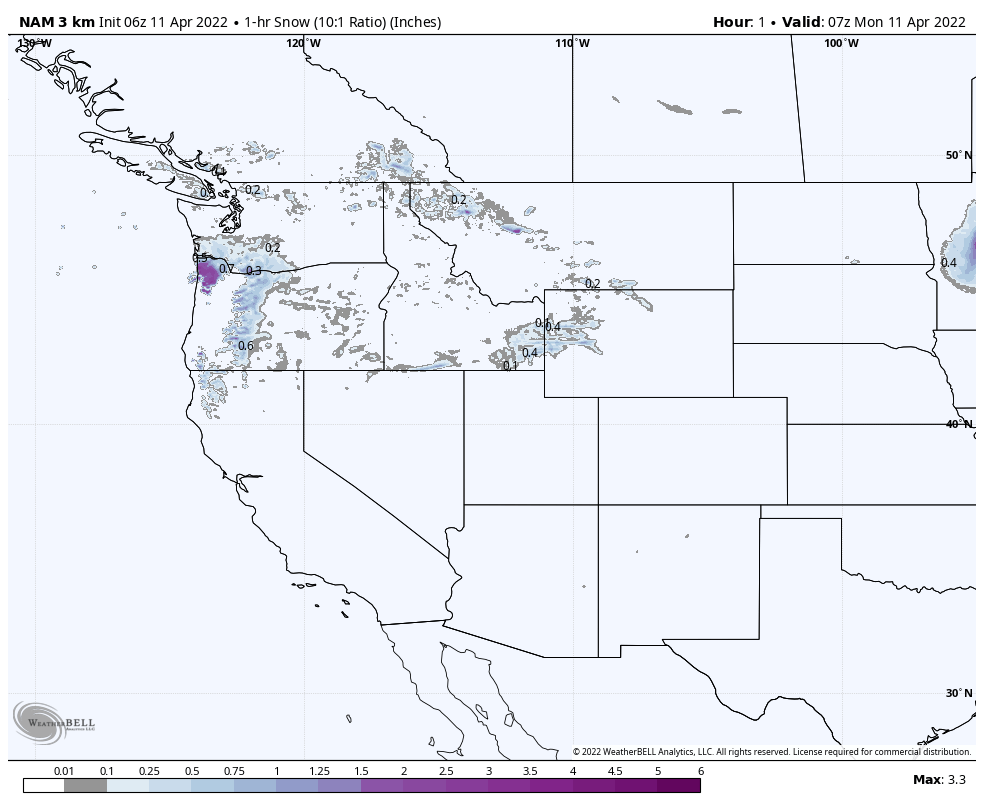
Heavy Snow today with high temperatures in the upper 20’s. Moderate winds in the northern Cascades with 30 mph gusts.
For the northern Cascades expect 5 to 10 inches today, with another 4 to 8 overnight. Southern Cascades resorts Timberline and Mt Hood Meadows, we are talking want to 1-2 feet today.
Tahoe

All resorts should do well with this storm with at least 4-8, generally speaking. Kirkwood, Homewood, Donner, and Dodge Ridge should be in the 12-20 range. Expect strong winds in the 25-35 mph range with 55 mph gusts. That will hamper operations, so tomorrow will be the day to ride. Another 1-3 overnight.
Utah
 Snowbird, Brighton, Alta and the rest of the Cottonwoods get in on the action tonight. Winter storm warnings are in effect until Tuesday evening.
This is a nice storm, I’m expecting 1 to 2 feet of dry champagne powder today and tonight. Temperatures will be in the middle teens with Moderat to strong winds. Gusts up to 40 mph.
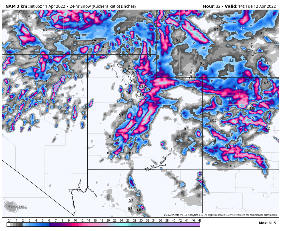
Colorado
 The storm moves into Colorado tonight but intensifies tomorrow and exits Wednesday.
I am expecting 0-2 inches tonight for most resorts. Tuesday the bulk of the snow will fall during the day. Models suggest most mountains will be in the 4 to 8 range, with a few spots in the 6 to 12 range.
Tuesday afternoon and Wednesday morning will be the best powder. Wednesday will bring cold temps with highs only in the low 20s. Expect heavy winds both Tuesday and Wednesday with gusts up to 40 mph.

I’m seeing a big storm pop up on the GFS for CO around the 22nd. Do you know if the teleconnection data supports the possibility?
Yes, that is the Trifecta. Remember, the last time through it was decimated by high pressure and had only 1 good day of snow for Colorado. This time through looks like it’s back to normal.