Summary
Day 3 of this 5-day storm for the Pacific Northwest. My thoughts were that NOAA would issue Winter Storm Warnings for Saturday. The passes around Snoqualmie and Stevens were shut down for hours due to slide offs and collisions. I-90 was shut down in both directions around 4 PM. What a headache, hopefully you did not get caught up in that. Winter Storm Warnings do go into effect for Snoqualmie, Mt Bachelor and Mt Hood tonight.
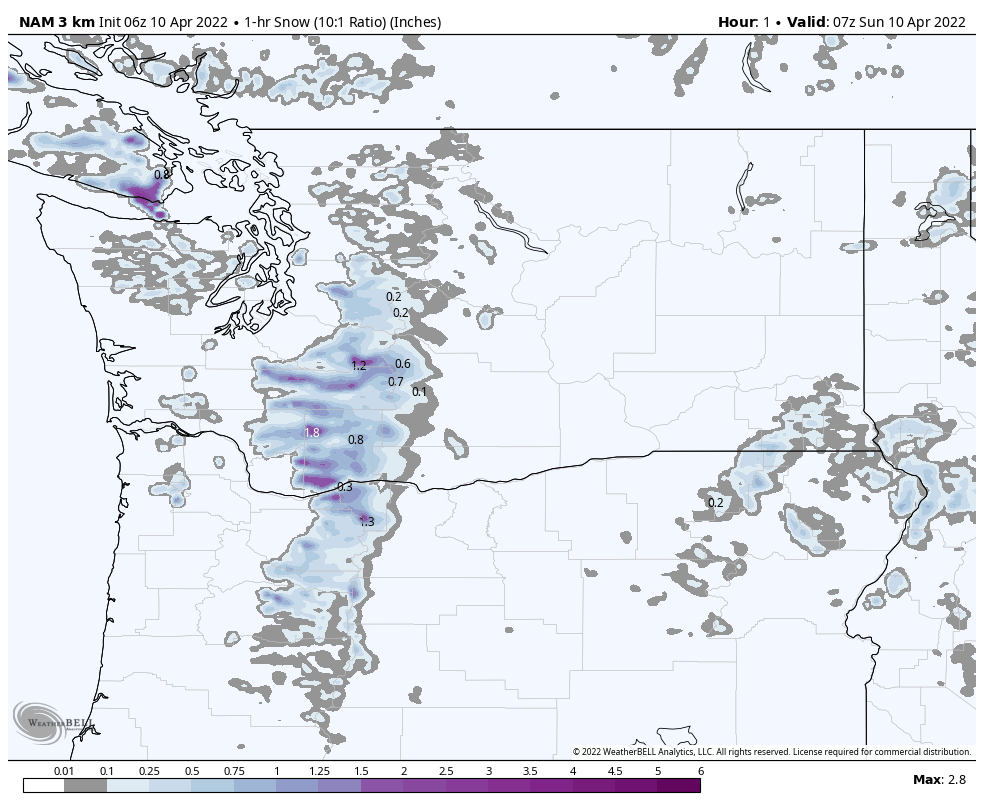
Below is the 1-hour snowfall chart. I choose this chart because it illustrates the waves of snow more clearly. Watching the snowfall rates, you can tell that for today, there will be steady snow until about 10 am, for the northern Cascades, with light snow throughout the day for the southern Cascades. Those snowfall rates pick up dramatically around 5 pm tonight–getting into 2-3 inches per hour in some places.
Forecast
PNW
Snow today with cold temperatures in the teens. Light winds in the northern Cascades with strong winds in southern Washington and southern Cascades with 40 mph gusts, so that could hamper upper mountain operations. Wind chills below zero! Winds calm down tonight and temperatures rebound Monday, generally upper 20’s for most resorts around 6000 ft.
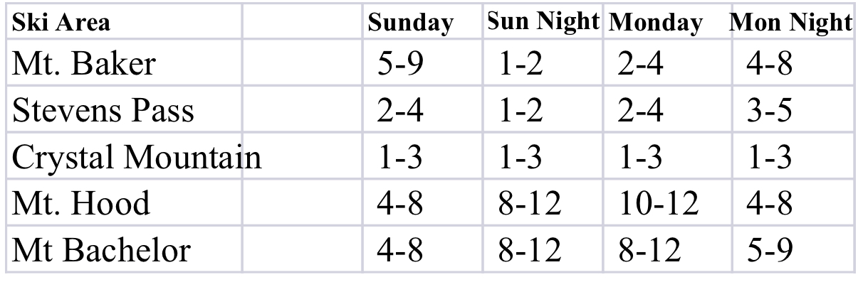
Snowfall forecast below
Tahoe

The Lake gets into the action beginning late tonight, but tomorrow is when this storm really kicks into gear. With falling temps overnight, we might get 1-2 before the main wave arrives around 1o. All resorts should do well with this storm with at least 4-8, generally speaking. Kirkwood, Homewood, Donner, and Dodge Ridge should be in the 12-20 range. Expect strong winds in the 15-25 mph range with 40 mph gusts.
Utah
Snowbird, Brighton, Alta and the rest of the Cottonwoods get in on the action Monday night.
Colorado
The storm moves into Colorado Monday night but intensifies Tuesday and exits Wednesday.
