Summary
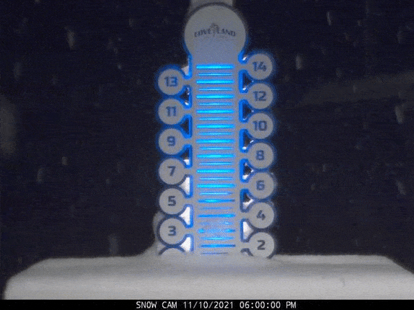
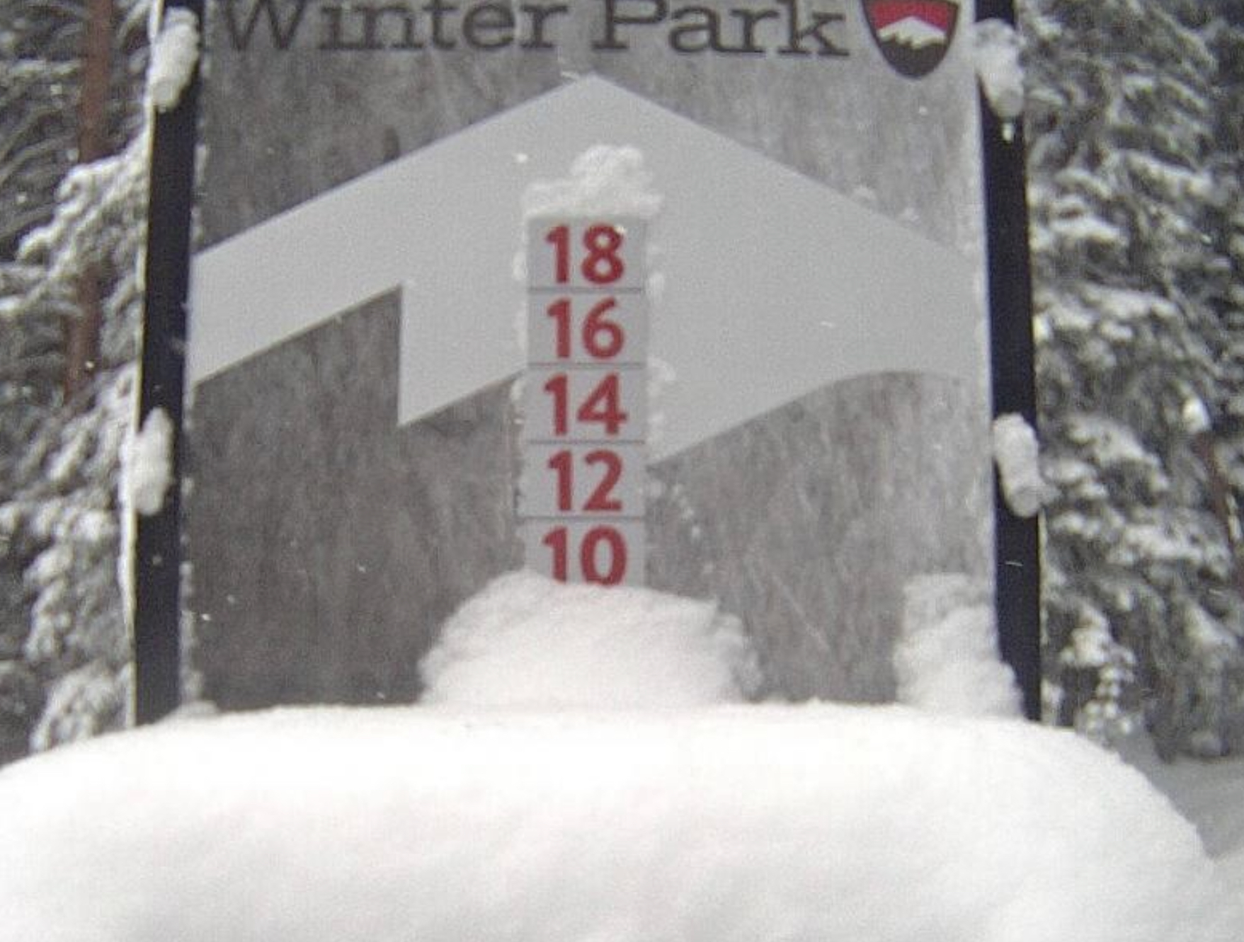
A major winter storm is brewing that will likely have winter storm warnings as early as Thursday evening. This storm has been on our radar since November when it came through the first time and blanketed Colorado November 10-11th. Winter Park and Loveland both received 8″.
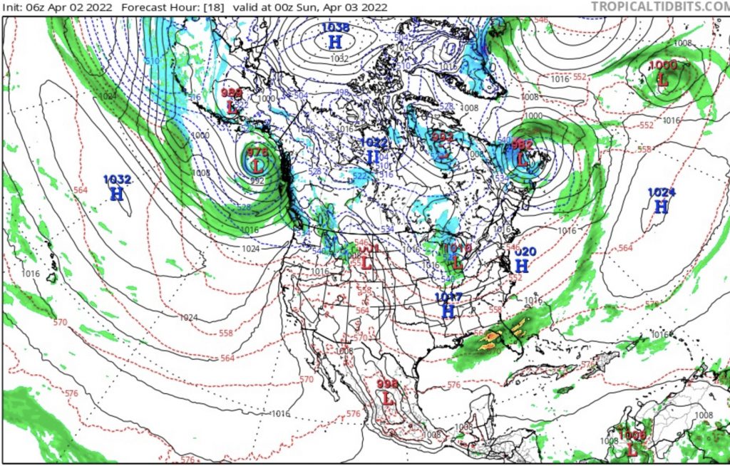
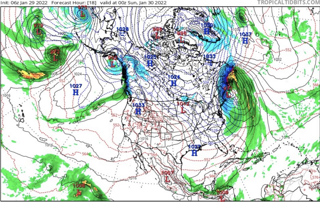
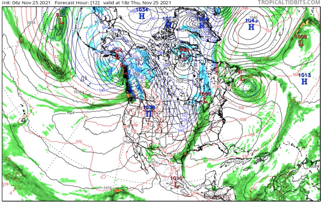
Models are becoming more aligned with this weekend’s storm and all of the action will begin overnight Thursday. Below was yesterday’s post followed by todays model run. You can see they are becoming more aligned in their shape and amounts.
Yesterday’s Model Run (total precip)

Todays Model Run (total precip)


Now how about them snow totals, eh?


Official Forecast Tomorrow
History of this Storm
 Cycle 1: 2-day total Breck 13, A Basin 9
Cycle 2: 1-day Winter Park 6, A Basin 3
Cycle 3: 2-day total Vail 10, A Basin 7
Summary of Remaining Pattern Storms
May 20-21 Last storm of Active West Last Active West storm and transition to the Northern Pattern. Hit in all 3 cycles for Utah and Colorado
June 5-6 AR 4th Straight for Seattle?
Possible 4th AR, as we gaze into our crystal ball for June
The last item I am personally looking forward to occurs on June 5-6th (days 56-57). That is when a possible fourth atmospheric river (AR) event is scheduled to hit Seattle. Below are the 3 previous charts that show the variations the last three times through beginning with cycle 3 down to cycle 1.
Looking at the charts you can see the low pressure in the Gulf of Alaska with an AR extending out in the Pacific in all charts. There are slight differences between them that are variations of the pattern.
Cycles mirror each other every other cycle. This year that means the variations in cycles 2 and 4 are alike, and cycles 3 and 5 are alike.
