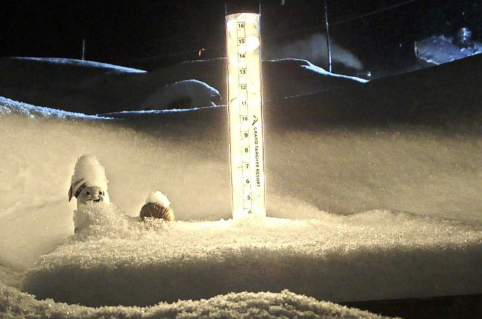
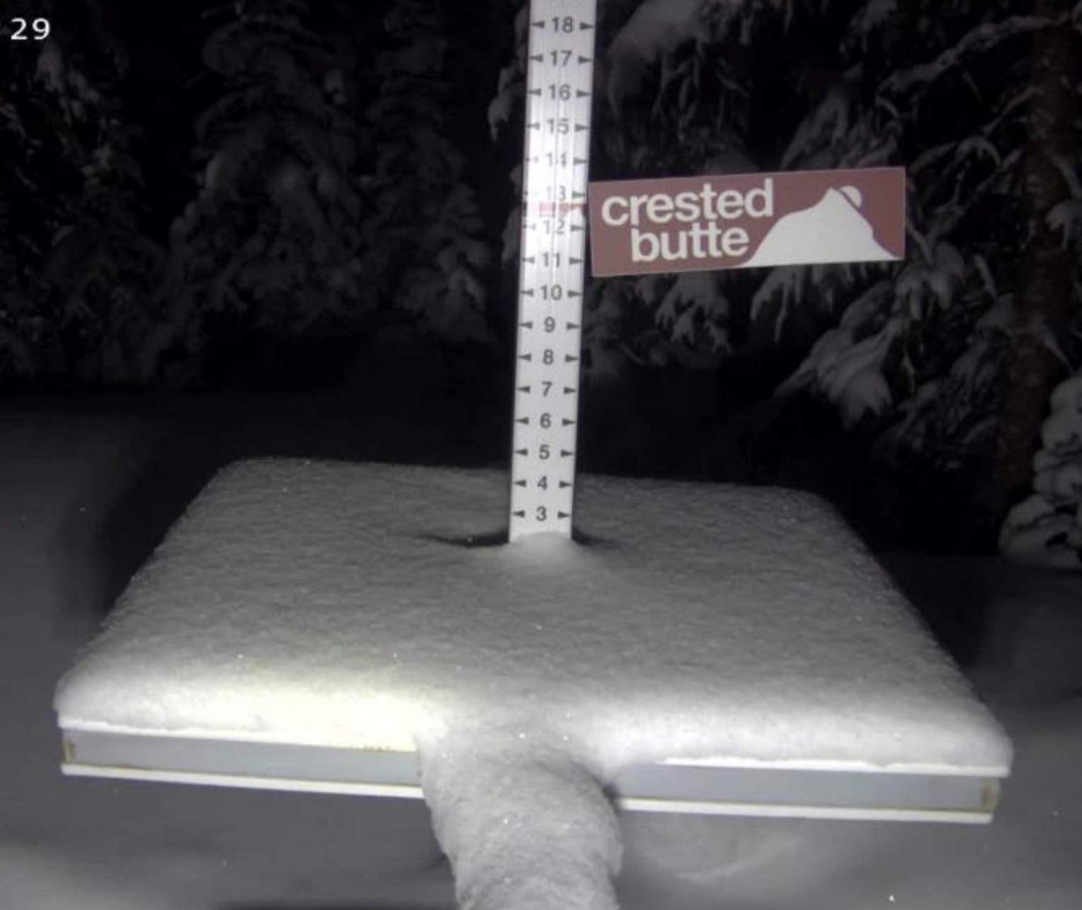
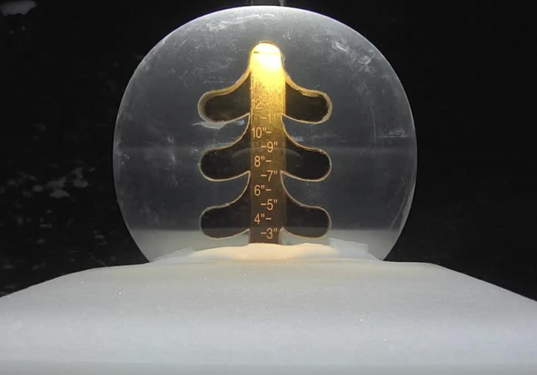
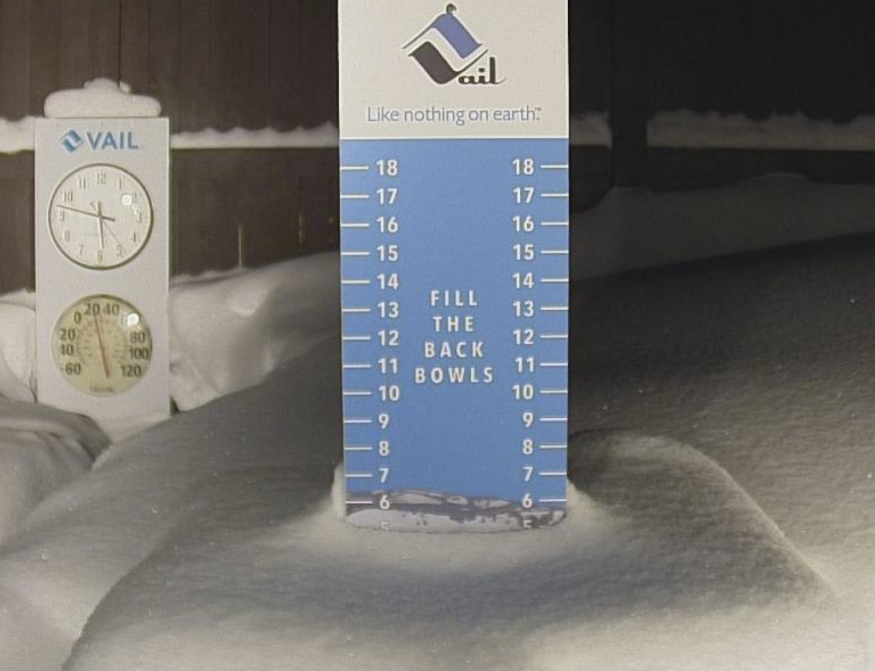
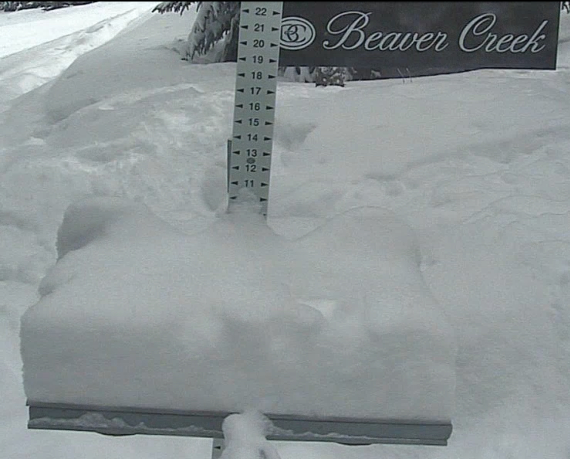
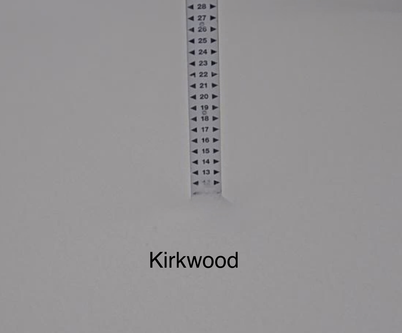
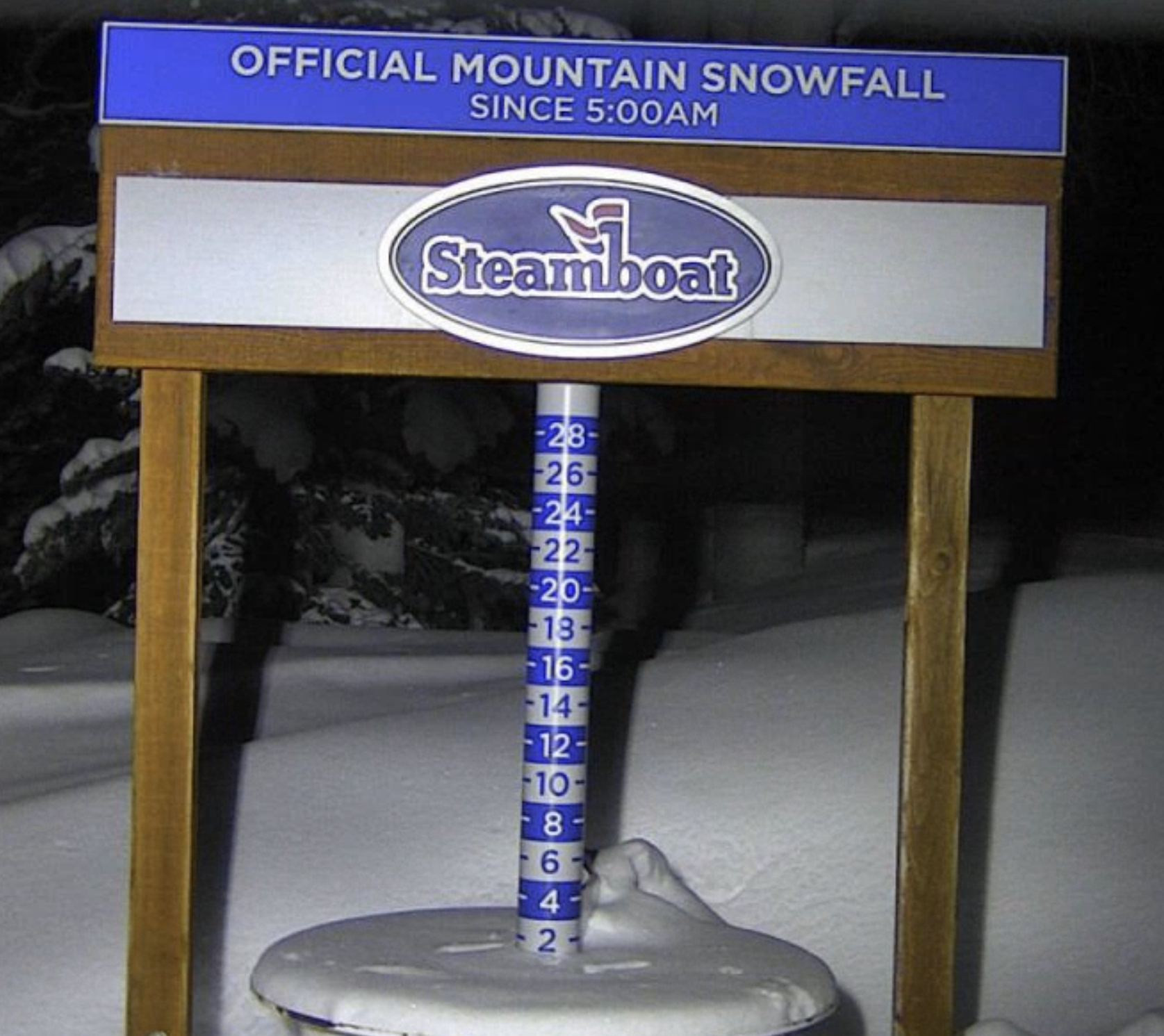
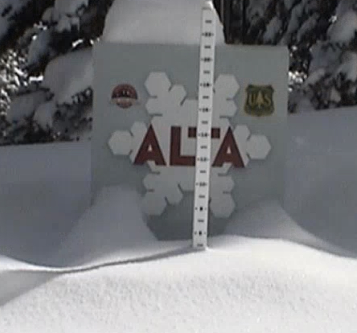
Daily Snow Stake
Spring Break/March Calendars

We posted our spring break forecast, thru April 1st on yesterday’s blog, in calendar format. It is pretty simple to use, the dark blue squares are probable storms, and the light blue squares are 60% chance, meaning if we have enhanced teleconnectivity, there will be extra waves, or more snow!


 Surface Chart
 All Snow GFS
 Forecast Summary
Let’s start with the present system working its way through California. This storm has been cut-off from the main flow and is spinning through Lake Tahoe, this morning, and will get forced out by the next system that arrives to the Pacific Northwest tonight.
The easiest way to see the transition is the 500 mb flow posted below.

Before the cut-off Low exits, it will continue to add to the totals at Lake Tahoe and SoCal resorts. Once the Low is forced out, it will move through southern Utah, New Mexico and Colorado by Sunday morning,
The next system arrives tonight to the Pacific Northwest, bringing 1-2 feet possible, for the southern Cascades and smaller amounts for the north.
That storm reaches the Lake by Sunday adding to the already deep totals. It moves eastward hitting Utah resorts by late Sunday afternoon and Colorado by Sunday Night.
I apologize for the short blog today; I am in a remote location and am having difficulties with connecting. I will go more in depth this afternoon. Thank you for reading! Mike
Forecasted Areas
Pacific Northwest Cascade Mountains
Crystal Mountain, Mount Hood Meadows, Timberline, 49 Degrees North, Bachelor, Mt Baker,
Lake Tahoe Sierra Mountains
Heavenly, Palisades Tahoe, Kirkwood, Dodge Ridge, Donner Ski Ranch
Utah Wasatch Mountains
Alta, Park City, Deer Valley, Brighton, Snowbird, Brian Head
Colorado Rocky Mountains
Aspen, Aspen Highlands, Snowmass, Vail, Beaver Creek, Winter Park, Keystone, Arapahoe Basin, Breckenridge, Copper Mountain, Powderhorn, Ski Cooper, Telluride, Crested Butte, Silverton, Wolf Creek, Eldora, Loveland
–
