
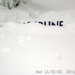
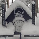
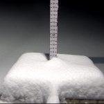
Mt Hood Timberline–45″ last 72 hrs

Forecast Summary
Snow continues in the Cascades with light accumulations today, in the 2-4 range for the north and 3-5 for the south. Blizzard conditions at Lake Tahoe today with Winter Storm Warnings in effect from now until Friday afternoon. Expect a couple of feet today as the bulk of the storm passes.
The energy from that system reaches Utah tonight bringing heavy snow and cold temperatures. First chair tomorrow will be deep.
Finally, Colorado gets in on the action late tonight, but the main part of the storm gets cranking tomorrow morning, with strong winds and falling temperatures.
Washington
Cold and snow this morning with temperatures in the teens and windchills around 0. Expect 2-4 in the early morning with light winds. We may see sone sun in the late afternoon. Next system Sunday.
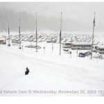
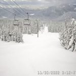
Oregon
Snow continues with moderate winds with gusts in the low 20’s. The storm looks to exit in the early afternoon, expect another 3-5 today for Mt Hood Meadows and slightly less for Mt Bachelor. Next system Sunday.
Tahoe
 Winter Storm Warnings and a full-on blizzard this morning and throughout the day as a couple of feet is likely for resorts along the crest. Strong winds in the 40’s with mountain top winds exceeding 75 mph. Temps will be falling throughout the morning and settle around 20.
 Expected Totals Today
Kirkwood 18-26, Donner Summit 20-28, Alpine Meadows 15-20, Sugar Bowl 20-28, Dodge Ridge 18-24 Palisades Tahoe 14-20, Boreal 20-28, Mammoth 6-12 (Storm Tot 12-20)
The storm exits Tonight, expect bluebird skies on Friday with temperatures in the low 30’s as resorts dig out and open.


Utah
 Light snow will begin late today, after the lifts stop running, as the system moves in. Expect strong winds ahead of the front with gusts close to 50 mph. The bulk of the precipitation falls tonight with 10-14 before first chair tomorrow for Alta and Brighton. Expect 6-10 for Park City, Deer Valley and Snowbasin.
Tomorrow there may be a few lingering snow showers, but the wind will be much calmer, around 14 mph with high temperatures in the low 20’s. Should be a great day! The next system moves in Saturday.
Colorado
 The snow begins to fall after midnight with strong winds as the front arrives. Expect 2-4 overnight, with snow throughout the day on Friday. The sweet spot presently looks to be Vail, Beaver Creek, Crested Butte and Aspen. Expect storm totals to be in the 6-10 range with Steamboat in the 4-8 range. West and Southwestern resorts look to be on the low side with 2-4 for Powderhorn, Telluride and Silverton.
Next System Saturday.
Long-Range Forecast thru December 21st

Subscription service begins in December.
- range
 Forecasted Areas
Pacific Northwest Cascade Mountains
Crystal Mountain, Mount Hood Meadows, Timberline, 49 Degrees North, Bachelor, Mt Baker,
Lake Tahoe Sierra Mountains
Heavenly, Palisades Tahoe, Kirkwood, Dodge Ridge, Donner Ski Ranch
Utah Wasatch Mountains
Alta, Park City, Deer Valley, Brighton, Snowbird, Brian Head
Colorado Rocky Mountains
Aspen, Aspen Highlands, Snowmass, Vail, Beaver Creek, Winter Park, Keystone, Arapahoe Basin, Breckenridge, Copper Mountain, Powderhorn, Ski Cooper, Telluride, Crested Butte, Silverton, Wolf Creek, Eldora, Loveland
