Summary
The next system begins in the Cascades tonight as an offshore trough moves in. It will bring with it a fair amount of moisture, double digits are possible, but temperatures and snow levels will be an issue.
Forecast
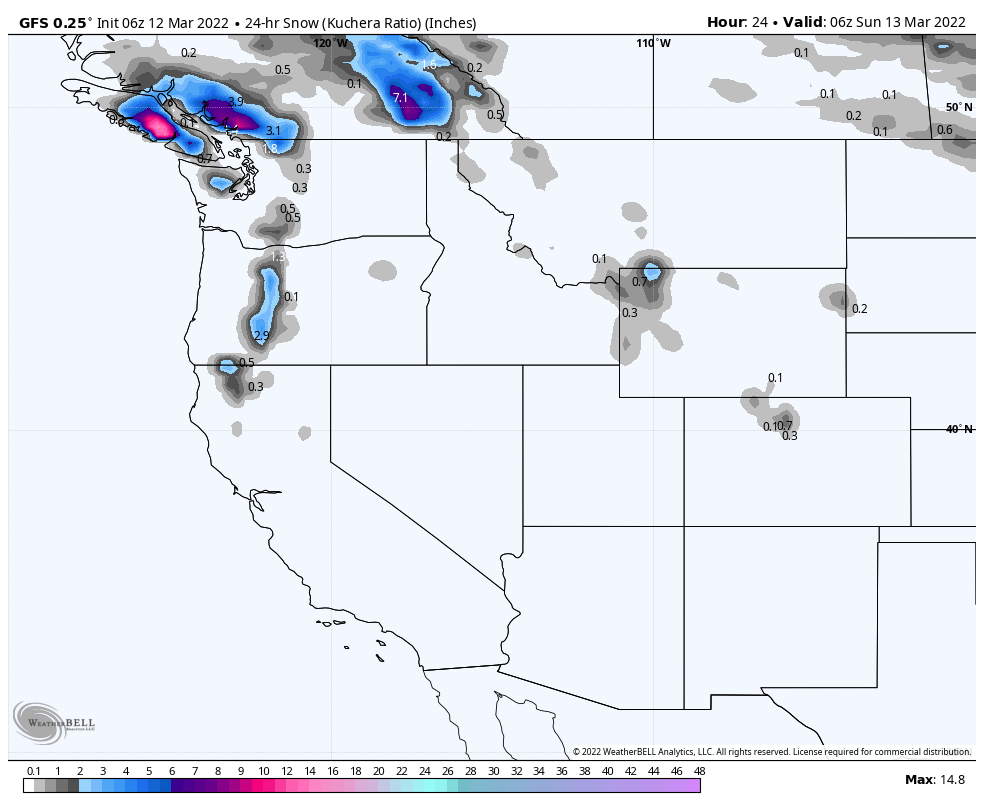
PNW
 Northern Cascades
Snow begins to move in around 4 o’clock expect windy conditions and gusts up to 35 mph as the front approaches. Temperatures will be warm with high temp around 40, at 4500 ft. Snow levels at 8000 falling to 2000 by midnight. Snowfall will be in the 3-6 range with more possible if temps fall a little faster with heavy bands.
Sunday
Expect another 1-2 as the system moves out. Base temperatures (Crystal Mountain)near freezing, with mountain top mid 20’s.
Southern Cascades
Similar conditions as above, high snow levels falling to 2000 after midnight. There is a little more moisture available, so I’m expecting 4-8 overnight, if temperatures are as expected. The low temp overnight will be around 30, @ 5000 ft, so Timberline and Mt Hood should fare well. Summit temps should be in the mid 20’s range.
Sunday
Snow all day at Mt Hood and Mt Bachelor with another 4-6 expected, temperatures should be near freezing all day, at 5000 ft.
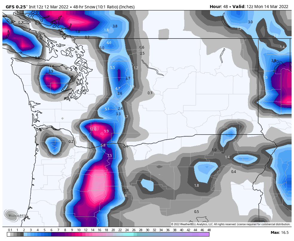
Utah
 The storm arrives tomorrow, around 7 am. Good temperatures for snow, in the lower 20’s, with moderate west winds 15-20 mph.
Not a lot of snow with this wave is expected, probably around 3-5 for the cottonwoods Snowbird and Alta, but there could be a surprise, as I expect the strength of this wave to grow. Another 1-2 overnight before the system exits.
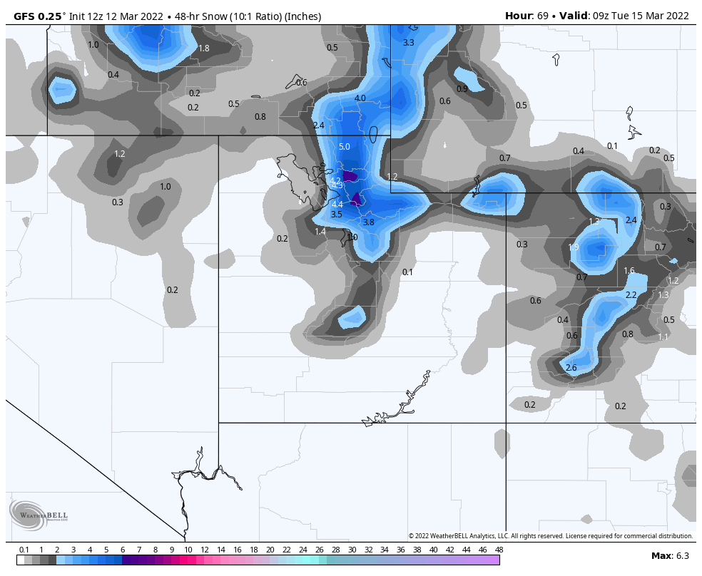
Colorado
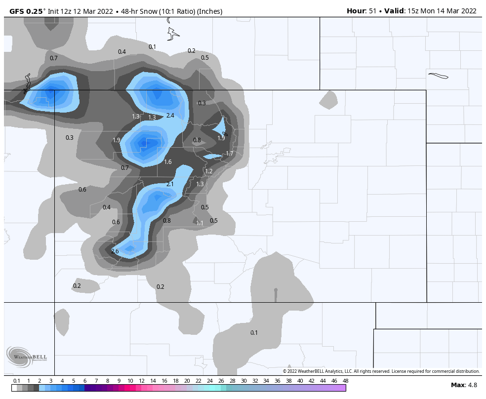
Sunday Night
Not a big system, as it stands now, but I am expecting this storm to grow as it approaches, nevertheless, 1-3 for most mountains with the exception of western and southern mountains, which as of the last few model runs, will be in the 0-2 range. Temperatures will be warm, as the front approaches, but the wind direction will change from south to west, then temps will fall.
I will monitor and update when something changes.
All Pattern Storms thru Mid-April
Place, Date of Prediction, Mountains, Lead Time, Date Predicted, Cycle day
| Colorado | 1-March | Northern Mountains | 18 | Mar 19-20 | 42-43 | 1 |
| Revelstoke, Banff | 1-March | Selkirk, Alberta Range | 21 | Mar 22-23 | 45-46 | 1 |
| Jay Peak | 1-March | Vermont | 23 | Mar 24-25 | 47-48 | 1 |
| Colorado | 1-March | Colorado | 28 | Mar 29-30 | 52-53 | 1 |
| Colorado | 1-March | Colorado | 31 | 2-Apr | 56 | 1 |
| Colorado | 1-March | Colorado | 41 | Apr 16-18 | 6-7- | 1 |
This is a reprint of our prior spring break forecast back in mid-February.
Spring Break Forecast for March
Spring break is right around the corner, so I thought I would break down, week by week, what will happen and more importantly, where the snow will be for the month of March.
March 1-5
March kicks off with a bang. In cycles 1 and 2 Utah had snow, so March 1-3 for Alta, Snowbird and the other cottonwood resorts.
Colorado had light snow, cycle 1 on the same days with heavy snow on day 27 (Mar 4). I expect the same in cycle 3, with the caveat, in cycle 2 it dumped, so a repeat like that would be a welcome surprise.
March 6-12
There is a split, during this week, in terms of pattern storms from the last 2 cycles. The one constant is Colorado. Colorado resorts received snow on days 33-35, which translates to March 9-11. Expect a good system for Vail, Steamboat, Aspen, Breckenridge and Crested Butte.
If the strength of the Pattern is more like cycle 2, Then Utah resorts Park City, Alta and Snowbird will have good snow. We will have to monitor the models to confirm those chances. Jackson Hole, Big Sky, both had good storms those days (Mar 10-12) in cycle 2, with JH having triple digit totals for 3 straight days,
March 13-19
We are split again during these dates. The only consensus is Colorado on days 42-43 (Mar 19-20). This was a small storm in both cycles with Colorado resorts picking up between 6-12, on average, in both cycles.
If the strength of the Pattern mirrors cycle 1, then Alta, Snowbird and Park City all received snow on day 41, which is March 18th.
March 20-26
During this week, in both cycles, we had a storm on day 43 (March 20), same storm as above, in Colorado (Nov 12, Jan 15). Both storms were on the mild side with Breckenridge getting 11 in cycle 1 and Aspen and Steamboat receiving 3 in cycle 2. Another small wave came through on day 49 (Mar 26) with snow totals between 3-4 for Breckenridge, Alta and Snowbird.
March 27-31
On days 52-54 (Mar 29-31), depending on which cycle, there was a storm that came through Colorado and Utah. Minor totals in both cycles for Utah, from 3 in cycle 1, to just an inch in cycle 2. Colorado ranged from 2-4 for most mountains in Cycle 2, to 6-9 for most mountains in cycle 1. I am expecting this to be more like Cycle 1 this time thru due to the strength of the jet stream this time of year.
