 Summary
Snow is back in the west today, from the Cascades to the Sierra. Snow begins in the Wasatch this morning, and Rocky Mountains by afternoon. This is part one of the storm with part two following up tomorrow. Below is a video that shows the two waves. The second wave follows a similar path, but it has a wider path and is stronger.


Forecast
PNW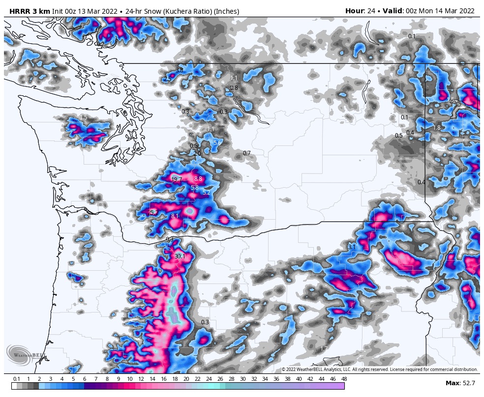
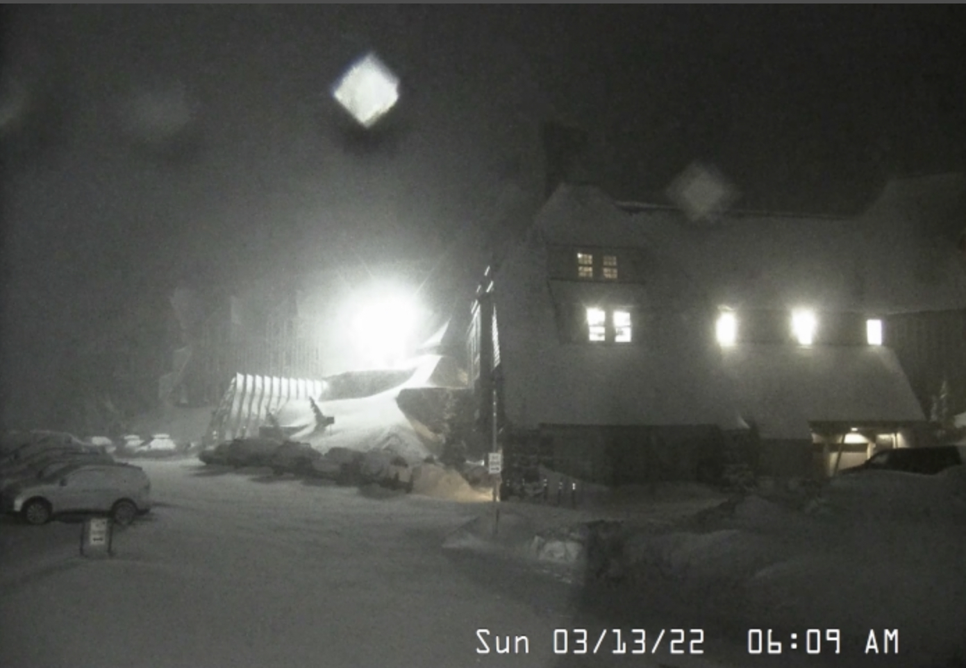
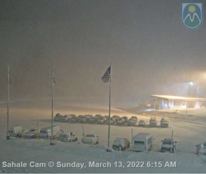
Light snow today for the northern Cascades as the low-pressure system moves into Oregon. For the southern Cascades Mt Bachelor, Mt Hood/Timberline and Meadows resorts expect heavy snow with strong winds from 20-25 mph, gust as high as 40. Snow levels hovering around 5000 ft. Tonight, another 2-4 before the next wave tomorrow.
This is a tough forecast, because Monday’s storm will be warm and will bring with it, r__n, so the best time to ride is today, but the winds may close some upper mountain lifts. Meadows may be the best choice today, Heather Canyon should be protected from the strong winds.
Tahoe
This storm has grown enough to include Tahoe–woohoo! Resorts along the crest and summits will have the best snow, like Kirkwood, Palisades and Sugar Bowl, where I expect 1-3 with more towards the mountain summits.
Utah
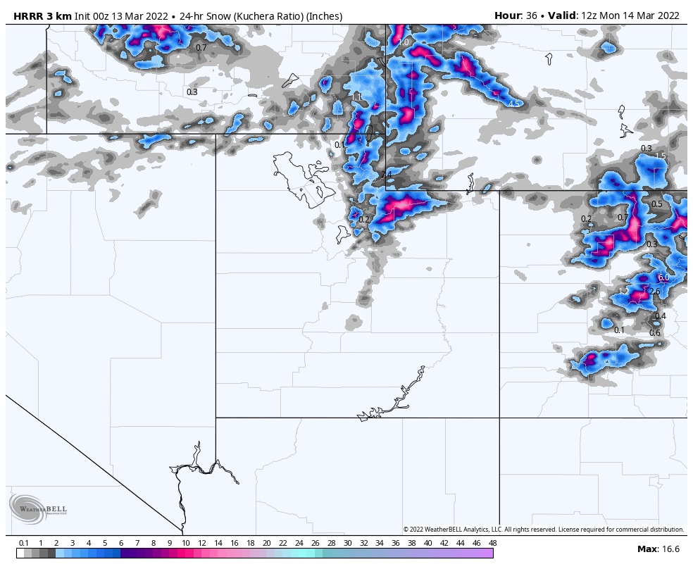 .
.This will be a fast-moving system and dump its load within 4-5 hours. The storm rolls in this morning about the time the lifts open and moves out in the early afternoon. Tonight, expect another 1-3. Monday will be sunny and dry with highs in the upper 20’s. Tuesday evening the next system rolls in.
Colorado

It will be sunny and warm today before the front arrives in late afternoon. Ther winds will pick up as the front arrives with gusts in the lower 30s. Expect 2-4 for Vail, Beaver Creek, Aspen and Aspen Highlands, with most other mountains in the 1-3 range. Monday and Tuesday will be sunny then the next wave arrives Tuesday night.
This is a reprint of our prior spring break forecast back in mid-February.
Spring Break Forecast for March
March 13-19
We are split again during these dates. The only consensus is Colorado on days 42-43 (Mar 19-20). This was a small storm in both cycles with Colorado resorts picking up between 6-12, on average, in both cycles.
If the strength of the Pattern mirrors cycle 1, then Alta, Snowbird and Park City all received snow on day 41, which is March 18th.
March 20-26
During this week, in both cycles, we had a storm on day 43 (March 20), same storm as above, in Colorado (Nov 12, Jan 15). Both storms were on the mild side with Breckenridge getting 11 in cycle 1 and Aspen and Steamboat receiving 3 in cycle 2. Another small wave came through on day 49 (Mar 26) with snow totals between 3-4 for Breckenridge, Alta and Snowbird.
March 27-31
On days 52-54 (Mar 29-31), depending on which cycle, there was a storm that came through Colorado and Utah. Minor totals in both cycles for Utah, from 3 in cycle 1, to just an inch in cycle 2. Colorado ranged from 2-4 for most mountains in Cycle 2, to 6-9 for most mountains in cycle 1. I am expecting this to be more like Cycle 1 this time thru due to the strength of the jet stream this time of year.
All Pattern Storms thru Mid-April
Place, Date of Prediction, Mountains, Lead Time, Date Predicted, Cycle day
| Colorado | 1-March | Northern Mountains | 18 | Mar 19-20 | 42-43 | 1 |
| Revelstoke, Banff | 1-March | Selkirk, Alberta Range | 21 | Mar 22-23 | 45-46 | 1 |
| Jay Peak | 1-March | Vermont | 23 | Mar 24-25 | 47-48 | 1 |
| Colorado | 1-March | Colorado | 28 | Mar 29-30 | 52-53 | 1 |
| Colorado | 1-March | Colorado | 31 | 2-Apr | 56 | 1 |
| Colorado | 1-March | Colorado | 41 | Apr 16-18 | 6-7- | 1 |
