Pattern Discussion
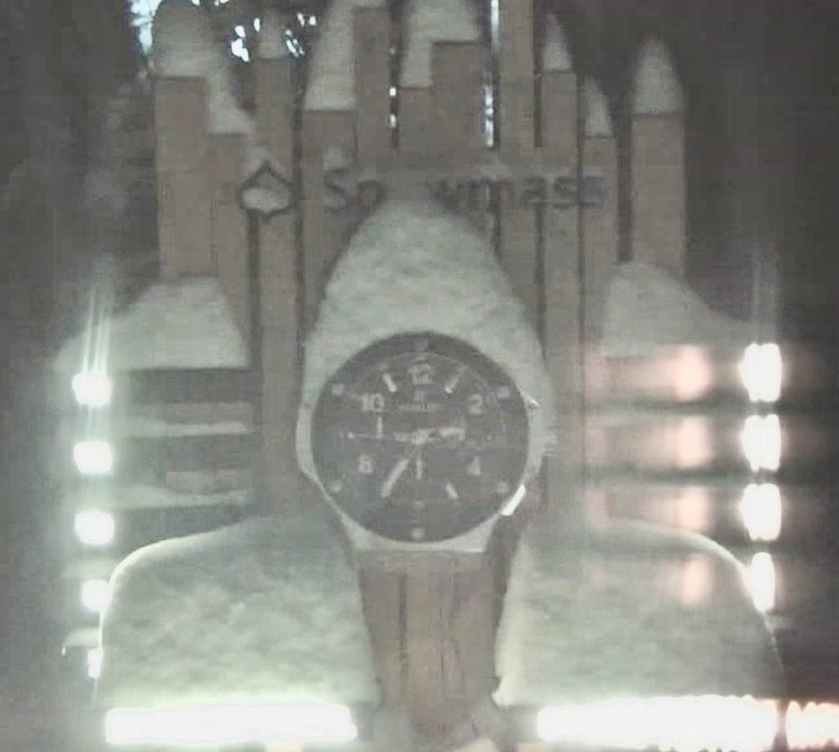
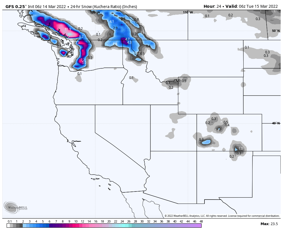
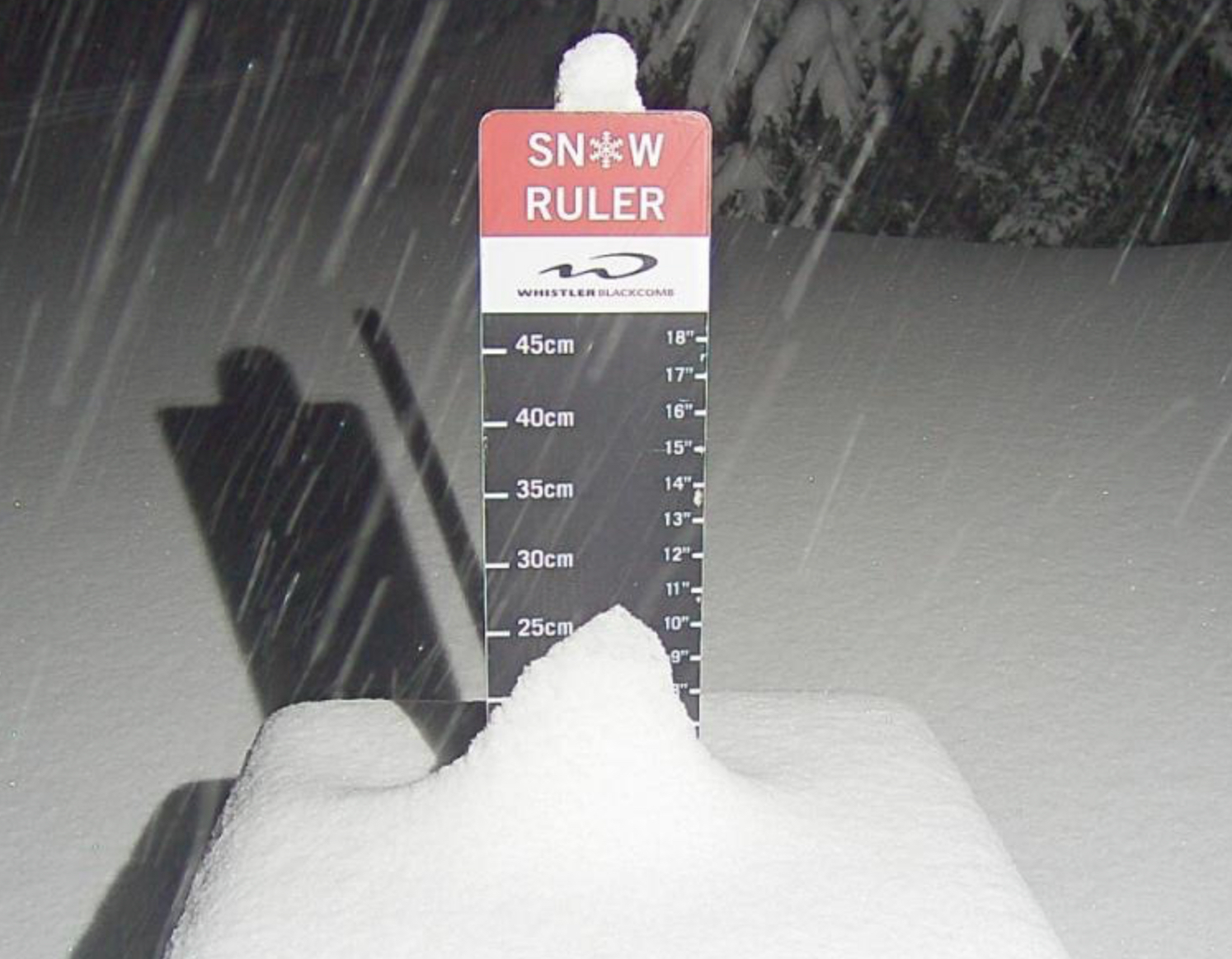
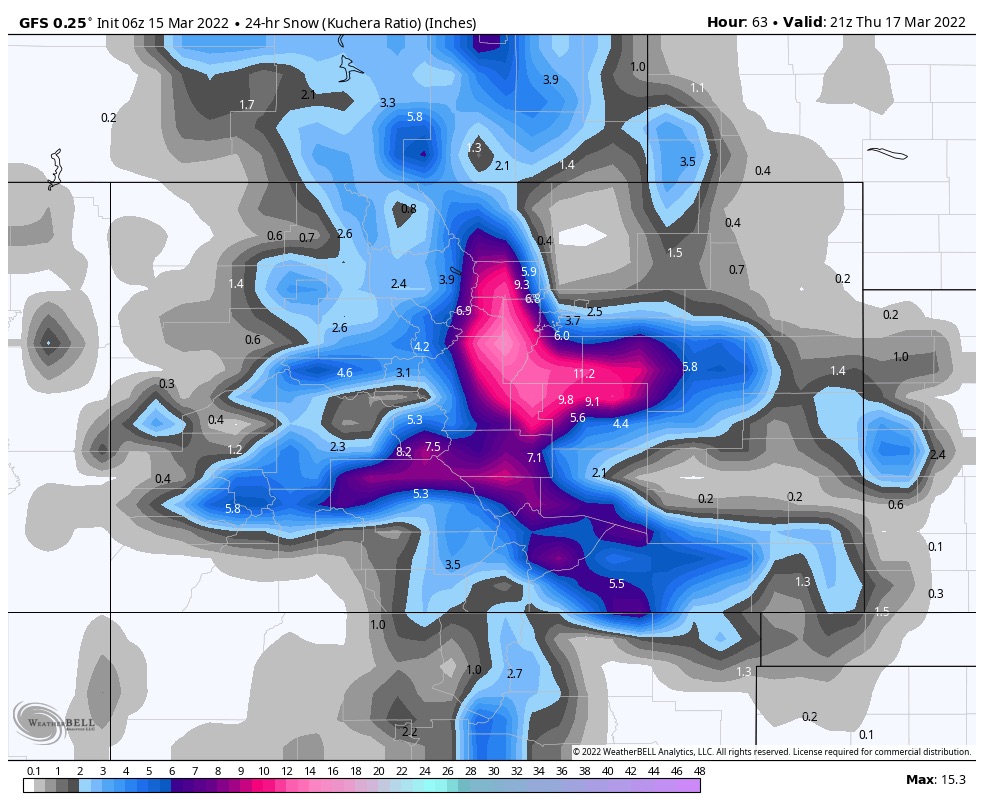
That was a nice refresh, the second wave gets underway today in the Pacific Northwest. Snowmass is the big winner, looks to have at least 10, on the snow stake cam. Below is the GFS 24-hour snowfall thru Thursday evening. This storm takes a similar path as the last one. We are about a week away from the Northern Part of the Pattern, but there is one more storm after this one, that arrives this weekend.
That Northern Part of the Pattern lasts about 3 1/2 weeks, storms track north of the US border, or take a track that favors the PNW, Idaho Montana and Wyoming. Looking at the GFS long-range, it has picked up on the pattern shift. It does have a huge system at the end of March, that is a Pattern storm for days 52-53.
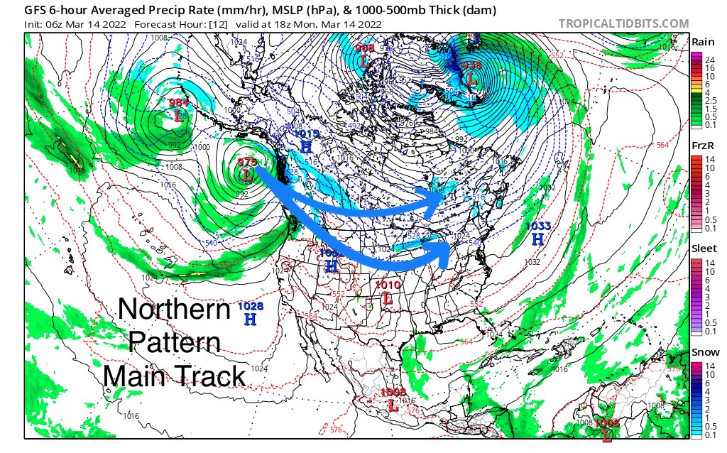
That storm, back in cycle 1 (Nov 10), was slingshot down the coast from a low, near Seattle. It slung deep into California giving Tahoe rain and snow. In cycle 2, it went north and completely missed Tahoe. This cycle is behaving a lot like cycle 1 so I expect the GFS to have the proper solution. We will keep an eye on it, Tahoe has been very hard to predict storms during La Nina seasons because they are on the edge of the Pattern.
Forecast

PNW
Not bad for the first round. About what we expected with Whistler, Stevens, Mt Hood and Timberline all coming in with 4+. Whistler leads the pack with 6.
Snow today for the northern Cascades with snow levels around 5500 ft, warm temps continue. Expect 2-4 today with 1-2 overnight.
Southern Cascades expect 3-5 of heavy wet snow, but better conditions up top. This system moves out Wednesday and the warm temps continue thru Friday, until our next system come in.
There’s a small wave that’s going to come through Friday, but a larger system arrives Saturday.
Utah
 The storm arrives tonight, it looks like cottonwoods resorts Alta, Brighton and Snowbird will get between 2-4, hopefully. The model trends continue to loose energy.
Next system arrives Sunday night.
Colorado
Today’s Map

Yesterdays Map
We are going in the wrong direction, in terms of snow totals. You can see the comparison from today’s map (top) to Yesterdays map (bottom).
The energy is still east of the divide, so resorts like Eldora and Arapahoe Basin should fare well. For most other Colorado resorts, I’m expecting in the 1-3, 2-4 range.
The Next system rolls in on Monday and there is much greater potential for snow, as it will tap into tropical Pacific moisture.
This is a reprint of our prior spring break forecast back in mid-February. All of the predicted storms have been there, on time. You can scroll thru and see the upcoming storms, we have just talked about, listed below and are on time, as of now.
Finally, the predictions thru mid-April are last. Thanks for reading the blog! Mike
Spring Break Forecast for March
March 13-19
We are split again during these dates. The only consensus is Colorado on days 42-43 (Mar 19-20). This was a small storm in both cycles with Colorado resorts picking up between 6-12, on average, in both cycles.
If the strength of the Pattern mirrors cycle 1, then Alta, Snowbird and Park City all received snow on day 41, which is March 18th.
March 20-26
During this week, in both cycles, we had a storm on day 43 (March 20), same storm as above, in Colorado (Nov 12, Jan 15). Both storms were on the mild side with Breckenridge getting 11 in cycle 1 and Aspen and Steamboat receiving 3 in cycle 2. Another small wave came through on day 49 (Mar 26) with snow totals between 3-4 for Breckenridge, Alta and Snowbird.
March 27-31
On days 52-54 (Mar 29-31), depending on which cycle, there was a storm that came through Colorado and Utah. Minor totals in both cycles for Utah, from 3 in cycle 1, to just an inch in cycle 2. Colorado ranged from 2-4 for most mountains in Cycle 2, to 6-9 for most mountains in cycle 1. I am expecting this to be more like Cycle 1 this time thru due to the strength of the jet stream this time of year.
All Pattern Storms thru Mid-April
Place, Date of Prediction, Mountains, Lead Time, Date Predicted, Cycle day
| Colorado | 1-March | Northern Mountains | 18 | Mar 19-20 | 42-43 | 1 |
| Revelstoke, Banff | 1-March | Selkirk, Alberta Range | 21 | Mar 22-23 | 45-46 | 1 |
| Jay Peak | 1-March | Vermont | 23 | Mar 24-25 | 47-48 | 1 |
| Colorado | 1-March | Colorado | 28 | Mar 29-30 | 52-53 | 1 |
| Colorado | 1-March | Colorado | 31 | 2-Apr | 56 | 1 |
| Colorado | 1-March | Colorado | 41 | Apr 16-18 | 6-7- | 1 |
