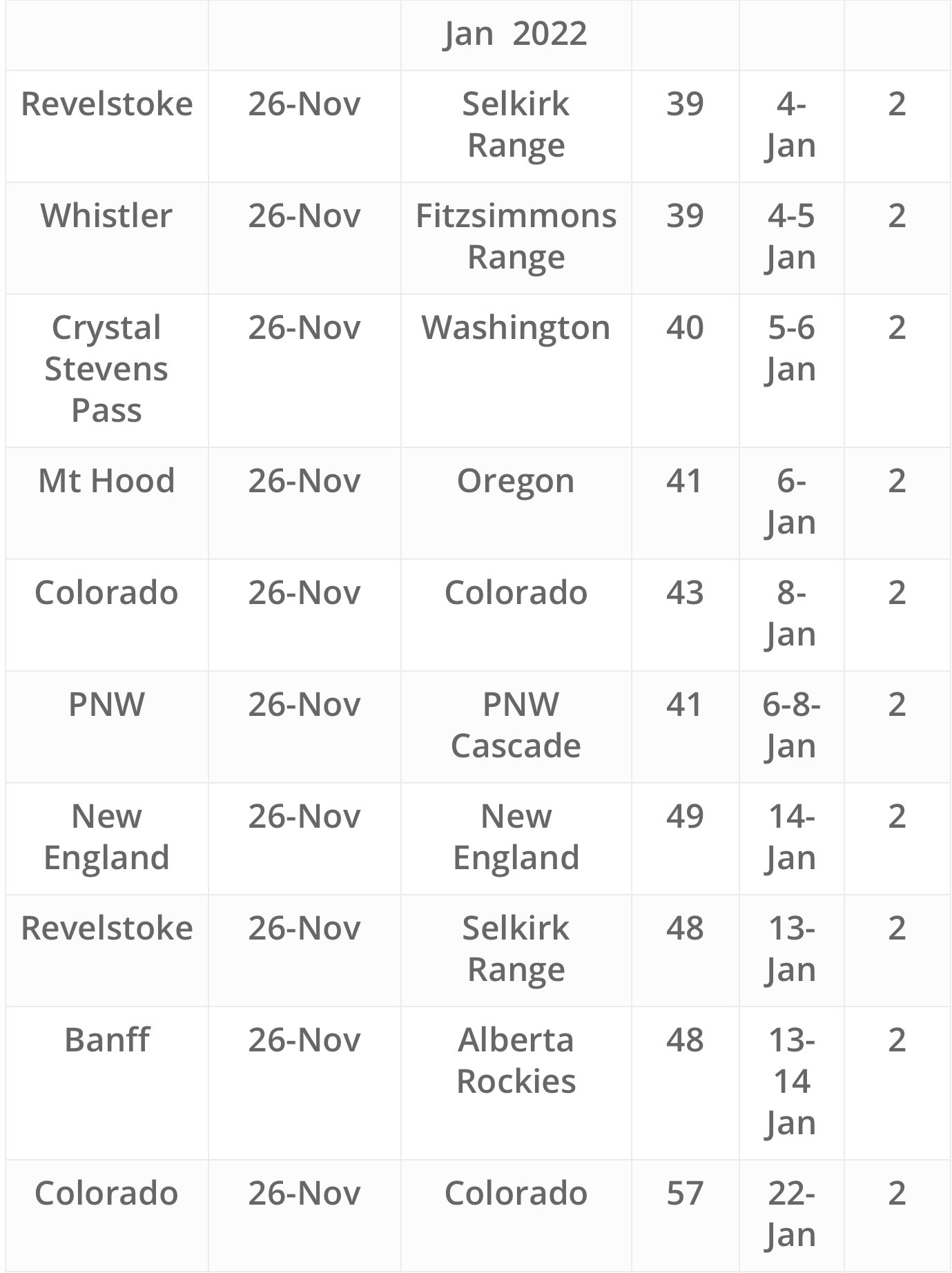
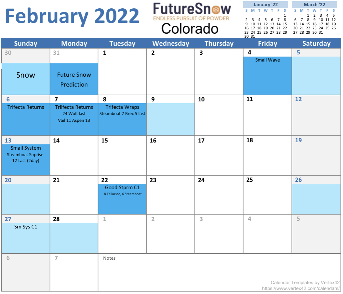
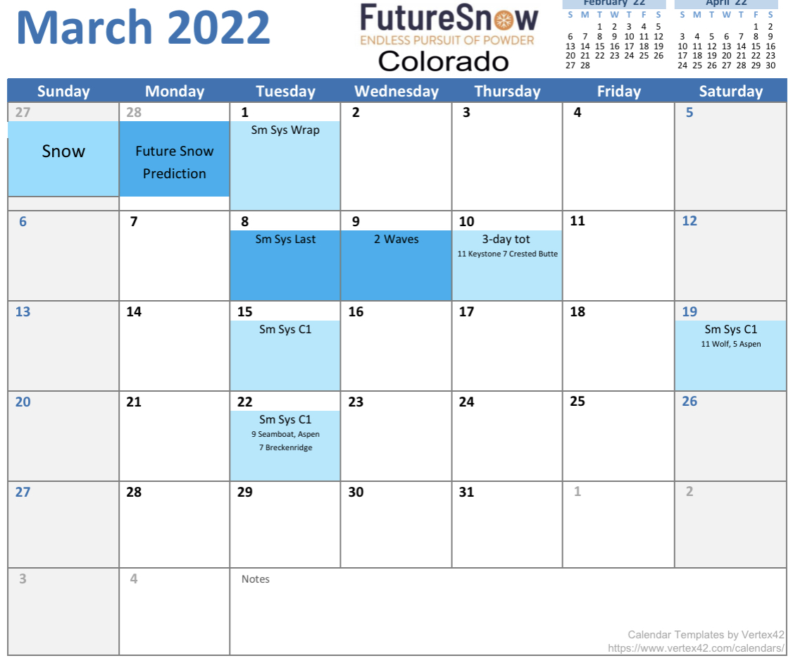
Colorado Calendar is Out thru March

You can also view these calendars at the resort specific locations in the Resort Forecasts tab.
Summary
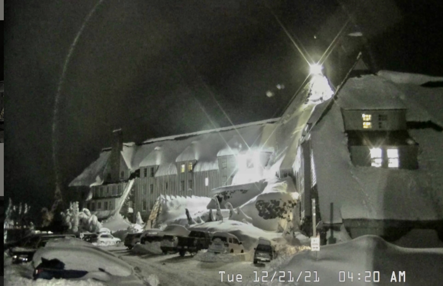
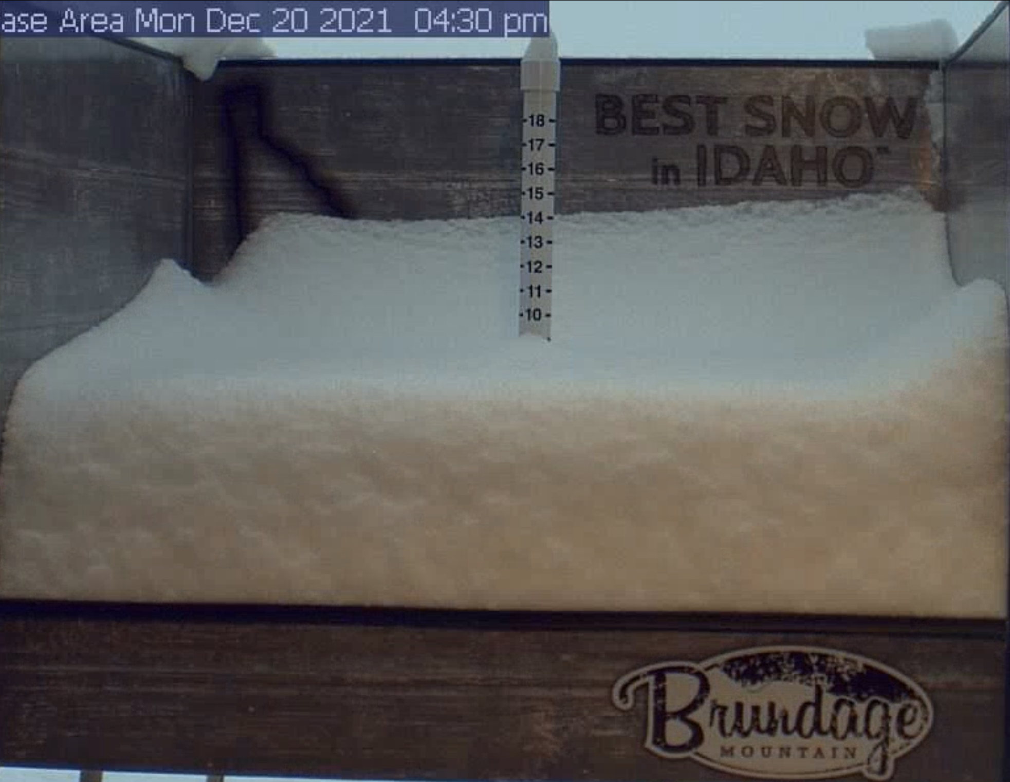
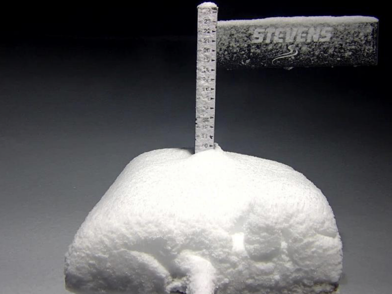
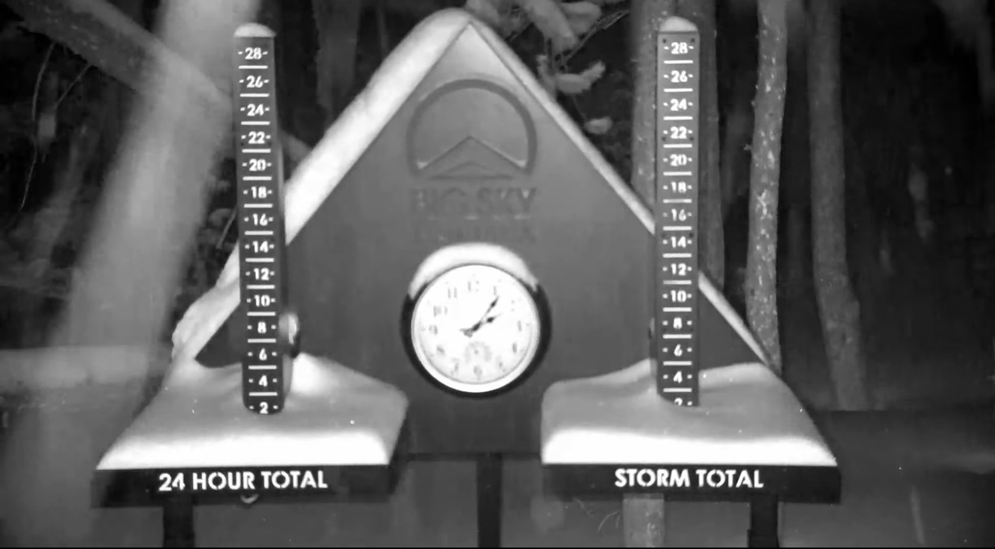
Break between systems today before the next round begins tonight. Here are a few shots of the day, that was yesterday.
Christmas Storm Breakdown
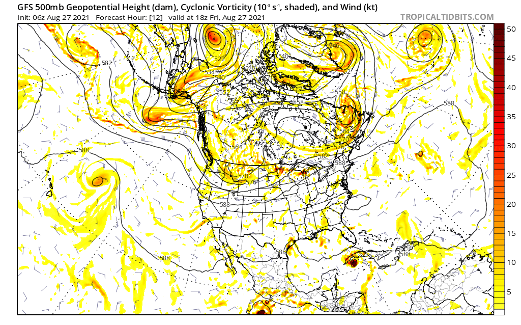
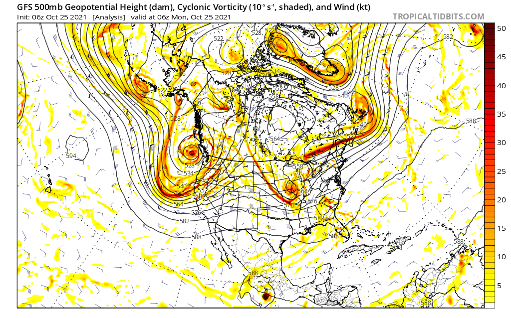
These next three charts show the 500 mb wave patterns from the pre-cycle (cycle 0), to cycle 1 and cycle 2, valid Friday. During the pre-cycle, the storms are all up in Canada. By the end of cycle 0, those wave patterns will propagate downward and will cycle regularly until a new pattern begins in the summer.
Cycle 1 Chart shows what the established Pattern looked like back in October. The shape of the flow is dictated by how the teleconnections are aligned. Finally, the Cycle 2 Chart shows the projected 500 mbar forecast for Christmas day. The differences in the pattern are due to the differences in the teleconnections. For instance, this cycle, the PNA is negative. Last time thru it was positive.
Cycle 0
Cycle 1
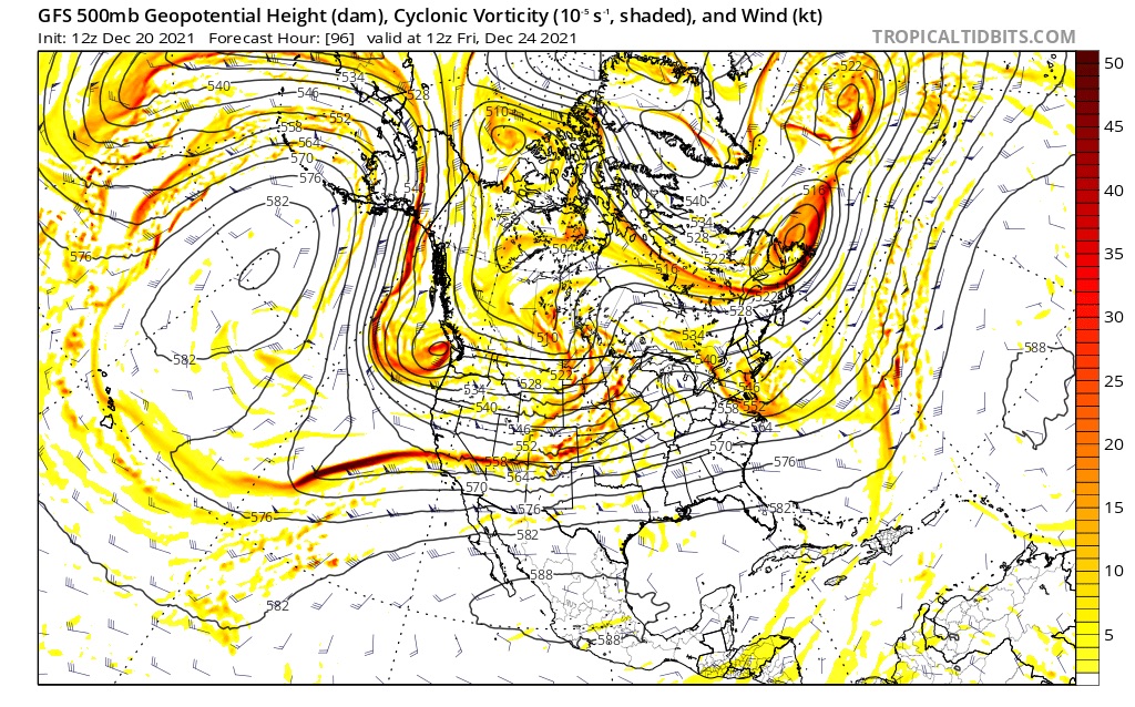
Cycle 2
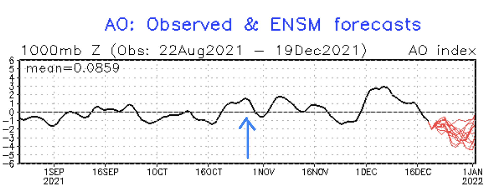
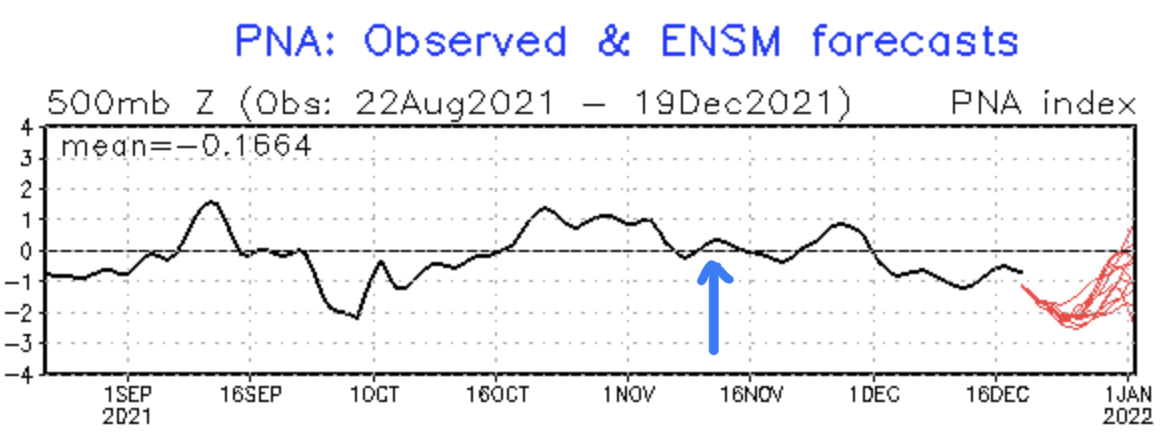
When you look at the Arctic Oscillation (AO) and Pacific North American Pattern (PNA) charts the AO took a similar dive the last time this storm hit. The PNA, however, has completely flipped. That is the main difference in the Cycle 2 chart Compared to Cycle 1.
There is an area of high pressure just below the Aleutian Islands of Alaska in Cycle 2. That creates that huge arcing ridge in the flow. Compared that to the cycle 1 chart, the high pressure is that circle just to the northeast of Hawaii.
Hopefully that explanation helps you understand the variances in the cycles. The variances can change the strength and position of the storm, but the storm is there regardless.
I am working on producing a video that documents both the 500 mb flow, and surface flow, for last year’s cycling pattern. I think it will help those of you who can’t understand, or “see” the Pattern, understand what I am seeing.
Tonight
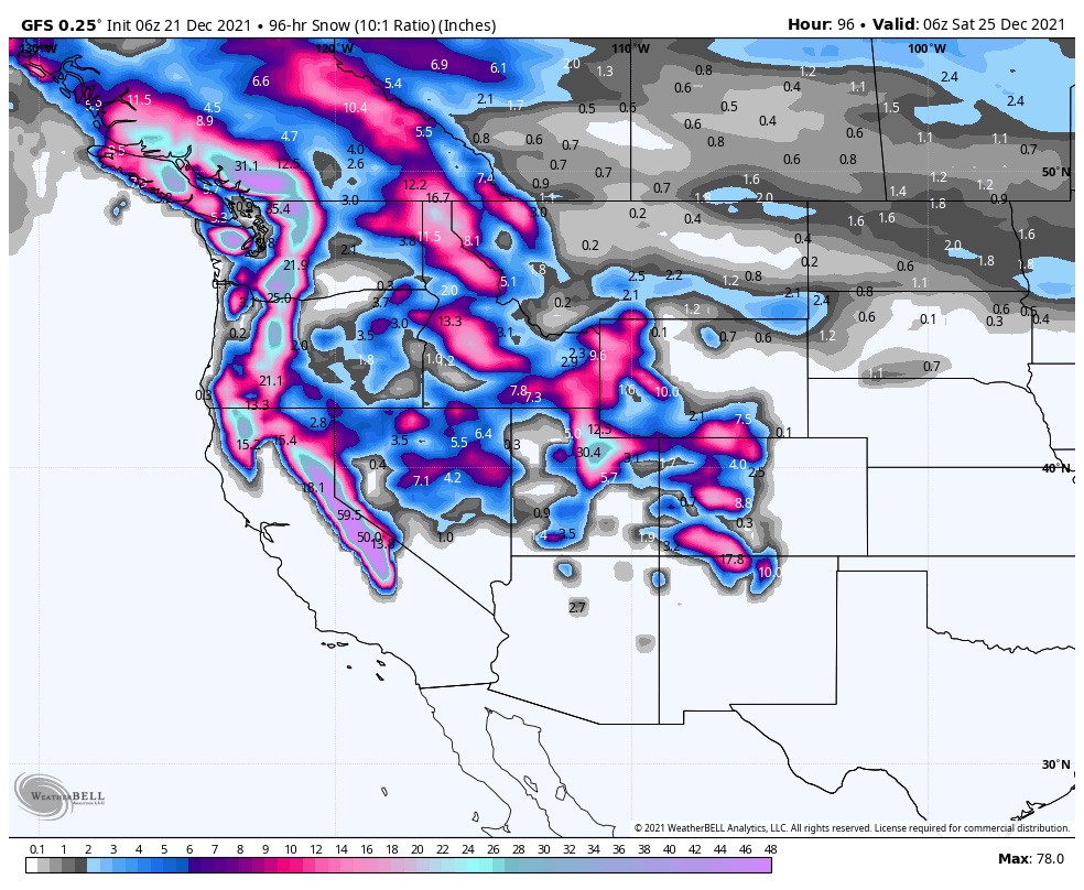
Next 4 Days Projected Totals
PNW
Snow begins, around 6, in the northern Cascades as the next wave makes its way down the British Columbia coast. Winds gusts of 40 mph expected, and freezing levels will be around 3-4000 ft. Total snowfall this evening will be in the range of 5-9 for mountain tops and 3-5 at 4000ft.
Snow begins in the southern Cascades, around 10, as the wave moves south. Freezing levels around 4-5000 ft. Total snowfall overnight in the 3-6 mountain tops, and 2-4 at 5000 ft.
Tomorrow and Tomorrow Night
PNW
Steady wind with gusts up to 30 mph. Snowfall range for 8-10 for lower mountain areas of the southern Cascades, and 10-12 for upper mountain. With slightly higher amounts for the northern Cascades.
Tahoe
Snow begins in the early morning hours tomorrow night, with snow levels being a factor again. Expect freezing levels around 5-6000 ft. Snow totals for this system should be in the 1-3 ft range, with more if we get some favorable upslope cooling.
Thursday
PNW
The storm is at its peak strength on Thursday as temperatures are more favorable, in the 20’s all day. Both southern and northern Cascades will add another 10-15 at resort bases and 15-20 up top.
Tahoe
Temperatures are more favorable, in the lower 20’s throughout the day, as the system intensifies. Expect 10-20 for most areas.
Christmas Eve and Christmas
The storm moves into Utah Christmas Eve and Colorado Christmas Eve/Day. More tomorrow as we draw a little closer.
Future Snow Prediction Chart