
Summary
The snow moves out of Colorado today; skies will clear in the afternoon for northern and central mountains. To the south, Telluride and Silverton will get 2-4 more of cold dry snow, as the system exits to the southeast. Meanwhile, a fast-moving clipper system is sliding down northern British Columbia and will combine with some offshore moisture and intensify. It will take a direct southeast track and arrive in Utah Tuesday morning, and Colorado by Tuesday night.
Stoke
Forecast
PNW
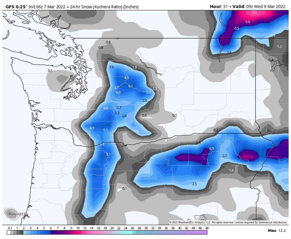
Tuesday Northern Cascades: Snow begins early tomorrow morning as a cold front drops down from British Columbia. Snow levels will be around 4000 ft with daytime high temperatures around 30. Expect 2-4 during the day for Stevens Pass and Crystal Mountain, with another 2-4 overnight. Wednesday will be clear with highs in the mid 20’s and light winds.
Southern Cascades: It will be windy as the front approaches around mid-morning. Freezing levels will begin at 4500 and drop to around 1000 by early afternoon. Expect 2-4 throughout the day, with the bulk of the precipitation, 3-6, overnight. A few lingering showers for Wednesday morning with gradual clearing in the afternoon.
Tahoe
Wednesday-Wednesday night. There is a chance that this system will drop far enough south before it slides to the east, so I will give an “hopefull” 1-2 for Kirkwood and Heavenly. Temps will be cold, if the system can make it.
Utah
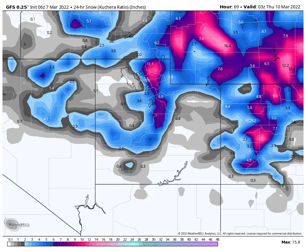
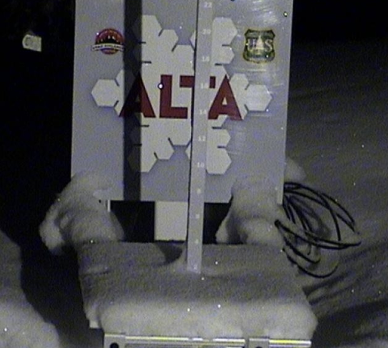
Tuesday: I am expecting Winter Storm Warnings with this approaching storm system, as it looks to be intense by the time it reaches the cottonwood mountains Alta, Brighton and Snowbird. Cold temps and moderate winds between 10-15 mph as the storm arrives mid-morning Tuesday. Expect 1-3 thru the day and the bulk of the snow after the lifts close. I am expecting 5-10 overnight.
Wednesday: Powder Day, it will continue snowing all day, so clear goggles a must. Expect another 6 to a foot. Thursday will be a great day too, with lots of leftovers. Expect clearing skies Thursday with cold temps in the single digits.
Colorado
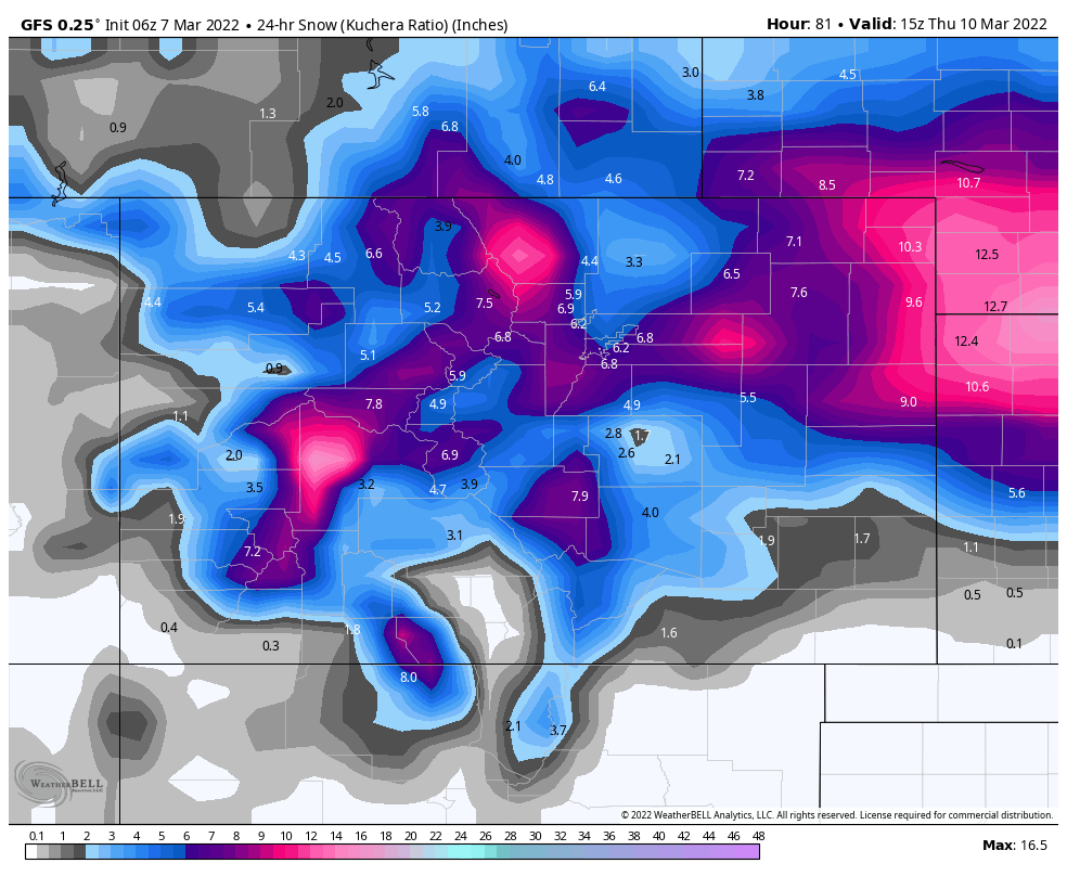
Wednesday: The storm arrives Wednesday around noon. We will dial in the precipitation totals as we get a little closer, but I am expecting beteen 6-10 for most mountains.
