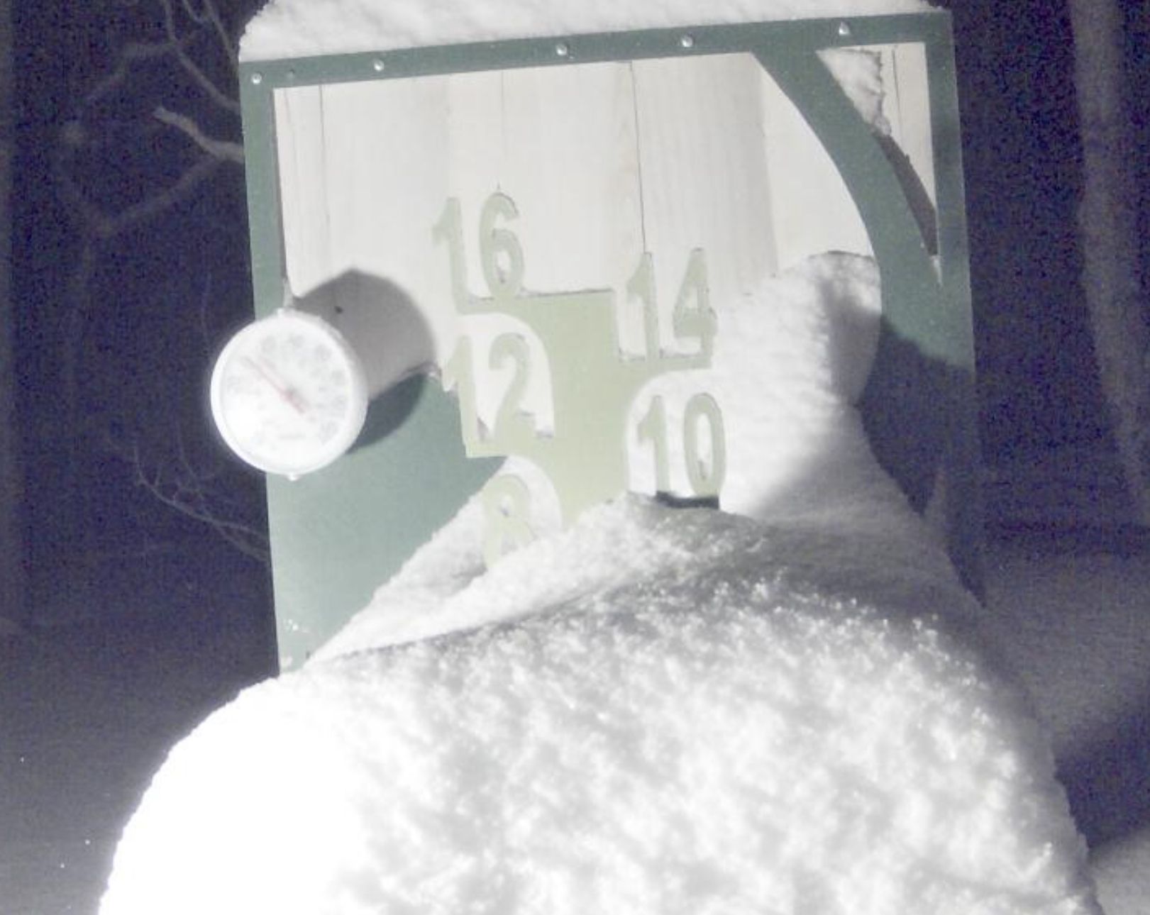
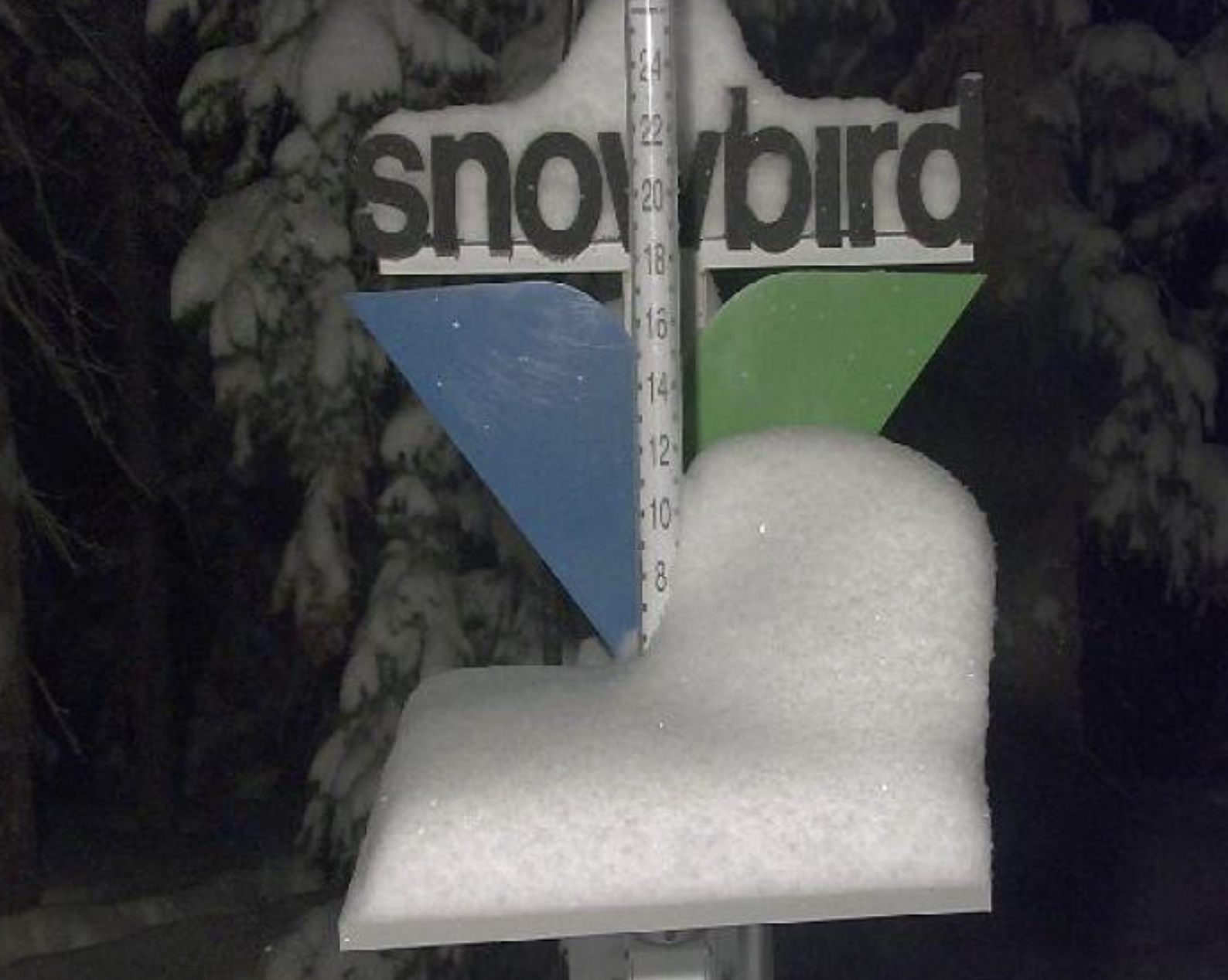
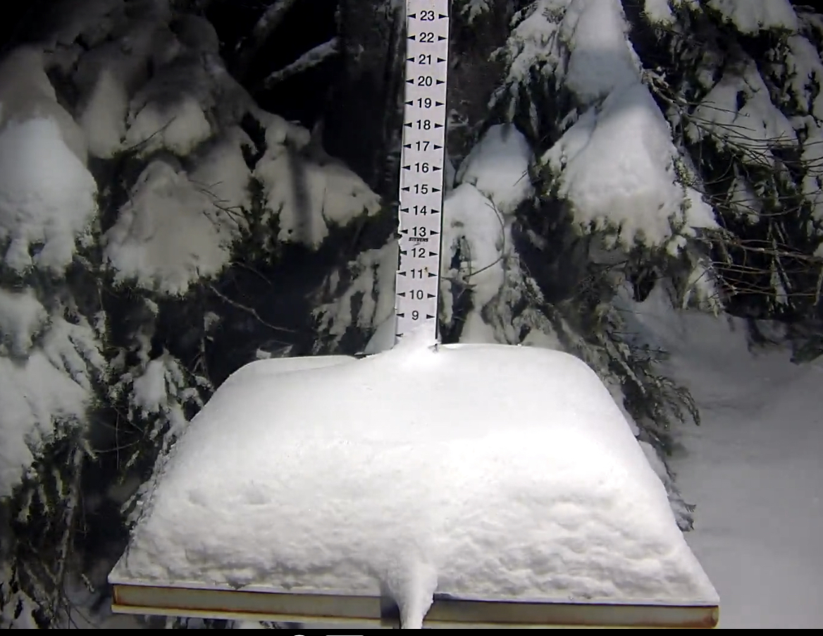
Snow Stake Cams (click to enlarge)


Snow Forecast thru Next 10 Days

Forecast Summary

Today, the next wave is well underway in the Pacific Northwest, down to Lake Tahoe and the Sierra.
Temperatures and snow levels are an issue with this wave, but only around base levels for Oregon resorts. Lake Tahoe is unfortunately higher. Snow levels are expected to rise to around 7500, so likely all rain below that level and snow above.
This storm moves into Utah Tonight and will bring DEEP powder for both Saturday and Suday first chair. Finally, the Storm rolls into Colorado Friday.
Forecast
Washington
 Washington Snow Forecast
Today, snow continues with temperatures around 30 and light winds. I am expecting 4-6 for Snoqualmie and Crystal Mountain, with 2-4 for Stevens Pass and Mt Baker.
Tonight, the snow continues, with a general 3-5 for most resorts before the lifts open on Friday.
Oregon
 Today
Today
A few more inches is possible at Mt Hood and Mt Bachelor, before the next wave comes thru after 10 pm tonight. Temperatures near 30 with strong winds 15-20 and gusts in the 40’s.
Tonight/Tomorrow
The next wave moves in after 10 pm that will add 2-4 before the lifts open. Tomorrow, freezing levels will be around 6000 feet with base temps near freezing. Snow totals throughout the day should be in the 5-10 range. Moderate winds expected, but not as strong. Gusts around 30.
Lake Tahoe

Today
Today the next wave arrives along with rising snow levels. Expect freezing levels to encroach 7300 feet, so the higher base level resorts will fare the best. Daytime snowfall in the 4-8 range for Donner, Kirkwood and Homewood, 2-6 range for Heavenly, Sierra at Tahoe and Palisades.
Tonight, thru Friday
Snow continues with totals tonight in the 6-12 range near Carson Pass (Donner) and Kirkwood. Expect lessor amounts for Palisades, Homewood, Mt Rose and Sugar Bowl.
Friday continues to be warm with freezing levels hanging around 7000 feet. Above that level will continue to get decent snow with totals in the 6-10 range for higher elevations. Saturday, the next wave hits and this wave has a little more punch. We will discuss more tomorrow.
Utah

Back-to-back DEEP Powder Days Saturday and Sunday
Next System moves in tonight and it is running a little late, so expect 2-4 overnight before the lifts open. Tomorrow will be a “ride the storm” day with heavy snow throughout the day. Snow totals in the 10-15 range for Alta, Snowbird and Deer Creek, with smaller totals for Park City and Brighton–4-8.
Snow continues tomorrow night and Saturday with possibly 1-2 feet before the lifts open and another 12+ throughout the day for Alta, Snowbird and Deer Creek, with more modest amounts for Park City and Brighton.
Colorado

Scattered snow showers possible today as there is a little moisture left from yesterday’s system, but I expect the skies to clear by midday. It will be cold and windy, especially along the passes. Strong winds and subzero temps around -15. Expect gusts to be in the low 30’s.
The next system reaches Colorado Tomorrow by midday.

When will you make the predictions for February?
thanks!
Joel