Snow Stake Cams (click to enlarge)


Snow Forecast thru Next 10 Days

Long-range Predictions thru January

Forecast Summary
Today, snow continues in Utah and Colorado, as the next storm approaches the coast. This is wave 2 of 5 storms that will ring in the new year.

Forecast
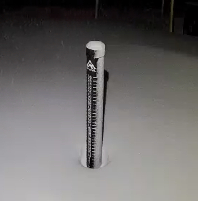
Washington
 Washington Snow Forecast
Today, a break in between systems this afternoon, as the next wave of energy is moving onshore, to the south, in Oregon and California.
Scattered snow showers are likely, due to a tremendous amount of moisture, 1-3 likely for Snoqualmie and Crystal, with 4-8 expected for Mt Baker and Stevens pass. Expect moderate winds, 10-15, with temperatures in the mid to upper 20’s.
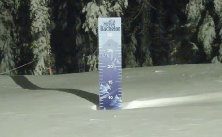
Oregon

Today
A few more inches is possible at Mt Hood and Mt Bachelor, before the next wave comes thru after 10 pm tonight. Temperatures near 30 with strong winds 15-20 and gusts in the 40’s.
Tonight/Tomorrow
The next wave moves in after 10 pm that will add 2-4 before the lifts open. Tomorrow, freezing levels will be around 6000 feet with base temps near freezing. Snow totals throughout the day should be in the 5-10 range. Moderate winds expected, but not as strong. Gusts around 30.
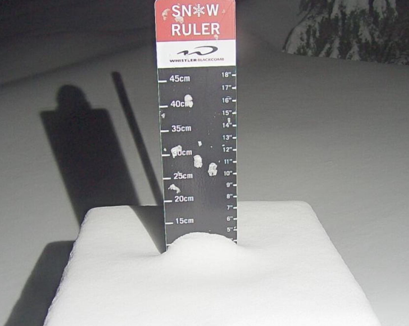
Lake Tahoe

Today
Today will be a nice bluebird day with temperatures near freezing level at lake level, with light winds. Next system arrives tomorrow morning.
Tomorrow, the next wave arrives along with rising snow levels. Expect freezing levels to encroach 7300 feet, so the higher base level resorts will fare the best. Daytime snowfall in the 4-8 range for Donner, Kirkwood and Homewood, 2-6 range for Heavenly, Sierra at Tahoe and Palisades.
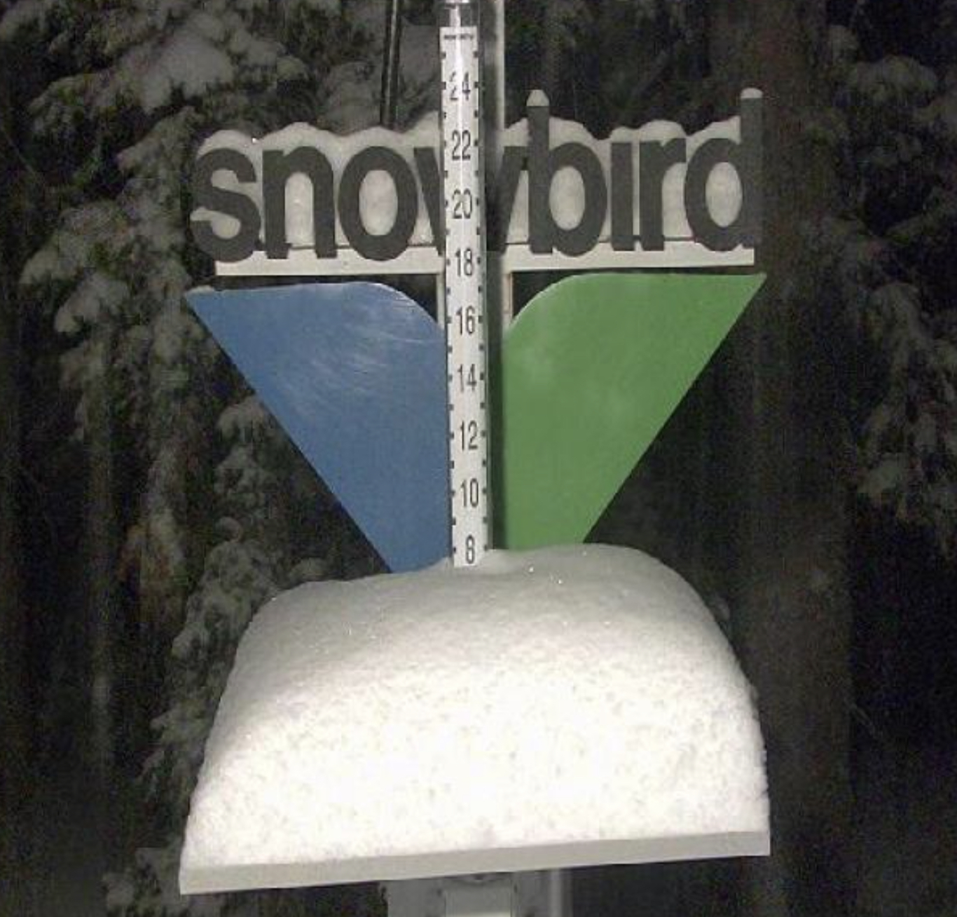
Utah

Snow continues today with daytime accumulations in the 4-8 range for Snowbird, Alta, Deer Valley and Brighton with slightly less for Park City. Temperatures will be in the low 20’s falling to the low teens by late afternoon. Moderate winds 10-15 mph.
Tonight
The system moves out after 10 pm, but not before adding another 1-3/2-4. Tomorrow May have some lingering showers but expect the skies to clear by midday cold windchills in negative territory, but winds won’t be that bad, around 10-13 mph.
Next System Hits tomorrow night. Expect 3-5/4-8 before the lifts start on Friday.
Colorado

Today, snow continues today with 3-8 expected for most resorts, from Telluride in the south to Steamboat in the North. A little less is expected along the divide, with 2-4 today for Arapahoe Basin and Loveland.
‘This system moves out this afternoon and the next system, hitting the coast today reaches Colorado Friday. Expect temperatures to be in the high 20’s with moderate winds 10-15.
Tomorrow will be cold and windy, especially along the passes. Strong winds and subzero temps around -15. Expect gusts to be in the low 30’s—ouch.
