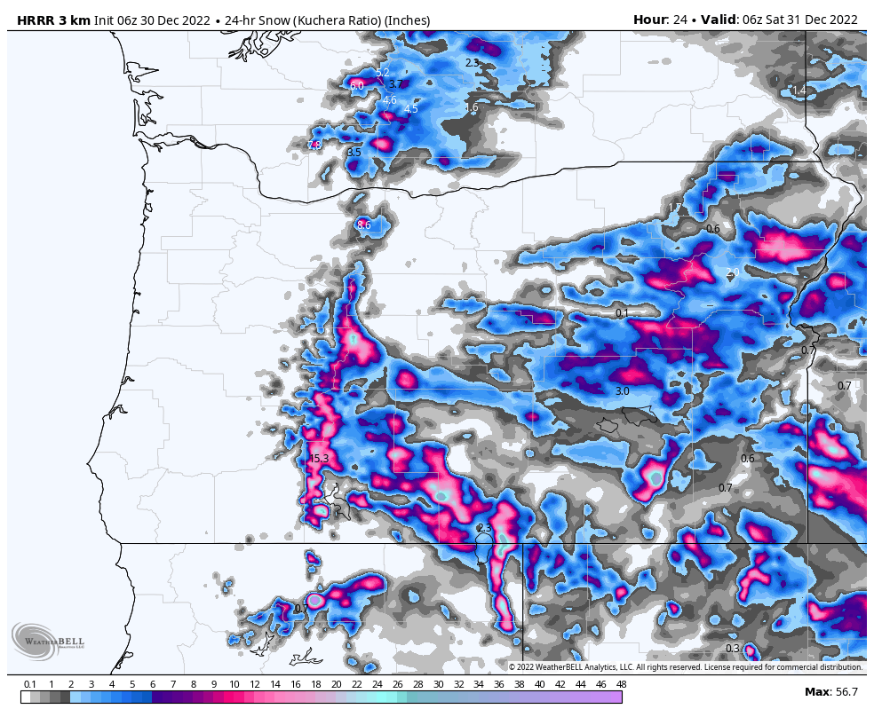
Projected snowfall for the next 5 days

Snow Stake Cams…..Coming Soon Snow Stake Page
Forecast Summary

The above animation shows storm 3 and 4 and their path. There is a ton of moisture with this system, another atmospheric river (AR) for California. In the last cycle, there was an AR as well, however, it was in the Gulf of Alaska due to a ridge of high pressure off the coast. As we learned from last year, AR’s repeat regularly, but not always the same spot.
This time the teleconnections favor the AR to have a direct line to the Sierra. With most AR’s though, there is a catch, warm temperatures. Rain will dominate below 8000 feet, for Tahoe resorts, with heavy snow above 9000 feet. Below, you can see the AR stretching way out in the Pacific.
 Storm 4, in the series of storms that Gary diagramed, is underway in California today, with storm 5 coming into view behind the AR. The current system reaches Utah early this morning and Colorado tonight. Tomorrow will be a powder day in Utah and most of Colorado, with deep powder for the Wasatch and northern resorts in Colorado.
Storm 5 follows right on the heels of storm 4 bringing cold air to Lake Tahoe beginning in the late afternoon New Year’s Eve, and a powder day to start off 2023, while the backside of storm 4 dumps 1-2 feet of snow, for Utah New Year’s Eve.
Forecast
Washington

Today, good snow totals at Mt Baker and Stevens Pass, expect 4-8 during the day, with moderate winds in the 15-25 mph range. Temperatures in the low 30’s at base level and mid 20’s at the summit. Smaller amounts today for Crystal Mountain and 49 Degrees North, in the 2-4 range.
Tomorrow, the storm moves out by mid-morning.
Oregon
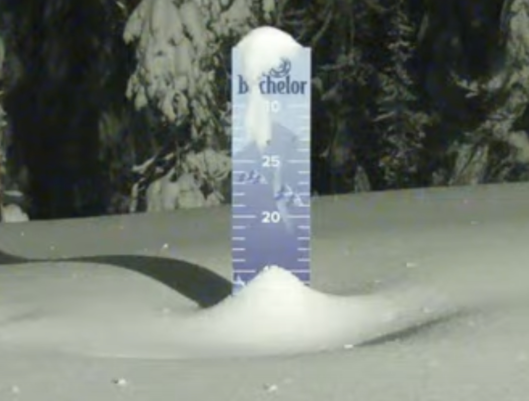
Today, heavy snow throughout the day today as the system moves out tonight. Moderate winds between 15-20 with 34 mph gusts. Expect daytime snow totals in the 3-5 range for Mt Hood Timberline and Meadows with 4-8 inches for Mt Bachelor.
Tonight, an additional 1-3/2-4 possible for both ranges.
Tomorrow will be mostly dry, with a possibility of a scattered shower. Base temperatures around the freezing mark with light winds.
Next system Monday
Lake Tahoe

Today
Rain below 9000 feet lowering to around 8400 by late tonight. Snow levels will drop throughout the night with northern resorts changing to all snow as early as 7 am for Mt Rose and 9 am for Kirkwood. Dodge Ridge by 10, and Donner Ski Ranch/Sugar Bowl by noon. Heavenly as late as 4 pm. Snow totals above 8500 today will be in the 6-12 range.
Saturday
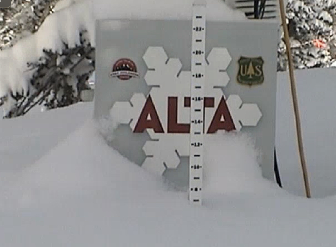
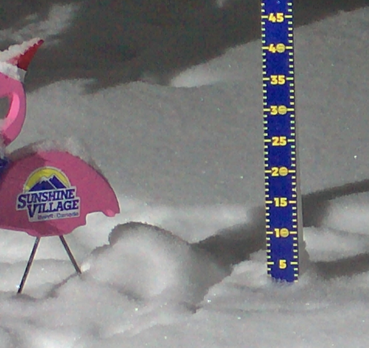
Snow totals will be dependent on the switch to all snow. Right now, it looks like you can expect Mt Rose to be in the 1-2 feet range, with Palisades, Kirkwood to be in the sweet spot with 2-4 feet. Donner Ski Ranch and Sugar Bowl should be around 1-3 feet.
New Year’s Day
It will be a beautiful day to ride fresh Powder. Cold temperatures in the morning warming up to around the freezing mark at base by 3pm. Light winds 5-10 mph.
Next Storm Monday
Utah

Today–Ride the Storm
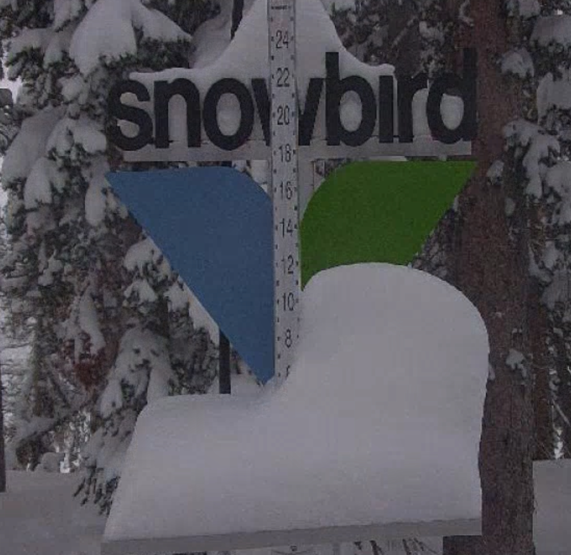
Heavy snow today with strong winds 20-25 mph with near white-out conditions possible in the Alpine. Temperatures in the upper 20’s. There will likely be a break between waves of energy and then the snow will pick up in the afternoon. Snow totals today in the 6-10 range for Alta, Snowbird, and Brighton with 4-8 range for Deer Valley and Park City/Canyons. Temperatures around freezing level at base with moderate winds at base level, 10-15 mph.
Tomorrow Powder Day 1
Overnight snow for Park City and Deer Valley 4-8, Snowbird, Alta, and Brighton will have higher totals, 10-15 likely or 15-20 on the high end. Temperatures will be near freezing at the base with gusty winds in the low 30’s.
New Year’s Powder Day 2
Overnight totals will be in the 10-15 range for Alta, Brighton, and Snowbird, with up to 20 on the high end. Park City and Deer Valley in the 5-10 range before the lifts open New Year’s Day. Expect another 4-8 during the day. Temperatures will be in the Upper 20’s at base level with moderate winds 10-15.
Colorado

Today will be cloudy for most of the day with a few scattered showers with 1-2 inches possible. Temperatures will be in the upper 20’s with increasing wind gusts as the front approaches in late afternoon.
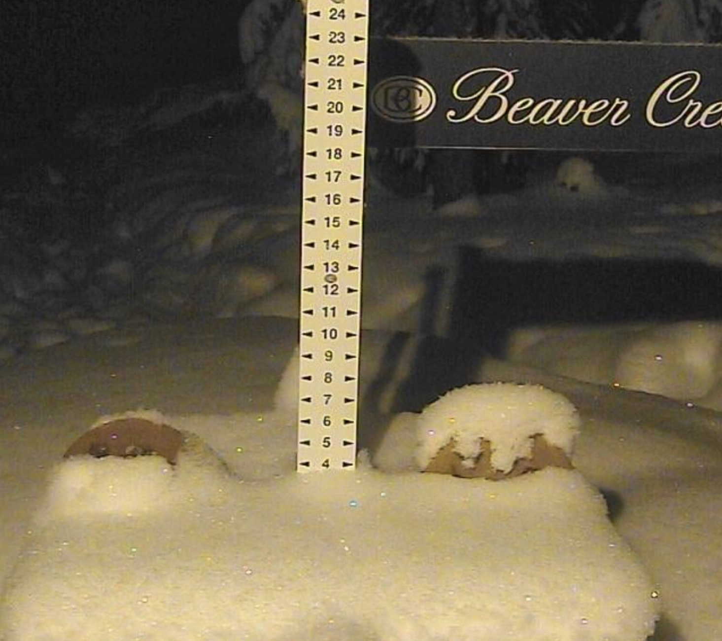
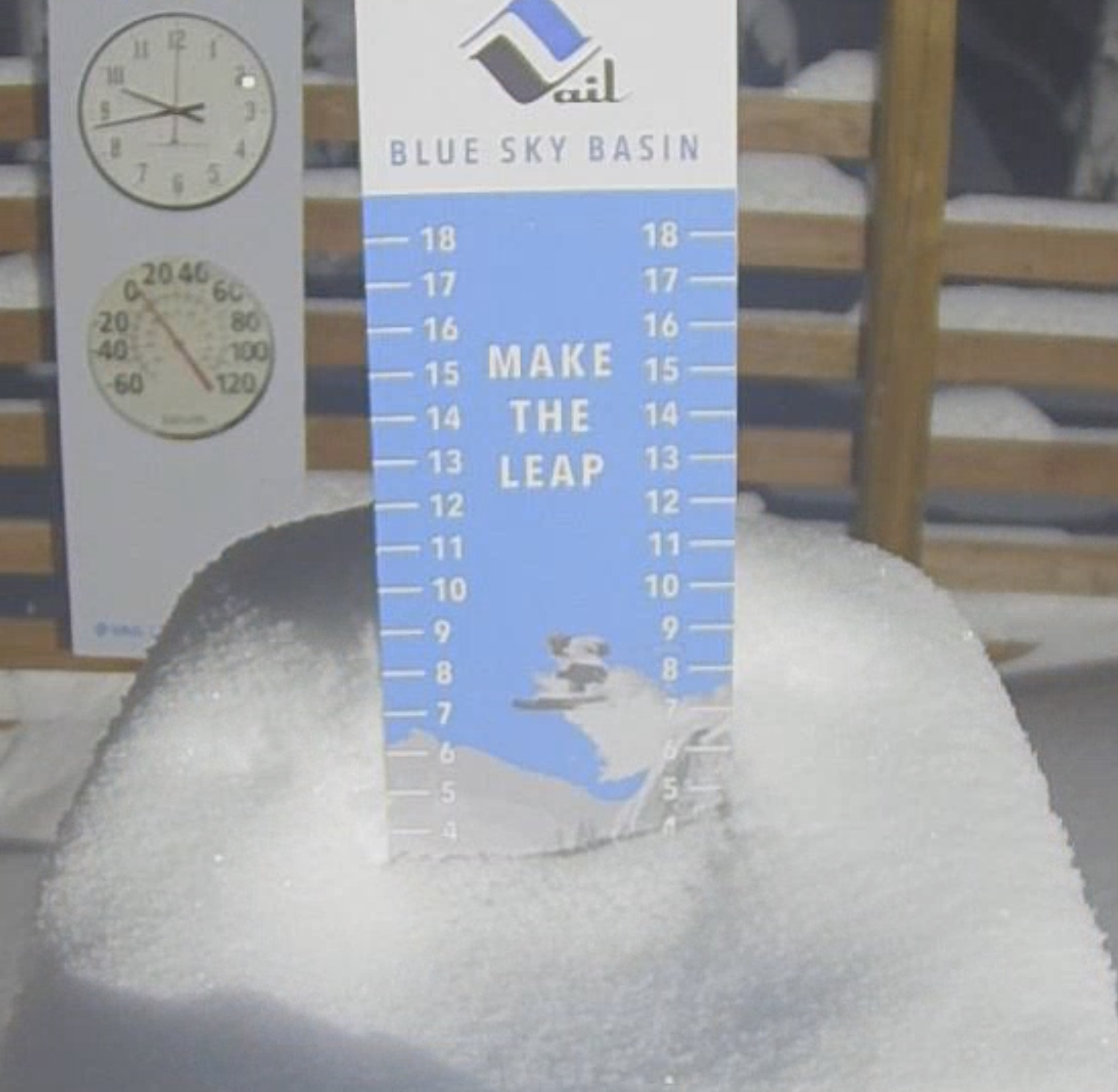
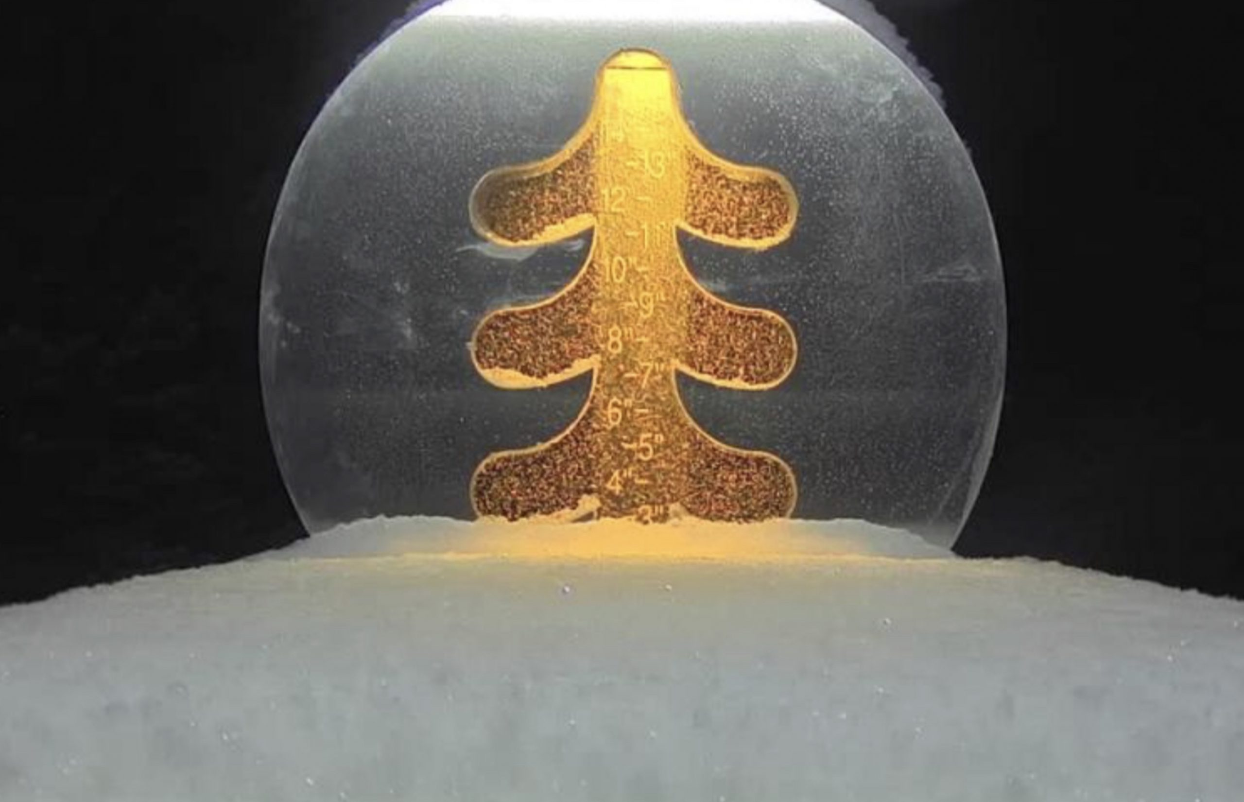
Tonight, the storm cranks up with heavy snow, especially for the northern resorts, Steamboat, Vail and Beaver Creek. Expect 5-10 for the aforementioned resorts, with 4-8 for Aspen, Crested Butte and Summit County resorts. Along the divide, 3-6 for Arapahoe Basin, Loveland and Eldora. Southern resorts of Telluride Silverton and Wolf Creek, 4-8. Powderhorn in the 2-4 range.
Tomorrow
Snow continues throughout the day with some breaks in the bands of snow. Winds will be from the southwest from 10-15 mph with gusts in the 25-mph range. Similar forecast as above with the strongest precipitation falling in the central and northern mountains. Steamboat, Vail and Beaver Creek likely in the 4-10 range with Aspen, CB and Summit County in the 3-5 range. For resorts along the divide, as well as Powderhorn and the southern ranges, expect 1-3.
The storm moves out New Year’s Day by noon with the bulk of the precipitation falling before the lifts open. Expect another 1-3 with slightly higher precipitation for the San Juans.
Storm History
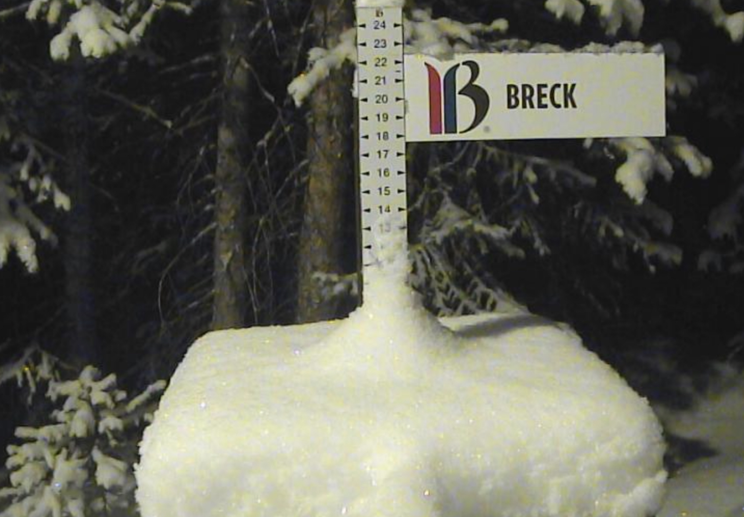

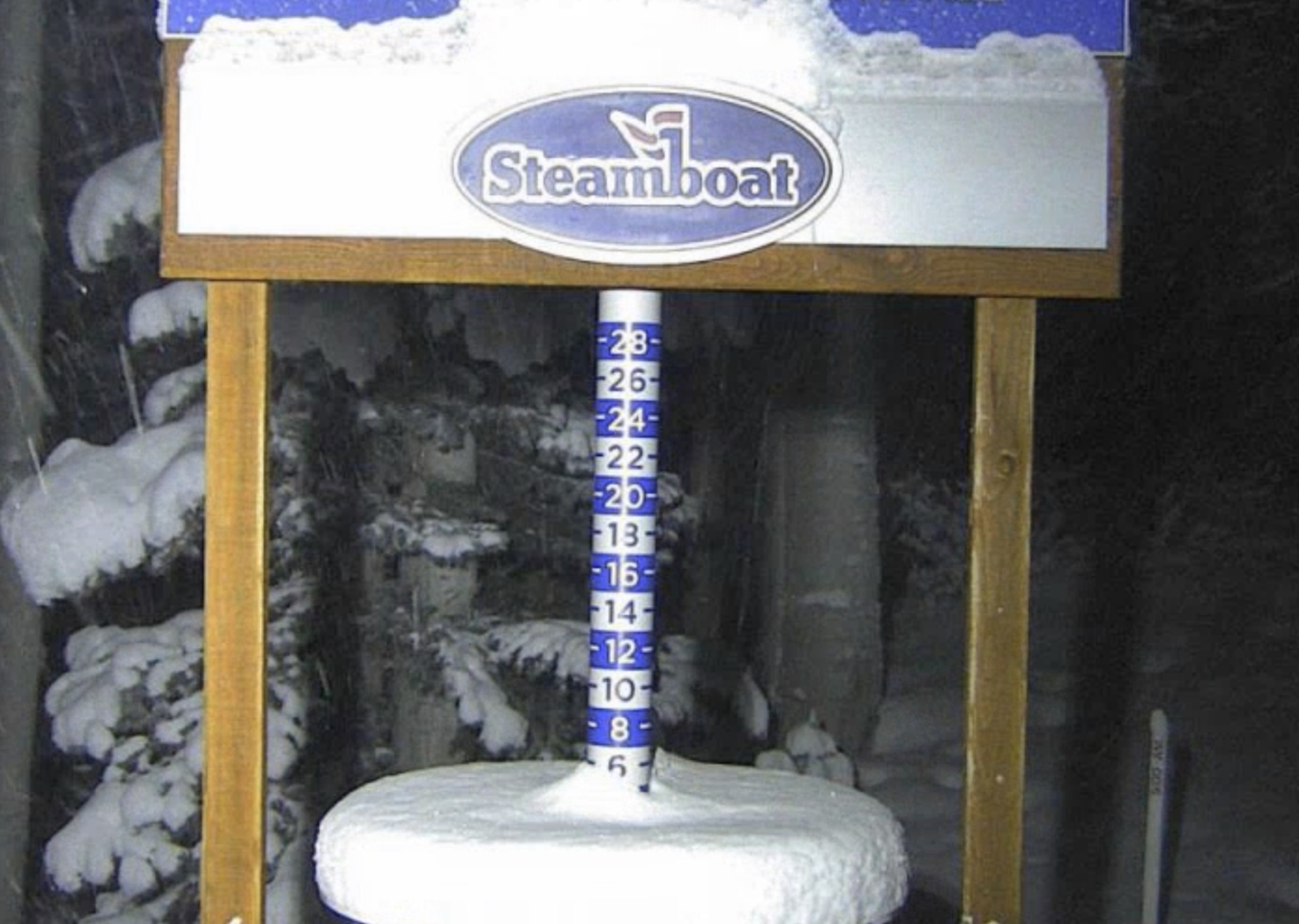

Last cycle, the northern and central resorts fared the best with Breckenridge the winner with 2-day totals of 12, followed by Steamboat with 7 and Vail with 6. Southern resorts were missed., but Powderhorn had decent totals on the southern edge of the storm.
Thanks for reading the blog, as always if you have any questions, please ask in the comments below or send an email to Mike@FutureSnow.CO
Forecasted Areas
Pacific Northwest Cascade Mountains
Crystal Mountain, Mount Hood Meadows, Timberline, 49 Degrees North, Bachelor, Mt Baker,
Lake Tahoe Sierra Mountains
Heavenly, Palisades Tahoe, Kirkwood, Dodge Ridge, Donner Ski Ranch
Utah Wasatch Mountains
Alta, Park City, Deer Valley, Brighton, Snowbird, Brian Head
Colorado Rocky Mountains
Aspen, Aspen Highlands, Snowmass, Vail, Beaver Creek, Winter Park, Keystone, Arapahoe Basin, Breckenridge, Copper Mountain, Powderhorn, Ski Cooper, Telluride, Crested Butte, Silverton, Wolf Creek, Eldora, Loveland
