

Snow Stake Cams…..Coming Soon Snow Stake Page


Pattern Discussion
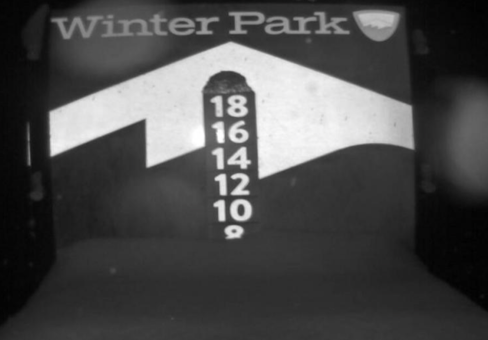
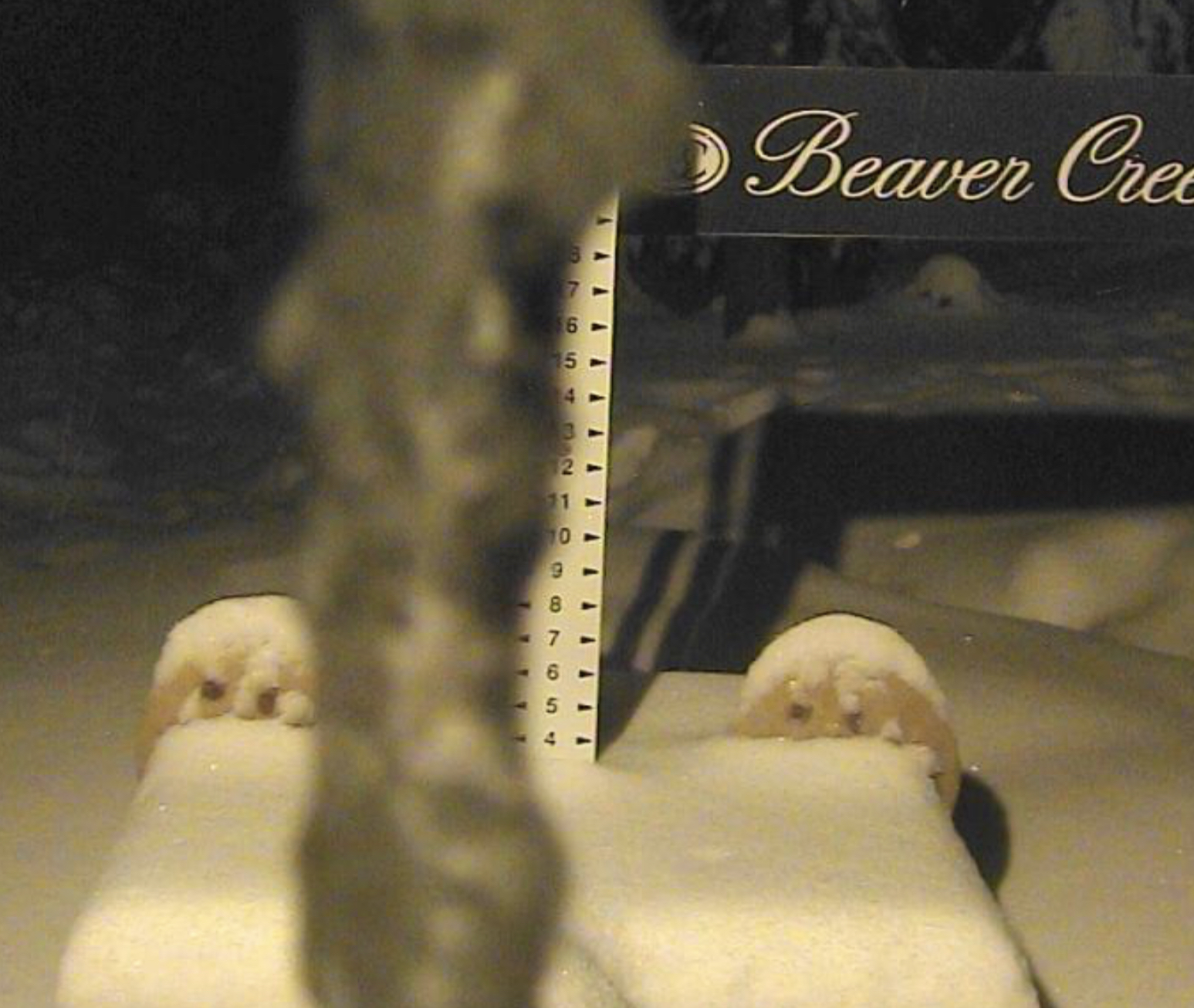
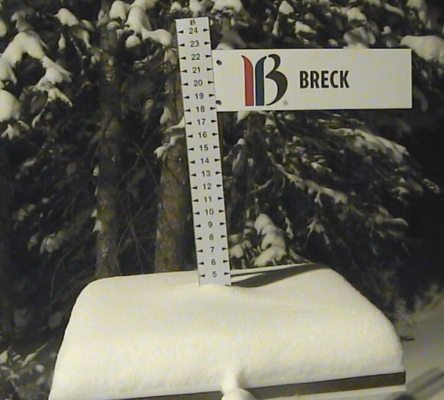
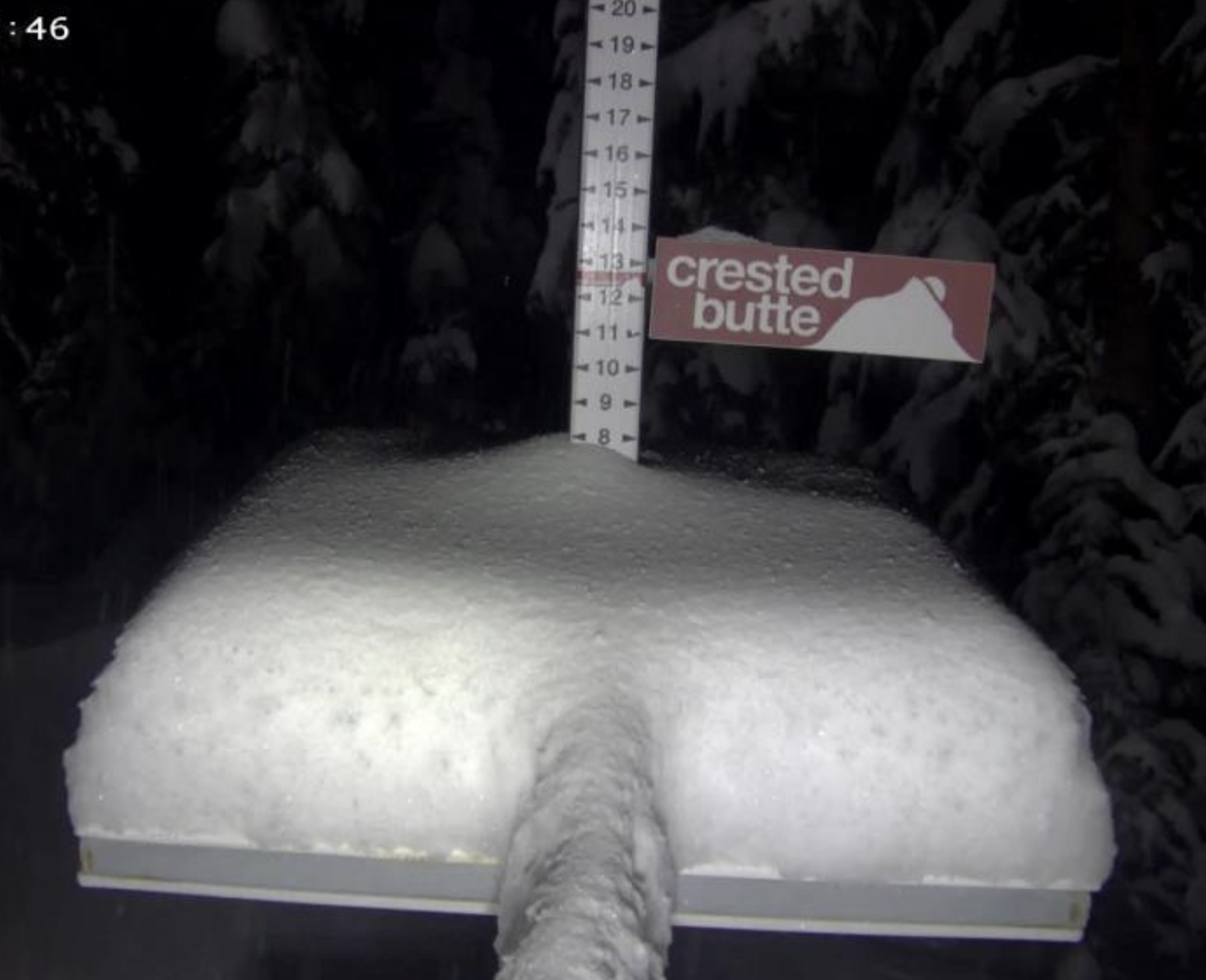
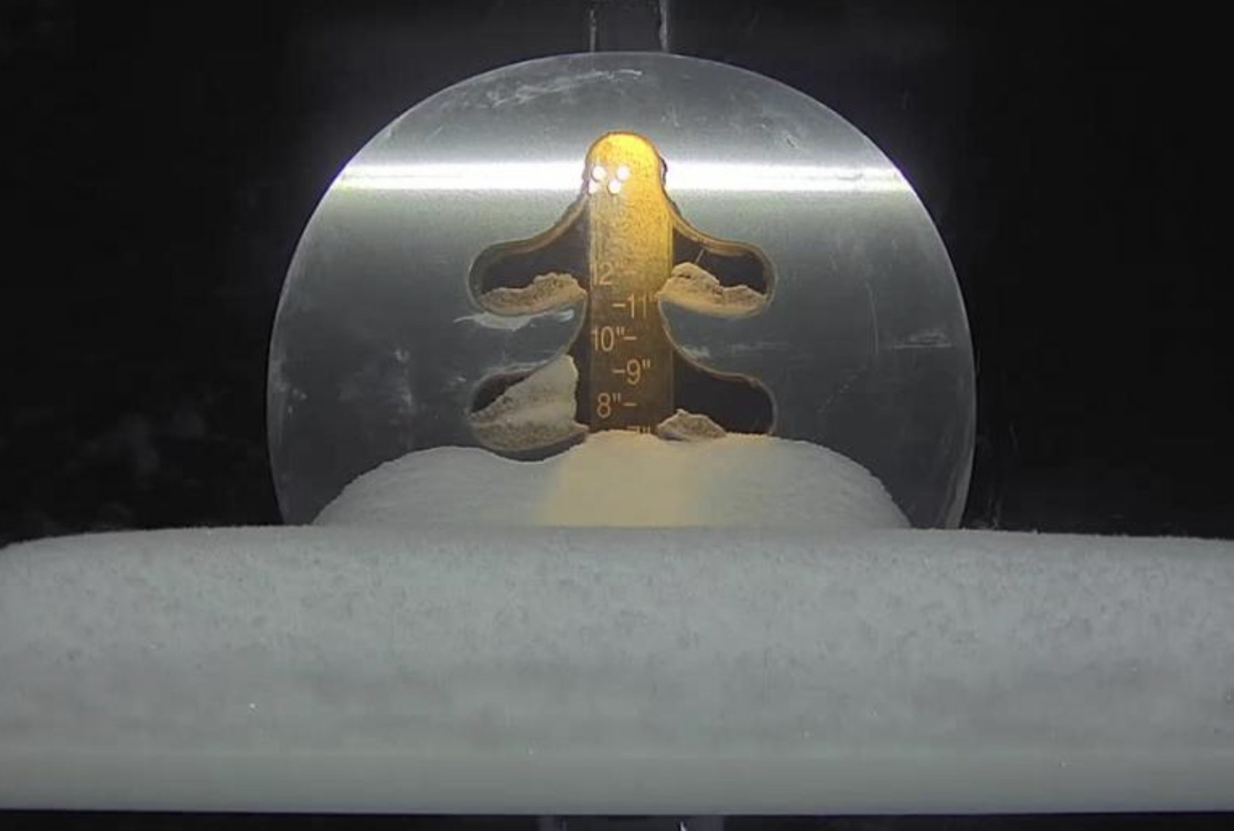
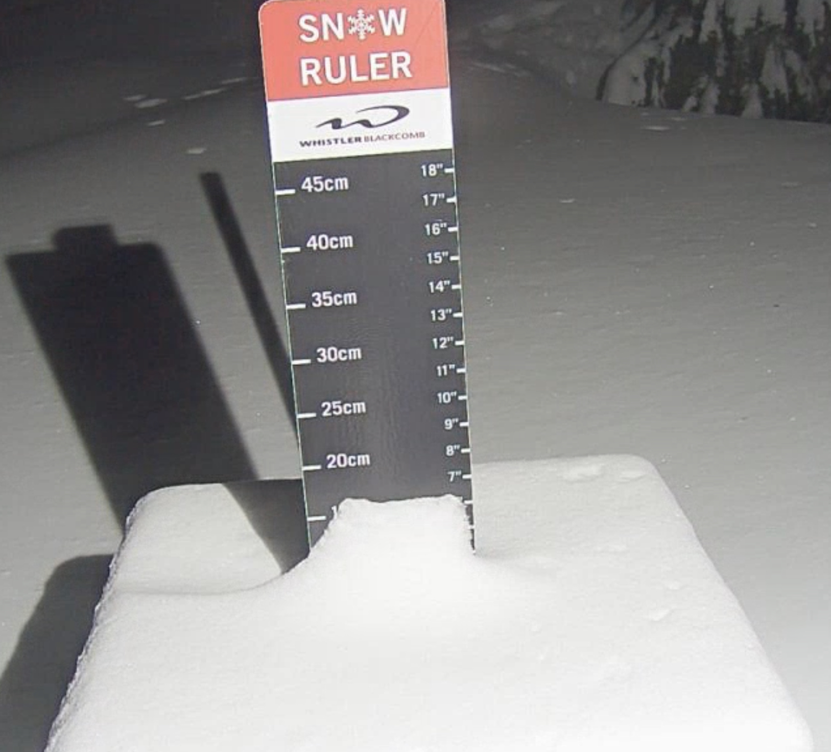
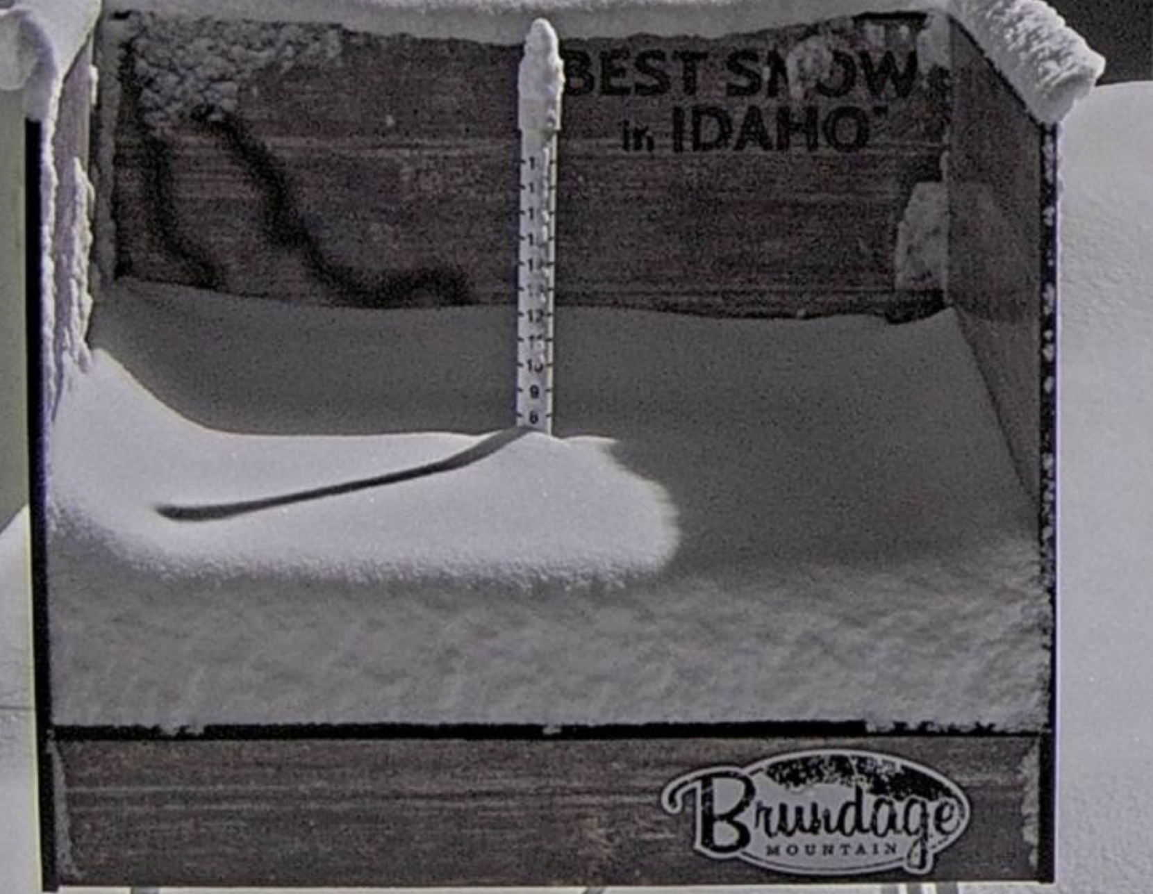
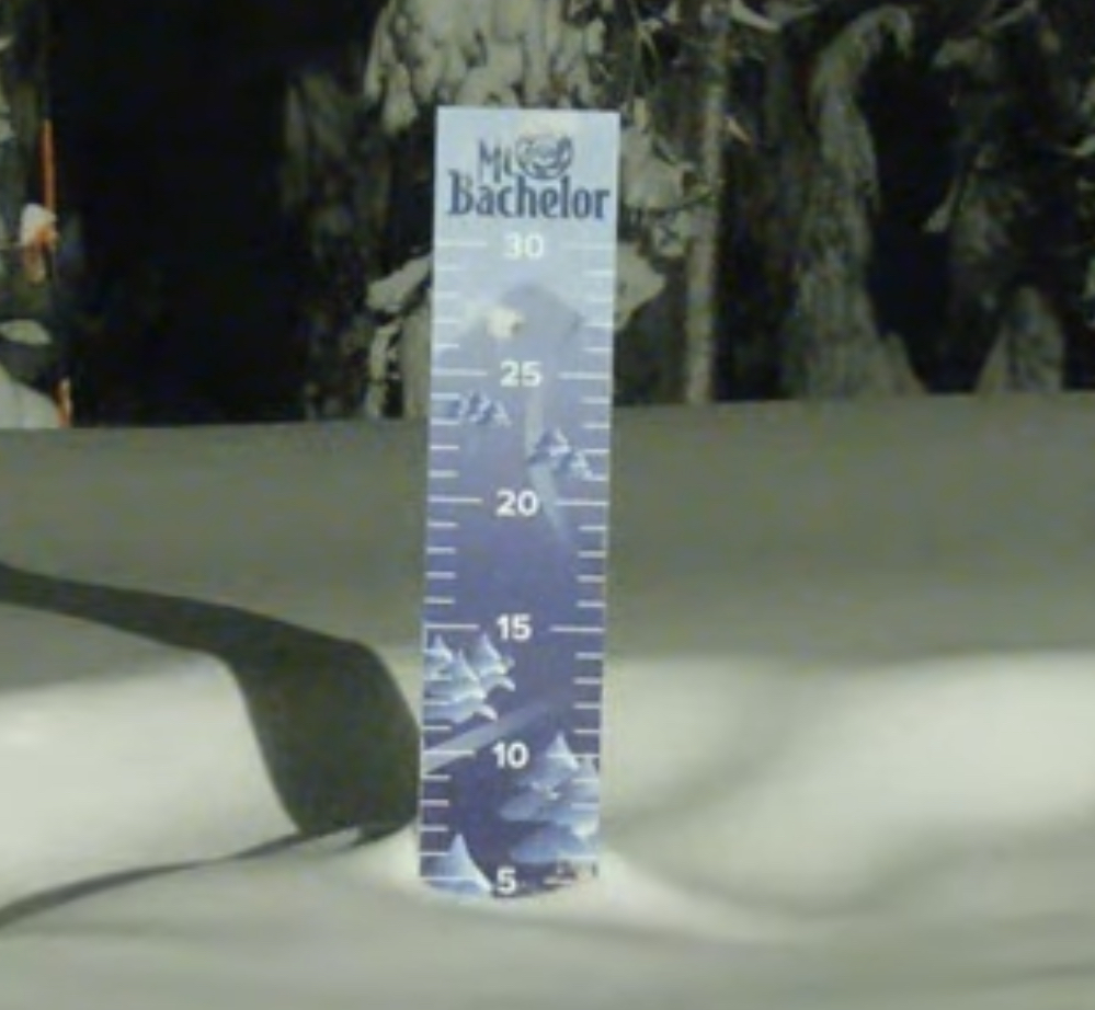
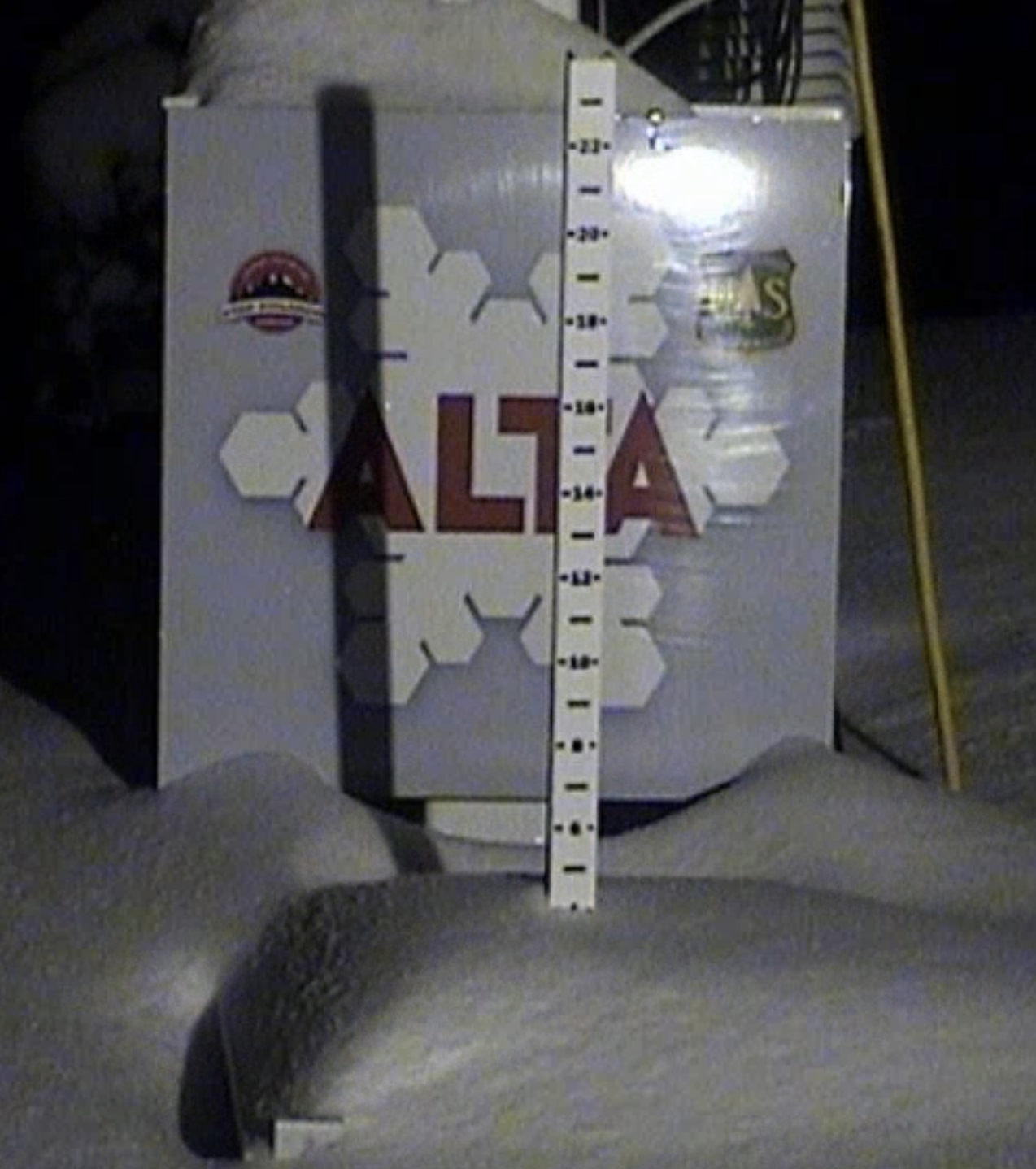
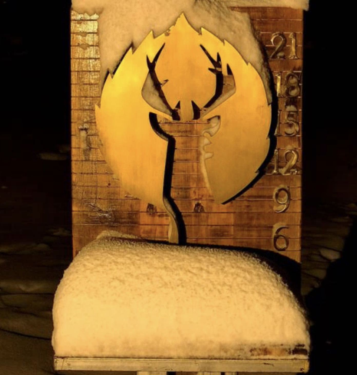
Every once in a while, you capture these “snow stake technicians”, or SST’s, at work. It’s hard work and some resorts have better skilled SST’s than others. Take Alta, for example. Alta’s SST knows when to leave the snow stake at a raised position, or when to lower it when windy conditions are in play. Unfortunately, the guy’s next door to Alta did not lower their snow stake and it looks like they received only an inch.

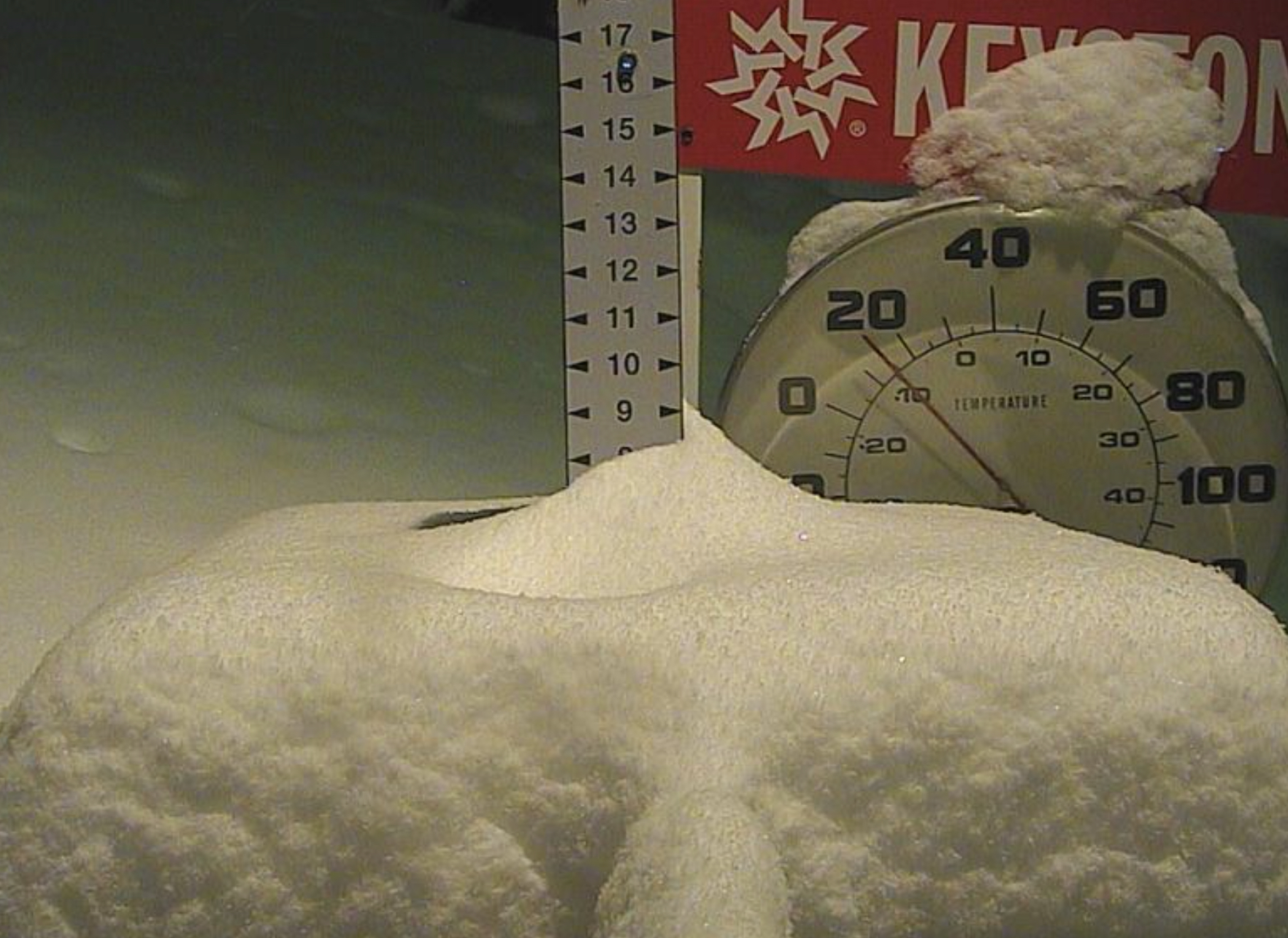
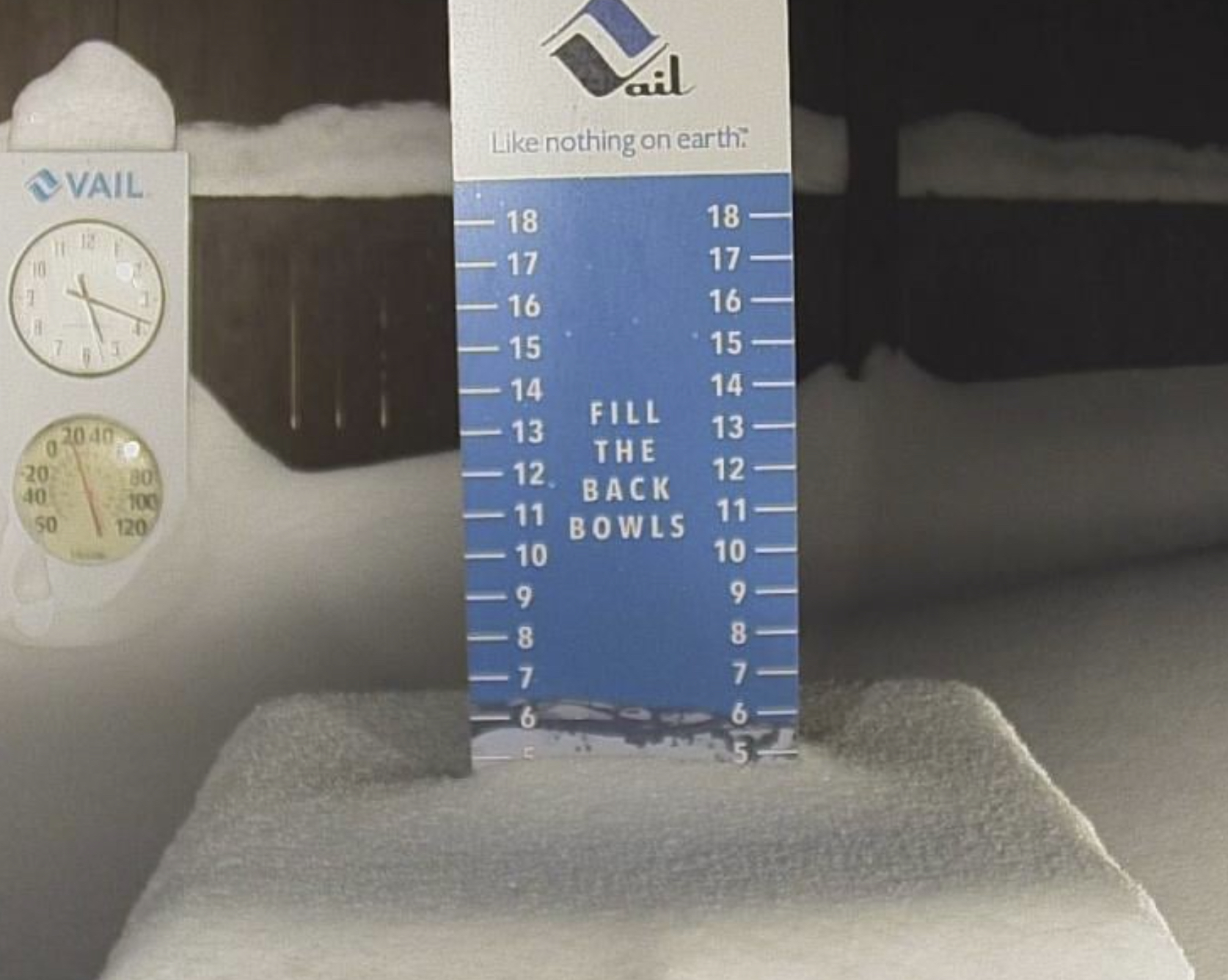
 By the way, if you are a resort and you don’t have a snow stake camera, you need to get one! There are some great examples of how to properly build a snow stake. I prefer snow stakes like Big Sky and Vail. They are well lit, at Vail, they have the stake, time and temp, however they do not have a storm total stake–need to add that. To kind of work around the lack of 2 stakes they leave a portion of the stake uncleared. Big Sky has two snow stake locations, so you can see which side of the mountain is favored. I would like to see a temp gage to have a better idea of the snow density.
We are adding snow stakes to our drop-down menu, and we will have that up this coming week. There will be a large number of “live” snow stake cams along with the usual 15-minute refresh pics.

Storm 4 is moving in with storm 5 on its heels. We have really good totals throughout the west with nearly every resort picking up good moisture. As we head into the new year, the storms will continue. There are not many lulls in this year’s pattern.
It took a while for the pattern to set up this year, as this year’s setup was about 2 weeks later than normal. Now we know that there will not be a 2-week stretch of dry weather, unless we get unfavorable teleconnection conditions. We saw conditions like that early in October, where we had a late drop in jet stream position and high pressure off the coast. That is always a possibility to return, but I don’t see any sign of that happening over the next 2 weeks.
Forecast
 Washington/Oregon
Scattered snow showers today with 1-3/2-4 possible for the northern Cascade resorts Snoqualmie and Stevens Pass. Temperatures generally in the high 20’s for the northern Cascades and low 30’s for the southern Cascades. Light winds between 5-15 mph.
Lake Tahoe

Today
Snow totals below 8000 ft will be dependent on the switch to all snow as the temperature drops later today. Looking at the 2m Temperature chart below, you can see the backside cold air moving in from the northwest. As you look at the time, remember the “Z” stands for Zulu time, which is -8 hours from the chart time.
There will be heavy snow today above 8500 ft, but most of the upper mountain lifts will be closed due to strong winds, making the lower terrain too nasty to bare–bring your squeegees! Looking at the 2m chart it looks like the northern resorts will see the cold air between 1 and 2 o’clock.

Above 8500 you can expect Mt Rose to be in the 1-2 feet range, with Palisades, Kirkwood to be in the sweet spot with 2-4 feet. Donner Ski Ranch and Sugar Bowl should be around 1-3 feet.
New Year’s Day
It will be a beautiful day to ride fresh Powder. There may be some lingering showers in the morning, but that will burn off by 10 am. Cold temperatures in the morning warming up to around the freezing mark at base by 3pm. Light winds 5-10 mph.
Next Storm Monday
Below is the GFS snow totals for Monday. I expect a general 5-10 out of this system as that was similar to what we saw the last time this storm came thru. The heavier precipitation to the west of the Lake should move more to the east. I will keep an eye on this as we move into the new Year.

Utah

Today Ride the Storm
Heavy snow today throughout the day as 10-18 inches expected for Alta, Snowbird, with slightly less for Brighton 8-12. Park City will struggle with warm temperatures. Expect rain at base level to at least mid-mountain.
New Year’s Powder Day
We are raising our forecasted totals overnight for the higher elevation resorts and lowering our totals for the lower elevation resorts. Overnight totals will be in the 14-20 range for Alta, Brighton, and Snowbird. Lesser amounts for resorts Deer Valley 6-12, Park City and Snowbasin are the 2-5 range, before the lifts open New Year’s Day.
Expect another 8-12 during the day for Alta, Brighton, and Snowbird, with 4-8 for Deer Valley, Snowbasin and Park City. Temperatures will be in the Upper 20’s at base level with moderate winds 10-15.
Colorado

Today
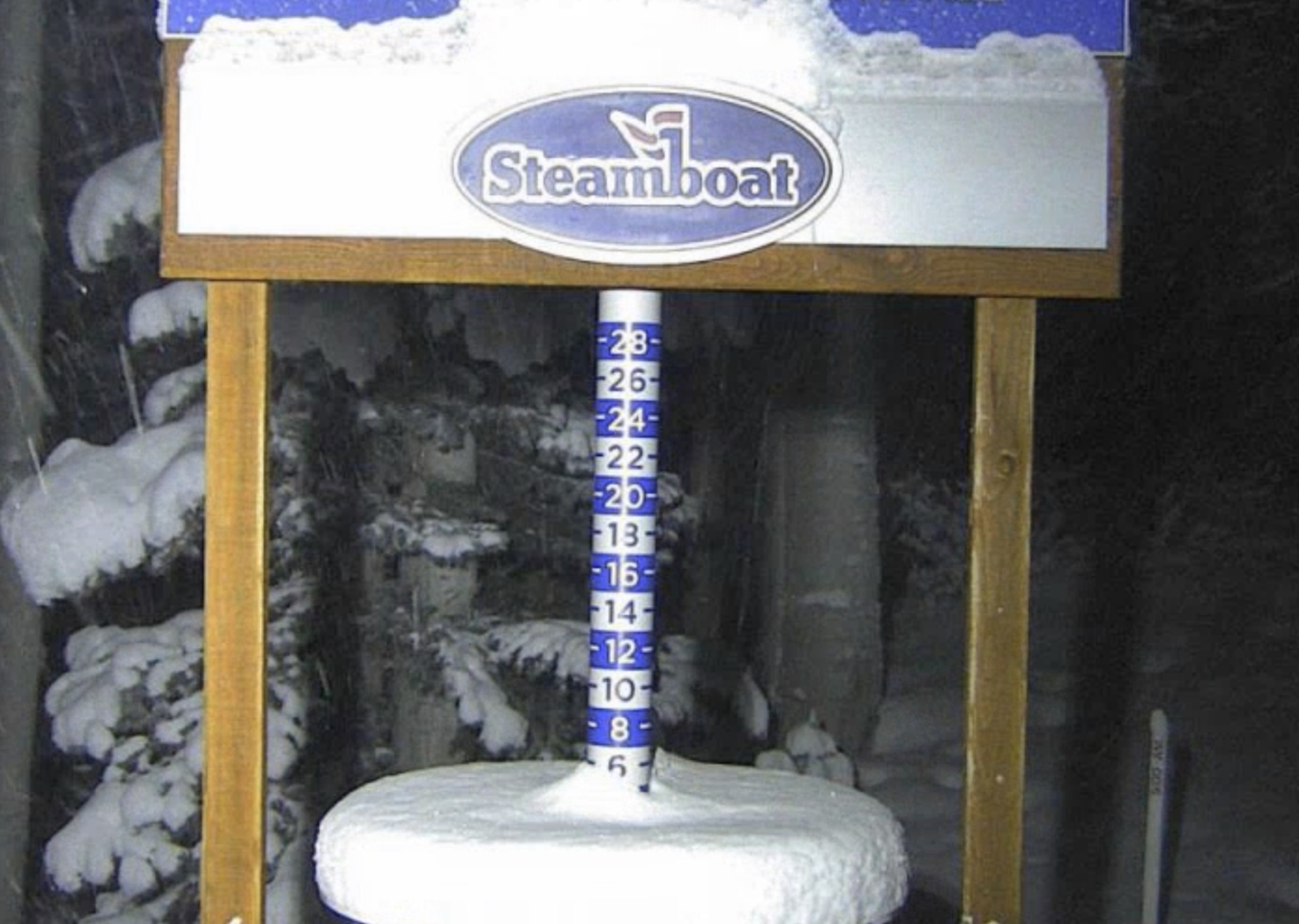
Snow continues throughout the day with some breaks in the bands of snow. Winds will be from the southwest from 10-15 mph with gusts in the 25-mph range. Steamboat, Vail and Beaver Creek likely in the 4-8 range with Aspen, CB and Summit County in the 3-5 range.
Resorts along the divide, A-Basin and Loveland in the 3-5 range. Southern and East resorts Telluride, Wolf Creek and Powderhorn and the southern ranges, expect 1-3. Slightly higher amounts for Silverton, 2-4.
New Year’s Day and Tomorrow Night
Expect lingering showers throughout the day with some clearing possible before Storm 4 moves in late today, for the southern resorts and overnight for the central and northern ranges. Temperatures near the freezing mark across the board for base level. Moderate winds from 10-15 mph. Not much snow is expected for the central and northern mountains.
Late Afternoon
The next wave (Storm 4) moves in from the southwest and it will move northeast. The timing of this storm is a little tricky as I think the first wave will begin between 2-3 pm. The southern and east resorts Telluride, Wolf Creek, Silverton and Powderhorn will receive heavy snow as early as 2 and possibly after the lifts close.
If you are riding these areas, tomorrow, be aware that the next storm is moving in sometime in the afternoon. Expected totals for Monday will be in the 4-10 range, for Silverton, Telluride, Wolf Creek and maybe 2-4 for Powderhorn, so it should be a nice powder day to start the week.
For the central and northern resorts, expect 3-5 for Crested Butte, Aspen, Steamboat and Vail/Beaver Creek. For resorts along the divide, Arapahoe Basin and Loveland will likely be in the 4-8 range, with Summit County resorts in the 2-4 range.
Next Storm (5) Wednesday
Storm History
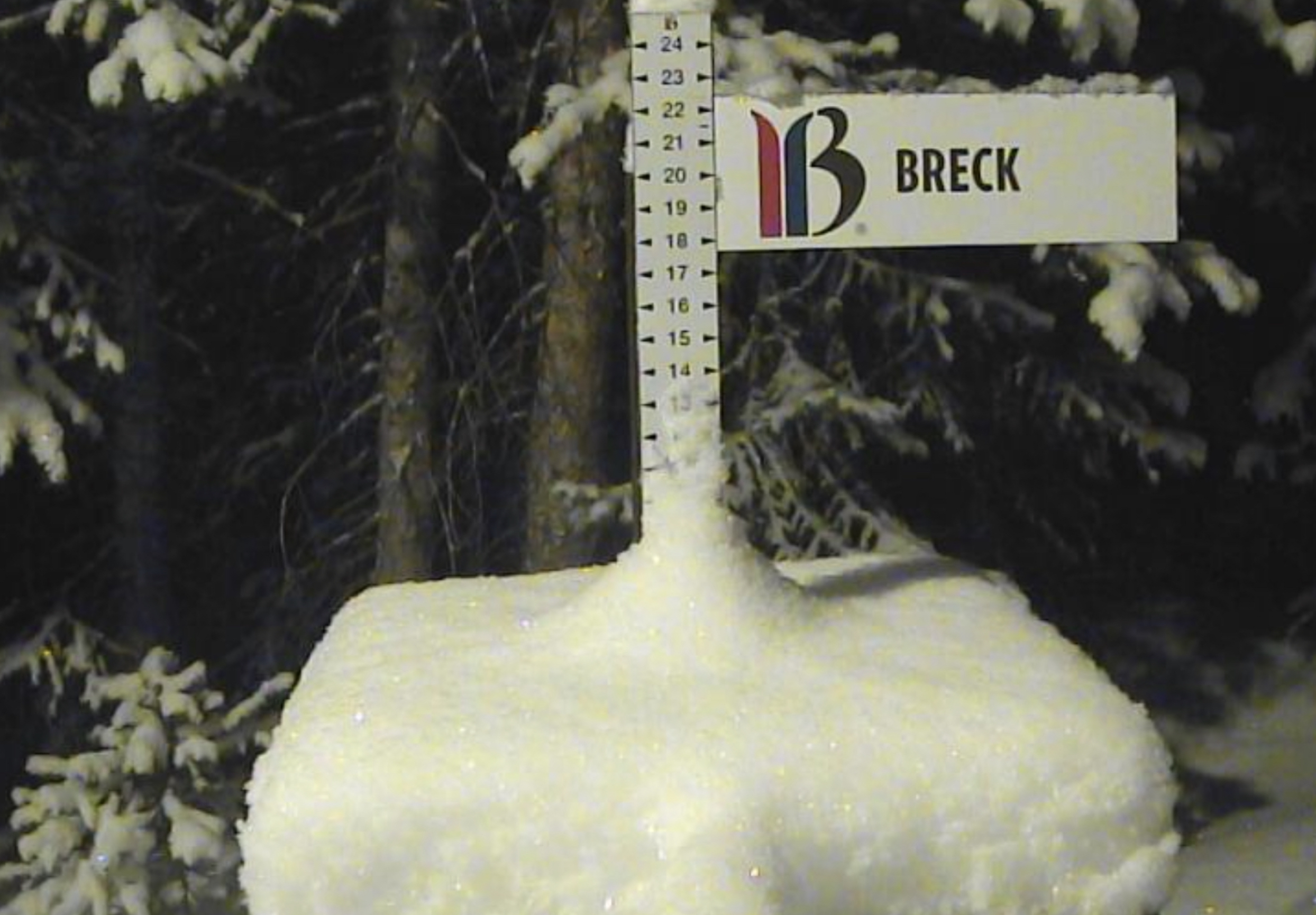


Last cycle, the northern and central resorts fared the best with Breckenridge the winner with 2-day totals of 12, followed by Steamboat with 7 and Vail with 6. Southern resorts were missed., but Powderhorn had decent totals on the southern edge of the storm.
Thanks for reading the blog, as always if you have any questions, please ask in the comments below or send an email to Mike@FutureSnow.CO
Forecasted Areas
Pacific Northwest Cascade Mountains
Crystal Mountain, Mount Hood Meadows, Timberline, 49 Degrees North, Bachelor, Mt Baker,
Lake Tahoe Sierra Mountains
Heavenly, Palisades Tahoe, Kirkwood, Dodge Ridge, Donner Ski Ranch
Utah Wasatch Mountains
Alta, Park City, Deer Valley, Brighton, Snowbird, Brian Head
Colorado Rocky Mountains
Aspen, Aspen Highlands, Snowmass, Vail, Beaver Creek, Winter Park, Keystone, Arapahoe Basin, Breckenridge, Copper Mountain, Powderhorn, Ski Cooper, Telluride, Crested Butte, Silverton, Wolf Creek, Eldora, Loveland
