I’ve been talking about this, for what it seems like weeks now. Friday, the switch between the northern part of the pattern and the active west part of the pattern flips. This first little system has a slight change of direction from the northern pattern. The new path takes it towards the northern part of Colorado, just like it did the last time through back in September.
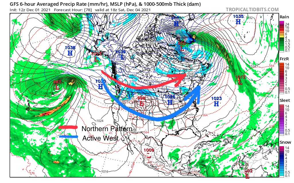
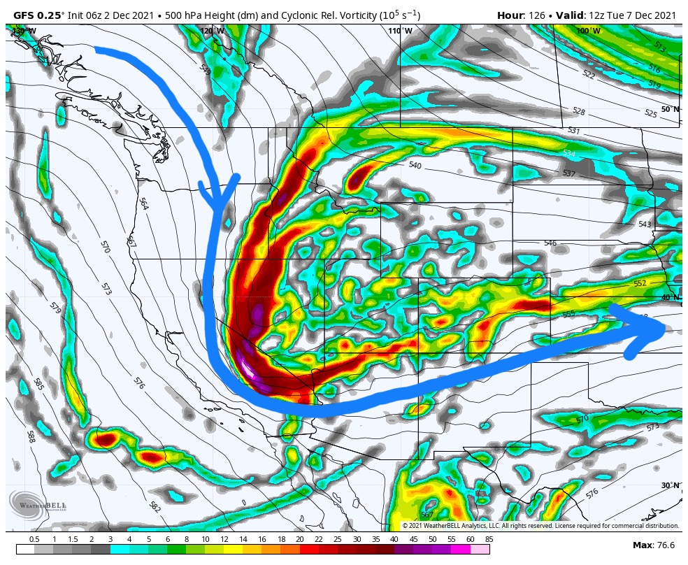
These next two snapshots of the GFS 500 mb flow shows the change in trajectory of the established northern Pattern. As the storm moves east, the waves drop towards Colorado.


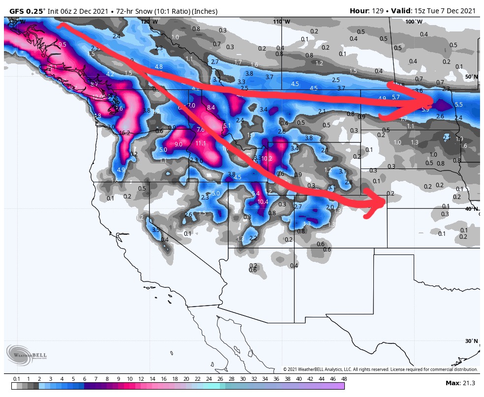
Below is the three day storm total that shows the diverging path. In the northern part of the pattern that upper path is Centered about 500 miles further north (800km), with no southern branch.
What this change does is it breaks the ice for the active west pattern. The next system after that dives deep down to Southern California with very strong vorticity (70 Max Vort). The blue line shows the flow.
This is all taking place with a positive AO. If we were to have a negative AO, the next time this storm comes through, it could be a monster. That is the benefit of knowing that weather cycles. These storms repeat and this one will return in February.
Short Term Forecast
There is a small convergence zone over Washington that will squeeze out an inch or 2 over the Northern cascades. Freezing levels will rise in the afternoon.
Warm temps and mostly dry until Friday, when the system we have been waiting for finally arrives.
Friday, Saturday and Sunday
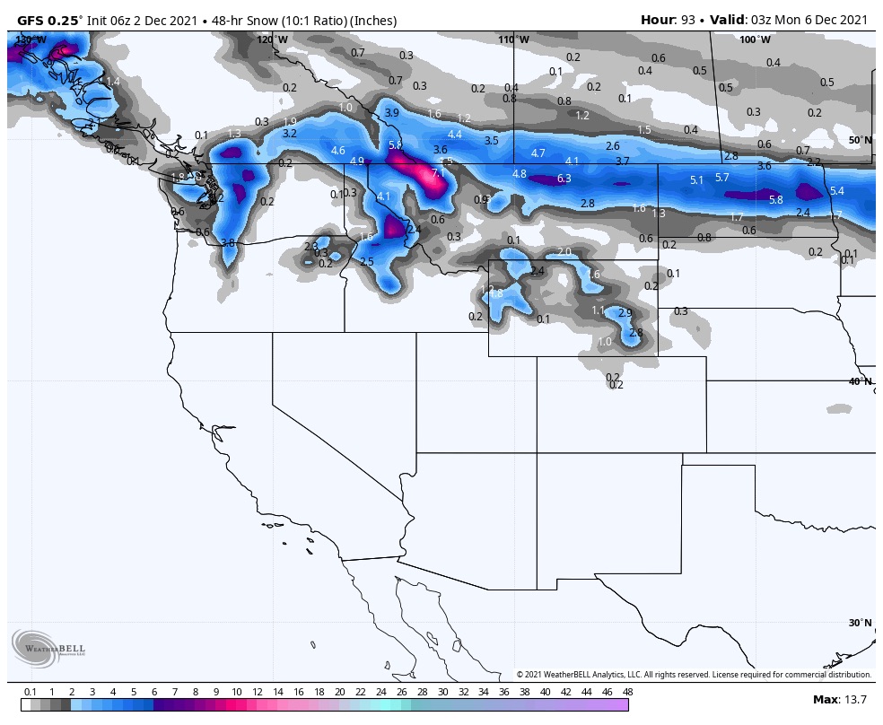
Rain arrives overnight Friday and Saturday morning to the PNW. Freezing levels will be around 1,500ft. That “ice breaking” system moves across towards Idaho and down to Northern Colorado.
The northern Cascade Mountains of Washington could pick up between 5 to 10”, with higher totals in eastern Montana and northern Idaho.
FutureSnow
Monday 6th
The next wave in this series of storms hits the BC coast. Heavy snow for Whistler down to the northern cascades. Snow levels will probably be around 1,500-2,000ft. We will dial in the freezing level in a few days.
I would expect Steven’s Pass to get a 12-15” and Crystal in the 8-12 range still a little too early to lock in. The Oregon resorts above 6000 should do well.
Tuesday 7th
That storm will arrive in Utah and western Colorado with all snow above 6,000 feet. The storm will arrive at Lake Tahoe, as well, however the freezing levels look high—9,000 feet.
Wednesday 8th
Wednesday afternoon the storm drops down into New Mexico before exiting. Below is a two day storm total. Remember this is 140 hours out, this will change.
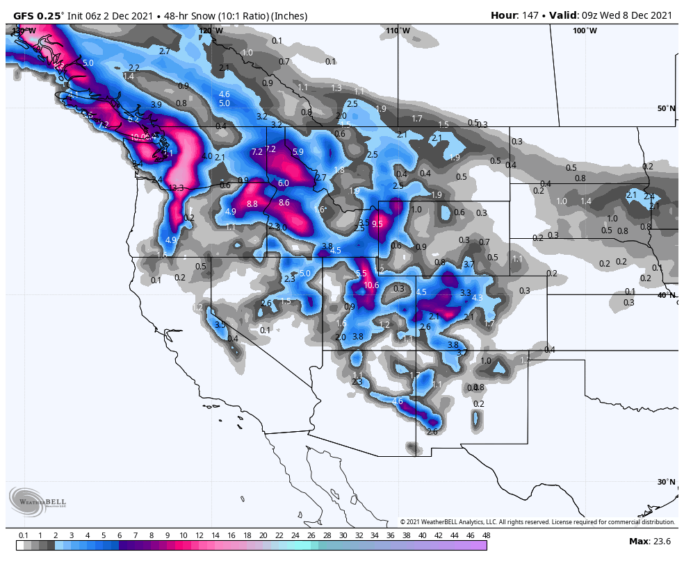
Two day Storm Total
Thanks for spending a few moments reading the blog. If you have questions, as always feel free to comment below, or send me an email to Mike@FutureSnow.co

Hi Mike,
Thanks for looking into everything and sharing your thoughts with us. Wouldn’t the December 7 storm return around January 24 if we are in a 48 day cycle?
The cycle length is longer than 48 days. We are still verifying the actual cycle length. That will be announced in the next few weeks.
You’ll probably be able to piece together that storm wind the prediction chart comes out Decorator 1.