Pattern Discussion
We will be in model range of the transition from the Northern Pattern to the Active West Pattern, in about week. There are pre-changes to the pattern before the switch. The change is in the direction of the storm flow as the Pattern morphs into its next phase. Also, there are couple of systems that come through, during the Northern Pattern, that will bring snow to Tahoe, Utah and Colorado. Remember, November wasn’t totally dry.
One of the advantages of knowing the Pattern, is you can crosscheck your data with the models. Here is a video of the long-range GFS out through January 29th.
Video Discussion
As you watch the video, keep in mind that a lot will change, but the model has the overall concept of what will happen, based on what we know of the Pattern. Below are snapshots of the video that correspond to the events, from last cycle, that are in the correct position, in line with the Pattern at the proper time.

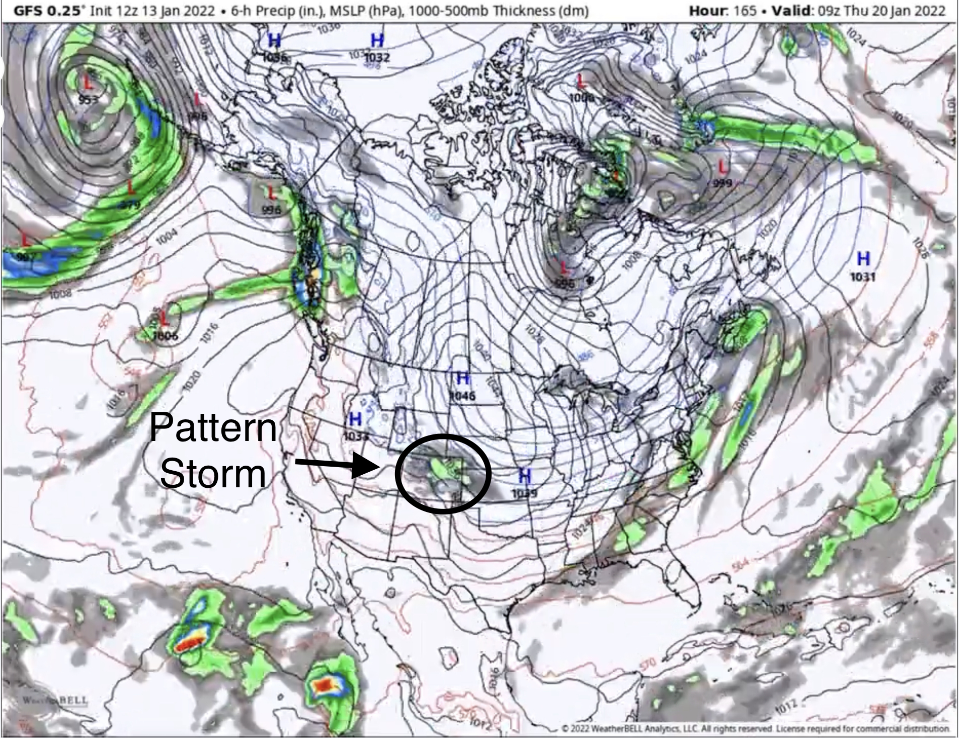
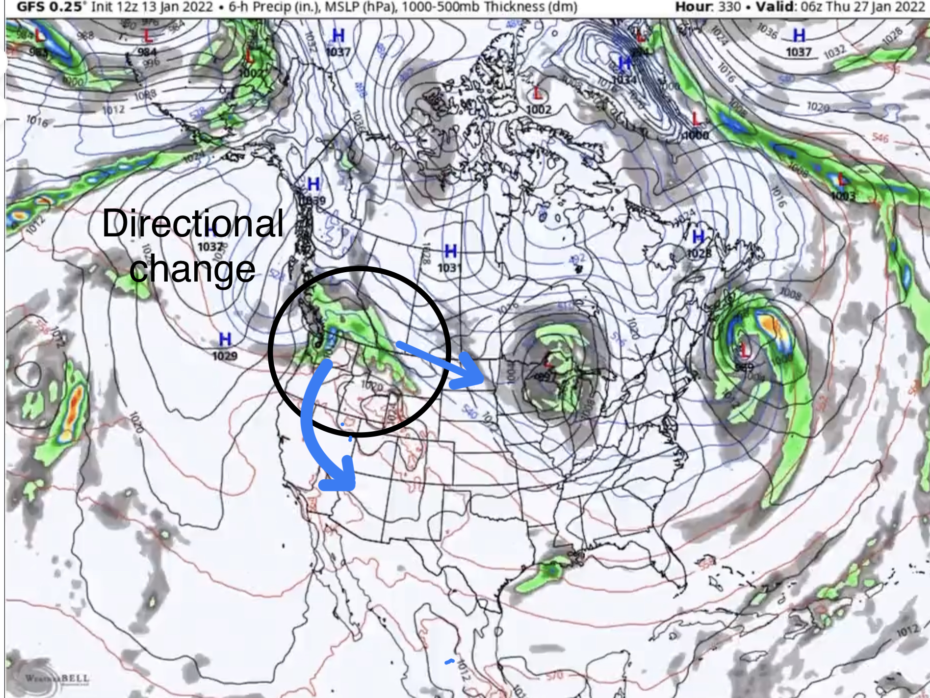
Like I said, this will change a lot over the next 2 weeks, but the outline should stay the same.
This Week
A small disturbance is moving thru Utah and Colorado today. Highs in the upper 20’s-30, with mild winds. Most of the action will remain north of the border, until the Pattern storm (above discussion) hits Thursday the 11th.
Monday
PNW
A small wave comes through the Cascades. Last cycle, both northern and southern Cascades picked up small amounts, 5-6″.

Mike,
The 0Z GFS run showed a couple shots of light snow for the northern rockies the week of the 24th.. Now the 06Z shows nothing.. No northwest flow.. I know the models are all over the place right now. What are you seeing for that week??