Santa hit the slopes early this morning after delivering all of those presents. He was seen dropping in at Courchevel France, the world’s largest ski area. Way to go Santa!
Today’s Stoke


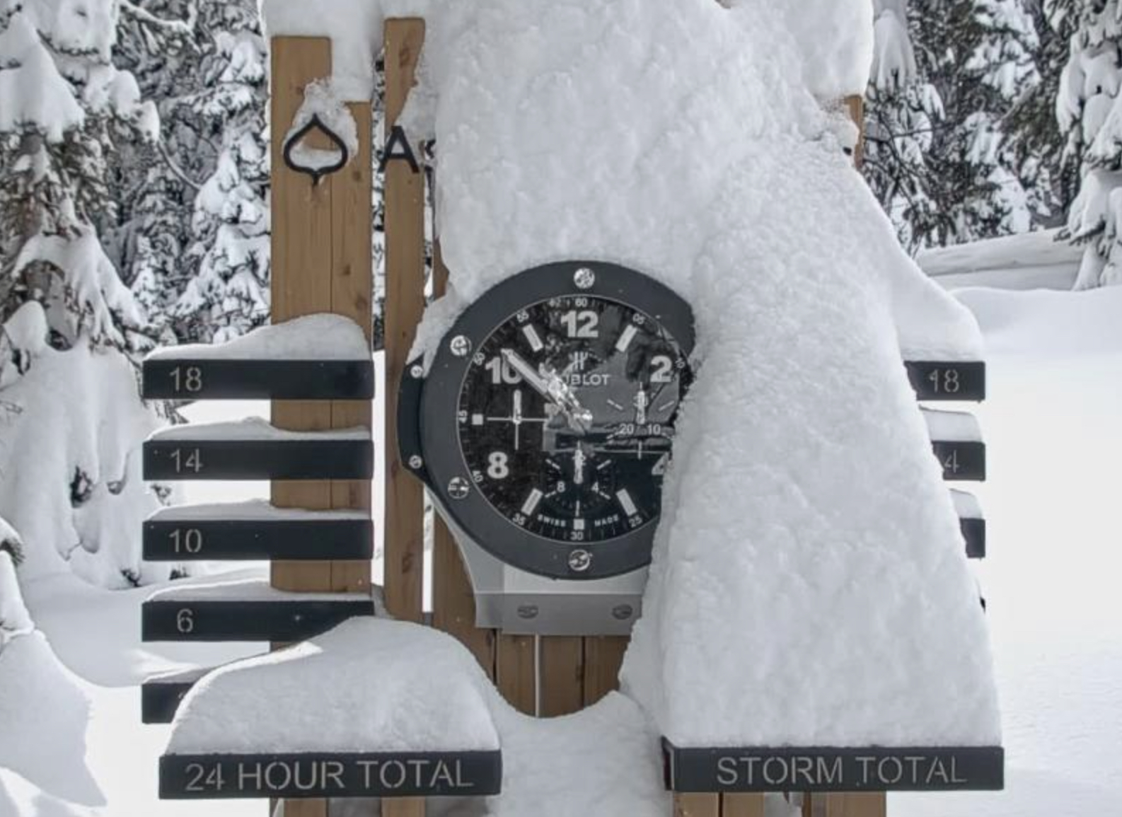


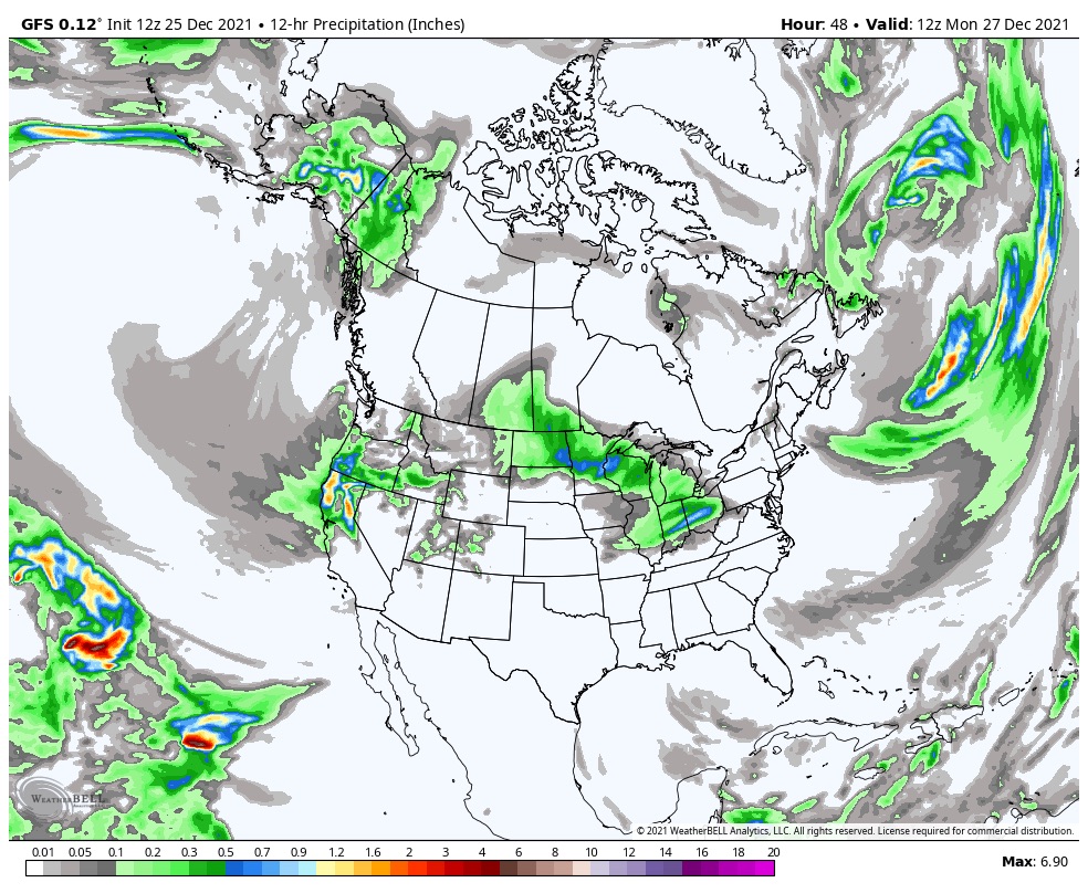
Cascades
Snow in the Cascades with 6-10 possible today, a little more in the southern Cascades with 8-12 possible. Cold and windy so bundle up.
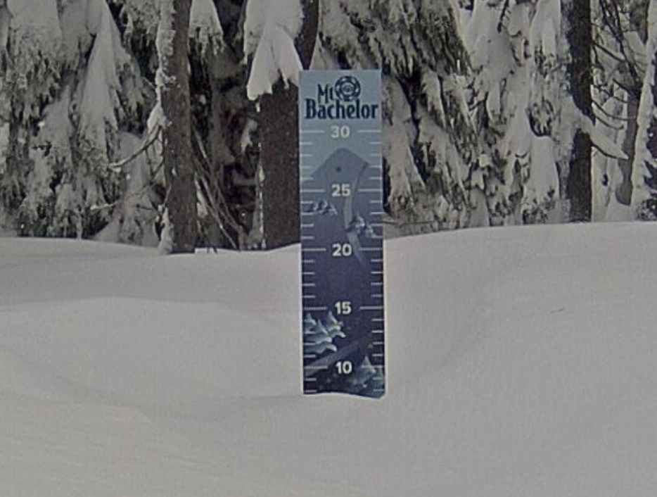
Sierras
1-2 ft today, Christmas Pow Delivered! Cold temperatures and windy. The bands of moisture keep streaming in from the coast as this large storm spins onshore.
Utah
A couple of inches of fresh topping today as a stronger wave moves in this evening. Temperatures in the mid 20s and breezy with 10 to 15 mph winds. Tonight expect 4 -8 for soft turns tomorrow.
Colorado
Mostly dry today as the next wave moves in later today from Utah.
Tomorrow
Cascades
Next wave arrives, in the early morning hours, to the Northern Cascades with heavy snow and super cold wind chills of -10-15. 1-2 ft of fresh blower pow expected as the track of the Low-pressure system passes by to the north. In the southern Cascades similar conditions as yesterday, with additional snowfall of 4-8 for the Oregon mountains.
Sierras
Snow continues, heavy at times and windy, with gusts up to 50 mph. Additional 10-16, with the heavier snow falling in the afternoon hours. Smaller amounts on the north side of the lake.
Utah
The heavy band of snow that hit the Sierras arrives in the Wasatch Mountains delivering 1- 2 ft to most areas. It will be cold and windy with falling temps throughout the day as the system intensifies. Wind chills will be below 0, so dress accordingly.
Colorado
Snow begins in the early morning hours. Most mountains will receive snow in the 3-5 range, with the central mountains favored in this one. Temps in the upper 20s with High winds in the 40s.
Monday and Tuesday
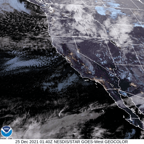
Monday night the next system drops down from British Columbia, while Tahoe reloads for the next wave. More on this tomorrow. Last Gif is the 500 mb flow that shows the offshore storm get picked up in the flow.

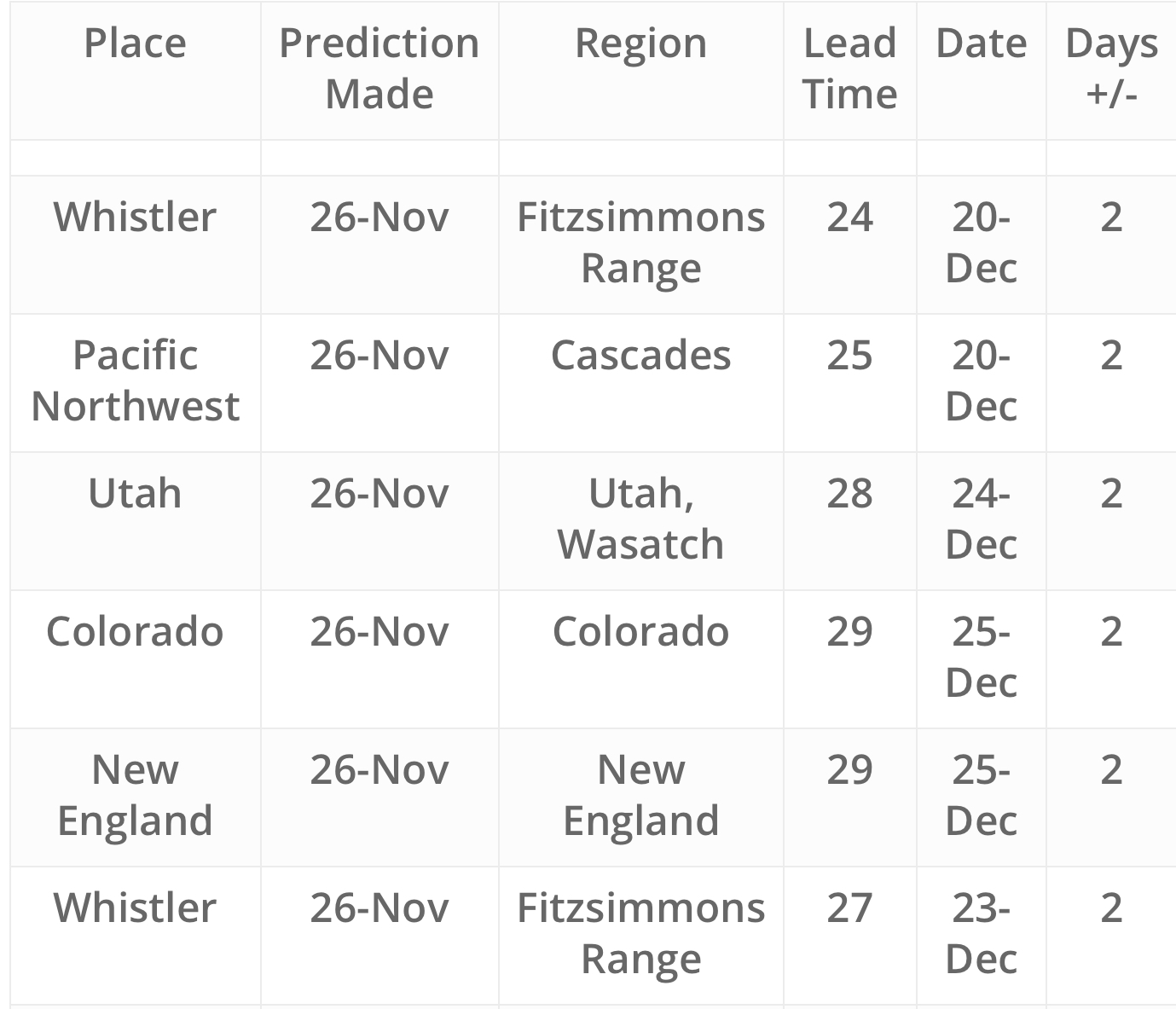
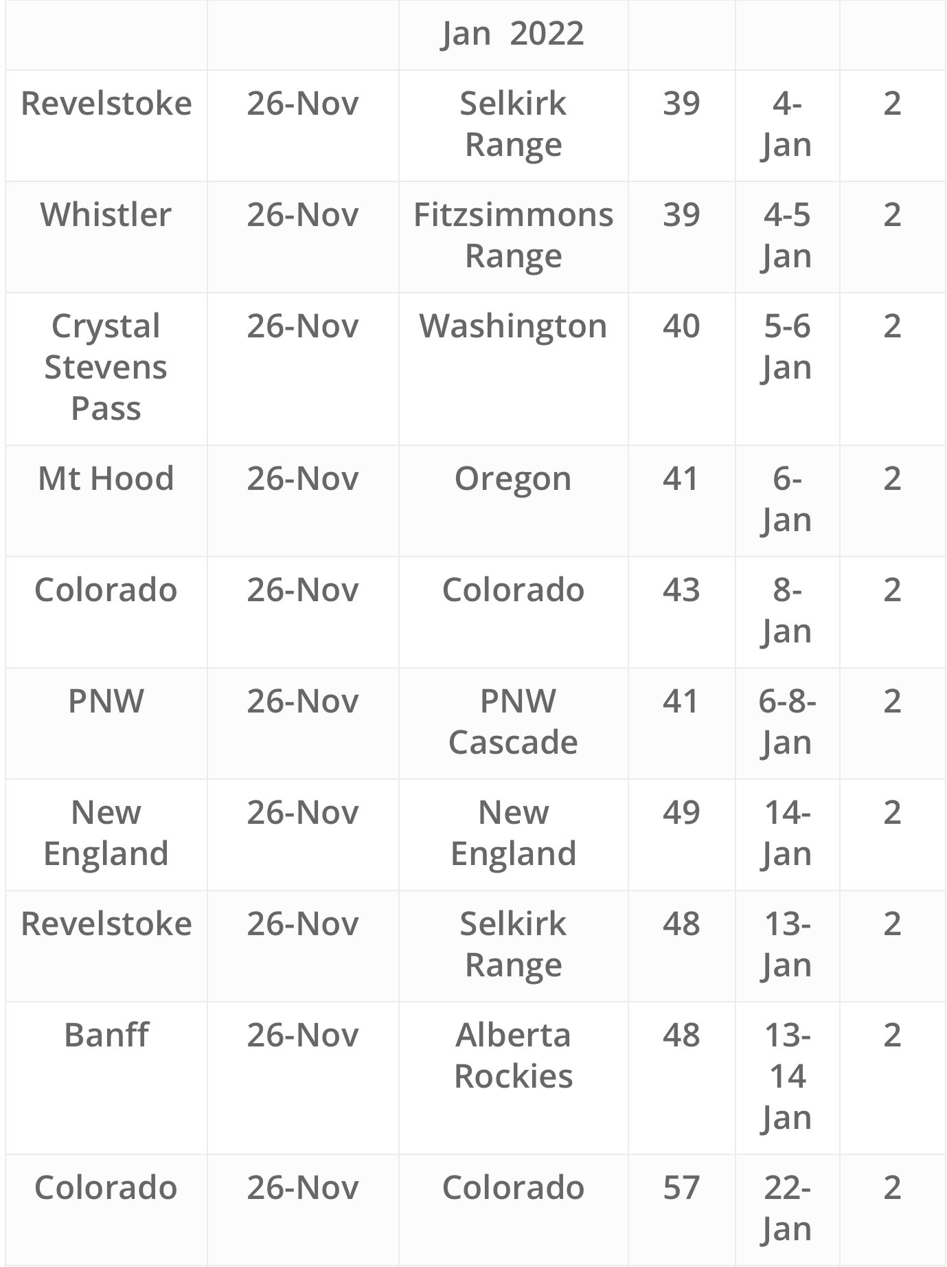
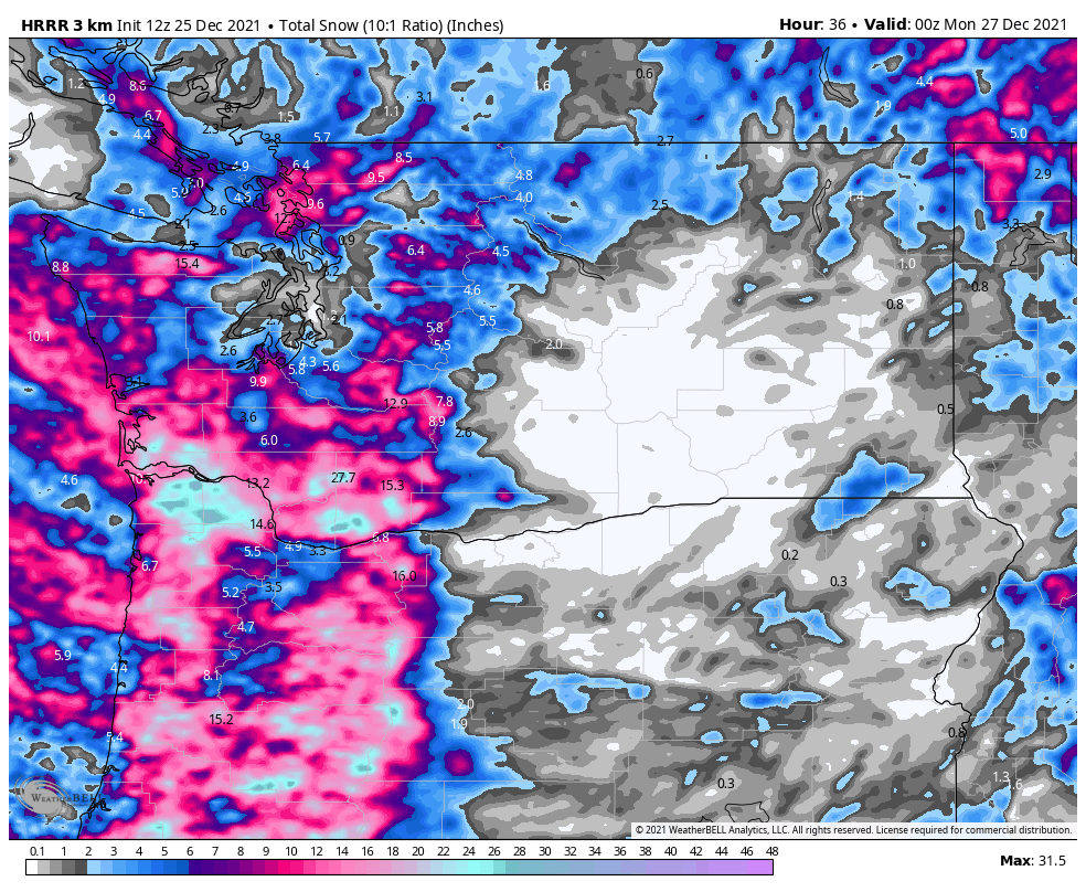
Future Snow Predictions Chart