Snow Stake Cams Page by Friday
Forecast Summary

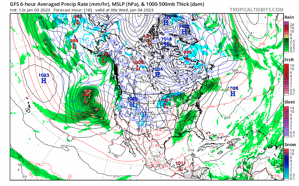
This is a cool little system coming in off the coast of California, let’s break it down. We have the big storm off the coast with the Low centered off of Oregon’s southern border, if you drew a line straight out. It takes a path towards the coast, then veers north, following the blue line.
Meanwhile the other Low-pressure area, near the Aleutian Islands, moves in the direction of the red arrow and ends up in the blue track of the first low. They become entangled and spin as if they were going down a drain. Lastly, as the Aleutian Low gets sucked into the vortex, it ejects its outer band and paves the way for another possible AR on Saturday. Take a look.
Lake Tahoe Forecast
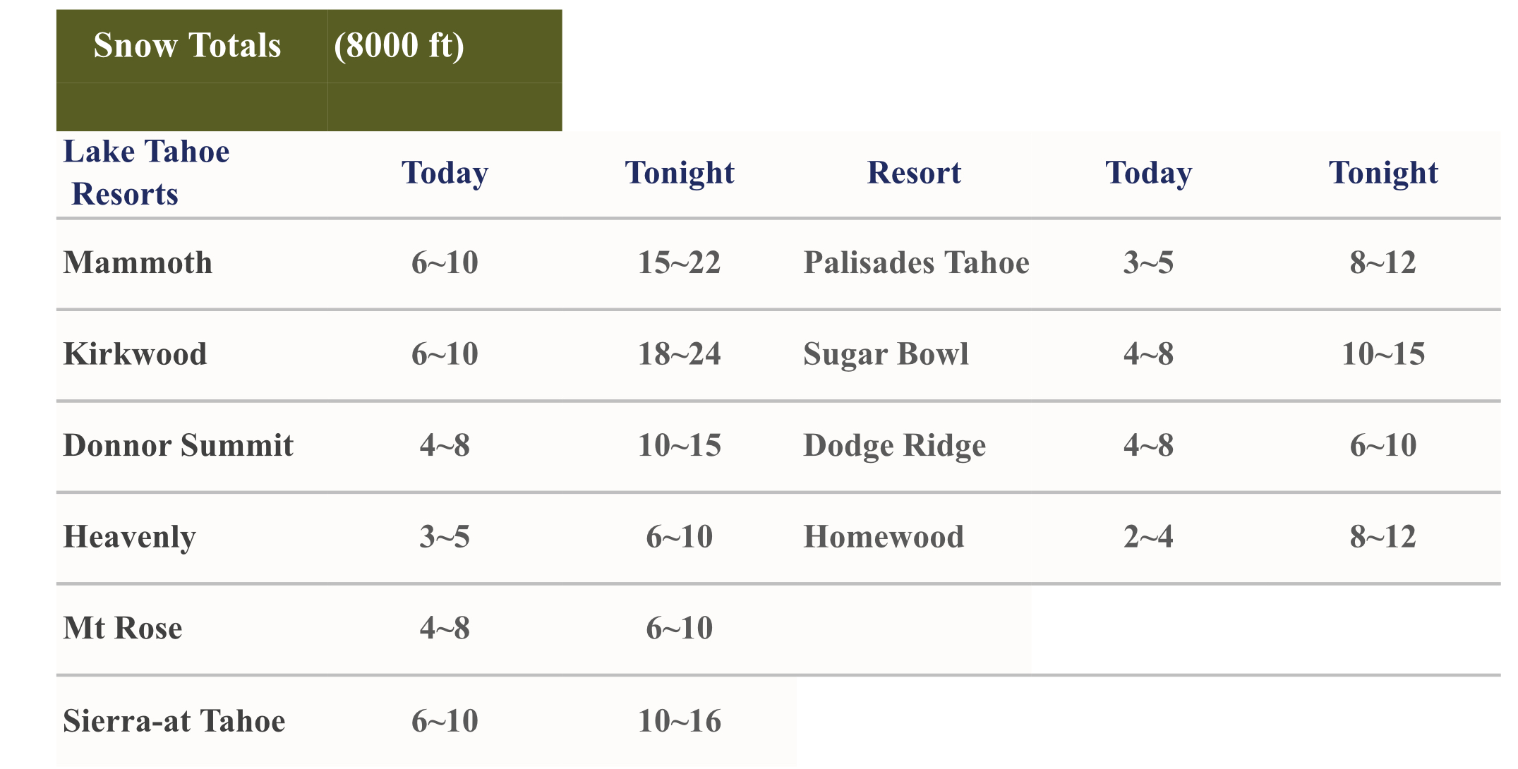
Today 1-3 Feet Storm Total
Mid 30’s 40 mph gusts at lake level, 80-90 mph winds at summit
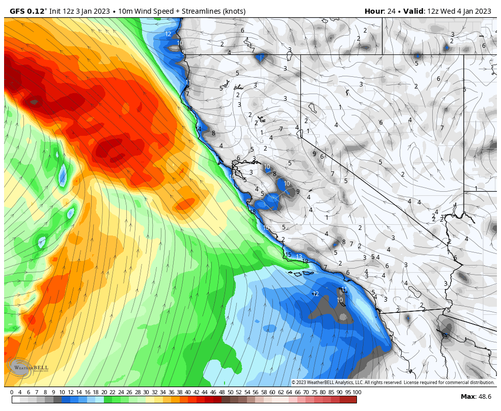
Lake Level Wind (Click to Animate)
This system moves in today and should reach the Tahoe resorts by 1 o’clock. We are dealing with high freezing levels that will peak around 7500 ft today and lower to below lake level by tonight. It will be all rain below 7000 by this afternoon and probably a mix around 7500. Freezing levels can drop with a heavy precipitation so it’s possible for snow below that mark.
 Tomorrow
Low 30’s 35 mph gusts at lake level, 60 mph at summit
Snow continues and moves out by mid-afternoon.
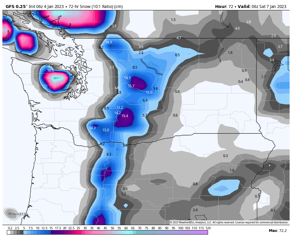
Pacific Northwest

Bluebird skies today until around noon, when the front approaches and clouds move in for resorts in Oregon. The timing for Washington resorts will be a couple of hours later, as the front moves from the southwest. Expect calm winds before the system moves in then strong gusts will signal the arrival. Gusts will be near 40 mph.
Generally, we can expect 2-4 for Mt Hood today with another 2-4 overnight. For the Northern Cascades, Mt Baker, Crystal and Snoqualmie in the 1-3 range. 49 Degrees North, no snowfall until Tomorrow.
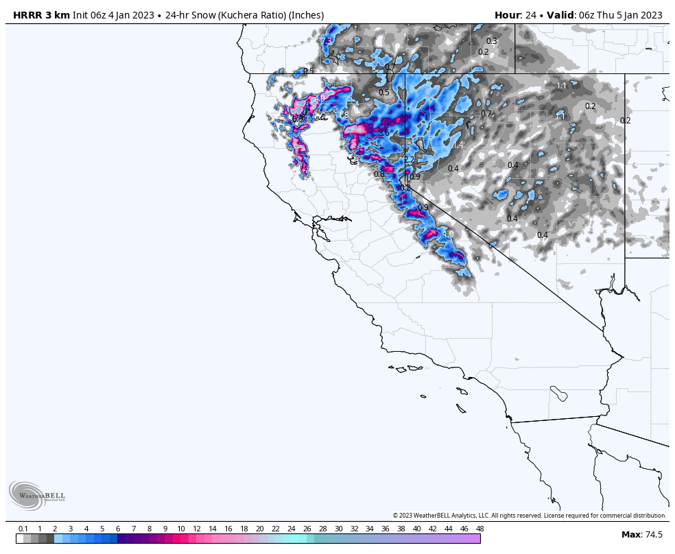
This is not a big producer, due to the position of the Low, but the next wave should be better. The models are struggling to find a solution. Below are the 4-day totals, with the next wave moving in on Thursday night and Friday.
Utah
Colorado
The storm arrives tomorrow night. As of now, the snow totals will be in the 4-8 range, generally, we will dial in this storm as we get better model data, likely by this afternoon.
Forecasted Areas
Pacific Northwest Cascade Mountains
Crystal Mountain, Mount Hood Meadows, Timberline, 49 Degrees North, Bachelor, Mt Baker,
Lake Tahoe Sierra Mountains
Heavenly, Palisades Tahoe, Kirkwood, Dodge Ridge, Donner Ski Ranch
Utah Wasatch Mountains
Alta, Park City, Deer Valley, Brighton, Snowbird, Brian Head
Colorado Rocky Mountains
Aspen, Aspen Highlands, Snowmass, Vail, Beaver Creek, Winter Park, Keystone, Arapahoe Basin, Breckenridge, Copper Mountain, Powderhorn, Ski Cooper, Telluride, Crested Butte, Silverton, Wolf Creek, Eldora, Loveland
