Happy New Year from Weather 20/20 & Future Snow!
We have another major storm coming into the west which will create some excellent ski conditions for the next month. Let’s take a look:
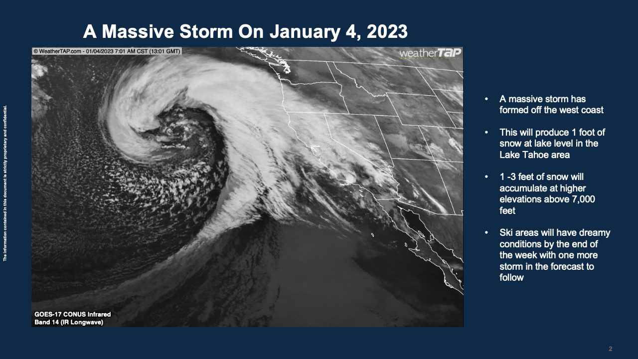
This is one massive storm. Just look at this circulation. It is a monster storm off the west coast. It will weaken as it approaches the coast, but it is filled with Pacific moisture. 3 feet of snow is expected to fall near Mammoth and the western slopes of the Sierra Nevada near Lake Tahoe. GREAT NEWS for skiers!

I have been to Lake Tahoe so many times and would love to test out the new snow. Let us know if you are in the region and how much you receive. We will be monitoring as well as Future Snow makes these incredible long range predictions!
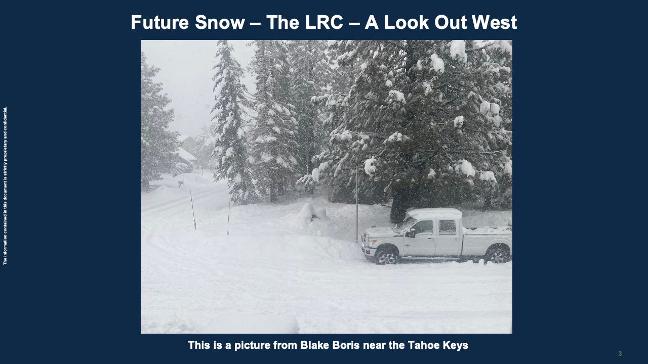
It finally started snowing in late December, and this is a picture, shown above, from near the Tahoe Keys on the California side of Lake Tahoe. The lake level is low, so any moisture is welcome. This is going to be great for all the ski areas from Ski Incline to Heavenly to Squaw Valley! Enjoy the beautiful powder coming your way.
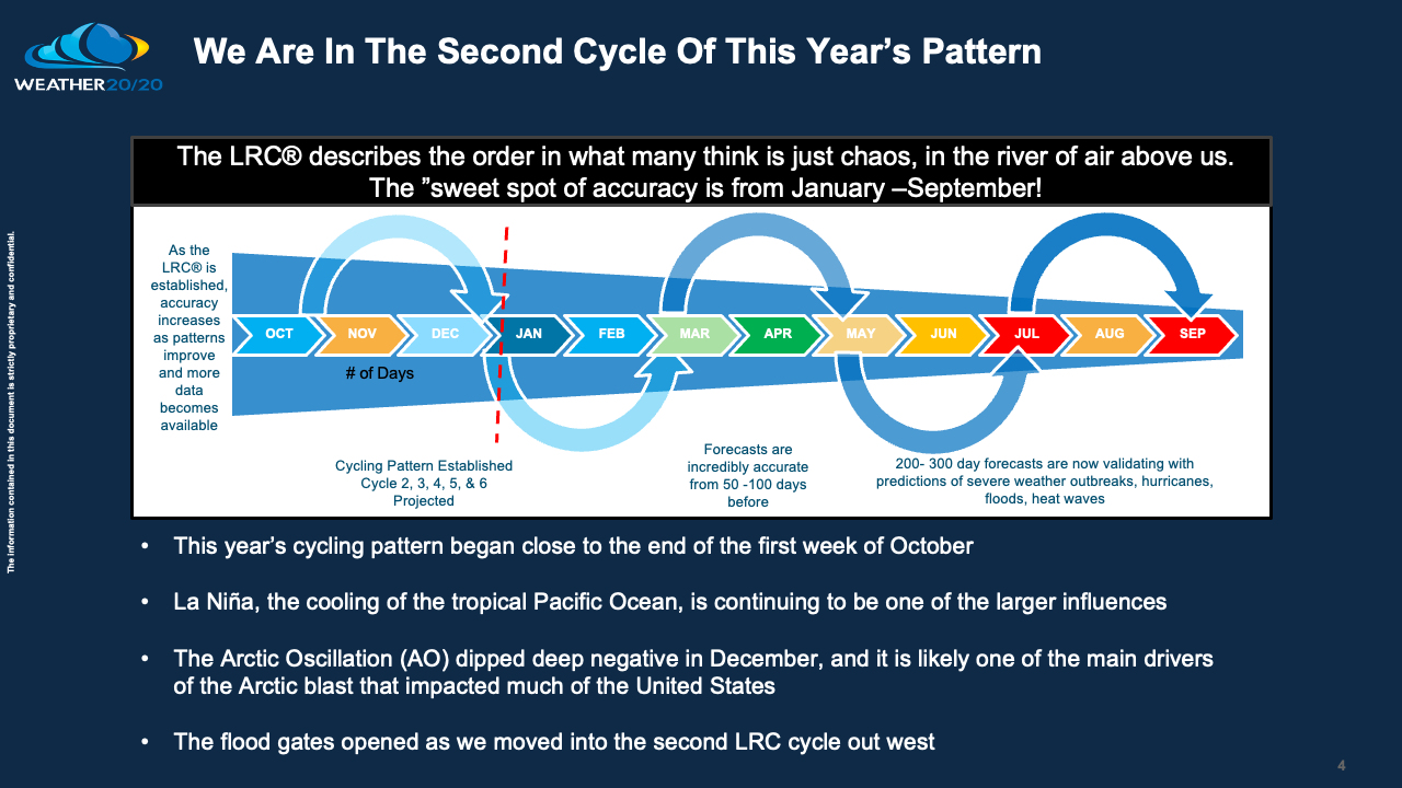
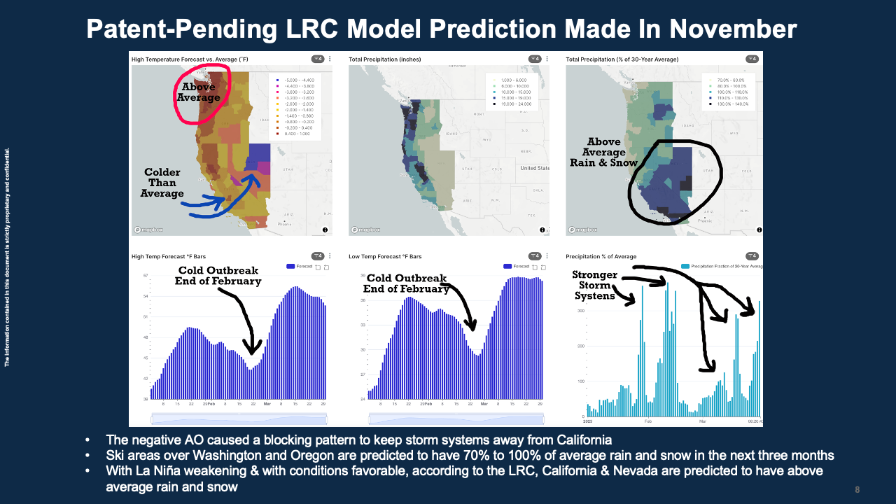
The weather pattern is cycling according to the LRC. We are in the second cycle of this year’s pattern and these storm systems breaking through into California are a good sign for the next three months.
The LRC is the centerpiece of a huge atmospheric puzzle. It provides the order in what most think is just chaos. It is far from chaotic. The LRC shows the almost perfectly cycling pattern. It is a fluid and oscillates. With an understanding of this oscillation we are able to make these long range forecasts for you as you prepare your ski vacation.
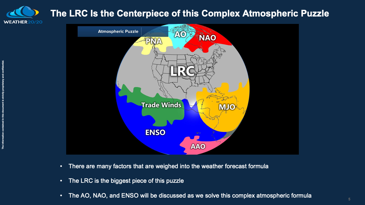
One of the big factors is the El Niño Southern Oscillation Index, or ENSO. ENSO has been in the La Niña phase for way too long. It is harder for storms to break into California during La Niña, but every year is unique. This year’s pattern, this year’s LRC, has likely modeled the end of La Niña into neutral conditions. We are currently studying this relationship as it was one of the main topics in our peer reviewed paper “Cycling Patterns of the Northern Hemisphere”. I live in Kansas City and La Niña has an interesting impact on the precipitation patterns. We just recently had a wet storm with over an inch of rain, which also is a sign La Niña is fading. It can’t come fast enough, as far as I am concerned.

Another influence is the Arctic Oscillation. It dipped deep negative two weeks ago and is likely one of the main factors to why that Arctic blast came down. It certainly exited fast. Will it return?

Our patent-pending LRC model shows one big blast of cold near the end of February. We also must watch the first half of February as this is when the part of the pattern that produced the first Arctic blast will cycle back through.
Thank you for reading this week’s blog! Have a great start to 2023 and let us know if you have any questions!
Gary Lezak
Founder/CEO Weather 20/20

Thank you for keeping us informed with your extensive knowledge Gary! miss you on TV. But being able to read you blog make the transition easier. Happy New Year!