
Summary
Winter Storm Warning for Northern Cascades: Ho hum, another atmospheric river (AR) for Seattle today. This is about the 6th AR for the season and 3rd strong one.
Today (Click to Animate)
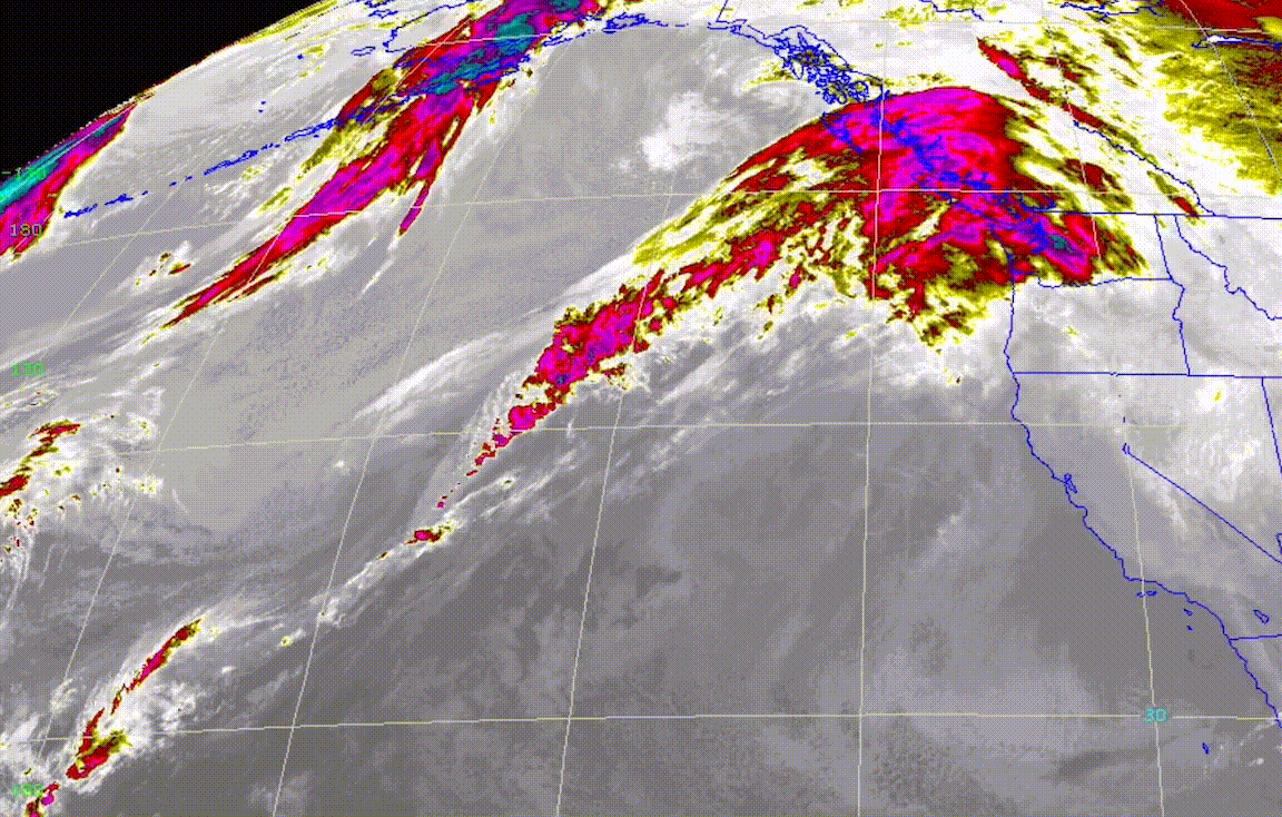
PNW Northern Cascades Winter Storm Warning until 4AM Dec 19
Snow today and tonight with accumulations of 12-20 for the Washington Cascades with higher amounts for Stevens and Snoqualmie (20-26). Freezing levels around 5000 ft this morning rising to 6000 this afternoon.
For the southern Cascades of Oregon, freezing levels are the issue with this forecast. Freezing levels are around 4000 this morning and rising to 6000 during the day. Most of the precip today will be rain mid mountain and below for Mt Hood. Mt Bachelors base is 6000, so a mix at the bottom and all snow as you work your way to the top.
Tomorrow
More snow for the Cascades with an additional 10-18 for Oregon mountains. The northern Cascades of Washington new accumulation of 6-10 and the strongest part of the system is over Oregon.
Monday and Tuesday
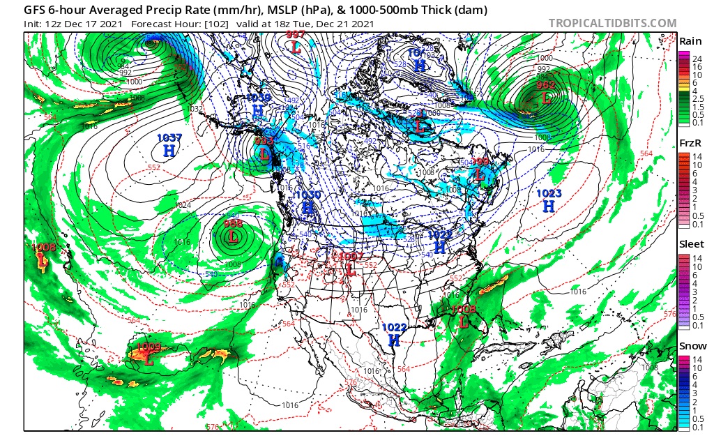
A brief break in the weather as the system spins off the coast and moves into the California and Tahoe area.
Wednesday and Thursday
Heavy snow for the Cascades down to the Sierras as the Christmas Pow storm ramps up. More detail on this storm tomorrow.
