Colorado Calendar Tomorrow thru March

Summary (Click to Animate)
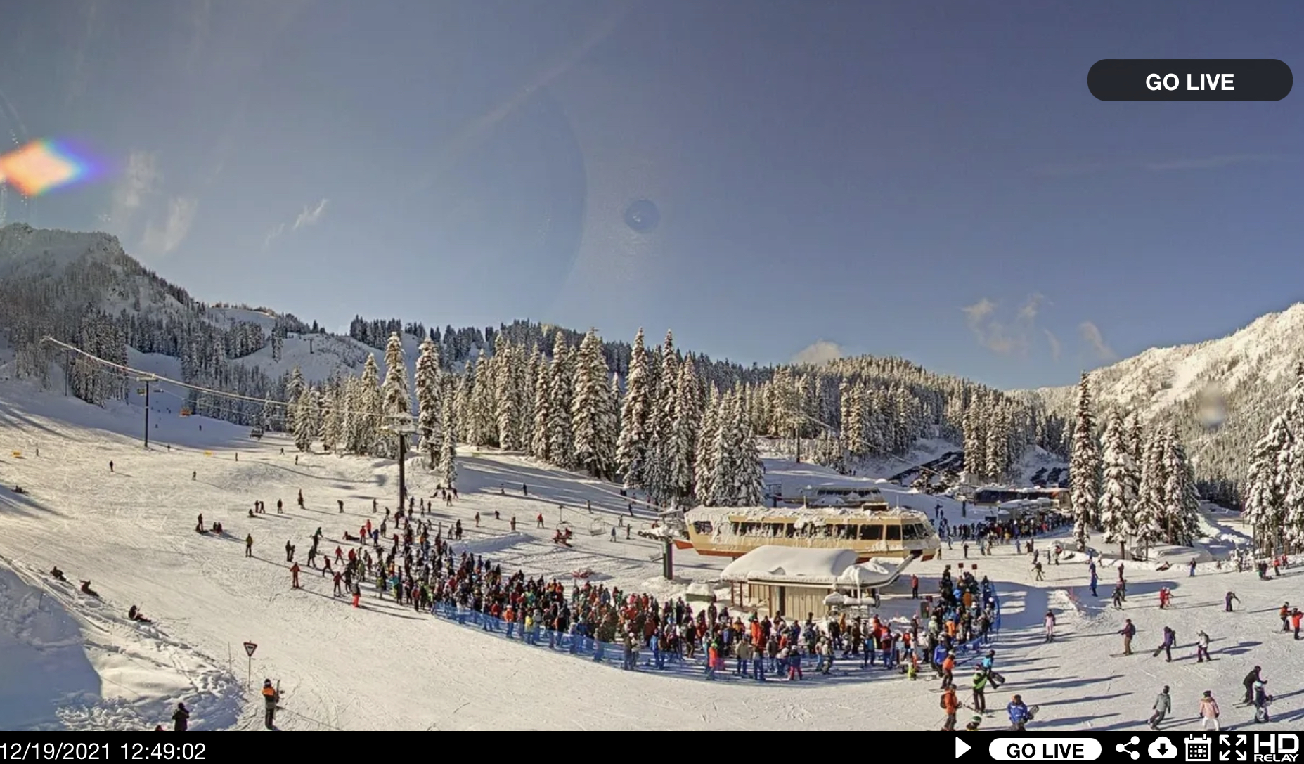
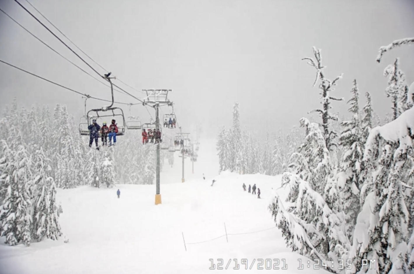
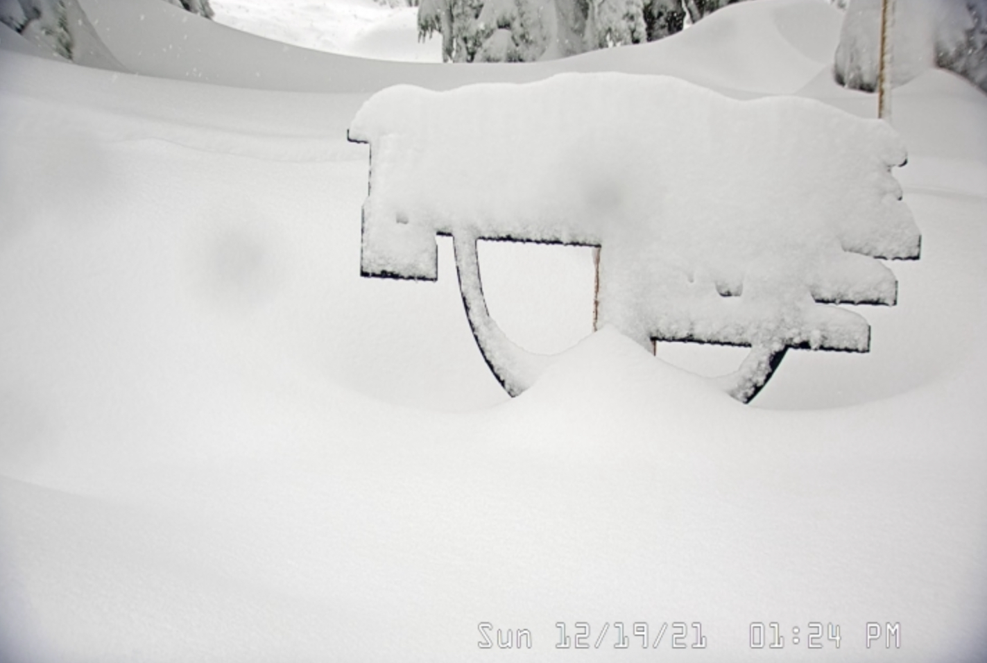
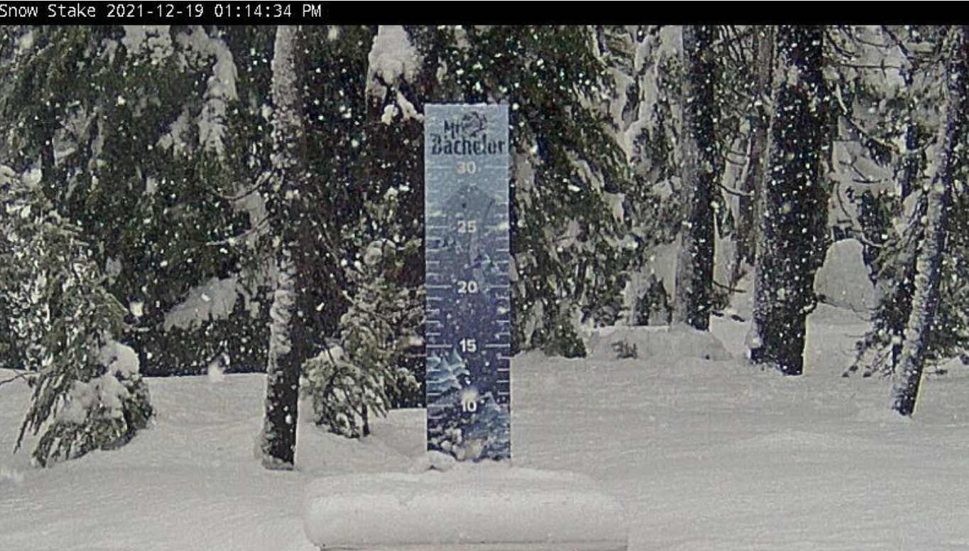
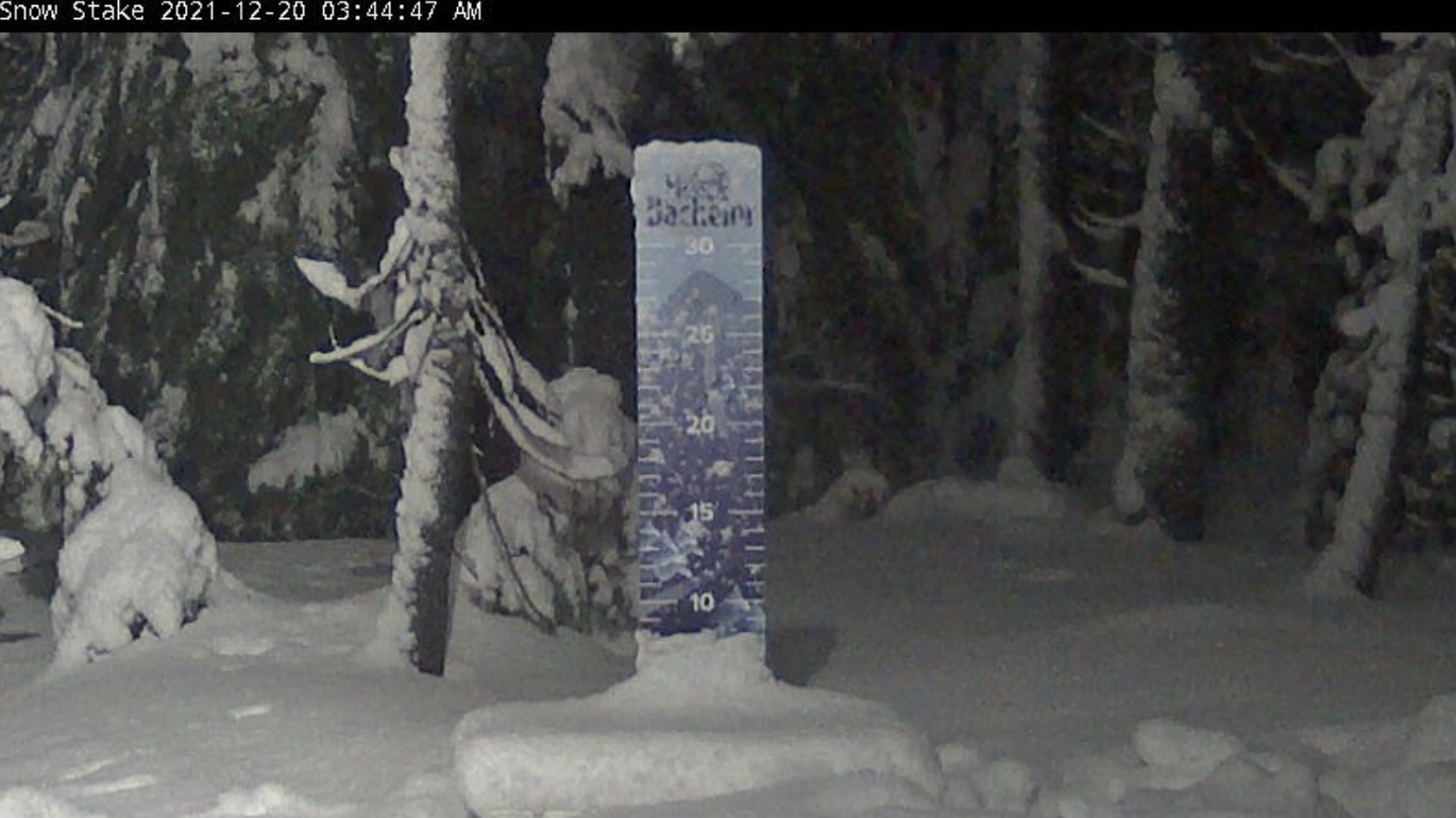
Snow through Wednesday in the PNW, as the storm progresses south and east. There is high pressure in the Gulf of Alaska that is driving the low to the south and into California tomorrow. Continued snow showers in Oregon today and tonight. Snow begins in Tahoe tomorrow night. Next are a few pictures are of skiing yesterday at Bachelor and Timberline.
Then and Now
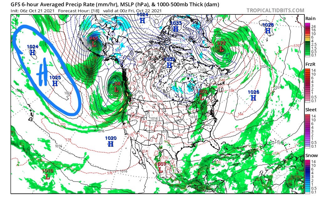
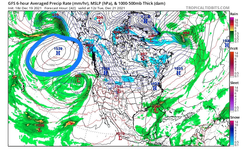
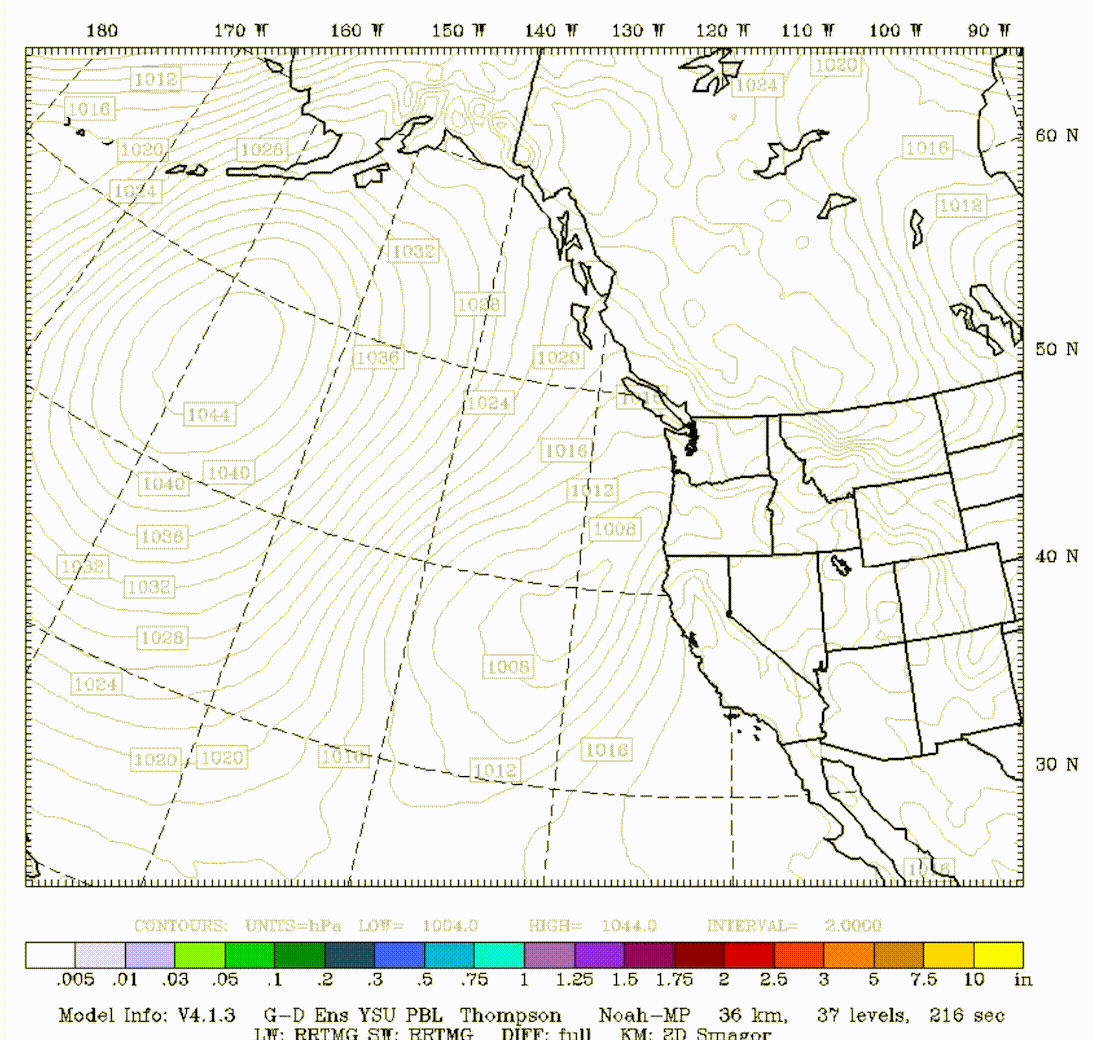
The first chart is from the last cycle back in October, second chart valid Tuesday. Last time this storm came through it became a monster atmospheric river (AR) a couple days later on the 24th. When we talk about the cycling weather pattern being different, from cycle to cycle, it is because of how the teleconnections (TC) interact with the storms.
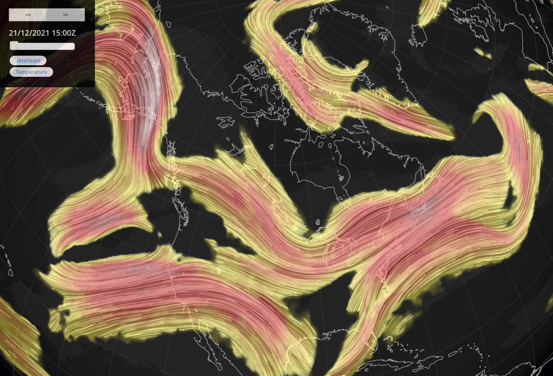
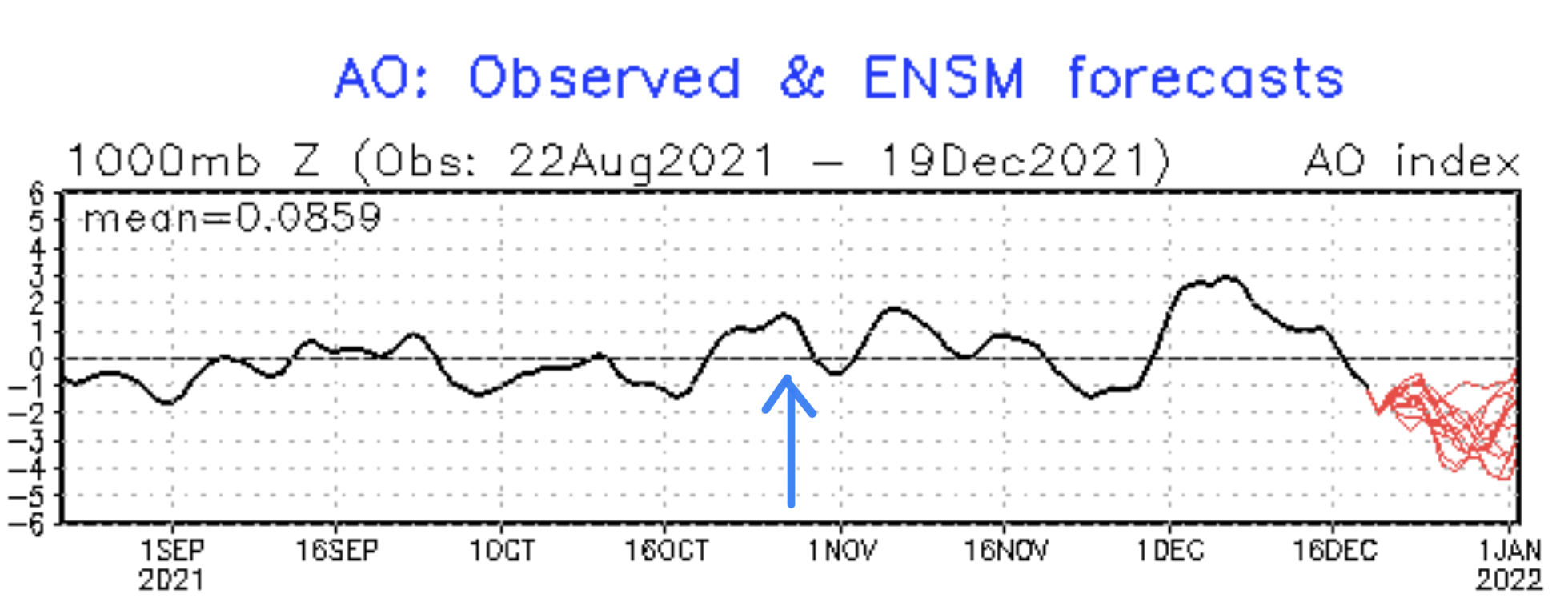
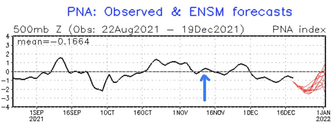
The storms are really regular with their timing, usually, within half a day. The strength and steering can be affected by the TC. When you look at these two charts the thing that jumps out at you is the position of the high pressure. This time through the Artic Oscillation (AO) is about the same. The Pacific North American Pattern (PNA) is negative. The PNA does a couple of things in terms of steering. When the PNA is negative, the jet stream retracts toward Asia and usually splits the flow. The next set of pictures is the jet stream flow. First was yesterday, and second valid Tuesday. You can see how that blocking high pressure affects the flow. 
So those are a couple of variances that can occur with the cycling pattern. Regardless of the block the storm was strong enough to be on time and snow!
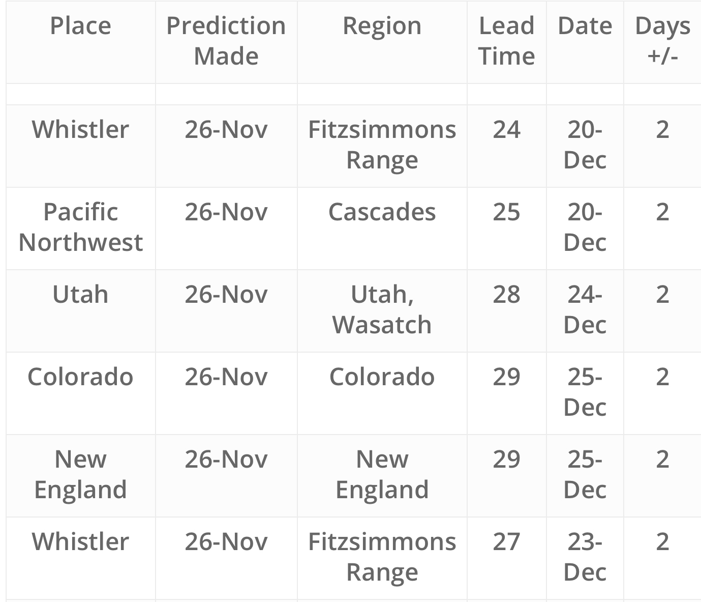
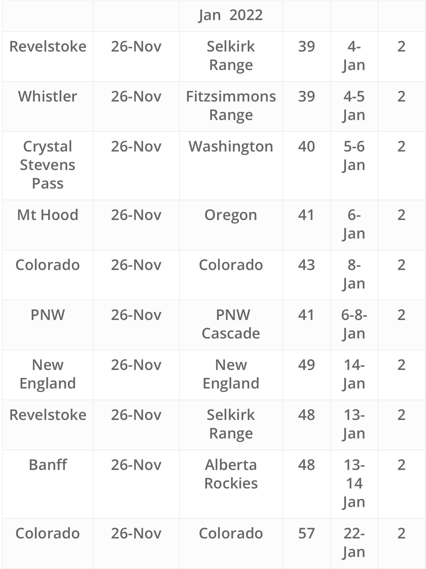
Christmas Pow Storm Predicted Nov 26th

Once the cycle length was determined we could plot where and when the storms would arrive. This was one that stood out because it had the timing that everyone could remember. It’s a good storm too. Below is the forecast for the progression of the Christmas Pow storm. This storm will return February 19th and most likely it will be at its strongest. These strong storms are what I plan my trips around.
Today and Tonight
PNW Winter Storm Warning for Oregon Cascade mountains until noon today, with another 6-10 inches for Mt Hood down to Mt. Bachelor. Snow tapers off this evening. Freezing levels around 3000 ft. Washington Cascades expect another 5-9 for most areas. The snow band reaches across Idaho and Montana with ID and MT resorts picking up 6-10 today.
Tuesday and Tuesday Night
Next wave moves into the Cascades in late morning and snow ramps up towards the evening hours. Snow levels will be around 5-6000 ft dropping to 3500 ft.
Snow moves into the Sierras Tuesday evening as the spinning offshore storm gets pinched by an incoming wave and moves inland. Light accumulations between 2-4 before the meaty part of the system gets into gear Wednesday and Wednesday night.
Wednesday-Thursday Night
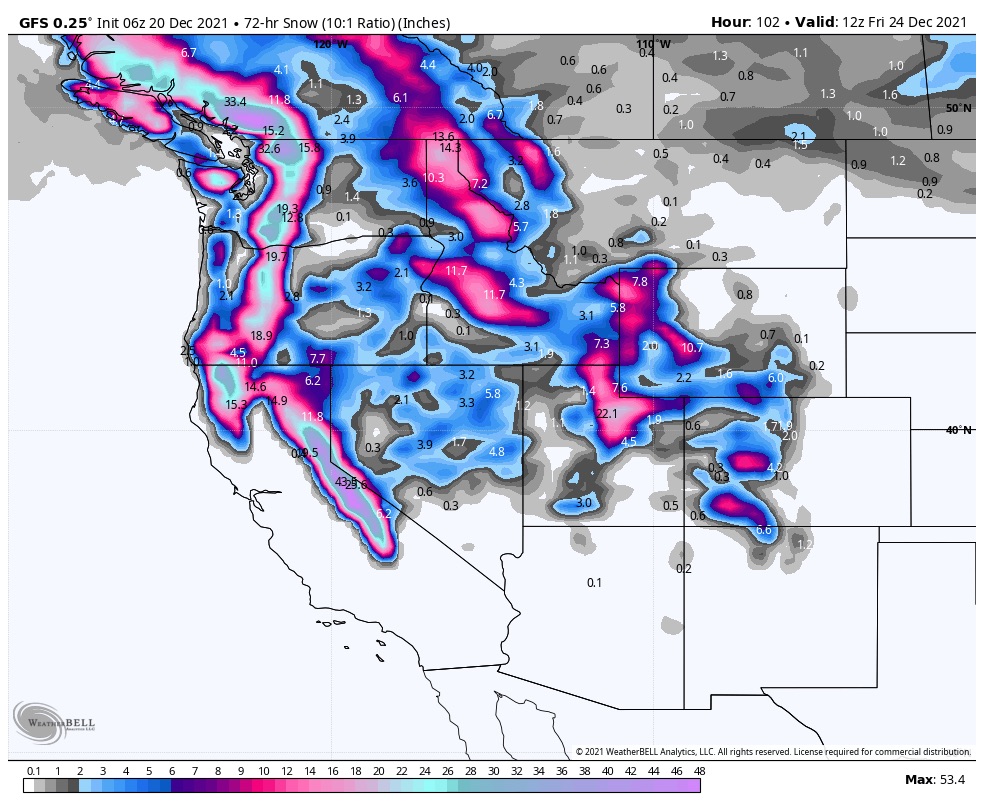
Lake Tahoe By Wednesday night the storm gets caught up in the flow of the jet stream and passes through. While a storm in the Gulf of Alasaka progresses south and collides with the Tahoe storm. This is the Christmas Pow storm predicted back in November. Snow and heavy snow at times expected with 10-12 by evening on Wed with another 8-12 by Thursday night. Storm should move to the east late in the evening Thursday. Below is the 3-Day total for the west.
Utah and Colorado The storm moves into Utah and Colorado Thursday night and Friday for Colorado.
Prediction Chart