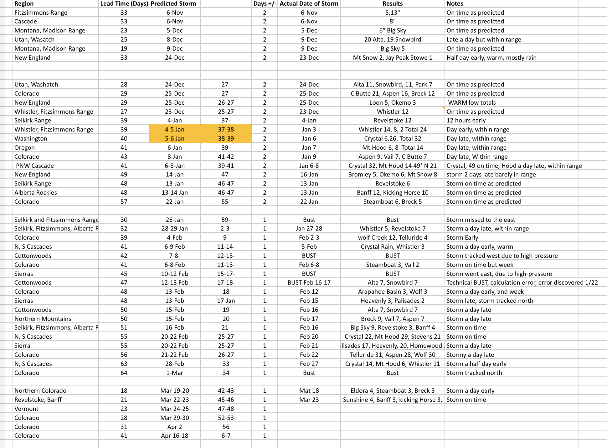
Prediction Chart Updated
During this lull in the weather, for the continental United States, we have updated our Predictions Chart. Presently we are just about 90% (89.74) accurate in predicting snowstorms with an average lead time of 36 days in advance. How can we do that? We use the cycling weather pattern to predict when the storms will return with incredible accuracy.
When I started using the Pattern to plan my ski trips back in 2015, I had no idea that it would be the inspiration for creating this weather forecasting service. At first, I tried to convince Joel Gratz, of OpenSnow, to use the pattern for long-range forecasts. He was skeptical, but I kept pestering him with dates that storms would come, over time he realized there had to be something there.
There IS something there. This is the beginning of a new era in weather prediction. Thanks for reading the blog and being a part of this.
Tahoe Storm on Track for Monday
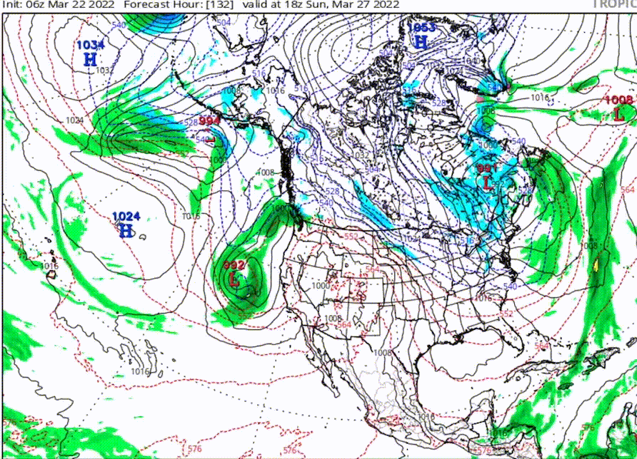
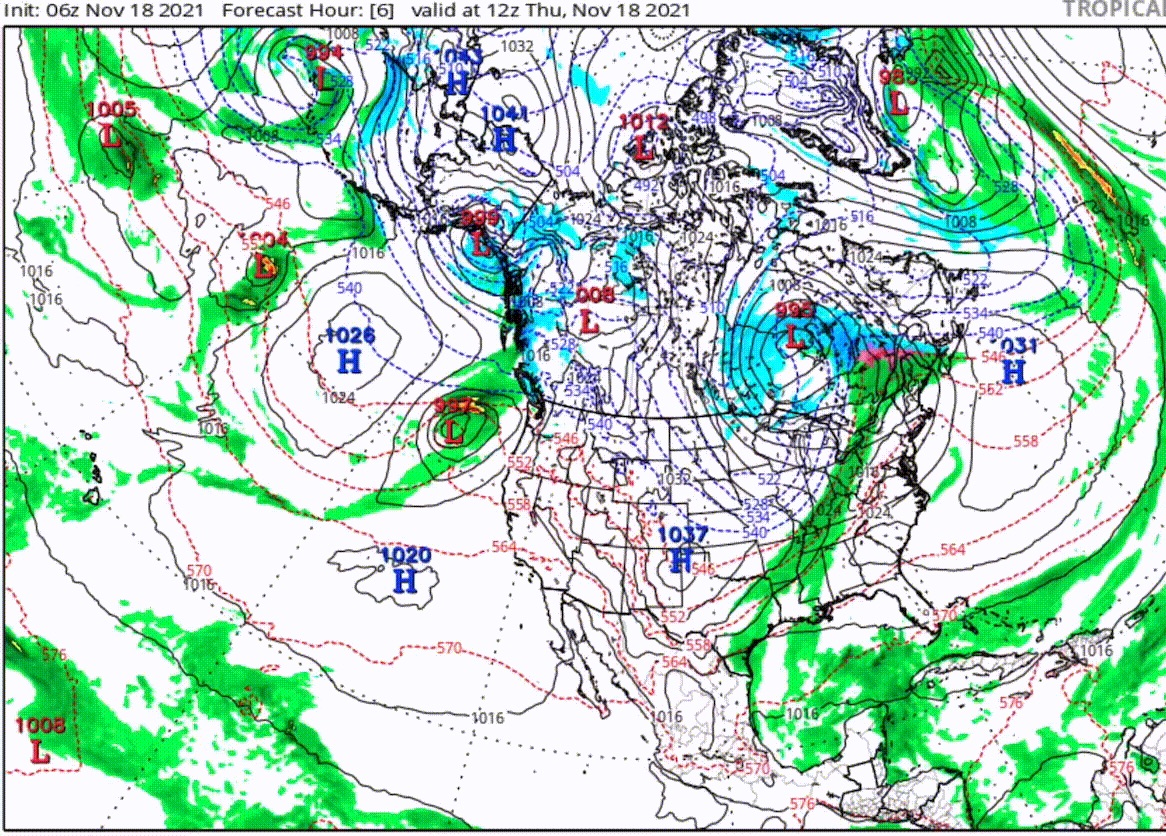
These two animations below (click to start) are of the upcoming Tahoe storm and the same system during Cycle 1. You can tell, back in November, the storms position of the low pressure is farther north, but it takes the same path as the projected storm for Monday. There are subtle differences between these two versions of the cycling pattern, such as the positioning of the high, but they are essentially the same.
Pattern Discussion
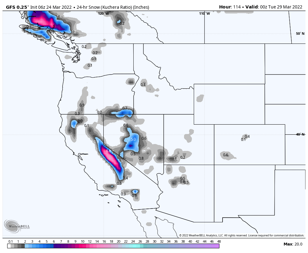
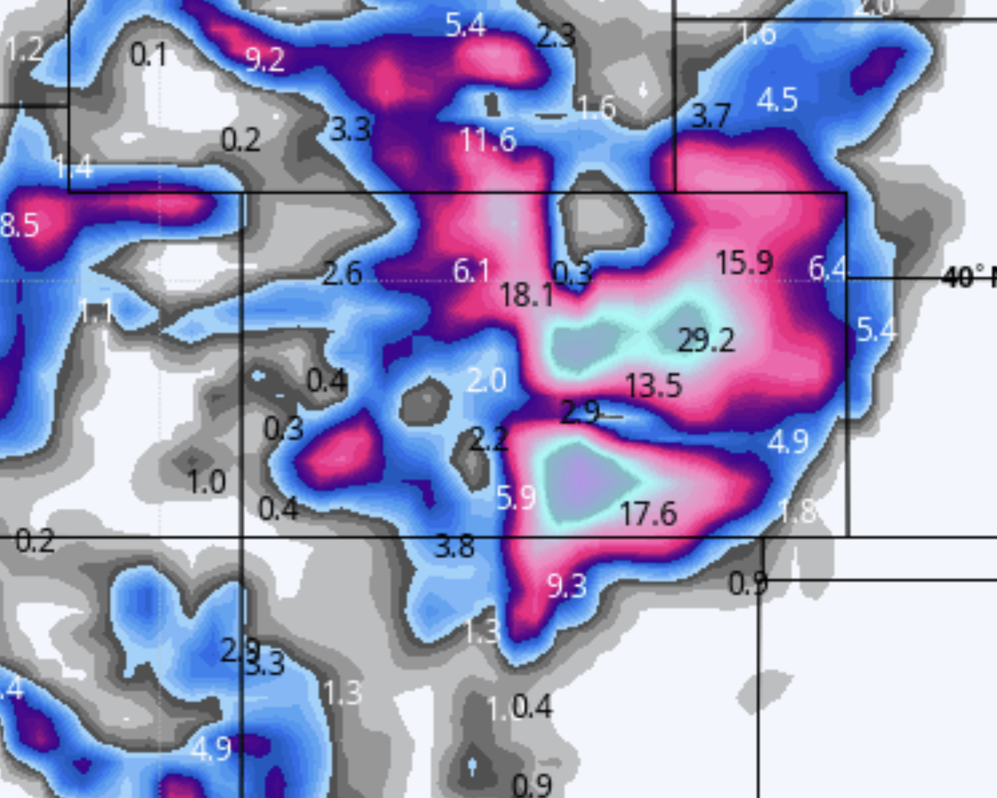
We are back to the Northern Pattern for the next three weeks and will return to the Active West pattern on April 14th. There will be some big storms once the Active West returns. For now though, we are in a weak pattern with no big storms either of the previous cycles during the Northern Pattern. I say that hoping that I will be jinxed, the latest GFS for Colorado has huge totals for this upcoming storm. Below is the latest snow totals thru Wednesday–still 162 hours out and the bulk of the precipitation is east of the divide, but that could shift.
Welcome to Future Snow (if you’re new)
If you are new to our site, you are in for a surprise. The weather repeats. Stay with me…..for the last 20 years, Gary Lezak, a meteorologist in my hometown of Kansas City, has been working on understanding how this all works and has authored a peer reviewed study called “Cycling Weather Patterns in the Northern Hemisphere“. Below is a video with two cycles synced up so you can see the pattern clearly.
That is a little background on what we call the Pattern. Once you understand it, you can predict weather months in advance–that is what we do here. Presently, we are about 90 percent accurate predicting storms over 30 days out. Here is the official prediction chart, with all of this years predicted storms and results.
All Pattern Storms thru Mid-April
Place, Date of Prediction, Mountains, Lead Time, Date Predicted, Cycle day
| Colorado | 1-March | Northern Mountains | 18 | Mar 19-20 | 42-43 | 1 |
| Revelstoke, Banff | 1-March | Selkirk, Alberta Range | 21 | Mar 22-23 | 45-46 | 1 |
| Jay Peak | 1-March | Vermont | 23 | Mar 24-25 | 47-48 | 1 |
| Colorado | 1-March | Colorado | 28 | Mar 29-30 | 52-53 | 1 |
| Colorado | 1-March | Colorado | 31 | 2-Apr | 56 | 1 |
| Colorado | 1-March | Colorado | 41 | Apr 16-18 | 6-7- | 1 |
