Forecast Summary
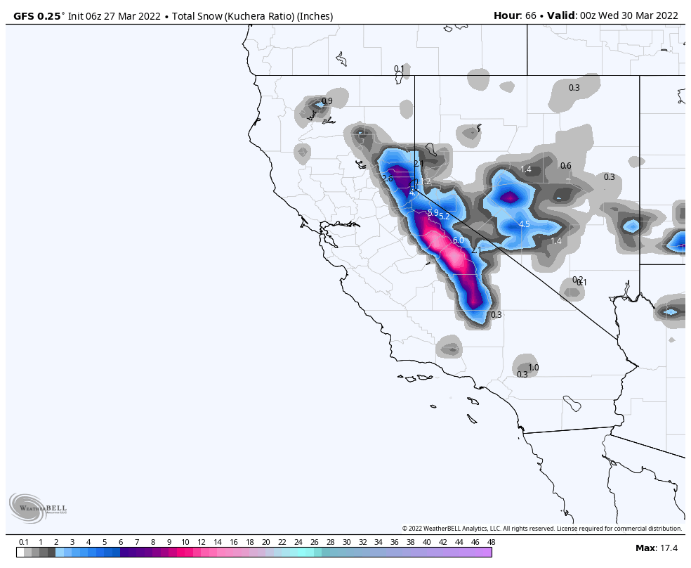
The storm we have been talking about, for the last week, finally arrives tonight for Lake Tahoe. Early indications from high resolution models suggest between a .25 to .5 inch of liquid water equivalent for areas above 6500 ft. That would be in the 6-12 range for snow.
That system progresses east reaching Utah Monday night and Colorado Tuesday Morning.
Forecast
 Tahoe
Tahoe
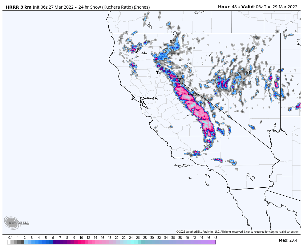
Storm arrives tonight, after midnight, with heavy snow above 7000 ft. High winds in the 20’s with gusts near 40 mph. Areas along the crest will fare the best with Kirkwood and Palisades in the 3-5 range before the lifts start spinning.
There is potential for higher amounts due to the amount of Pacific moisture that is available, so we will keep monitoring and update as necessary.
Monday
Snow continues with thunder snow possible. Another 3-7 is expected, again for Palisades and Kirkwood, although Kirkwood appears to be the bullseye due to its position with the approaching trough.
Snow totals through Monday:
Crest: 6-12 Kirkwood, Palisades
West: Dodge Ridge, Homewood 3-5
East: Heavenly, Mt Rose 2-4
Utah
 The storm moves into Utah in the afternoon Monday. There will be high winds with the approaching front, 20-25 with 35 mph gusts. This is a warm system with high snow levels Monday, around 7-8000 ft, dropping below 7000 ft Monday night.
Cottonwoods Alta and Snowbird 1-2, Brian Head 2-4.
Tuesday
Colder temps will allow heavier bands to form with better snow totals and much better wind conditions 10-15 mph. Expect another 1-3 for The Cottonwoods and Brian Head. Lower elevation resorts will struggle with snow levels.
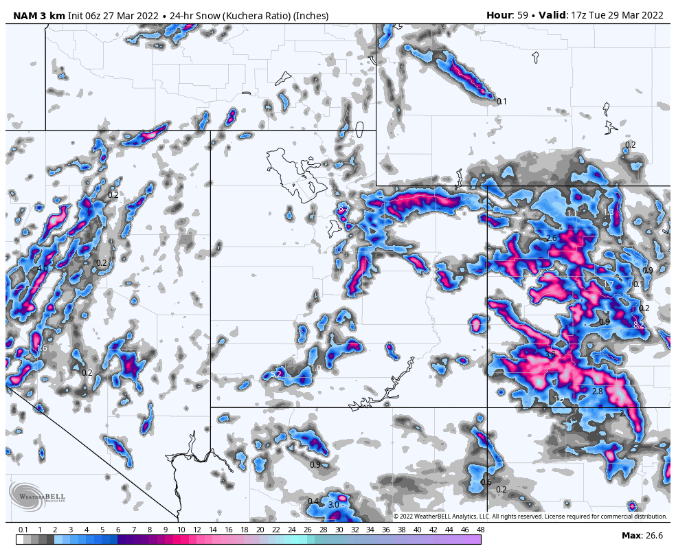
Colorado
As you can see from the animation above, the storm arrives Monday night for southern Colorado, and works its way northward. Warm temperatures continue ahead of the front but will return to winter like conditions by tomorrow night. This should be a good storm for the southern mountains Telluride, Silverton and Wolf mountain.
‘Tuesday
Expect heavy snow in the San Jauns with 4-8 during the day and another 4-8 overnight thru Wednesday morning
For central and I-70 resorts I am expecting 2-4 throughout the day, with another 1-3 overnight. I will dial in this forecast more tomorrow as we get higher resolution modal guidance.
The NCAR fire in Boulder should have relief on Tuesday, as the system reaches the front range. Much lighter winds are expected today thru Tuesday, so hopefully firefighters can get this contained and not need help from Mother Nature.
Next System
The next system is a fast moving clipper, that will follow this storm and arrive in Utah and Colorado Wednesday.
Prediction Chart