 Water Year to Date Video
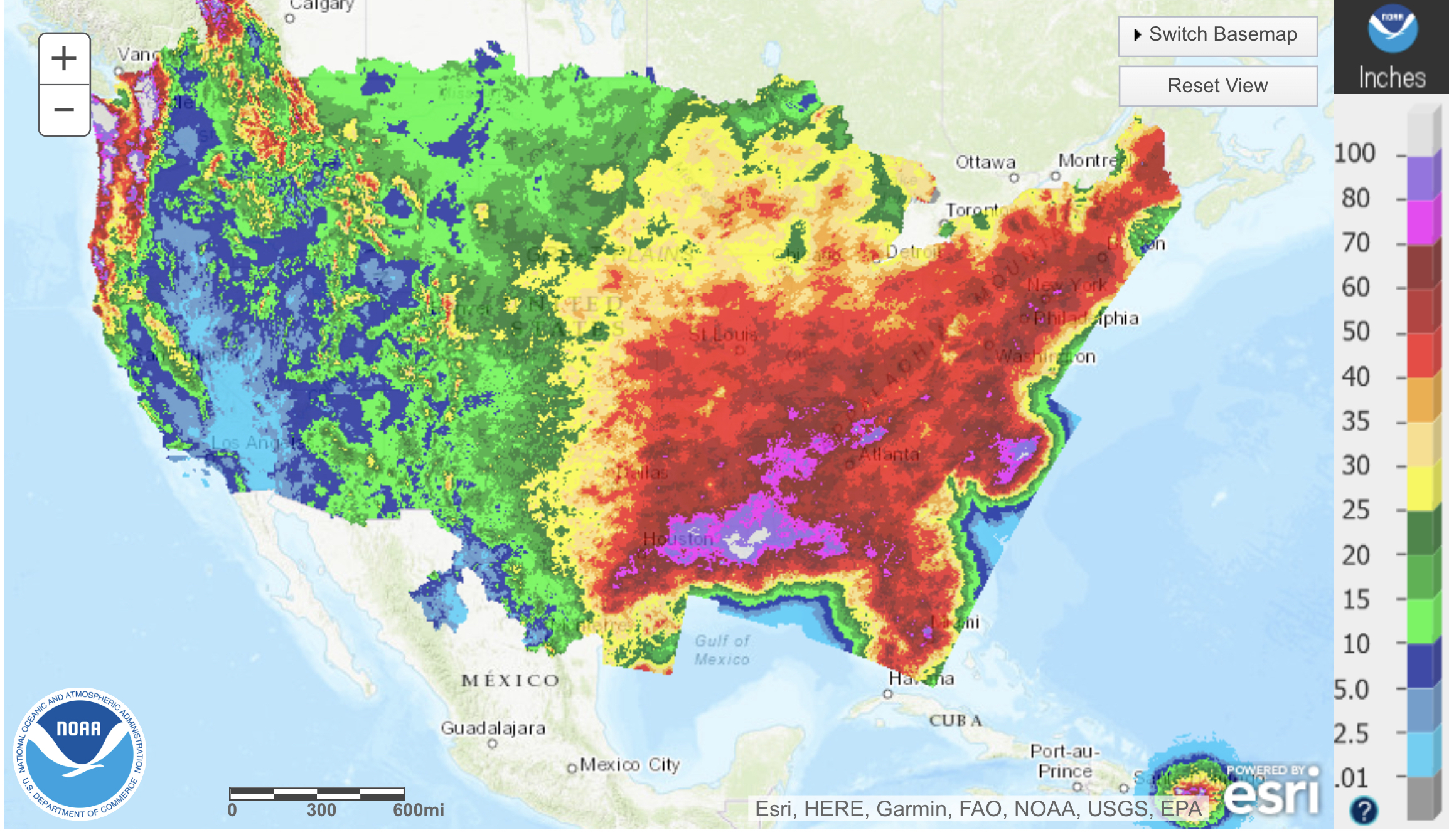
Below is a time lapse, so to speak, of all of the systems and their tracks to date. It’s cool to look at during this boring stretch (for most of us). Keep an eye on your city or resort location and watch all of the hits and misses. If you live in the PNW you are having a great water year, but average snowfall due to warm AR’s (atmospheric rivers).
PNW Wet and Wild
Forecast Summary
The AR kicks into gear through Wednesday, as the system slides down the coast and hits Tahoe on Friday. Warm temps in the PNW will dominate until we reach the back side of the storm on Wednesday night.
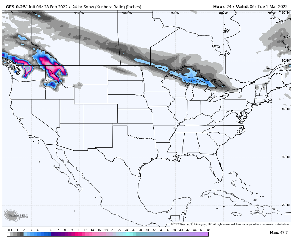
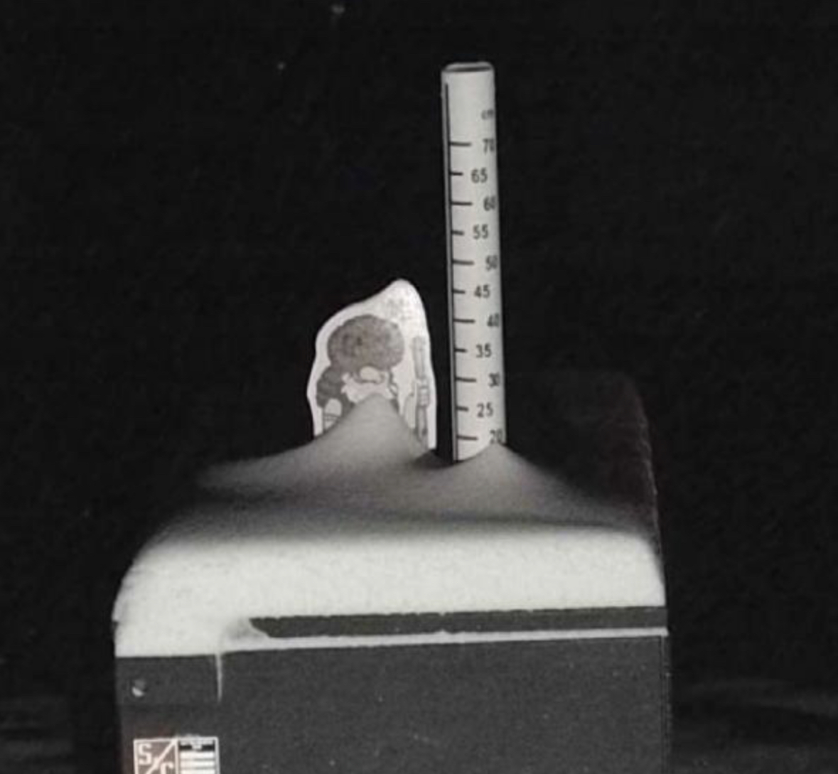
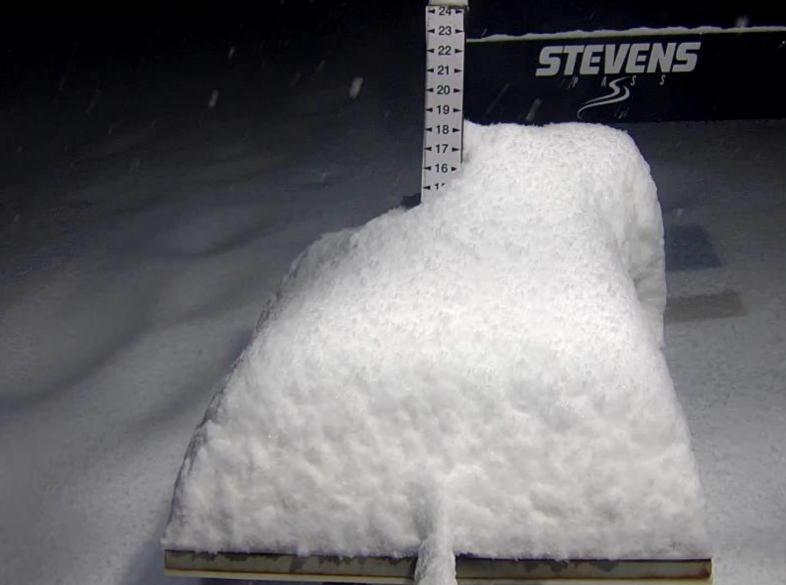
PNW
Atmospheric River–Engaged. High snow levels today through Tuesday, 8000-6000 on Tuesday. Cascade cement for the upper mountains over 8000. High winds with gusts in the lower 40’s, so it will be pretty “nice” today and tomorrow.
Freezing levels start to decline Tuesday night and especially into Wednesday night.

I love it bring it on