Summary
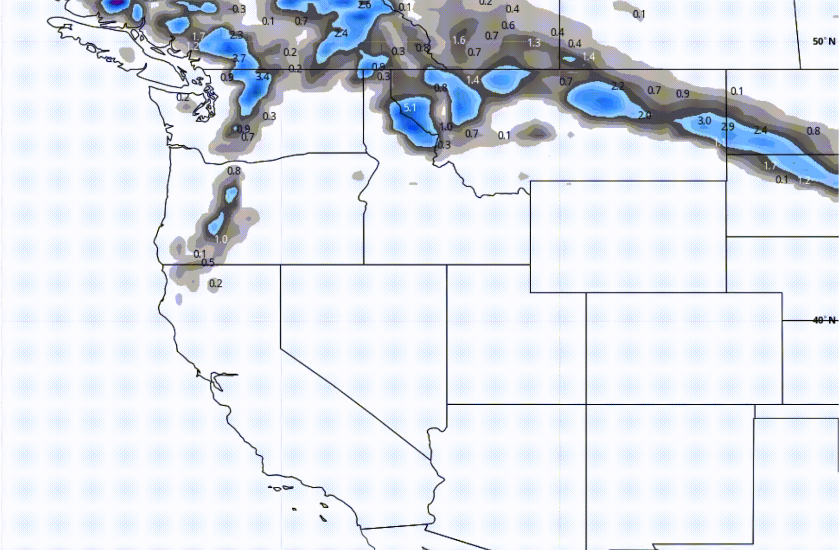
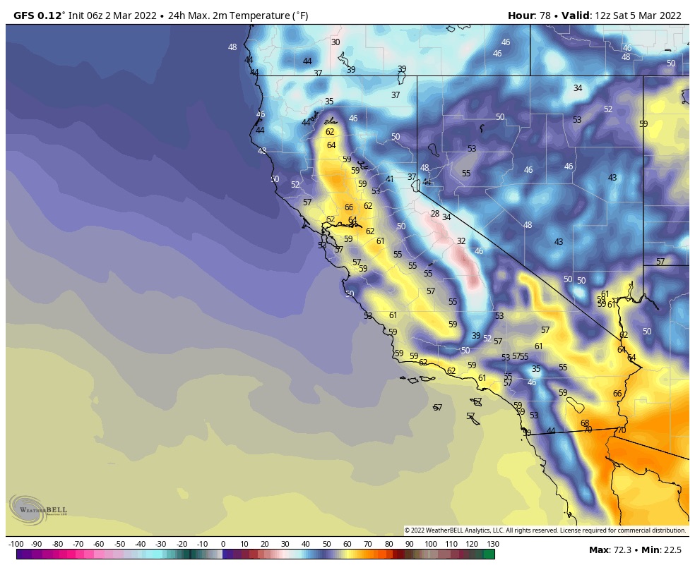
While the Pacific Northwest’s AR (atmospheric river) event is in full swing, with record -breaking rain, the rest of the west is having a spring preview. With temperatures in the mid 50s lake level at Tahoe, bluebird skies and 40s at Alta, and nearly 50 at Vail mountain today. The same will continue until Thursday, when the waves from the next system drop down and reach the Tahoe basin.
 Time Lapse
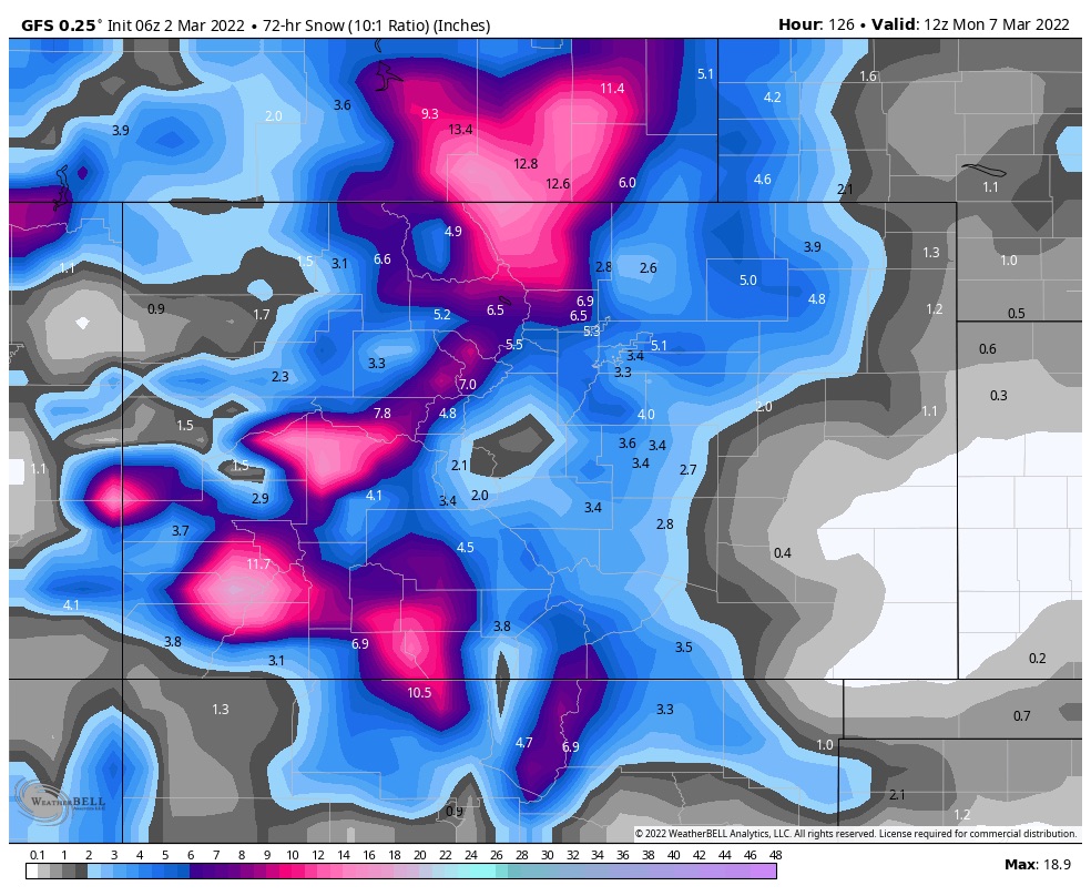
I posted this Monday; in case you did not see it. This is a video of every system during the water year beginning on October 1st. It goes by really fast, only 23 seconds in length, but you can use the slider to slow it down.
When you speed up storm systems like this, you get a sense of where the pattern track is and its frequency. Also, you can clearly see the differences in the size of storms. The flow of the storms is part of the Pattern. This year, we have basically two parts. The Active West and the Northern Patterns. During the Active West, the storms flow from the PNW southeast to Colorado then up the east coast. The storms that hit Tahoe during this time, take a dive down the coast in a “U” shape. Then the Northern Pattern takes over and the storms slide across Canada.
Things to look for, watch the east coast systems, the track of those storms are pretty regular. The ski resorts in the northeast are having a good year with some big storms rolling through. Watch the west coast light up with huge ARs that have hit Tahoe, Seattle, and up to Alaska.
Forecast
PNW
Snow and rain today and tomorrow with snow levels hovering around 5500 with light winds in the southern Cascades with slightly higher winds in the north.
Tahoe
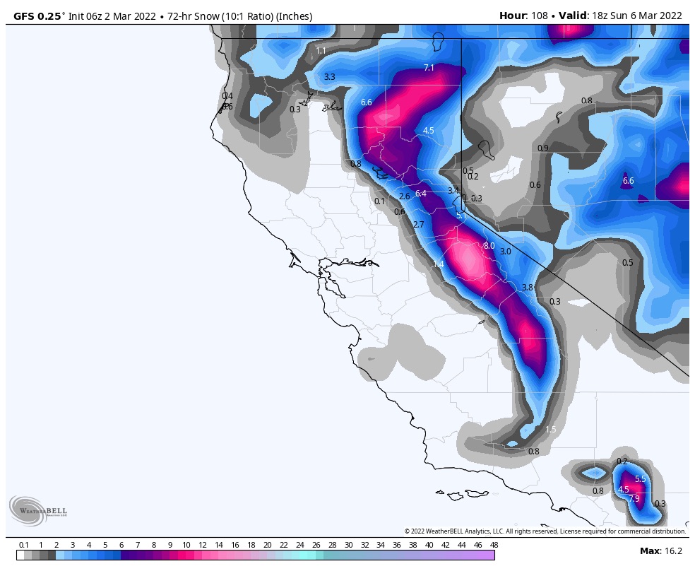
Today thru Thursday will be dry with the system moving in Thursday night. Snow levels will begin at 8000 ft lowering to 7000 ft. The snow will be wet and heavy, I am expecting 2-4 by Friday. On Friday, the bulk of the precipitation occurs with snow levels drop to around 2800. It is still a long way out, but I am expecting 4-8 additional for Friday and Saturday. Areas along the crest and west will do best.
Utah
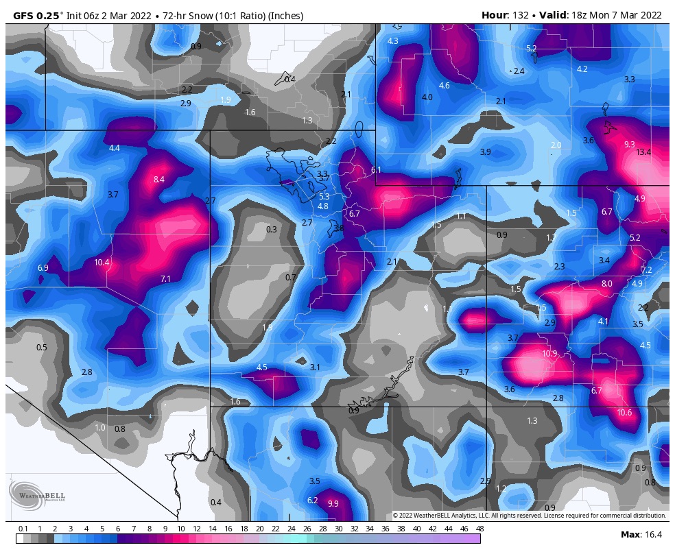
The storm will reach Utah by mid-morning Friday. Expect warm temperatures throughout the day, with a high of 38, dropping during the evening hours and overnight to the low 20’s. Moderate winds from the southwest. I am expecting 3-6 by Saturday morning with another 2-4 on Saturday for Alta, Snowbird and Brighton, with smaller totals for Park City and Deer Valley.
Colorado
The storm arrives Friday in the afternoon. Warm temperatures to start, falling throughout the day and evening. I am expecting 4-8 for storm totals for most mountains, with the southern mountains favored again. We will dial in the snow totals as we get a little closer.
