Pattern Discussion
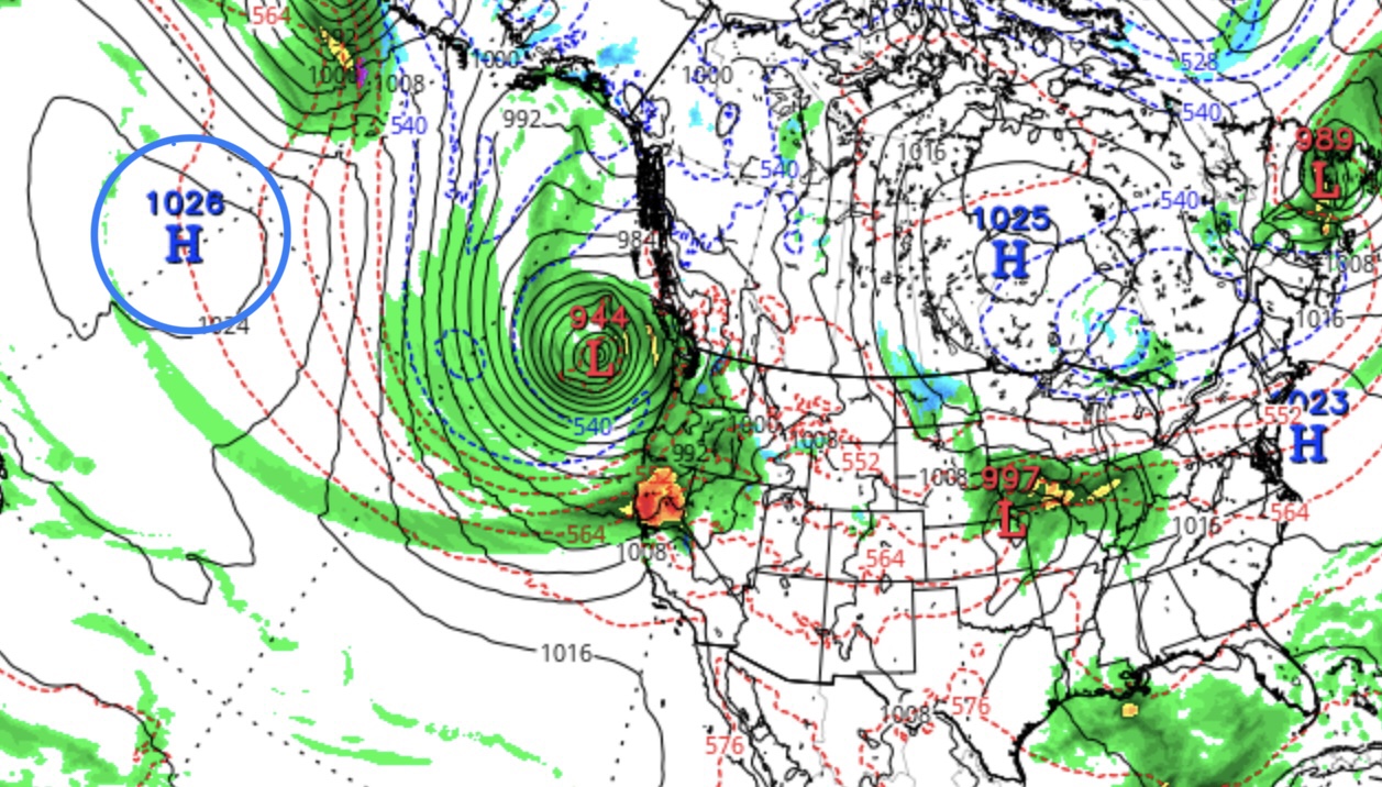
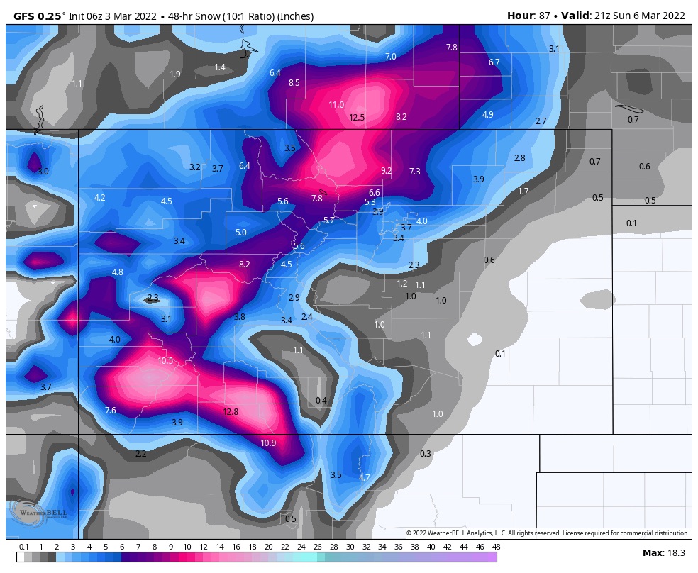
The atmospheric river (AR)event that hit Seattle slides down the coast tonight and moves into Tahoe. There will be minor totals due to warm conditions, but the higher elevations will pick up the most snow, as snow levels will be between 6-7ooo ft. Expect 3-6 at the mountain passes. Here is the MSLP from tropical tidbits showing the AR. Watch how it lights up yellow, I love that.
We are in the 3rd cycle and the history of this storm has been impressive. In cycle 1, an AR hit Tahoe and over 3 ft fell. In Cycle 2, The storm system slid down the coast just as it’s doing now, however it was able to tap into offshore moisture. That was the Christmas storm, over 100 inches.
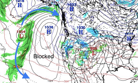
This should be a big storm, but it’s not, because of the position of the high pressure. We are blocked from the offshore flow. The moisture has to go around the block. The storm is still there and on time. We will still get a nice refresh. Perhaps Cycle 4 we will be more like cycles 1 and 2.
I have mentioned this on Brian Allegretto‘s Tahoe OpenSnow blog, if we have cold conditions and the high pressure off the coast is in the proper position, the storm returns April 20. Let’s hope that hits!

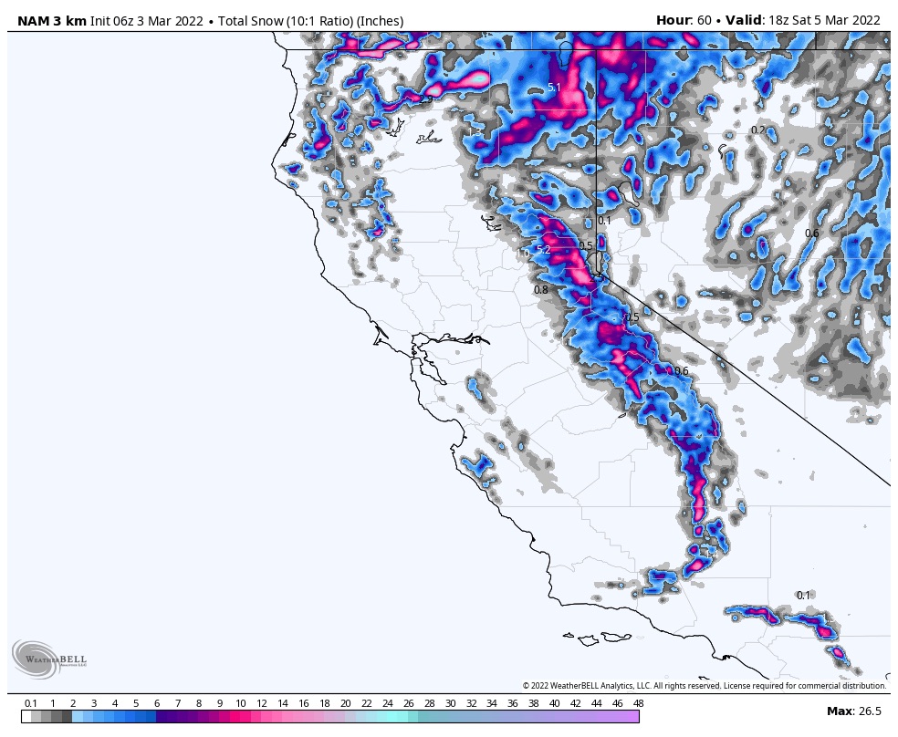
So back to the storm, Friday the system kicks into gear with falling snow levels throughout the day. A cold front arrives after the lifts close and with the bulk of the energy. Areas along the crest are favored with this setup. I am expecting 4-8 for Dodge Ridge and Kirkwood. 3-5 for Donner Ski Ranch and Palisades.
 Forecast
Tahoe
 See above for forecast
Utah
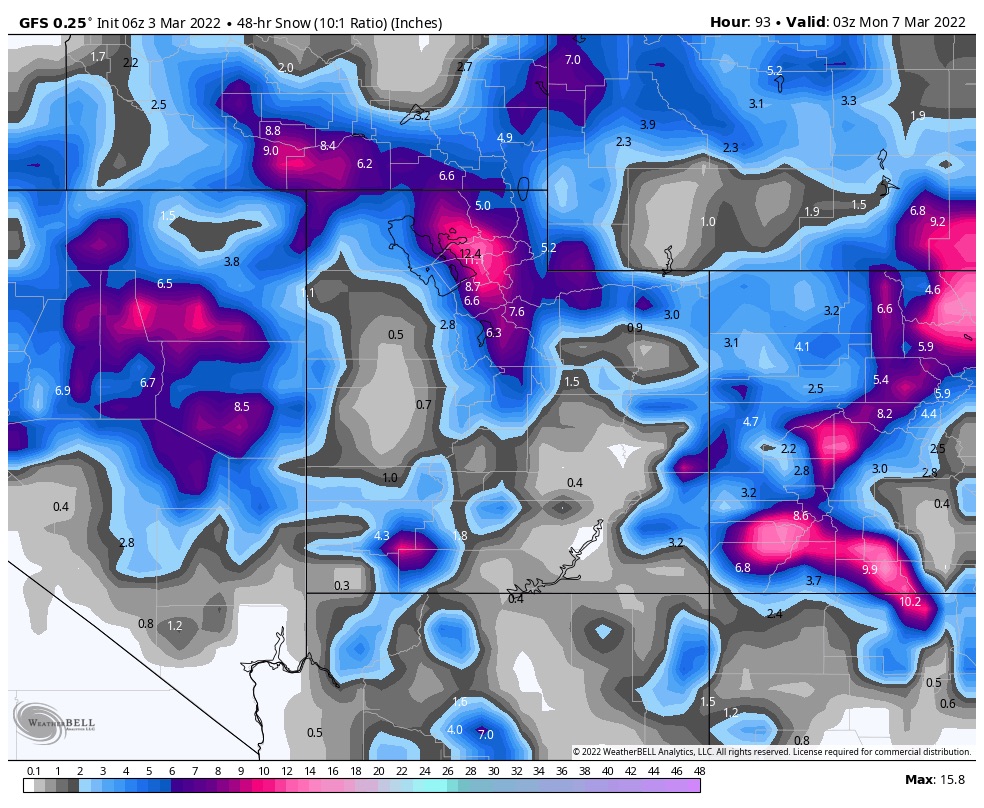
The system moves in Friday morning before lunch. Similar to the Tahoe setup, the main energy follows with the second wave that will pass through Saturday. I am expecting light totals through Saturday, 3-5, then after the lifts close, we are looking at 5-10 overnight.
Powder day Sunday for Alta, Snowbird and Brighton with snow continuing throughout the day with another 3-6. Temperatures will be in the low 30’s Friday lowering to the teens on Saturday night with moderate winds 12-18 mph. Wind chills will be cold so dress warm Sunday.
Colorado
It will be warm Friday night as the first wave approaches from the southwest, with highs in the mid 40’s during the day. Temps cool off quickly though, into the low 20’s overnight. I am expecting 1-3 for most mountains with 2-4 for the southern San Juan’s.
Saturday
Snow showers on Saturday throughout the day with heavy snow at times, windy with gusts in the mid 20’s. Temperatures will fall in the afternoon with overnight lows in the teens, so better snow conditions for Sunday.
I am expecting 5-10 for the San Juan mountains Telluride, Silverton, and Wolf. The central, I-70 and northern mountains we are looking at 3-5 range. I will keep an eye on the model runs so we can dial in the totals better.
Sunday
Snow continues Sunday with similar totals as above, with the southern ranges doing the best. Temperatures in the mid 20’s. The bulk of the system moves out Sunday night.
Next Storm
The next pattern storm is a clipper system that hits the PNW on Tuesday, Utah and Colorado Thursday. It is right on time and is one of our Spring Break storms. We will go into further detail tomorrow.
