Summary
Nice refresh for Tahoe’s Kirkwood, Palisades, Heavenly and a few other spots. Sugar Bowl and Kirkwood both had 5 on their snow-stake cams. We are in the Northern Pattern until the second week in April so the strength of the storms are low. There will be strong storms beginning around the 2nd week, the question is will we have cold air for snow?
Forecast
Utah
 Today, snow with base level high temps in the upper 30’s with moderate winds 10-15 mph. Alta and Snowbird snow accumulations in the 3-6 range today. Brighton 2-4, and Brian Head 1-3.
Wednesday will be a bluebird day and the next wave, a clipper system swings by Wednesday night.
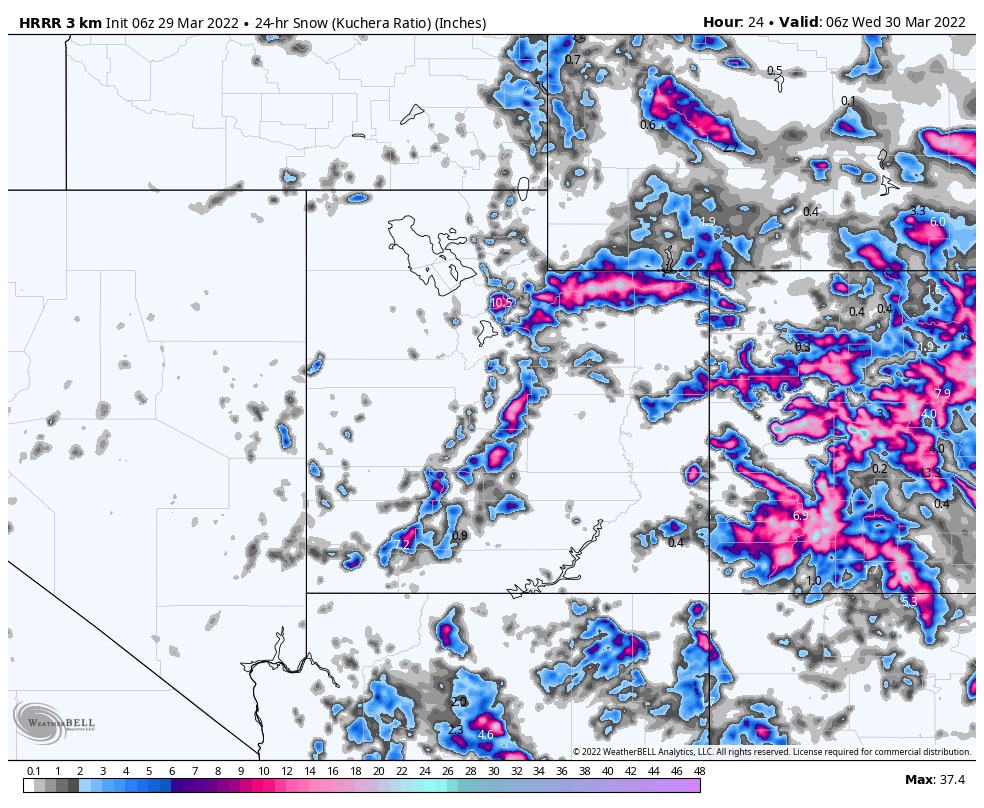
Colorado
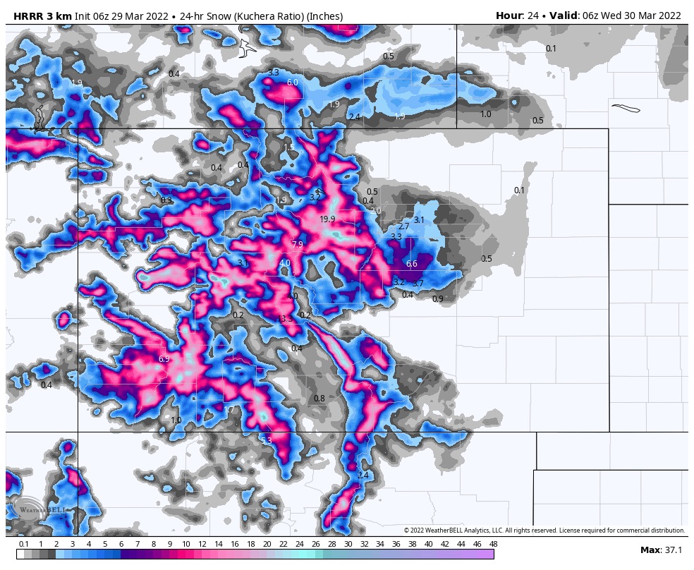 Norhtern resorts and I 70 will see 4-8 today with an additional 1-3 on Wednesday. Wednesday will be the best day to ski and ride with lower temperatures. It will be windy each day with gusts in the mid 20’s.
East resorts Powderhorn and Sunlight, in the 4-8 range today with the snow ending tonight around midnight.
Southern resorts are in the bullseye for this wave, with higher snow totals. Silverton and Telluride are in the 4-8 range today with 3-6 tomorrow with heavier totals at higher elevations.
The next wave is a fast-moving clipper system that will come through on Friday.
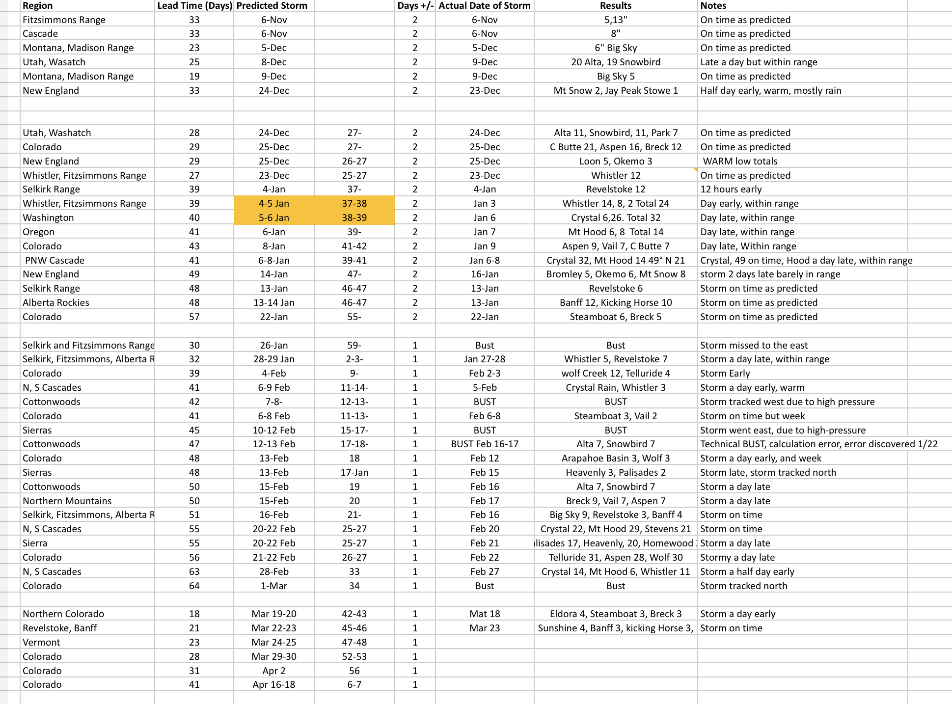
Here is our score sheet for this season. Thanks for reading the blog! Mike