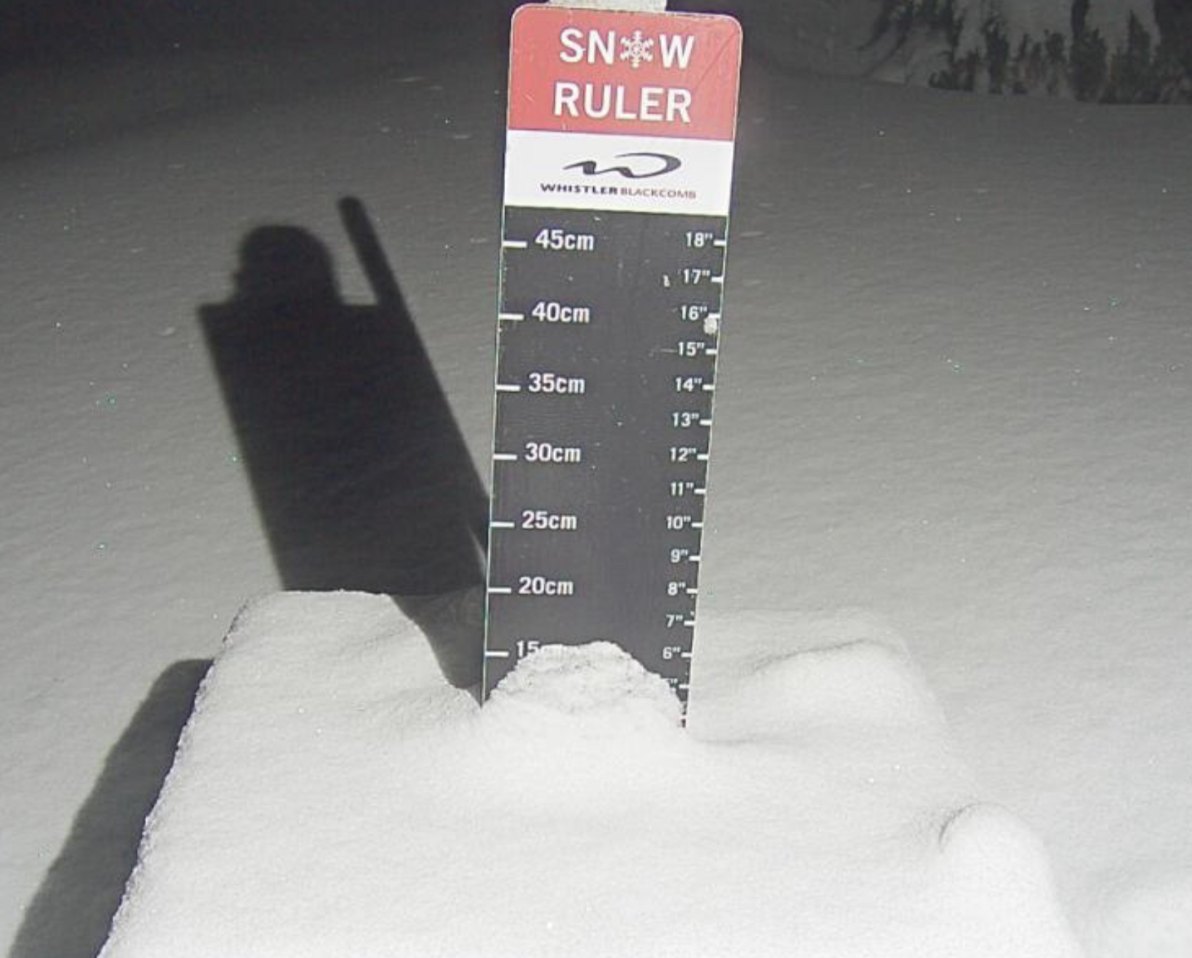
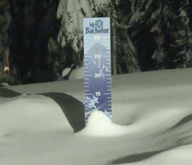
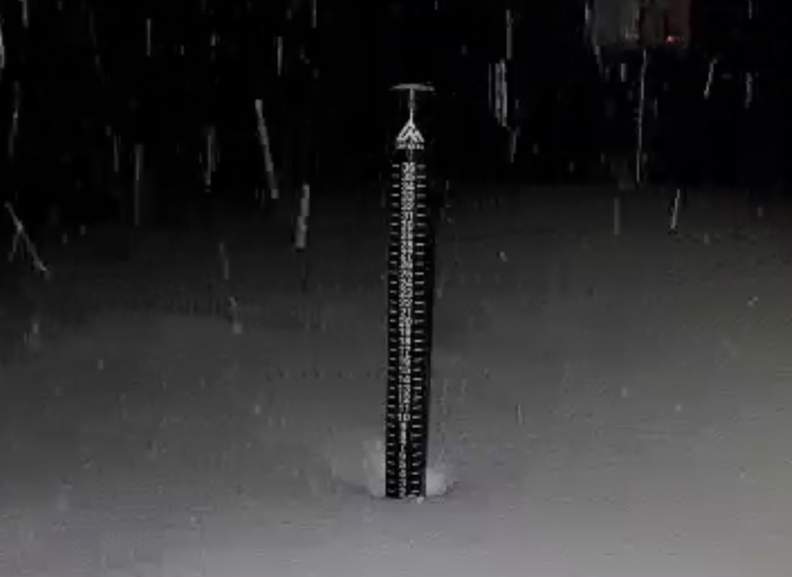
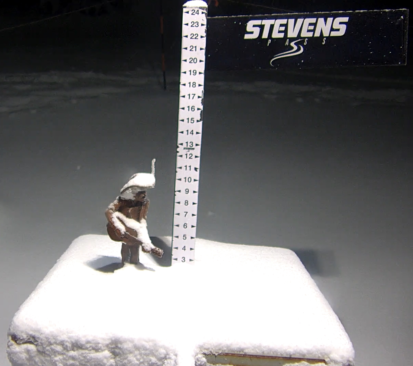
Snow Stake Cams
Forecast Summary
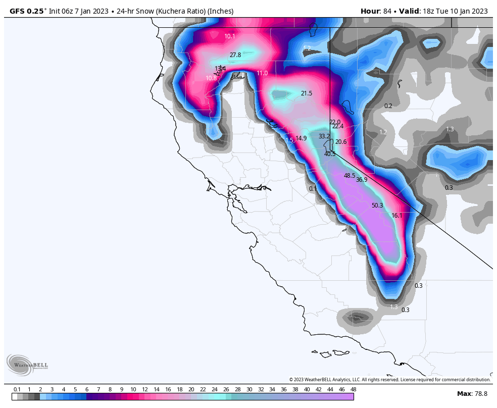
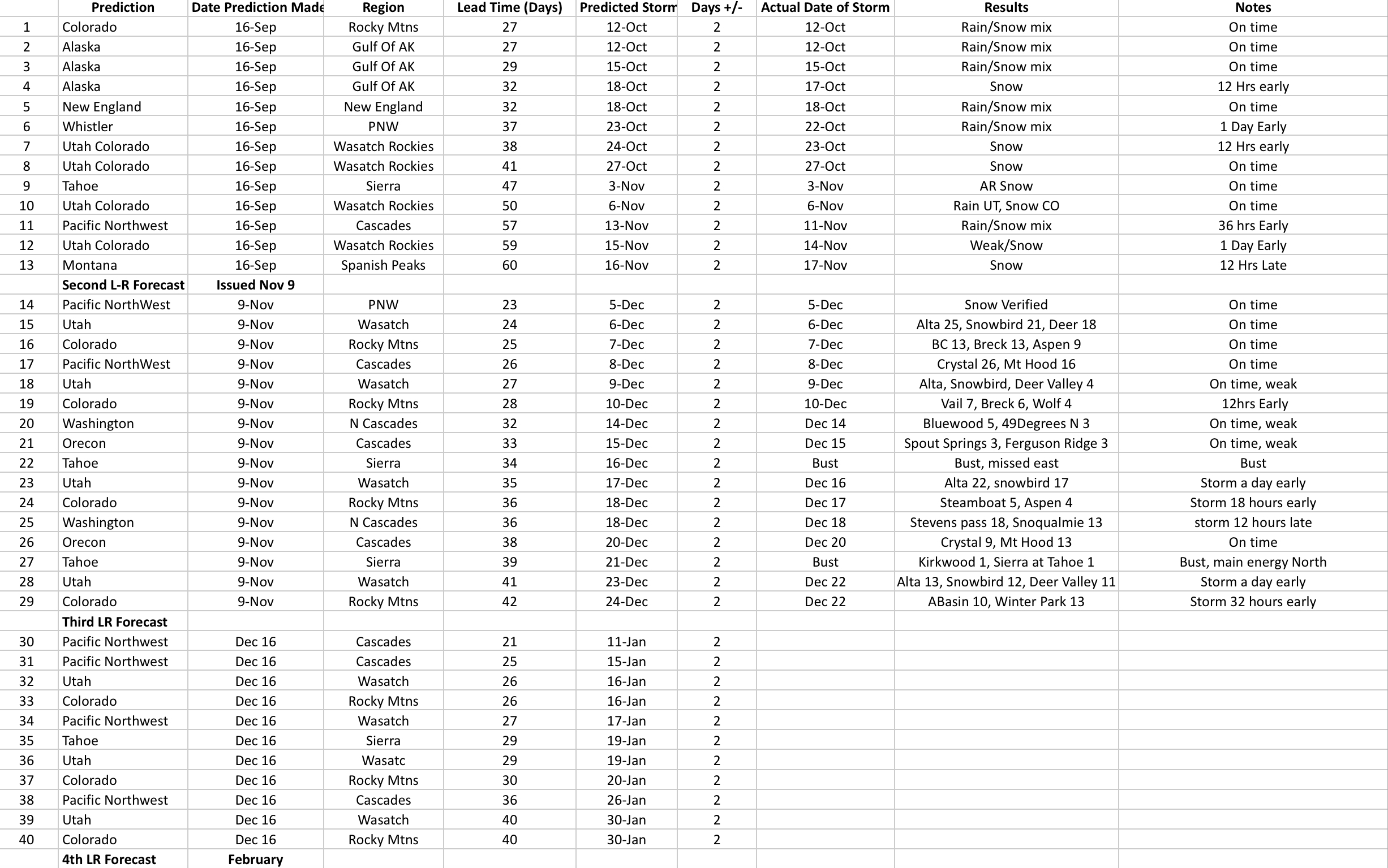
Short and sweet this morning, as I will update later today. Check out the predictions from the drop-down menu. Long range forecast predictions out through mid-March.
Forecast
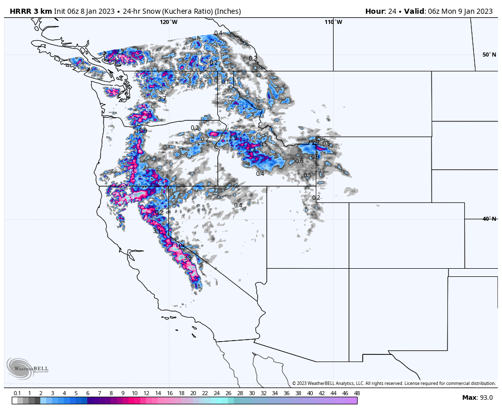
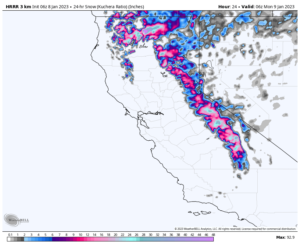
Lake Tahoe
Storm 1, 1-2 feet, Storm 2, Monday 3-5 feet
Today
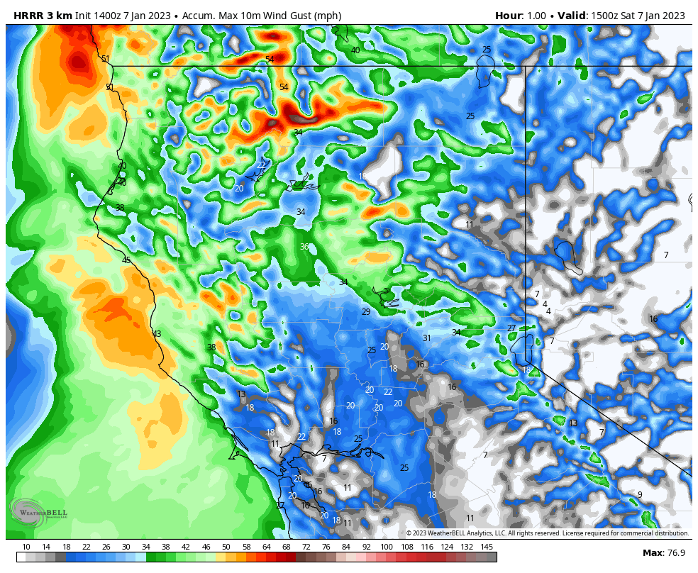
Click for Wind Animation
The snow continues and is out of the area between noon and 2pm. Additional snowfall amounts in the 4-8 range for the West (Homewood, Dodge Ridge) and the Crest (Sugar Bowl, Palisades, Kirkwood and Sierra). For the east side resorts (Heavenly, Mt Rose), expect 2-4.
Tonight
Another wave moves in with generally 2-4 for most resorts. This wave is the precursor to a very large storm that will bring 3-5 feet from Monday thru Tuesday night.
Monday Storm 2
Long Range Forecast Predictions
 Forecasted Areas
Pacific Northwest Cascade Mountains
Crystal Mountain, Mount Hood Meadows, Timberline, 49 Degrees North, Bachelor, Mt Baker,
Lake Tahoe Sierra Mountains
Heavenly, Palisades Tahoe, Kirkwood, Dodge Ridge, Donner Ski Ranch
Utah Wasatch Mountains
Alta, Park City, Deer Valley, Brighton, Snowbird, Brian Head
Colorado Rocky Mountains
Aspen, Aspen Highlands, Snowmass, Vail, Beaver Creek, Winter Park, Keystone, Arapahoe Basin, Breckenridge, Copper Mountain, Powderhorn, Ski Cooper, Telluride, Crested Butte, Silverton, Wolf Creek, Eldora, Loveland
