Pattern Summary
We are just 7 days into the Active West pattern and what a difference between the 2 patterns. Crystal Mountain Washington has had 12, 13, 5, 2, and 5 (37) since the switch. Alta has received 11, 5, 1, 3, 3, and 4 (27). Palisades Tahoe has recorded 3, 15, 4, 8 and 1 (31). Big Sky 3, 11, 2, 3 and 3. Aspen Mountain has had 2, 14, 2 and 2 (20).
There is a northern track storm, beginning tonight, that will bring snow to the Pacific Northwest Cascades, skirting the Sierra, and sliding across Canadian resorts Whistler, Revelstoke and Banff. This Cycle, it is looking similar in size and strength to Cycle 2. Below is a look back at the series of storms that will be occurring next from the Cycle 2. It begins Dec 6th is day 3 of cycle 2, which corresponds to April 13, or last Wednesday. Then the Trifecta looks to return strong around the 21-23rd.
Compare the above video to the present cycle below, over the same timeframe in the cycle. This video begins last Wednesday and is projected throughout the same timeframe, ending this Saturday. Remember, the first half of the video has already happened.
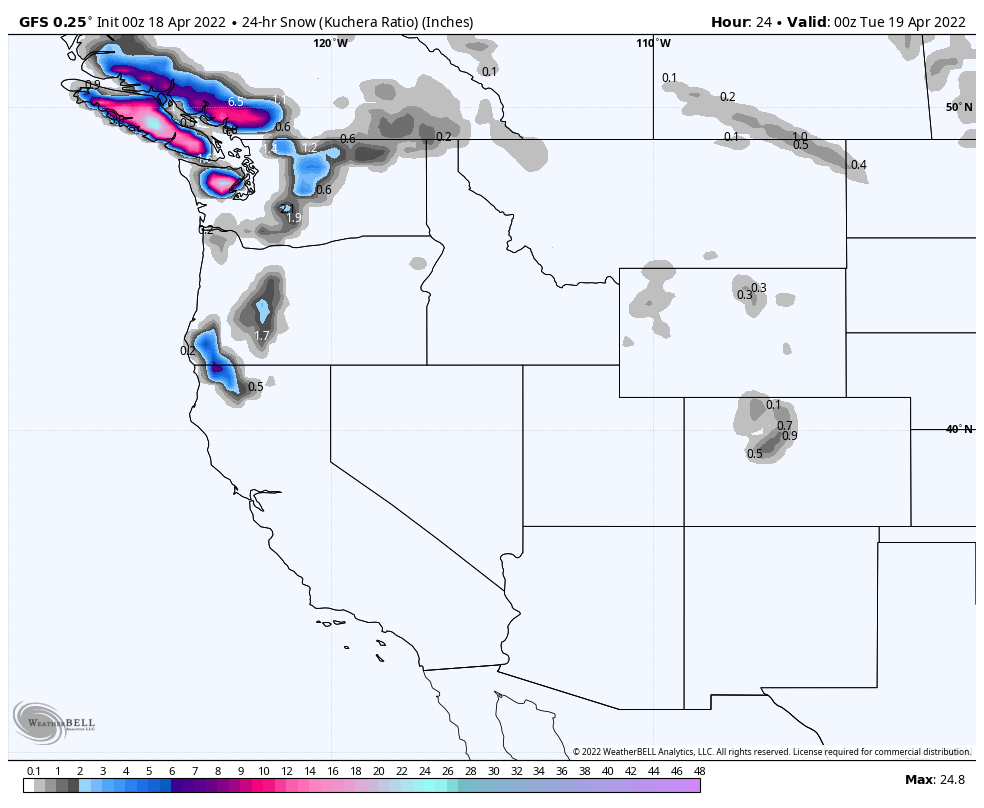
Below is the projected snowfall throughout the same time period. First the GFS model with the European model following. They both have the first storm down but differ on the second storm. I believe the Euro has the second storm path correct, with the trough digging a little deeper into Colorado.

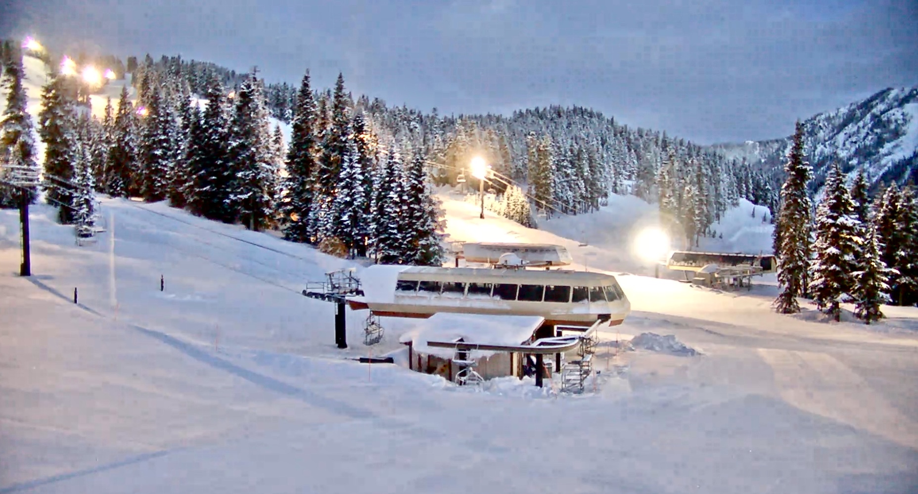
Closing weekend at Kicking Horse resort in east British Columbia, about a 2.5-hour drive from Calgary, on the fabled Powder Highway. There were quite a few resort closures this past weekend, but there is more snow to come.
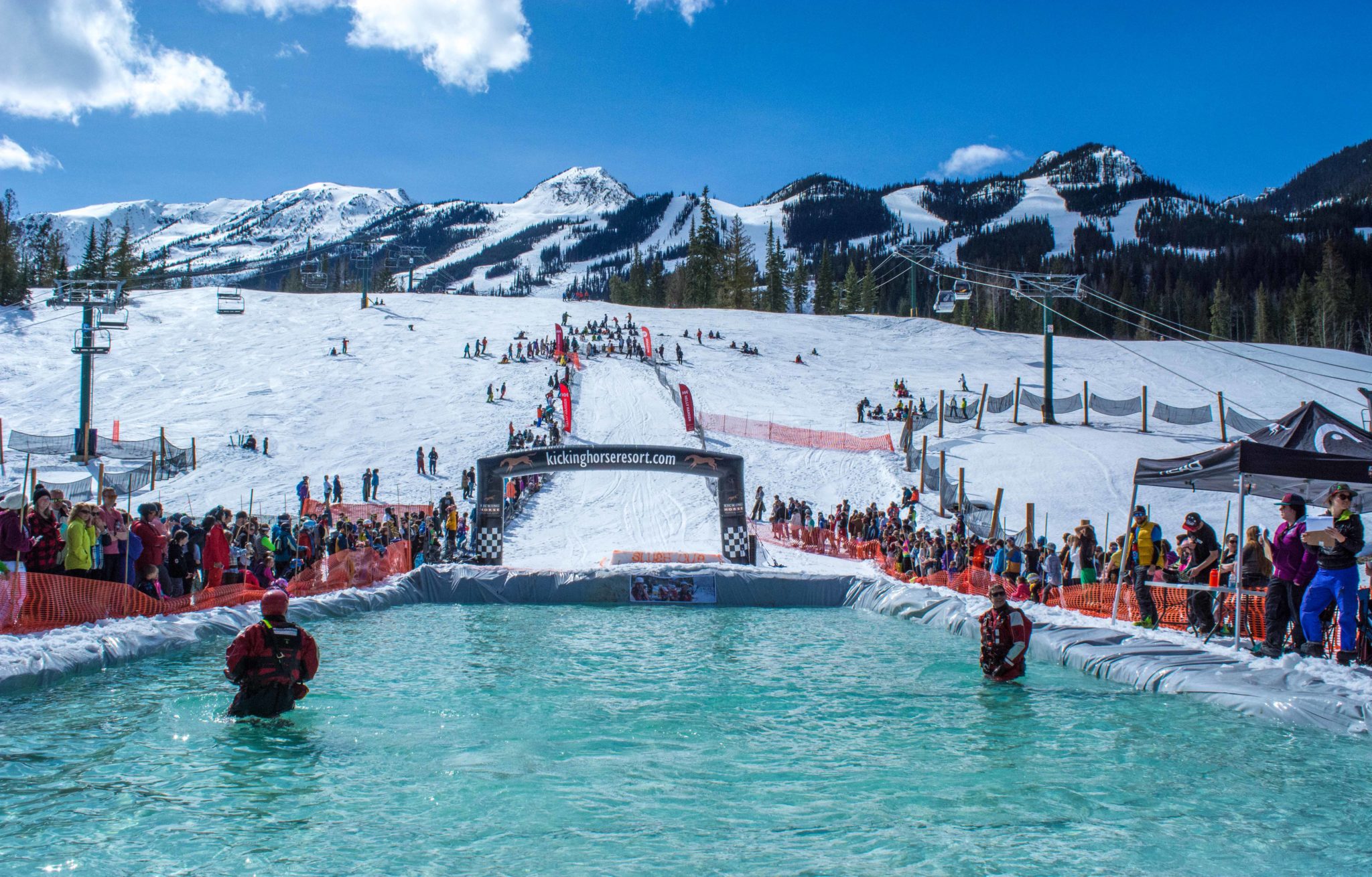
Pond Skimming courtesy Kicking Horse Mountain Resort
Forecast

PNW
The next system arrives this morning and will bring snow to the Cascades, again, around 8 am for the northern Cascades and noon for the southern Cascades. Winds will be from the southeast 10-15 mph, switching to the southwest late today. Snow accumulations between 5-10 today with another 2-4 tonight, for Crystal, with Stevens receiving much less, between 1-2 today with 2-4 tonight.
Southern Cascade snowfall totals for Mt Hood Timberline and Meadows in the 2-4 range today with another 1-3 tonight. Mt Bachelor is in the sweet spot, again, with higher totals–4-8 today with another 2-4 tonight.
Tahoe
More snow for Tahoe, Woohoo! Snow moves in tonight, after midnight with strong winds between 20-30 with 50 mph gusts. There should be 1-3, 2-4 before the lifts start spinning at Kirkwood with 3-5 throughout the day.
This is the primer for the bigger storm that arrives Thursday. Strong indications are that this storm, the Trifecta, will bring up to a couple of feet.
Trifecta is next!
Upcoming Pattern Storms through June
Below are storms in the pattern that are significant and have repeated at least twice. We have a long cycle length of 64 days, that is the second longest length in the last 20 years. The average cycle length, over the last 20 years is 53 days. The shortest was 38 days and the longest was 75. The long cycle length has a possible connection to the following years El Nino Southern Oscillation (ENSO). Sixty four percent of the time, after a significant jump in cycle length, the following year was an El Nino year.
April 21-24 Trifecta 2 waves: Rain cycle 1 for PNW, between 10-18″ for Colorado resorts, over 2 feet for Utah’s Cottonwoods. Cycle 2: Crystal 30, Snowbird 32, and Crested Butte 31. Cycle 3 Mt Hood (Timberline) Alta 7, Vail 7
April 28-29 This storm hit in Cycles 1 and 2 and was 2 days late in Cycle 3. Cycle 2 had rain for the PNW
May 5 (Tahoe AR Oct 25) Epic 100″ week in Cycle 2 with 39″ 1-day total in Cycle 1.However, in Cycle 3 the storm was caught up in the double-barrel high and that pushed the storm up in Canada.
May 7-8 Good storm all three cycles for Colorado and Utah with double-digit totals for all 3 Cycles with Cycle 2 the winner. If you are looking for a powder day in May, this is the one to watch. Arapahoe Basin time?
May 13-14 Storm hit Colorado all 3 cycles and missed to the north of Utah, in Cycle 1
May 17 Missed Utah and Colorado to the north in Cycle 1, but hit in both Cycle 2-3
May 20-21 Last storm of Active West Small system due to the weakening Active West pattern and transition to the Northern Pattern. Hit in all 3 cycles for Utah and Colorado
June 5-6 AR 4th Straight for Seattle?
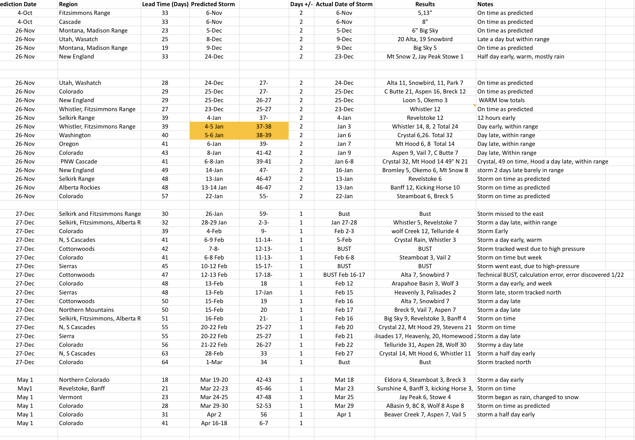
Updated Prediction Chart