Summary
The season is winding down and a lot of resorts have closed. This weekend, however, has a full-on winter storm, as the Trifecta returns. This storm is a great example of the repeating weather pattern. It is the first storm identified as the new pattern transitioned from last year’s pattern in August. It was not hard to spot, in fact it was completely different than the storms from the previous year.
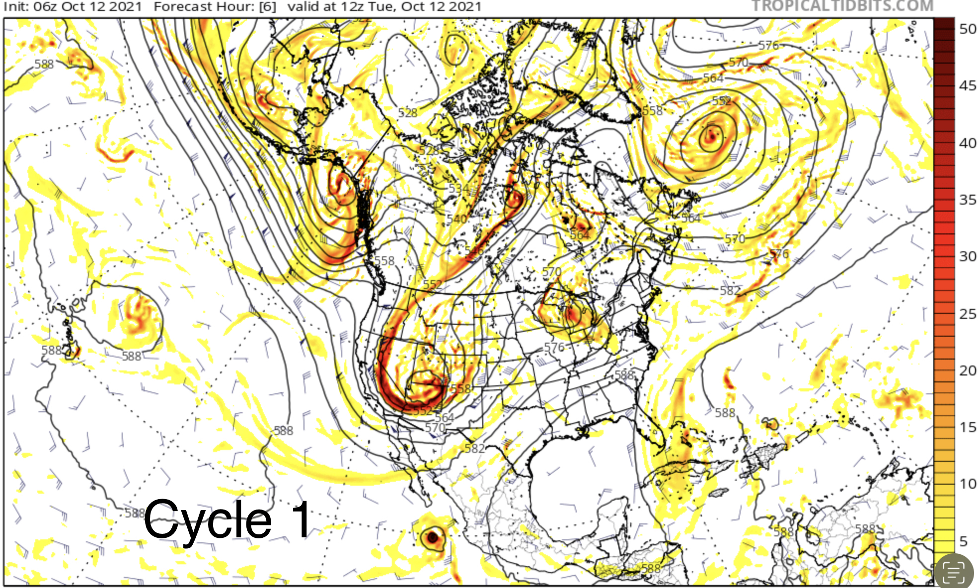
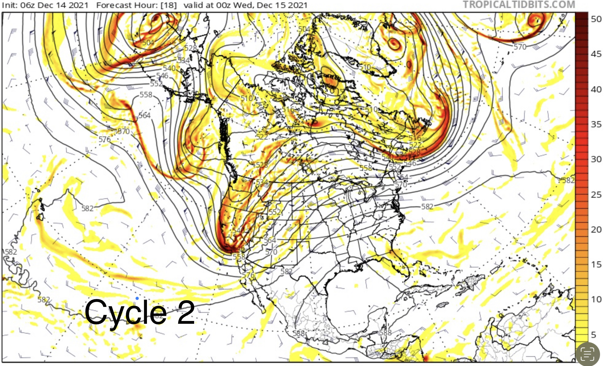
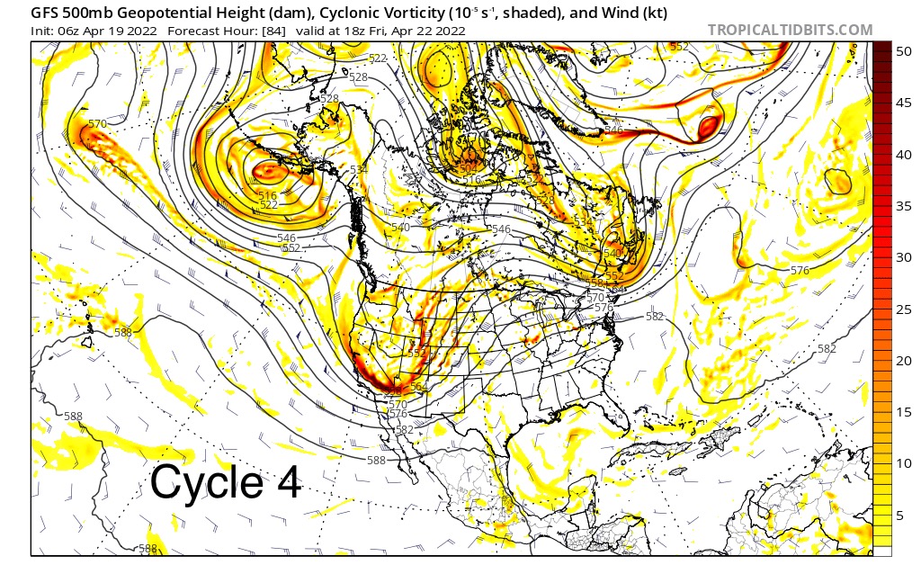
This is what it looked like back in August at the 500 mb level.
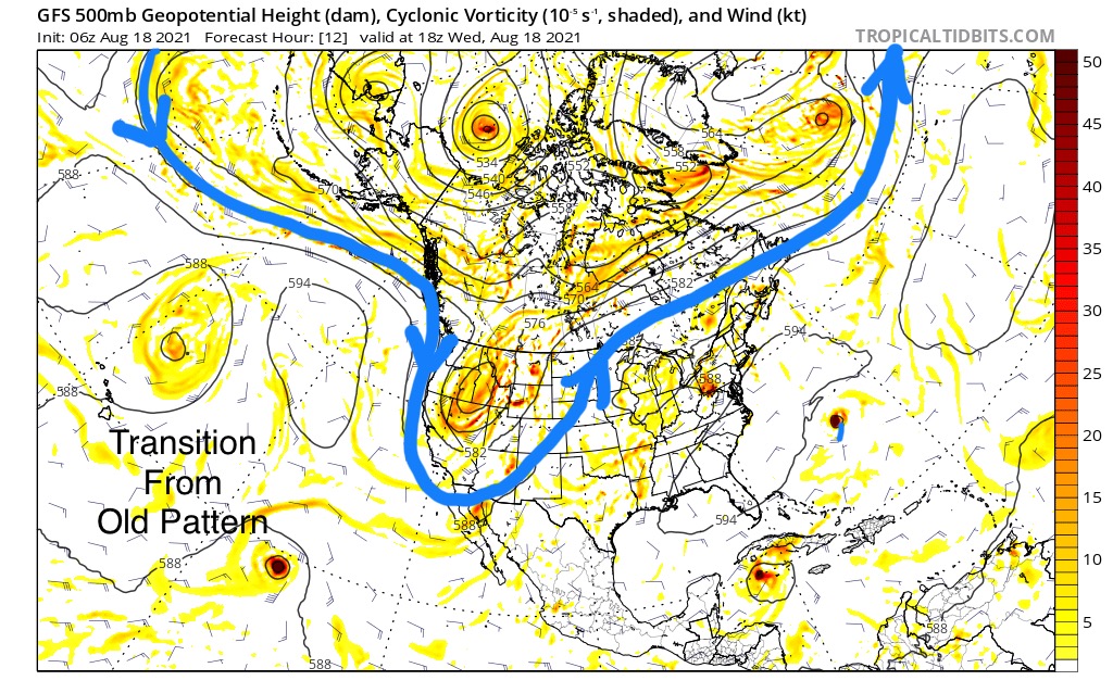
It was a good storm, that had three distinct waves. The first of which, now in cycle 4, has just come through. The chart above is the second wave, the chart below is also the second wave that is coming through on Friday. This storm has matured since its conception in August.

Let’s take a look at all four cycles side by side. You can see how similar they are. There are subtle differences with size and strength, due to teleconnection variances, but essentially, they are the same storm repeating every cycle. That is how we can predict storms over 30 days in advance.

PNW
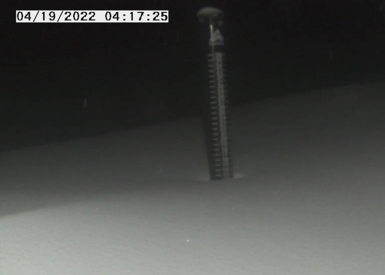
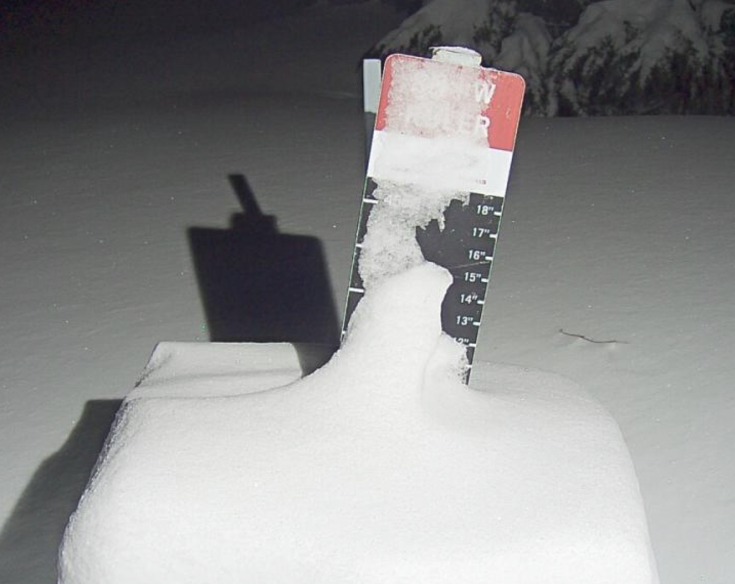
 Today, light snow showers for the Cascades with high temperatures in the low 30’s at base level. Light winds so today is a great day to be on the hill. Expect a few inches today at Crystal Mountain and Mt Hood, with 3-5 today at Mount Bachelor.
Tahoe
Resorts open Kirkwood, Heavenly and Palisades Tahoe
Tahoe Time continues at Kirkwood, Heavenly and Palisades, but the real fun begins Thursday.
Today, expect 3-5 with strong winds to start the day with over 50 mph gusts, with stronger winds at summit. That will hamper some upper mountain lifts, but winds will calm down in the afternoon, with gusts likely in the 30’s.
Warm temps on Wednesday will likely produce rain and a rain/snow mix–yuck! Don’t forget your goggle scrapers. Wednesday night temps will fall and so will the snow, another 3-6 possible.
Thursday
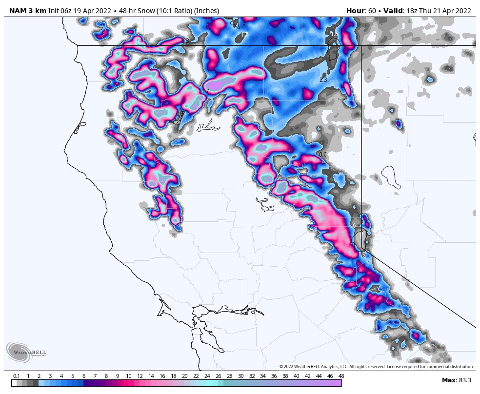
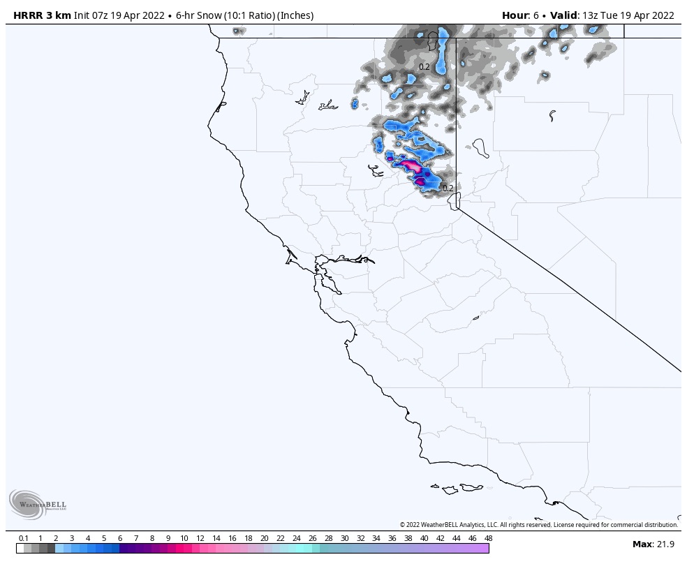
Trifecta time! Heavy snow during the day and night with 1-2 feet by Friday.
Utah
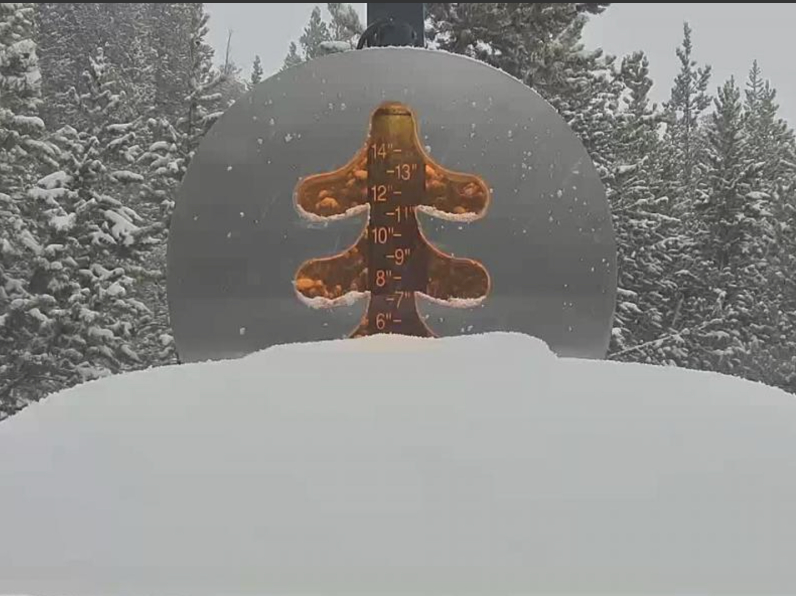
Snow tonight in the cottonwoods. Expect 3 to 5 overnight Wednesday will have bluebird skies with 40° temperatures at the base. Beautiful day, get out early and enjoy before it gets too warm.
Friday
The trifecta storm arrives early Friday. Expect heavy snow throughout the day.
Colorado
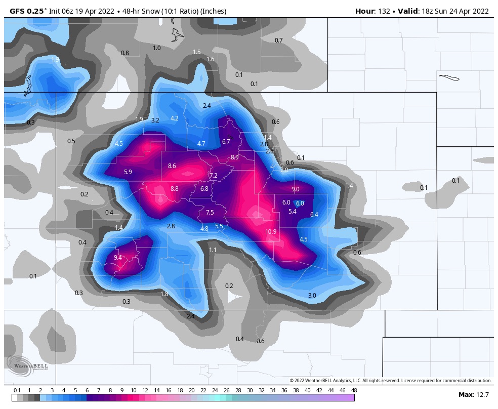
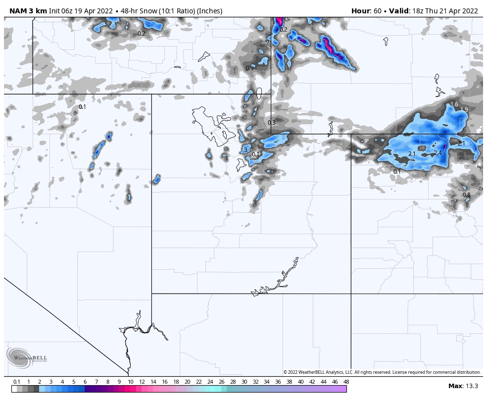
Trifecta arrives Friday night with falling temps. More to come on this one as we get a little closer.
Thank You!
The season is winding down and I want to thank all of you who have been following along since this year and last. This is a fun job bringing you this new technology. I have received so many comments and emails throughout the year from other passionate people that love the sport. So, I say thank you!
If you are new to the blog thanks for reading and if you have any questions please feel free to send me an email to Mike@FutureSnow.CO
Below are the upcoming storms using the cycling pattern, followed by our official predictions chart. We are around 90% accurate over 30 days out, on average.
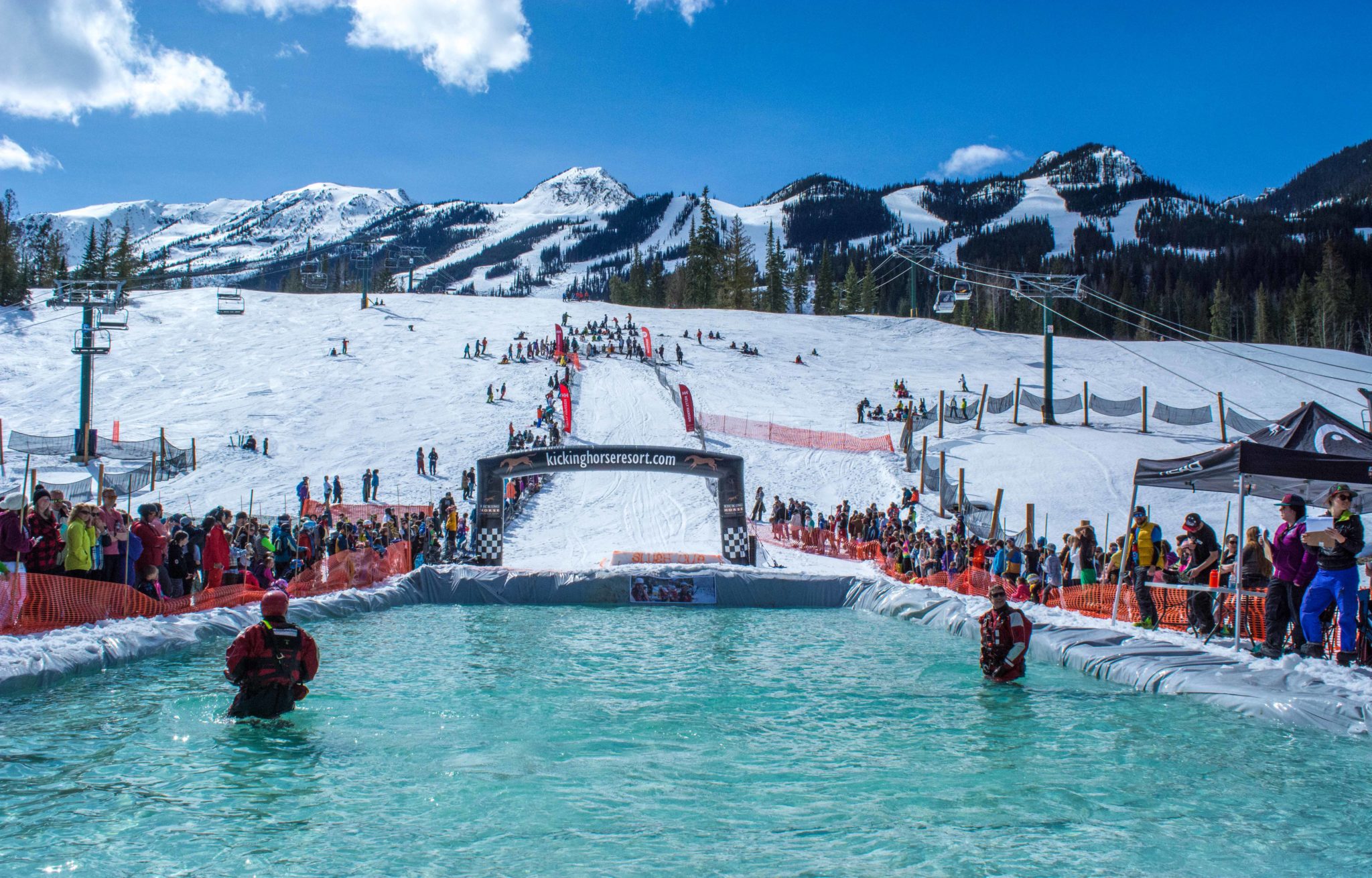
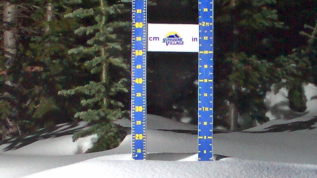
Pond Skimming courtesy Kicking Horse Mountain Resort
Upcoming Pattern Storms through June
Below are storms in the pattern that are significant and have repeated at least twice. We have a long cycle length of 64 days, that is the second longest length in the last 20 years. The average cycle length, over the last 20 years is 53 days. The shortest was 38 days and the longest was 75. The long cycle length has a possible connection to the following years El Nino Southern Oscillation (ENSO). Sixty four percent of the time, after a significant jump in cycle length, the following year was an El Nino year.
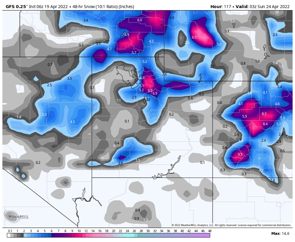
April 21-24 Trifecta 2 waves: Rain cycle 1 for PNW, between 10-18″ for Colorado resorts, over 2 feet for Utah’s Cottonwoods. Cycle 2: Crystal 30, Snowbird 32, and Crested Butte 31. Cycle 3 Mt Hood (Timberline) Alta 7, Vail 7
April 28-29 This storm hit in Cycles 1 and 2 and was 2 days late in Cycle 3. Cycle 2 had rain for the PNW
May 5 (Tahoe AR Oct 25) Epic 100″ week in Cycle 2 with 39″ 1-day total in Cycle 1.However, in Cycle 3 the storm was caught up in the double-barrel high and that pushed the storm up in Canada.
May 7-8 Good storm all three cycles for Colorado and Utah with double-digit totals for all 3 Cycles with Cycle 2 the winner. If you are looking for a powder day in May, this is the one to watch. Arapahoe Basin time?
May 13-14 Storm hit Colorado all 3 cycles and missed to the north of Utah, in Cycle 1
May 17 Missed Utah and Colorado to the north in Cycle 1, but hit in both Cycle 2-3
May 20-21 Last storm of Active West Small system due to the weakening Active West pattern and transition to the Northern Pattern. Hit in all 3 cycles for Utah and Colorado
June 5-6 AR 4th Straight for Seattle?
Updated Prediction Chart