Forecast Summary
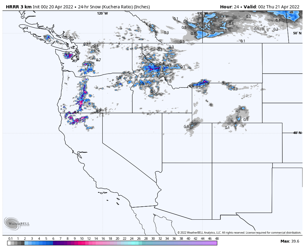
Snow begins this morning in the Southern Cascade mountains of Mt Hood and Mt Bachelor, as the center of the storm makes landfall around the California/Oregon border. It expands to the north and south, as the outer bands eject, as the storm rotates. Snow moves into the Tahoe basin, as early as 5 pm, with Winter Storm Warnings beginning at the same time–so you know it’s good!
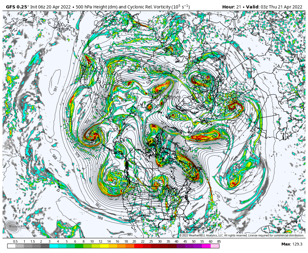
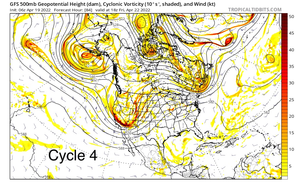
It’s best to show the size and scope of this storm at the 500 millibar level, with vorticity. Watch the storm move on shore and across the CONUS. It is about a third of size of the US.
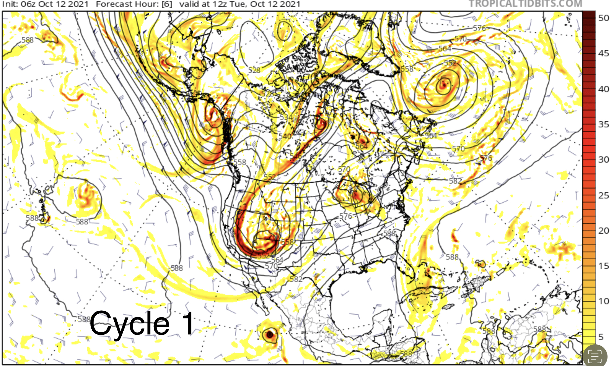
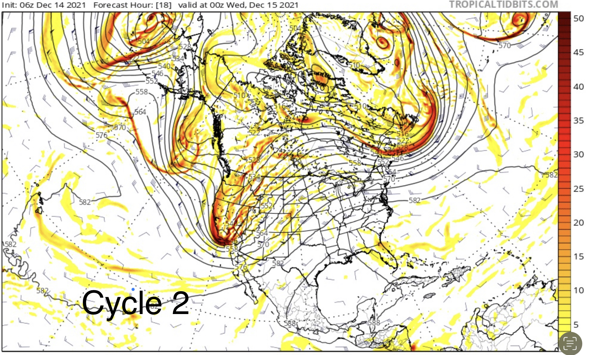
We first noticed this storm back in August, as the new cycling pattern was setting up and named it the Trifecta, as it has 3 distinct waves. This is the fourth time it has come through. Below are 4 charts showing each time they have come through. As you can see, they look very similar. Click to expand.

PNW Stoke
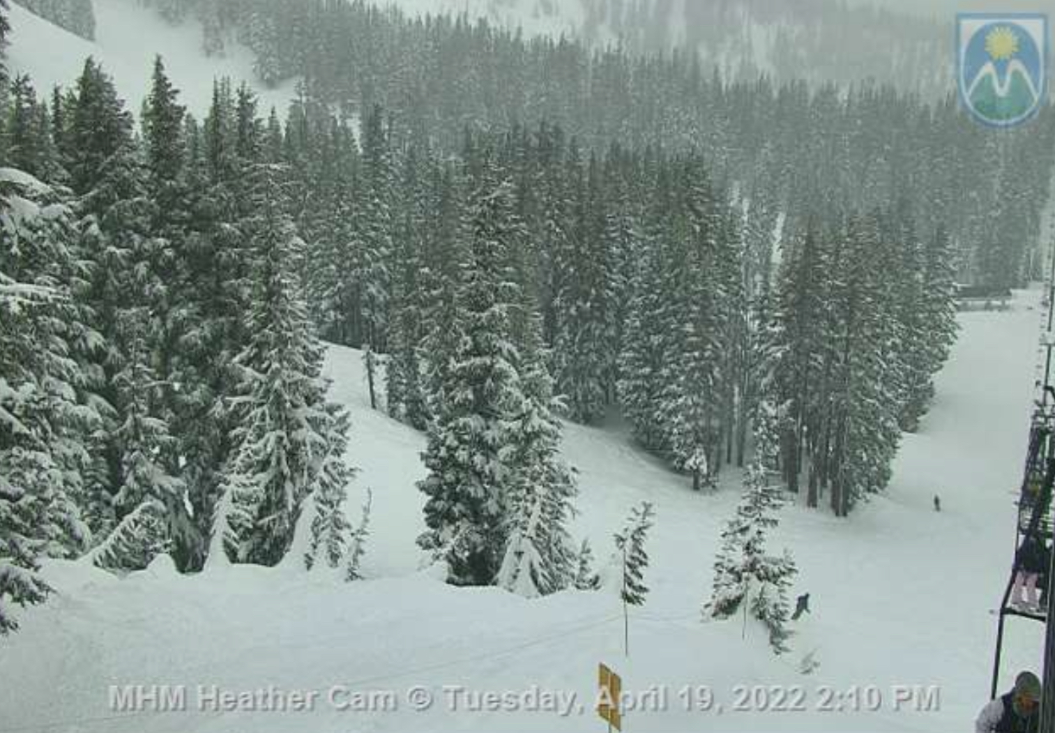
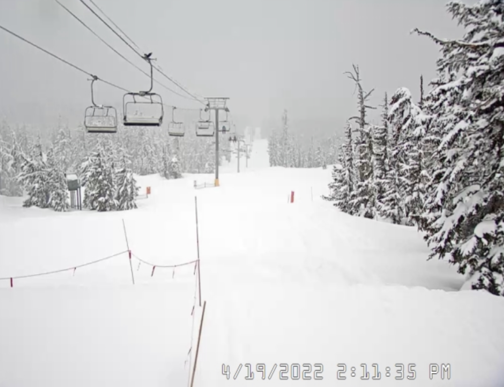
Timberline Mt Hood
Forecast
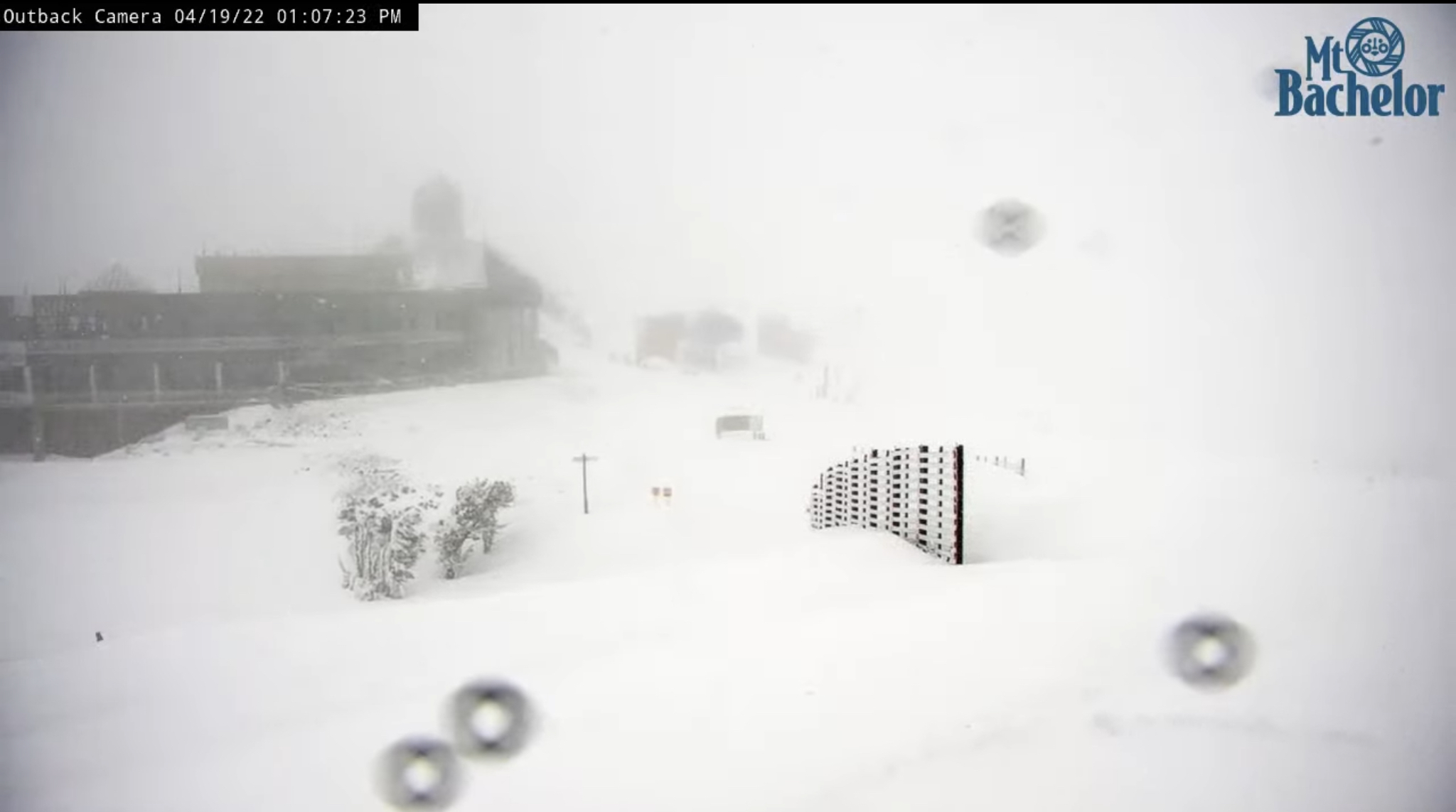
PNW
Snow begins this morning for the northern Cascades and this afternoon for the southern Cascades. Snow levels will be between 3-4000 ft with moderate winds 10-15 and 20 mph gusts. Expect 3-5 inches today for Mt Hood Timberline/Meadows and Mt Bachelor with about the same for Crystal Mountain Washington. Stevens Pass is in a bad spot for this storm, I expect 0-3 for that area.
Tonight
Another 1-3 for most areas with low temperatures in the mid 20’s.
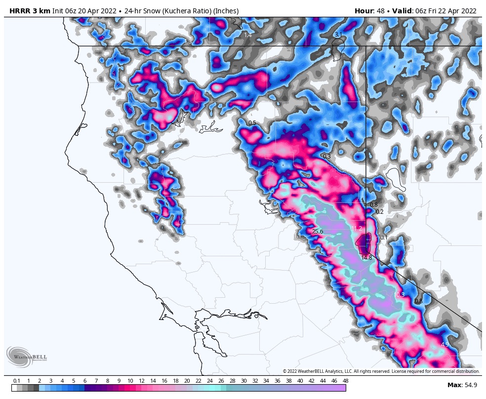
Tahoe 2-3 Feet Likely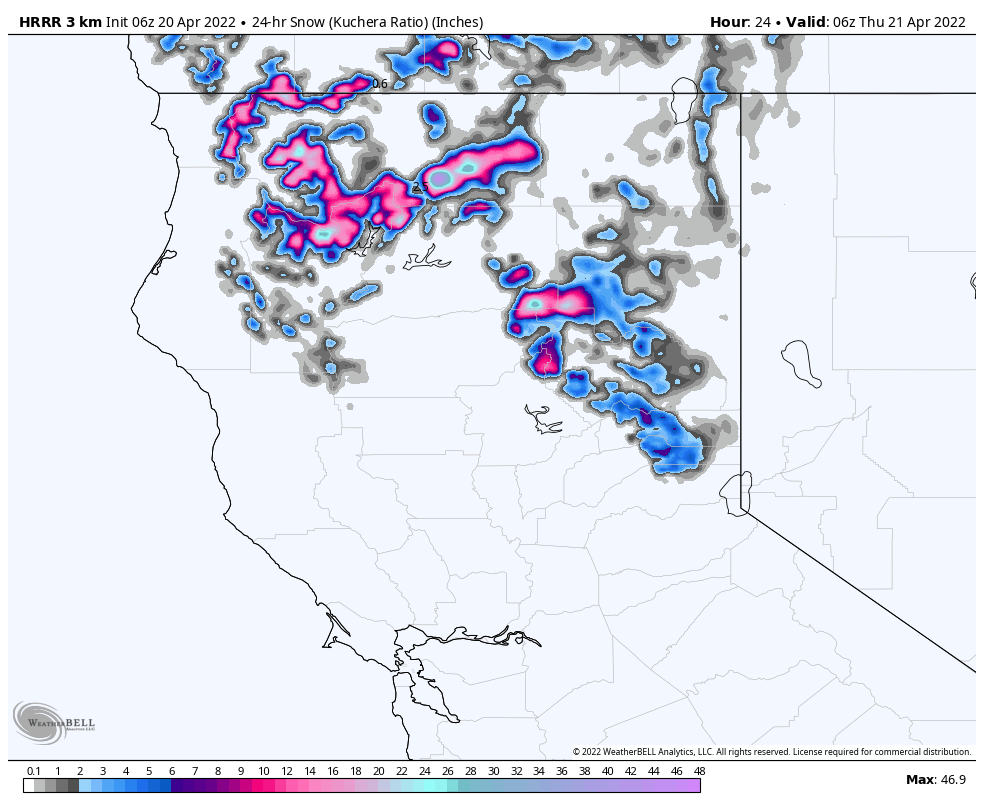
Tonight
Snow begins, in earnest, after 9 pm. Snowfall amounts will be between 8-12 inches tonight before the lifts start spinning on tomorrow. Thursday will have heavy snow throughout the day with another 10-16 possible. Temperatures will be around freezing at lake level and mid 20’s up top.
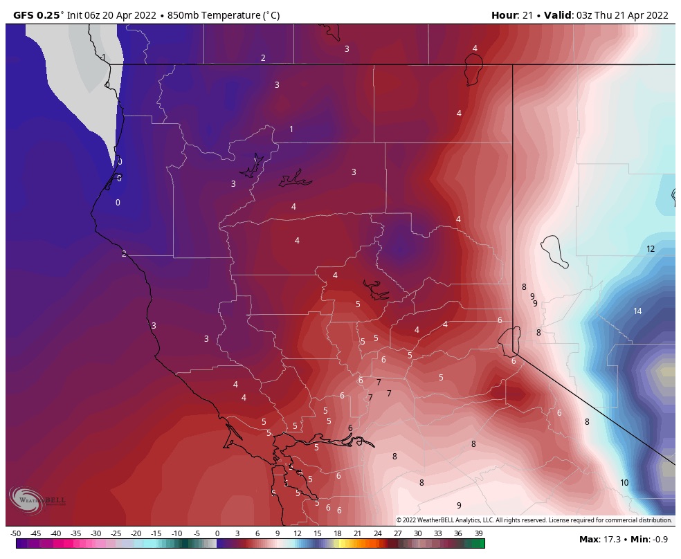
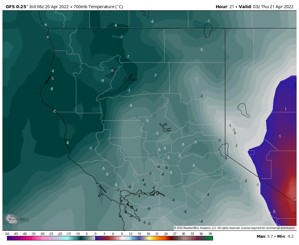
Below are temperatures at 850 mb and 700 mb levels. 850 is roughly 4800ft and 700 is around 10,000. They fluctuate because they are tied to the current pressure. They can move up and down in feet accordingly–I won’t bore you with the formula, but that is how we figure snow levels.
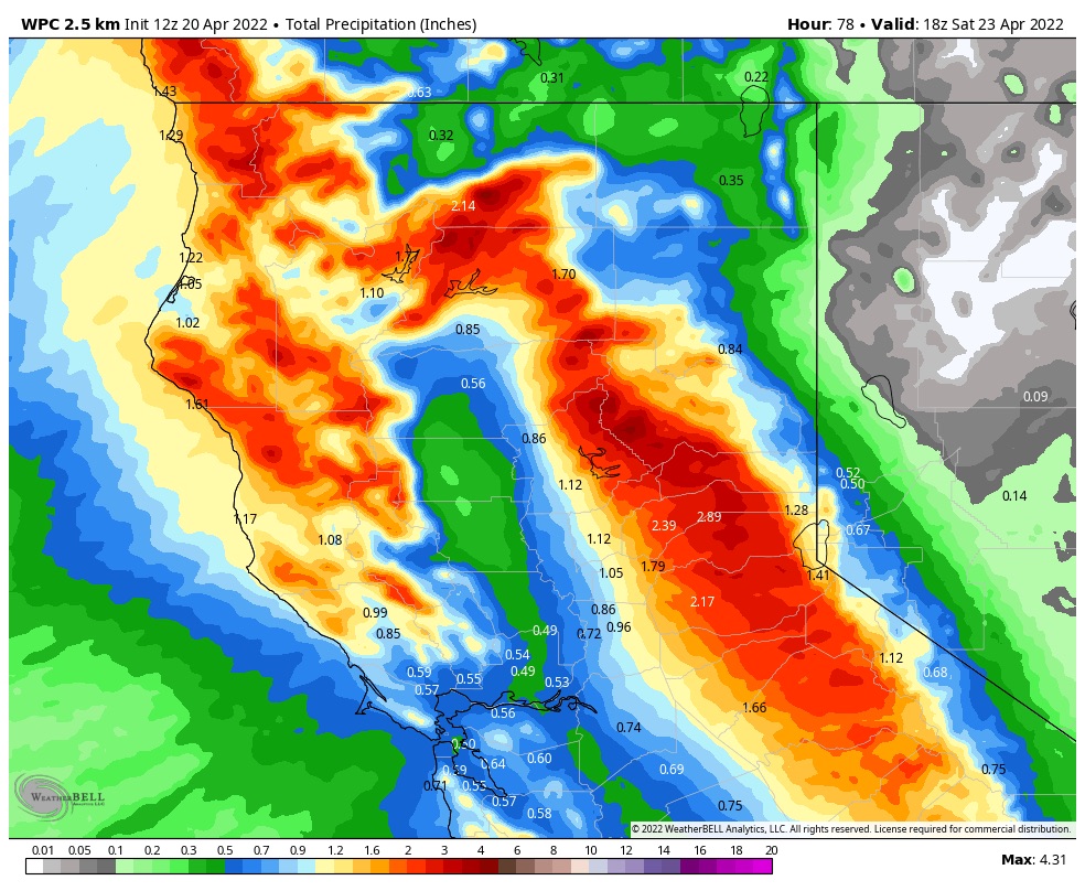
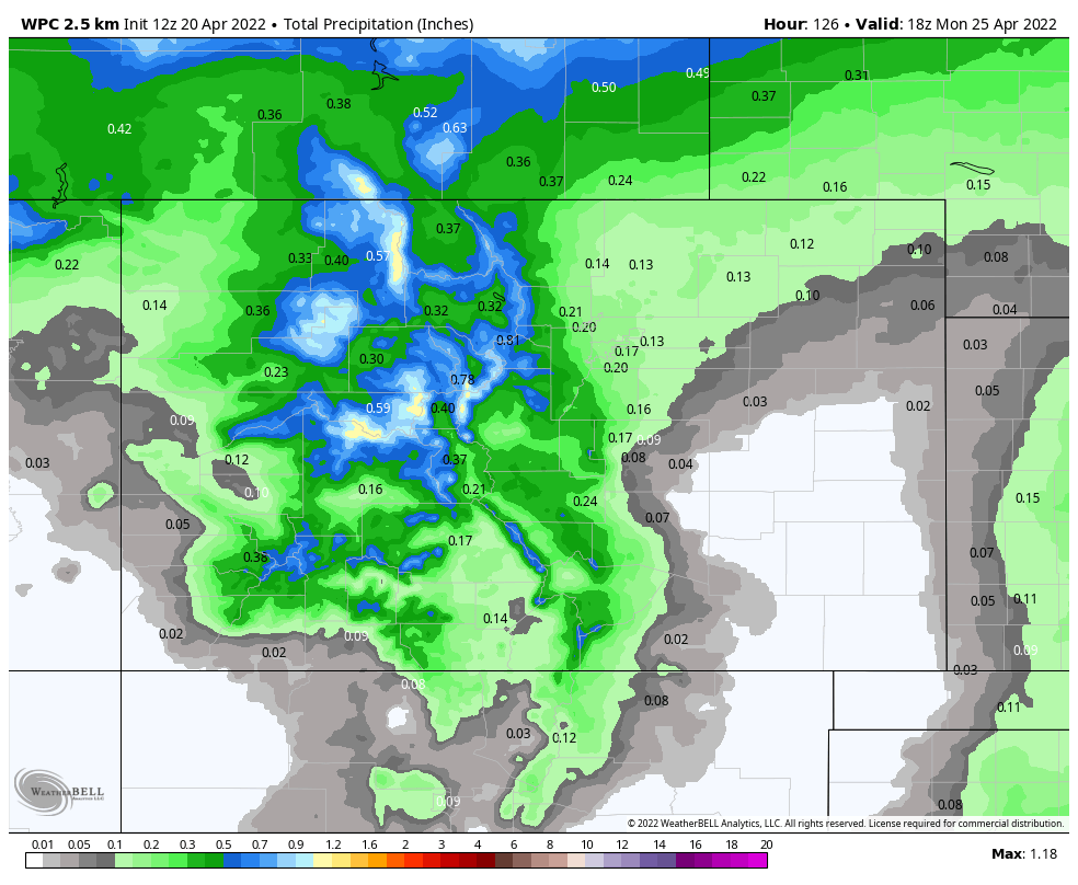
Thursday night will have another 8-12 with the storm exiting Friday morning. Below are a couple of charts displaying the liquid water precipitation expected
Utah
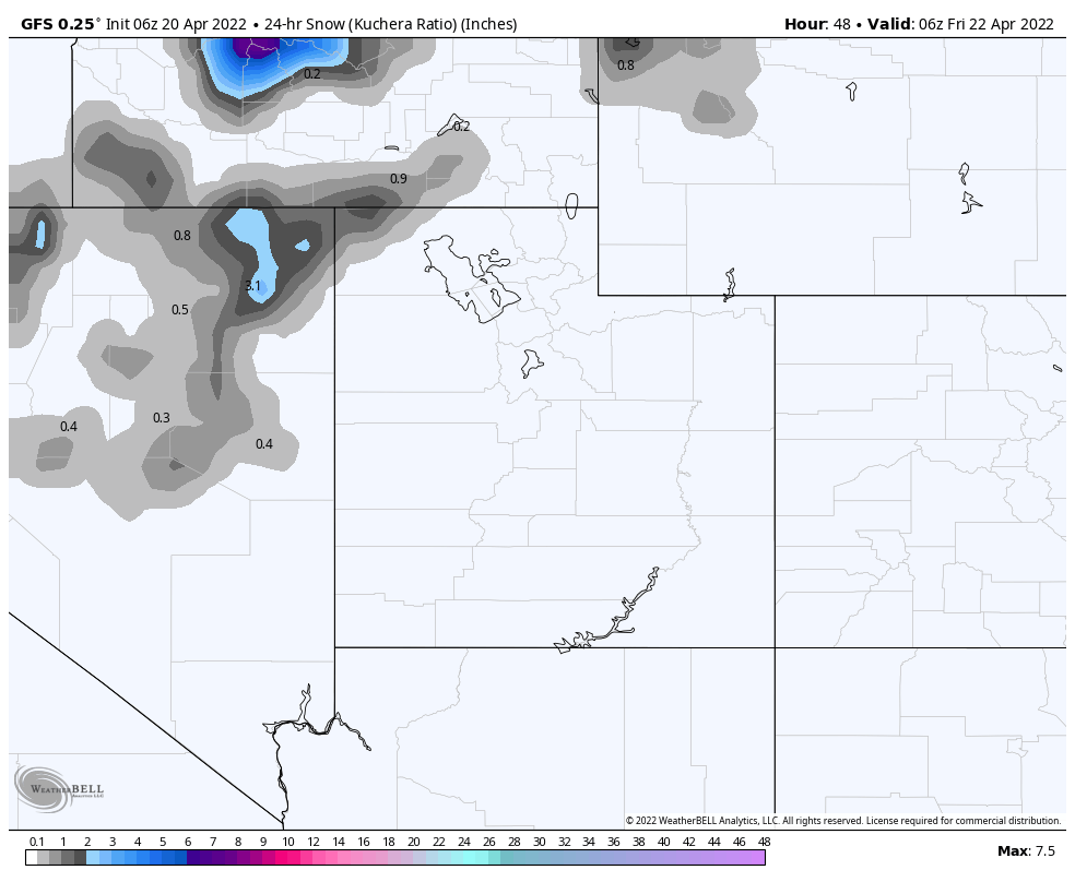
The storm arrives Friday morning. Expect moderate winds between 15-20 with near freezing temperatures at base level. As of now, it is looking like 4-8 during the day, with another 4-8 after the lifts close. Saturday will be the best day to ski/ride with great temps (upper 20’s) and moderate winds and another 2-4.
Colorado
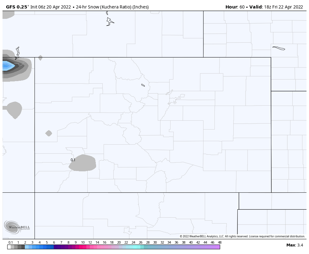
It is a little too early to forecast this storm yet, but looking at the blended models I will say that most mountains will be in the 3-12 range. I will have a better handle on this storm tomorrow. Saturday will be good, Sunday may be even better. Below is the water equivalent total. More to come.
Thank You!
The season is winding down and I want to thank all of you who have been following along since this year and last. This is a fun job bringing you this new technology. I have received so many comments and emails throughout the year from other passionate people that love the sport. So, I say thank you!
If you are new to the blog thanks for reading and if you have any questions please feel free to send me an email to Mike@FutureSnow.CO
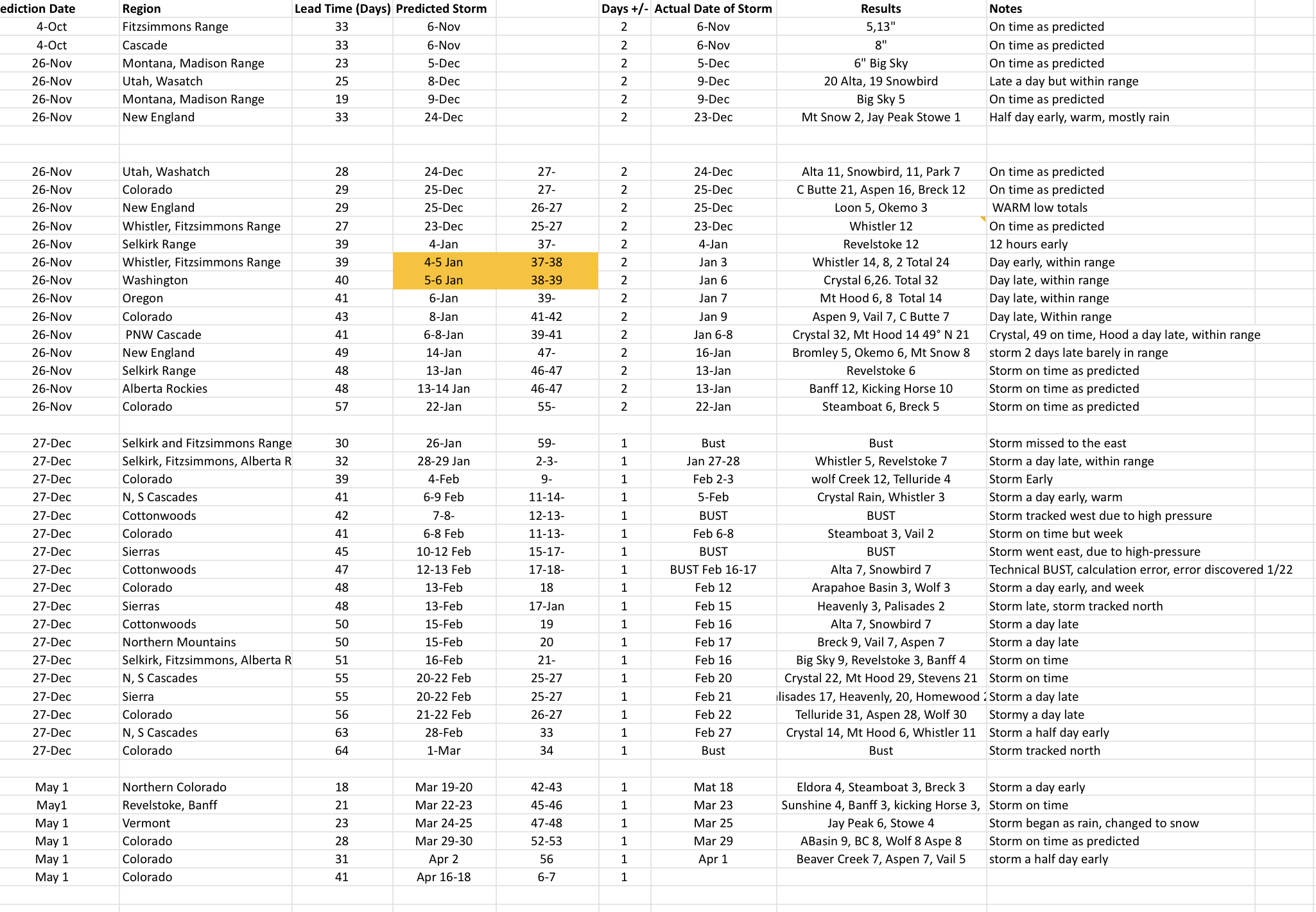
Below are the upcoming storms using the cycling pattern, with a brief history from previous cycles, followed by our official predictions chart. We are around 90% accurate over 30 days out, on average.
Upcoming Pattern Storms through June
Below are storms in the pattern that are significant and have repeated at least twice. We have a long cycle length of 64 days, that is the second longest length in the last 20 years. The average cycle length, over the last 20 years is 53 days. The shortest was 38 days and the longest was 75. The long cycle length has a possible connection to the following years El Nino Southern Oscillation (ENSO). Sixty four percent of the time, after a significant jump in cycle length, the following year was an El Nino year.
April 21-24 Trifecta 2 waves: Rain cycle 1 for PNW, between 10-18″ for Colorado resorts, over 2 feet for Utah’s Cottonwoods. Cycle 2: Crystal 30, Snowbird 32, and Crested Butte 31. Cycle 3 Mt Hood (Timberline) Alta 7, Vail 7
April 28-29 This storm hit in Cycles 1 and 2 and was 2 days late in Cycle 3. Cycle 2 had rain for the PNW
May 5 (Tahoe AR Oct 25) Epic 100″ week in Cycle 2 with 39″ 1-day total in Cycle 1.However, in Cycle 3 the storm was caught up in the double-barrel high and that pushed the storm up in Canada.
May 7-8 Good storm all three cycles for Colorado and Utah with double-digit totals for all 3 Cycles with Cycle 2 the winner. If you are looking for a powder day in May, this is the one to watch. Arapahoe Basin time?
May 13-14 Storm hit Colorado all 3 cycles and missed to the north of Utah, in Cycle 1
May 17 Missed Utah and Colorado to the north in Cycle 1, but hit in both Cycle 2-3
May 20-21 Last storm of Active West Small system due to the weakening Active West pattern and transition to the Northern Pattern. Hit in all 3 cycles for Utah and Colorado
June 5-6 AR 4th Straight for Seattle?
Updated Prediction Chart
 –
–