Summary
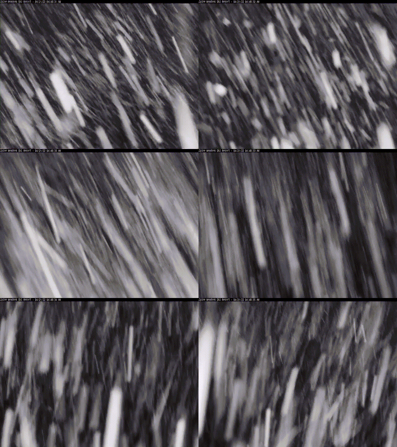
It is full on nuking in Tahoe. The Trifecta basically skipped the Lake in cycle 3 with a measly 6″, at Heavenly, after receiving over a hundred inches in Cycle 2. This time around it is more like Cycle 2. I don’t like to show videos of snow usually, but this heavy snow at Alpine Meadows Tahoe this morning was irresistible–mesmerizing.
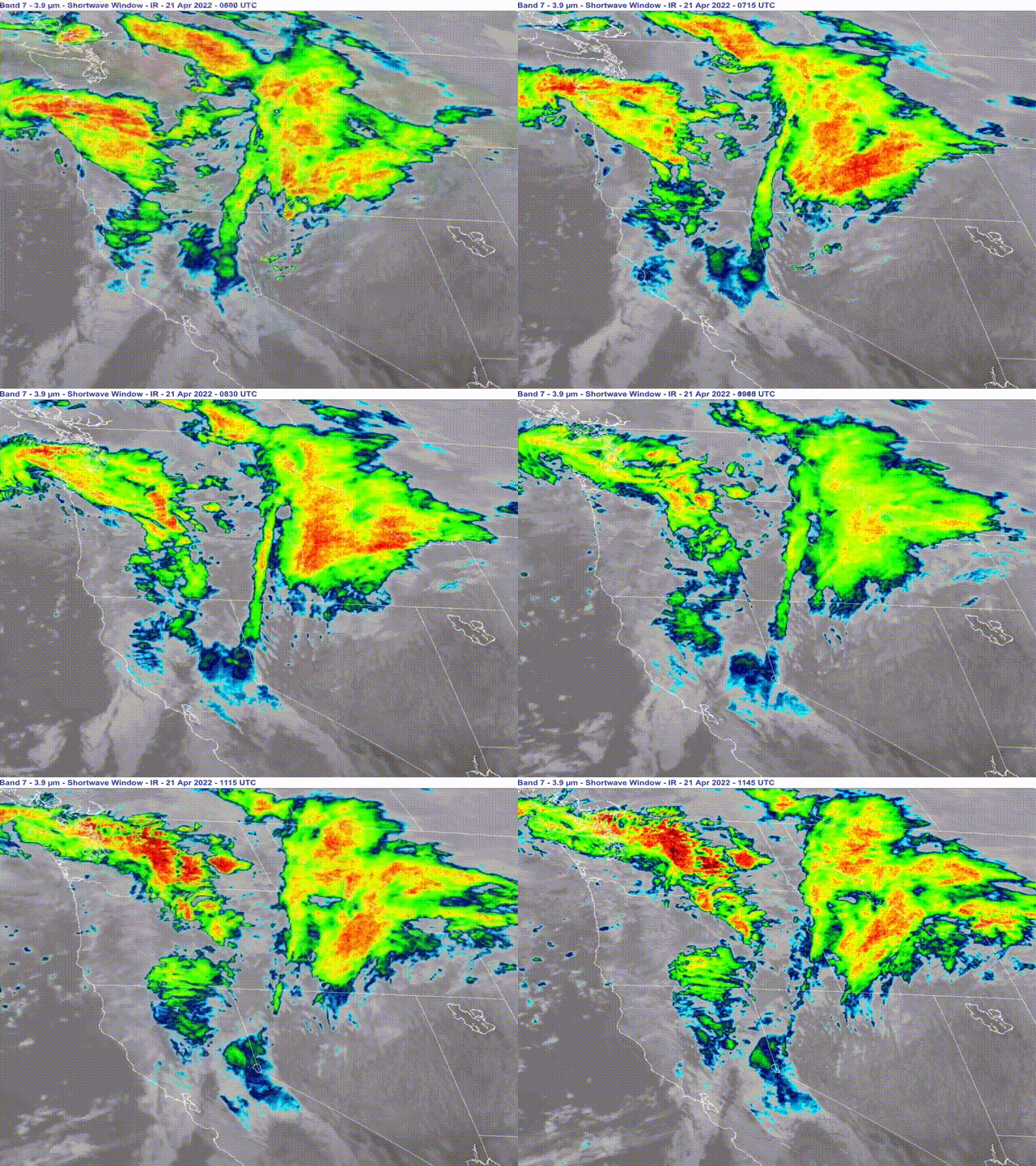
Light snow today in the Cascades and heavy snow, coupled with Winter Storm Warnings, for Lake Tahoe. The storm system moves into Utah’s Wasatch mountains tonight and Colorado tomorrow afternoon.
Below is the infrared satellite view from GOES-West.
Forecast
PNW
Light snow today thru Friday for the Cascades with snow levels hovering around 4000 ft. Temperatures will be in the lower 30’s at base level with light winds, between 5-10, so a great time to get out. Snow fall amounts in the 1-3 range both today and Friday.
Tahoe
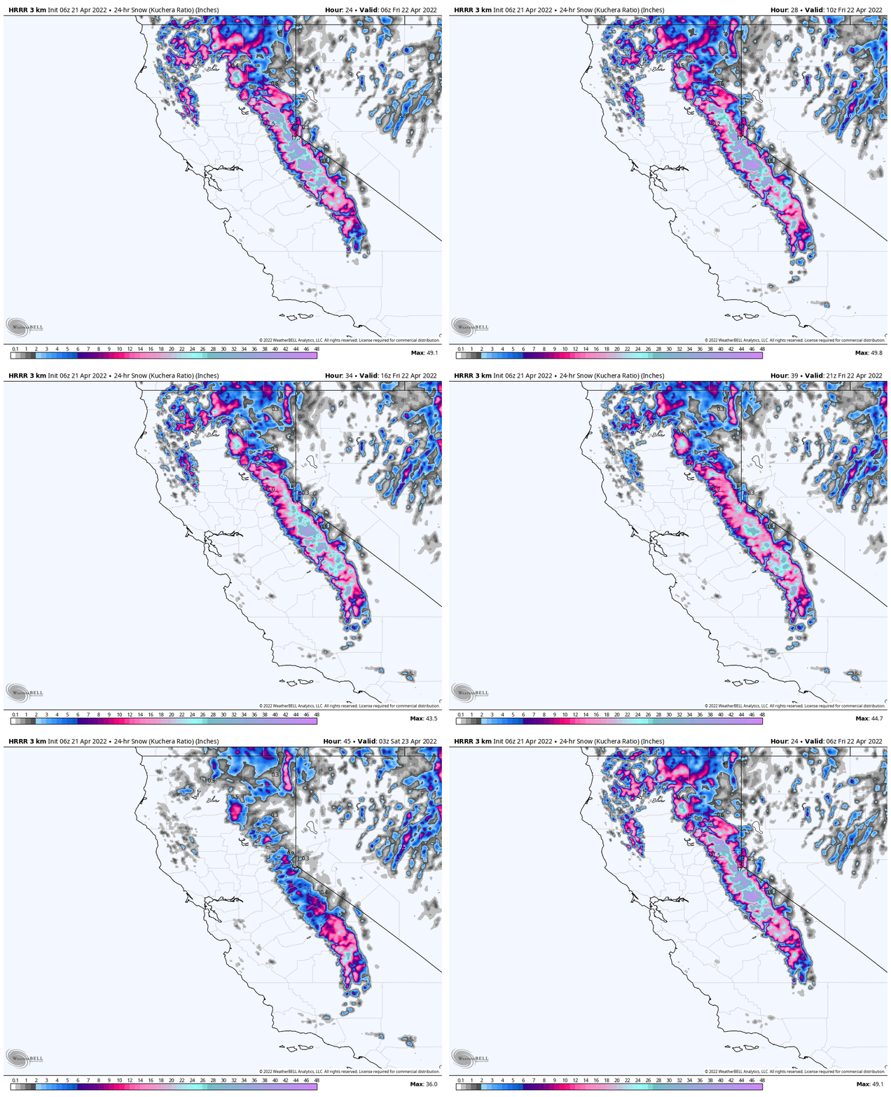
Yesterday, I forecasted 10-16 for today and that looks to be a little low for Kirkwood, so I will up that to 14-20 today with 10-16 for Donner and Palisades. High winds again today with 40 mph gusts.
Tonight and Tomorrow
Winds calm down tonight and will be mild tomorrow, for Tahoe standards, between 10-15 with 20 mph Gusts. Expect another 5-10 for Kirkwood with Palisades in the 4-8 range.
Utah
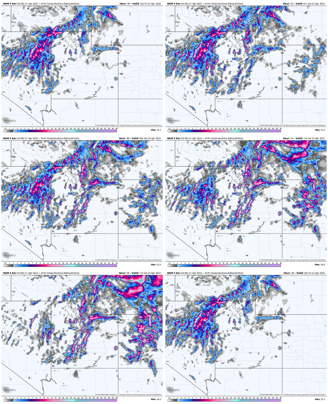
The system moves into the Cottonwoods tonight but really gets going tomorrow. Strong winds 15-20 with 30 mph gusts will make it feel quite cold, temps will be in low 30’s at base. Heavy snow, clear goggle alert, will be in effect with 1-2 feet expected tomorrow. Expect 8-12 throughout the day and another 5-10 after the lifts stop spinning.
The storm moves out Saturday afternoon, with another 3-5 before exiting.
Colorado
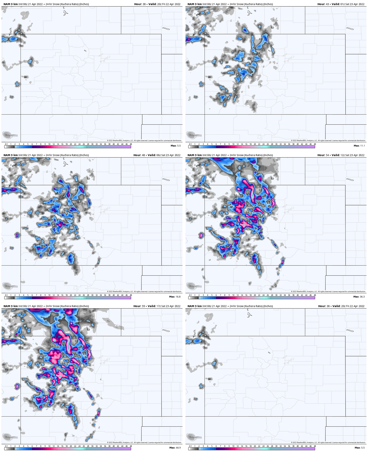
Colorado starts out with high temperatures and rain Friday afternoon, as the system moves into eastern Colorado. That rain switches over to snow, Friday night, as temperatures plummet below the freezing mark.
This forecast is tricky due to temps and snow levels. I like the northern mountains, and resorts along I-70, with this setup. I expect Vail, Beaver Creek, Breck and Arapahoe basin to be in the 3-7 range, both Saturday and Sunday. Steamboat looks to be in the sweet spot for a surprise–6-12 Saturday, but that could change.
For the southern mountains, the higher elevation resorts like Telluride could have a mix during the day Saturday, with snow up top and rain at the base. Expect 3-6 above the snow line around 8000 ft.
Thanks for reading the blog, as always if you have any questions please feel free to email me at Mike@FutureSnow.CO

