
Pattern Discussion
We are 10 days away from the Active West Pattern and the transition storm we have been talking about now has the proper path showing up on the GFS. This is still around 200 hours out, so the final solution will change from this GIF, but you get the gist of it.
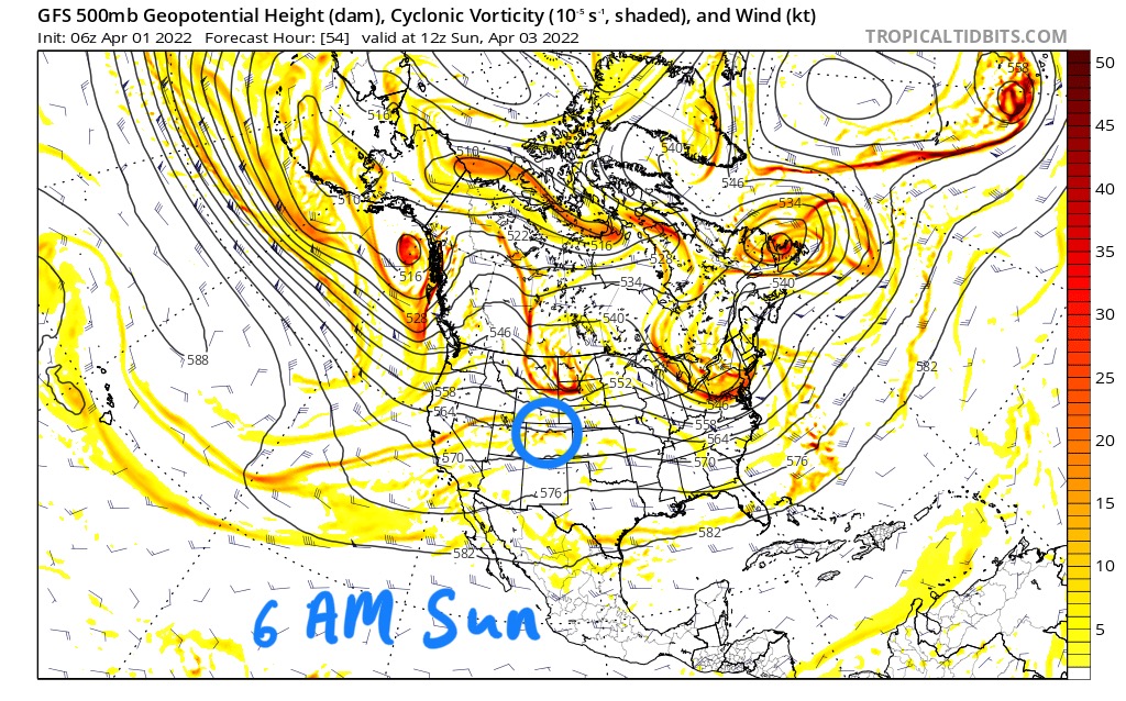
Let’s back up a bit, there are a couple systems before we get to the transition storm. First, there is a northern storm that slides across the upper west tonight hitting nearby Seattle and Portland mountains Crystal and Mt Hood. There is a slight chance that this system produces a small storm to spawn right over Colorado about 6 AM Sunday.
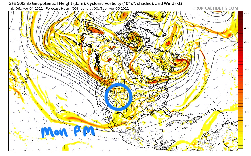
Then overnight Sunday the next wave hits the Pacific Northwest taking a similar path, with the exception that this wave is much larger and will likely hit Colorado late Monday afternoon and possibly backfill, spreading to Utah overnight. After this storm passes, we will have a boring week and then transition storm arrives.
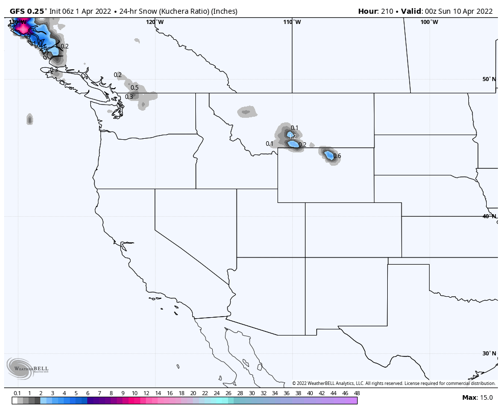
Below are all of the storms on the GFS through 384 hours. After the 11th, the solutions are a little fuzzy but the energy is likely correct. The heavy snowfall that ends up in Wyoming should be in Colorado. When we get a little closer this should auto correct.

Thanks for reading the blog of course if you have any questions please send me an email to Mike@FutureSnow.co or you can simply comment below. We have had so many comments and emails this year, always glad to answer any questions that you might have.
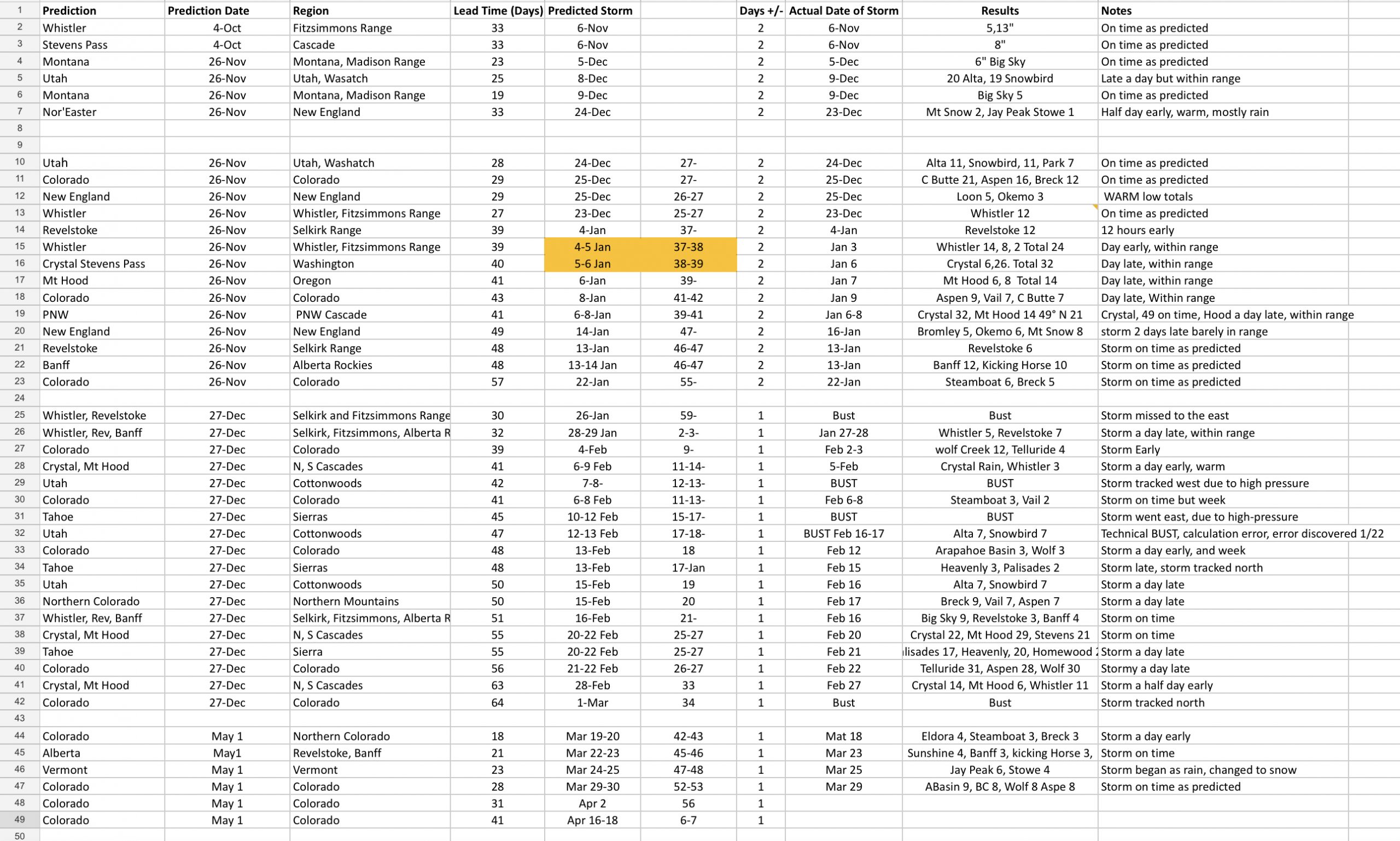
Below is the updated prediction spreadsheet, we are over 90% accurate with Predictions more than 30 days out.