 Summary
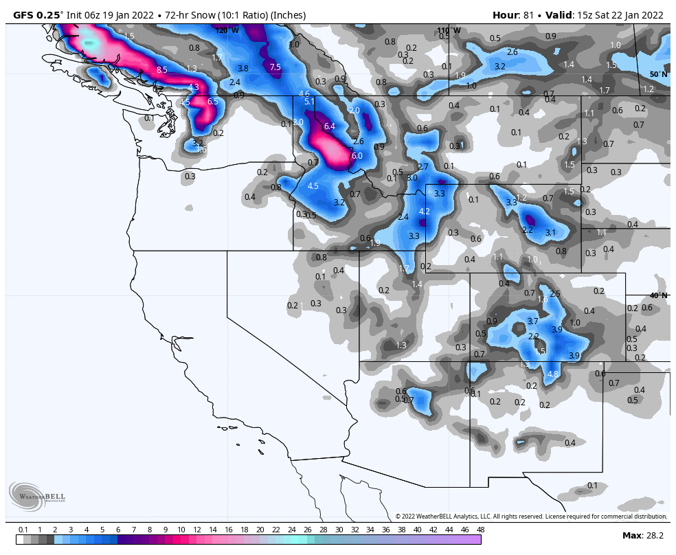
The next system arrives along the British Columbia coast Thursday. The precipitation totals are improving as this storm draws near. You can clearly see the transition from the northern Pattern to the Active West Pattern. That will continue for the next 10 days.
Thursday
The storm approaches the northern Cascades as the system moves from the northwest to southeast. Snow levels begin the day at 8000 and will drop to 5500 by Thursday night, with much lower snow levels as you move inland and light winds. The track of the storm will favor the eastern resorts, like 49 Degrees North, Idaho and western Montana ski areas.
Friday
Utah
The storm moves out the PNW and reaches Utah by Thursday night into Friday. Expect 1-3 inches of fresh in the morning with the snow falling throughout the day with another 2-6. This is big improvement over the last couple of days.
Colorado

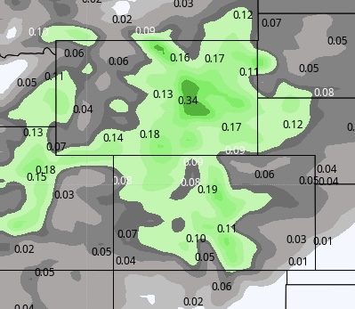
The above map tells the story of the storm track favoring the central mountains. The blend of the models gives you a better idea of the overall precipitation.
I think this chart (below) is more indicative of what will happen. The last time through, the models behaved very similarly as well. All mountains received precipitation in the range of 4 to 9 inches with Steamboat and Aspen both receiving 9. I think the same thing happens again.