Summary
This Christmas storm is expanding in all directions today, from British Columbia, down the coast to southern California, across to Utah, Idaho, Wyoming, Montana and Colorado. Winter Storm Warnings in several of the aforementioned states, or forthcoming this afternoon, in states such as Colorado, where the Holliday cheer arrives later today.
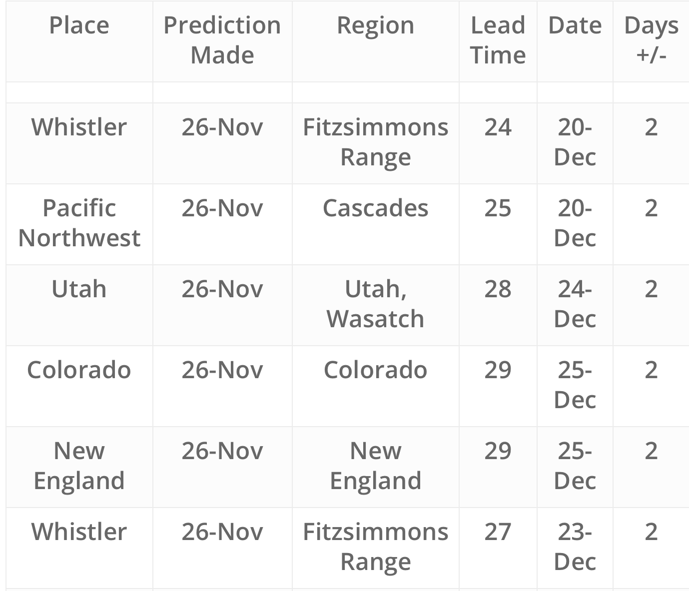
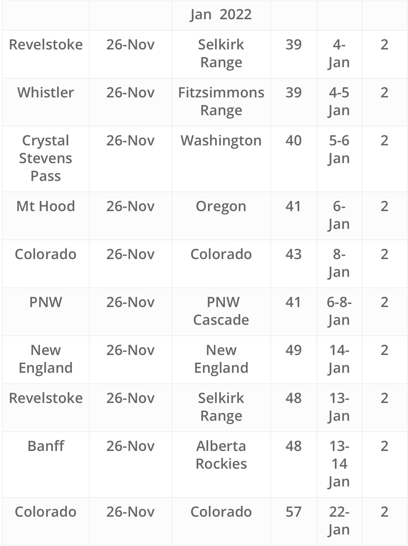
Once we zeroed in on this year’s cycle length, we poured through the data to target the return dates of strong storms. This was one of 6 strong storms that recur each cycle. No other snow forecasting site has this technology, you can only find it here. FutureSnow is your home to plan trips more than 30 days out. Our record is over 80% accurate over 30 days, no one is even in the same ballpark. Our Predictions chart currently goes out to Jan 22. Our forecast calendars use the same algorithm and go out to late March.
If you are new to FutureSnow, take a look at our about page that explains our methodology.
Today
PNW

Winter Storm Warning for the Cascades today with snow totals around 5-10 for the Washington side, and 8-12 for Oregon’s southern Cascades. Freezing levels low, around 1000 ft.
Tahoe
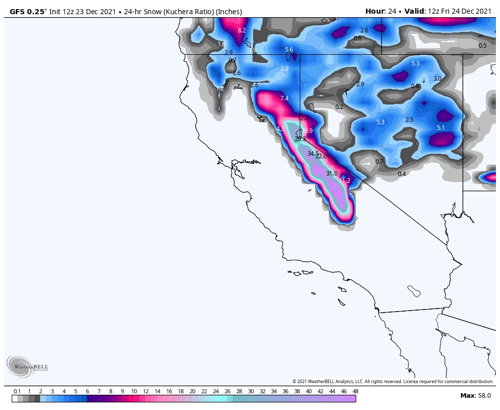
Snow ramps up this morning, but the freezing level is tricky. It will probably be a mix, or rain, at lake level and around a foot at 7000 ft. High wind warning with gusts over 100 mph. Tonight, freezing levels drop to around 5000 ft, with the latest GFS.
Utah

Windy today as the snow kicks into high gear this afternoon. Gust around 40-50 mph. Snow totals 12-20 range.
Colorado
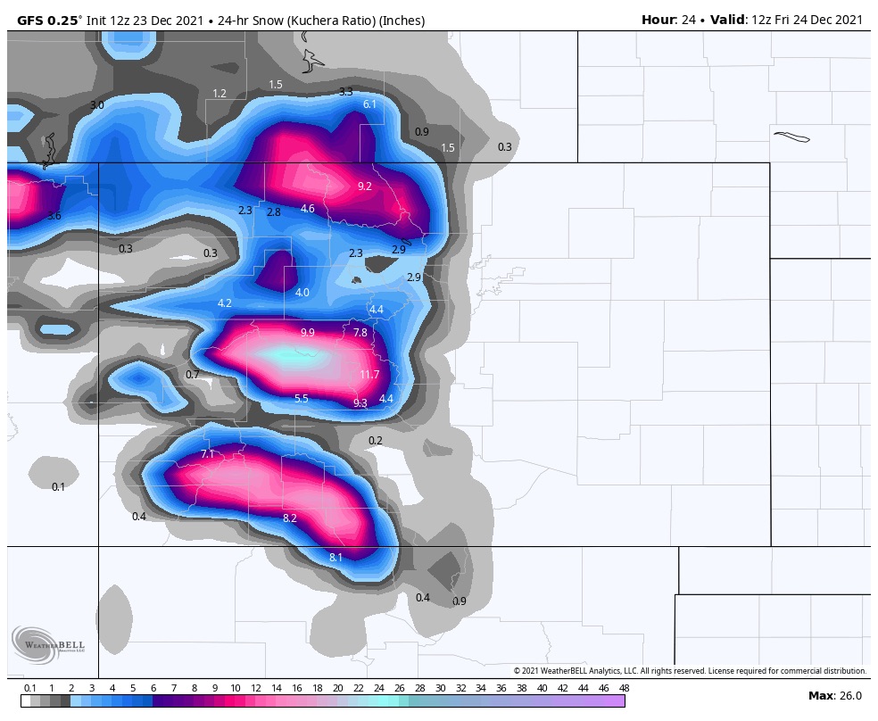
Southern mountains get started first, with Telluride and Silverton getting 3-6. A little less for the central and northern mountains.
Tomorrow
PNW
Decent temps for Friday with low snow levels. Fresh snow to top off yesterday’s haul with another 6-10.
Tahoe
A few inches in the morning as there will be a break between waves. Temps drop late in the day and look good for overnight with 4-6 by Christmas morning.
Utah
Another really good day for all mountains with cold dry snow. Snow totals in the 12-18 range again.
Colorado
Strongest part of the storm comes through with all mountains expecting 6-10. Temps are on the warm side so the snow quality will be on the thick side.
Christmas Day
 PNW
PNW
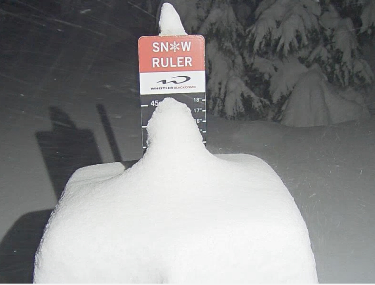
Another 6-10 for the southern Cascades with more to the north. Northern Cascades of Washington new snow of 1-2 ft.
Tahoe
Cold temps as a strong wave of energy will ramp up the snow rate/hr. Snow totals should reach 1-2 ft.
Utah
Snow moves out after another 2-4.
Future Snow Predictions Chart
Don’t forget to check out our resort specific calendars in the Resort Forecast section.